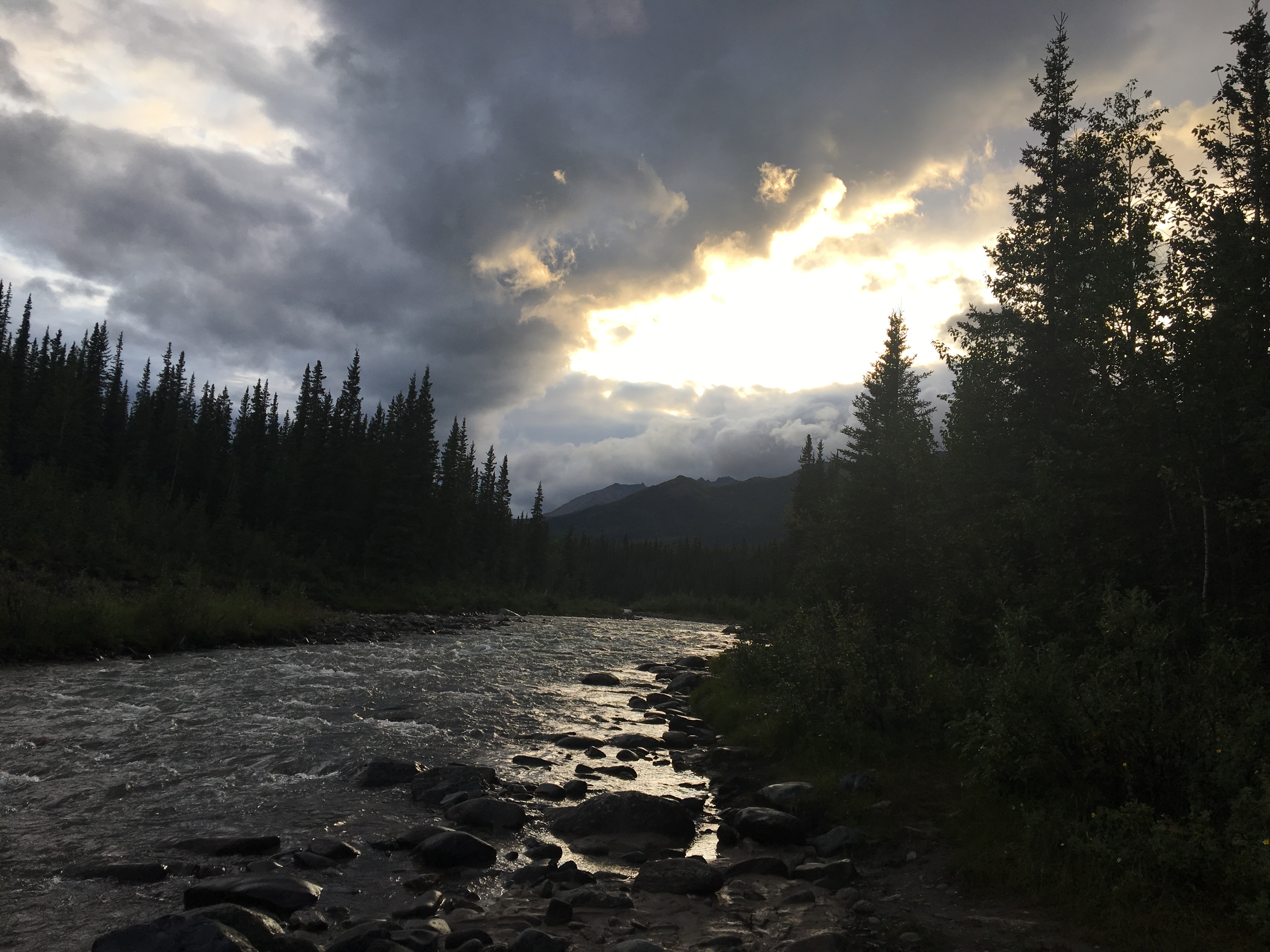
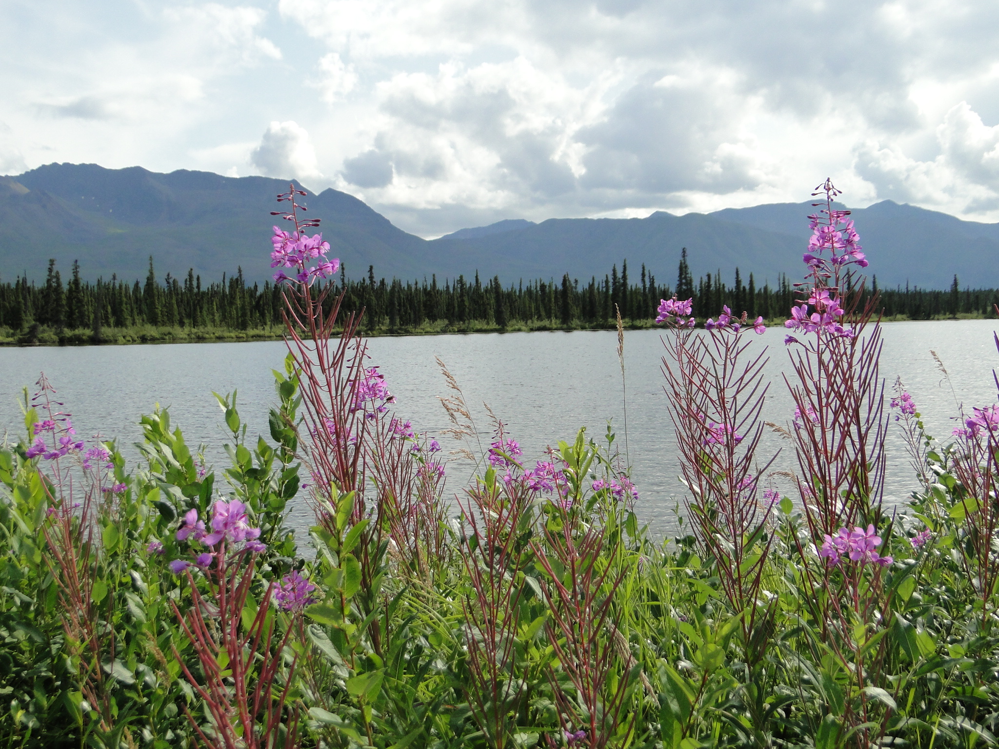
In 2011 we made our first trip to Alaska. On our last night there, walking around the campsite at 11 p.m. (no real total darkness in Alaska in the summer), we spotted a range of extremely high mountains in the near distance. The Glenn Highway, an east- west route across southeastern Alaska rides between the Chugach Range and the Alaska Range. The route looked enticing and though we did not have time to drive that road on that night, we decided that the fulfillment of that desire would be our next life direction. And we finally returned to Alaska, as dreamed 8 years ago.

We crossed back into the US after 8 days in the Canadian wilderness. Crossing at Beaver Creek with relative ease, we drive next to the town of Tok. (pronounced toke) We spent the night at the Tundra Lodge & RV Park, a nicely treed park right off the Alaska Highway. Tundra offers hot showers, power and water and an adjacent bar that was not open the night we were there because the bartender was ill. A nice place to stop for the evening that also had reasonable WIFI near the office only. (Comfortable lounge inside or patio furniture and a small table outside)
Continuing north on the Alaska Highway, 110 miles north of Tok is the official end of the Alaska Highway at Delta Junction, still 100 miles to Fairbanks, our northern most destination. Though this town is the intersection of the Alaska Highway and the Richardson Highway, it seems as though it is mostly a convenience stop rather than a town for touring.
The road into Alaska from the Yukon is markedly better than the Canadian roads we have just recently traveled. Though there are occasional frost heaves, the surface is smoother in general and the use of asphalt is much improved over the chip seal that the Canadians are currently using.
Within a couple of hours, we have arrived at the Riverview RV Park, just east of Fairbanks. A word of caution about camping in Fairbanks. There is an Army Base as well as a commercial airport there and both have constant air traffic. We chose this campground as it was further from the airport yet we had air traffic for a good part of the evening both nights that we were there. We did explore a portion of the region and were able to visit Creamer’s Field Migratory Refuge, an 1800 acre former dairy farm that is now home to seasonal migrating birds. There are several trails on the property that include a boreal forest, a seasonal wetland, and an open field farm road trail and while we were there we were fortunate to see a flock of juvenile sandhill cranes. Unfortunately they were a bit too far for a decent picture.
While in Fairbanks, we also visited the Ice Museum in the downtown area. This museum is essentially a theater surrounded by a large freezer where ice sculptures are displayed. After a beautiful film about the Aurora Borealis, you are led into the freezer to photograph and walk amongst the large ice sculptures including a long slide, compete with sled for quick thrills. (There are parkas available for walking into the freezer) After this brief tour, the ice sculptor gives a 10 minute demonstration of ice carving, a major event in the dead of winter, complete with prizes and stature.
Note: While in Fairbanks we were deep in the smoke from the regional fires for a few hours. As the wind shifts, the smoke can be gone as quickly as it arrived.
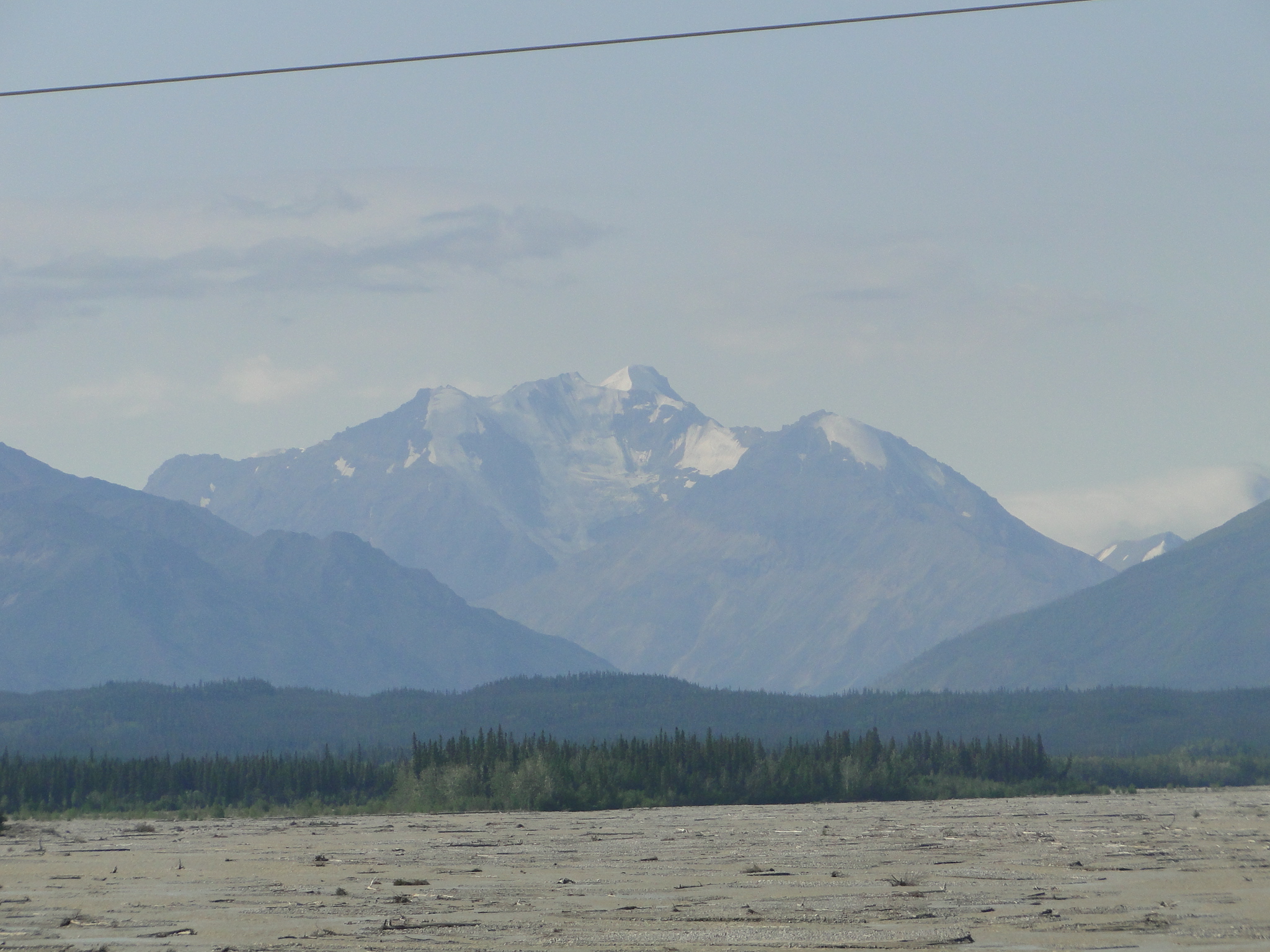
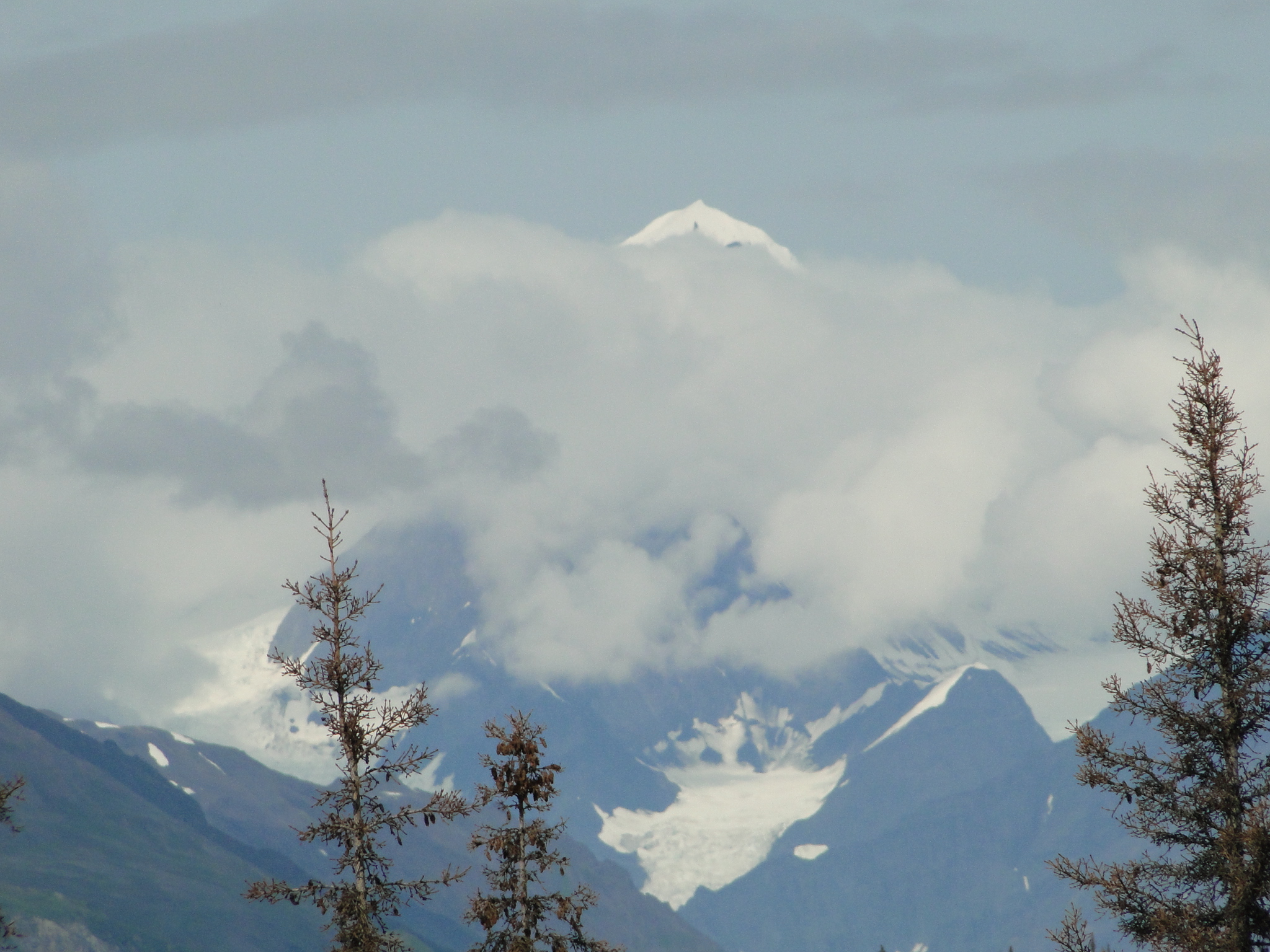
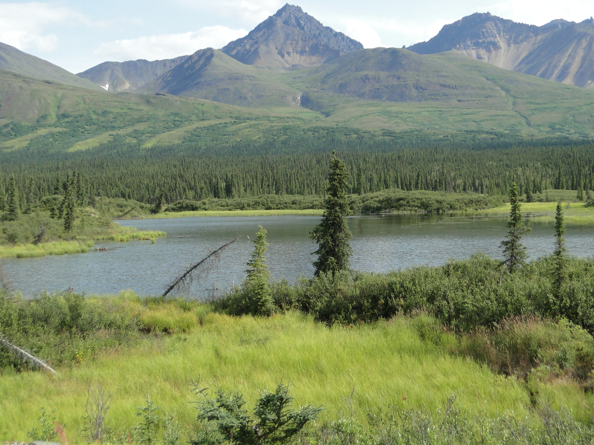
The day we left Fairbanks was quite rainy with very low clouds and fog. This was not the day that we wanted to see as we drove south to Denali National Park. Our hope was to see Mt. Denali ( the “high one” in Athabaskan) from the north approach. Our previous visit to Denali was from the south and some of the views were magnificent.
As we continued south, climbing into a higher terrain, the fog finally lifted and the skies cleared to a point, though the long range mountain views did not materialize. We camped at the Riley Creek Campground inside the park, near the entrance. This gorgeous, wooded campground was within walking distance of the camp store, the bus depot and the Visitor’s Center, all within two miles. The campground offers no hook-ups, some areas with flush toilets and no showers. (Pay showers are available nearby at the camp store.) However, the beauty and the layout of the sites is what makes this park standout.
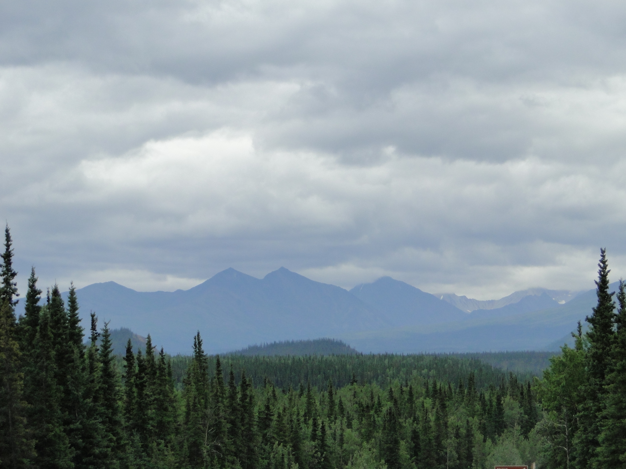
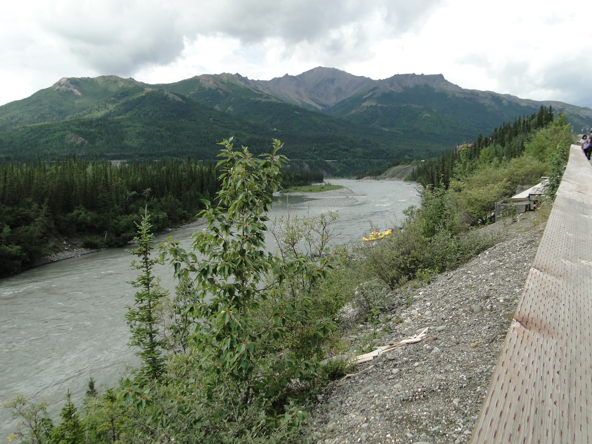
Denali is a massive park system with several primitive campgrounds that you can drive into, several tent only campgrounds that you ride a shuttle bus to, and some luxury resorts that you travel to via bus or van. One can only drive a vehicle into the first 20 miles of the park. Thereafter you are required to ride the transit buses or the tour buses as the road is extremely narrow, with steep cliffs at every turn, dirt and gravel only and an abundance of wildlife. (The transit bus drivers are not required to narrate but many do, whereas the tour bus drivers give a full narration – at a premium cost) You purchase passage on the bus based on how far and how many hours that you want to travel. The road is 92 miles one way to the end at Kantishna so taking the bus to the end and back (one of the bus options) is a 12 hour excursion. There are regular bathroom stops as well as several longer photo opportunities and a visitor center at mile 66.(45 minute break) Though there are several options for buses, all stop when wildlife is spotted. The passengers are instructed to call out “Stop” when they spot something or, if possible, what you see and what direction- “bear at 3 o’clock.” The drivers stop as quickly as possible, often times turning the bus for better viewing and even back up if they’ve missed it.

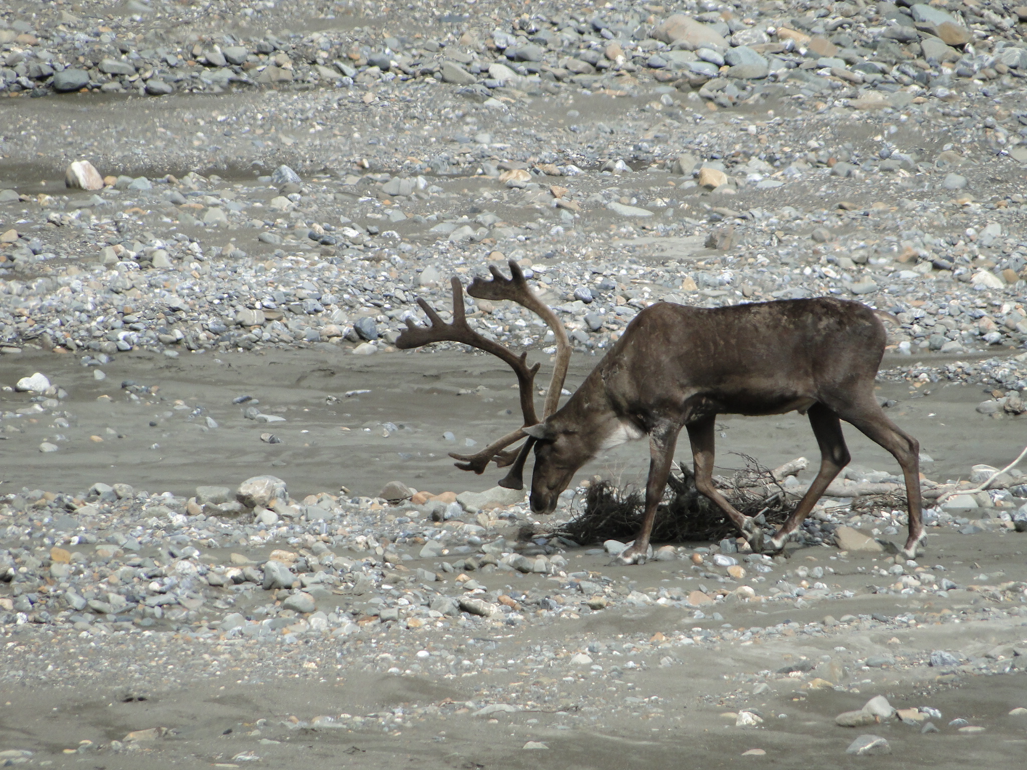

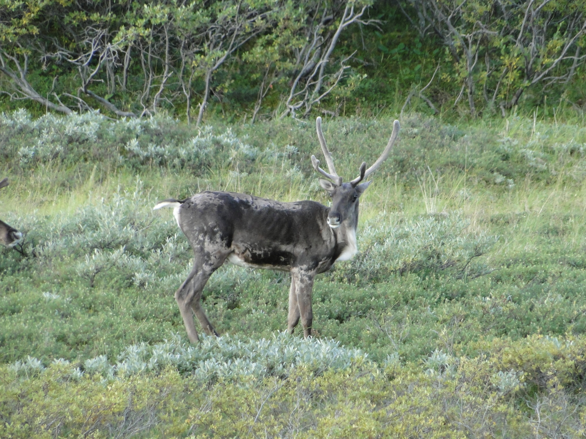
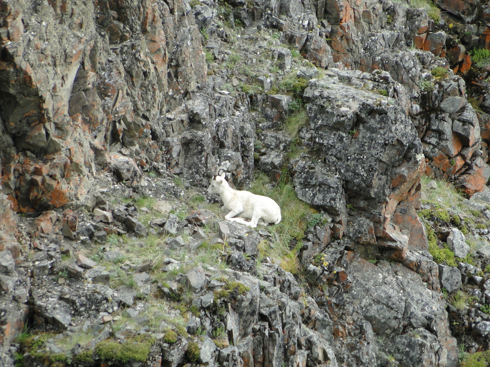
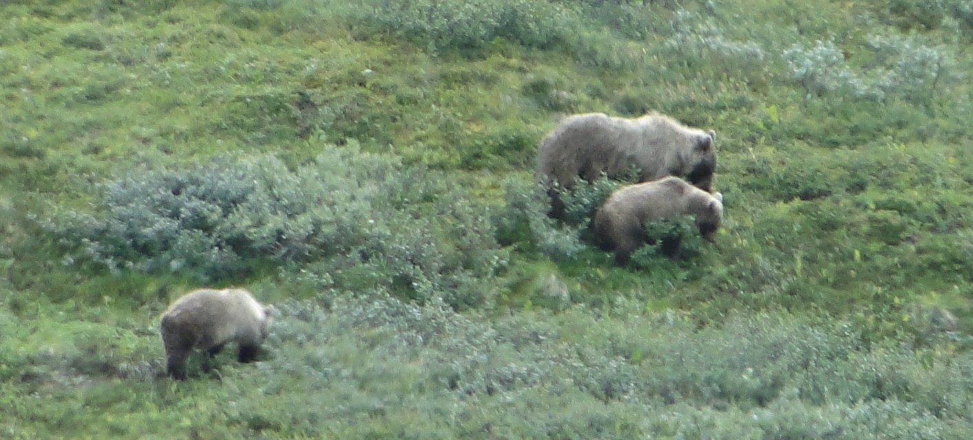
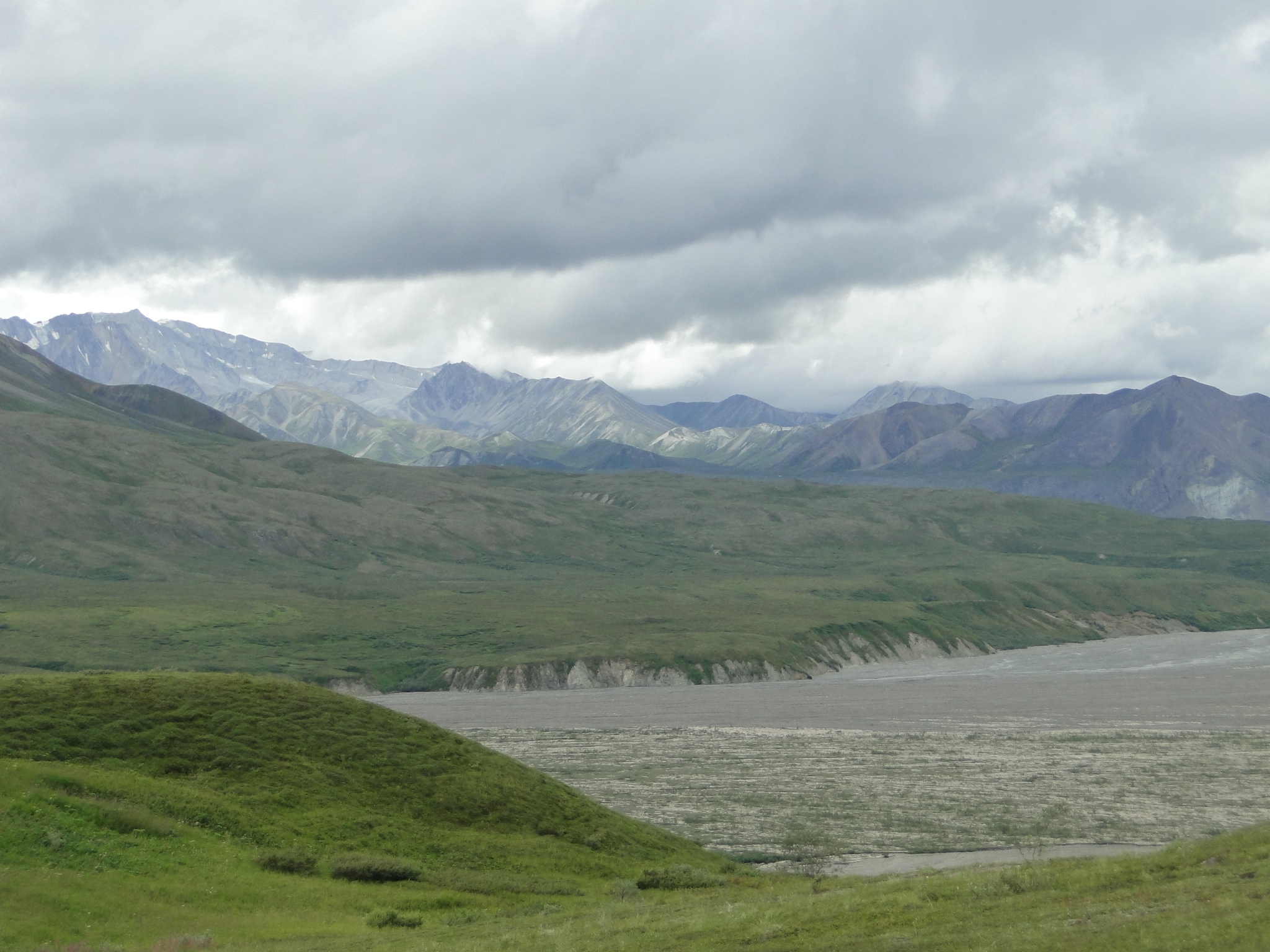
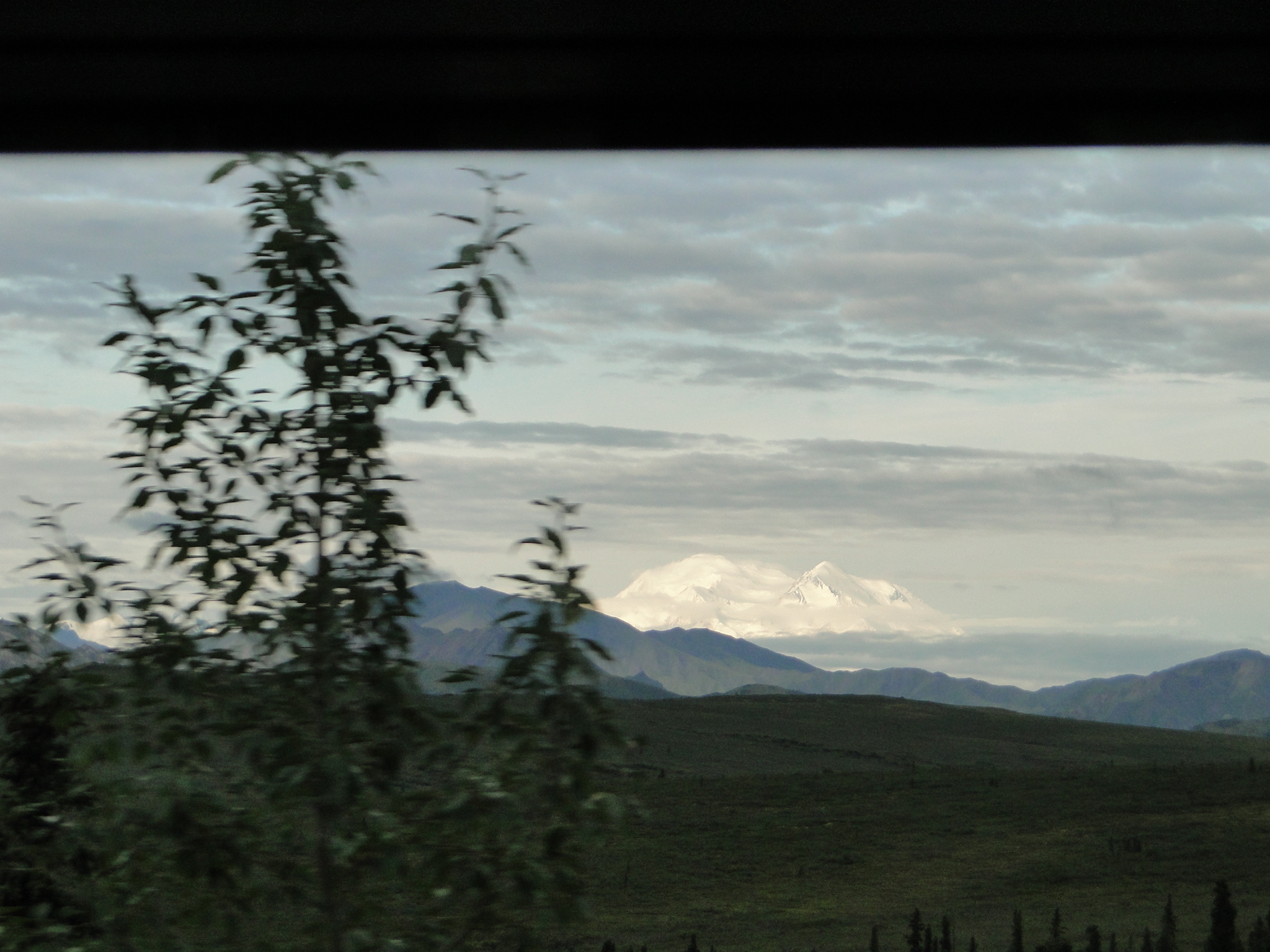
But the real magic of this ride is seeing “the mountain.” Because Denali, formerly Mt. McKinley, is 20,310 feet high, the largest mountain in North America, it creates its own weather and only 30% of visitors get a glimpse. On our bus trip in- bound we were very fortunate to see the mountain, though some portions were obscured. By the time we returned, Denali was completely hidden. (in 2011, we saw the mountain on 3 separate occasions.)
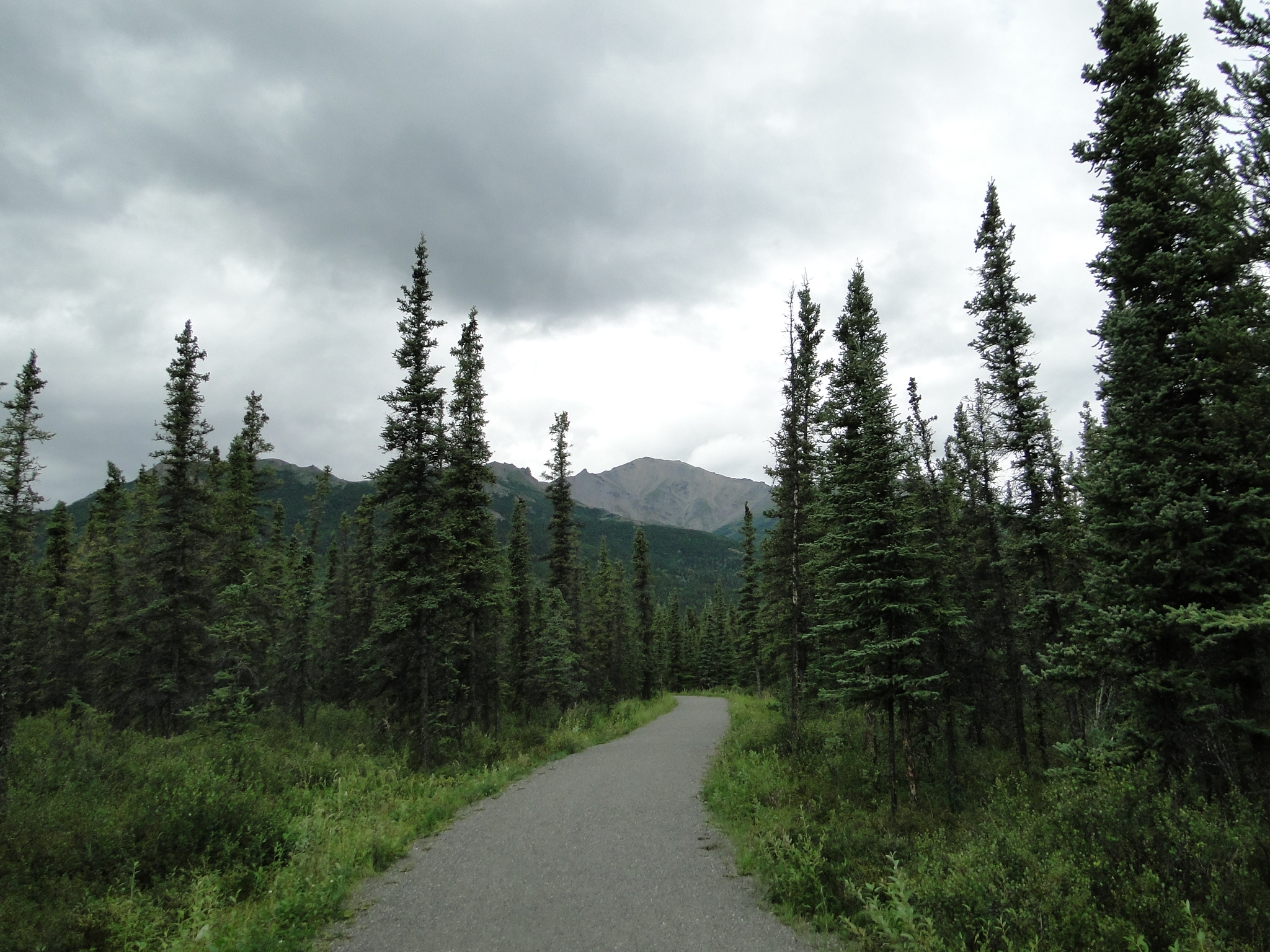
In the park, there are many opportunities for hiking, as there are over 6 million acres or 9,492 square miles of pure wilderness. Backcountry camping is available but be advised – this is bear country and you must take appropriate precautions. Backcountry campers are also required to take a short safety course by the park rangers as well as register and obtain a backcountry permit.
Denali is a most wonderful and exciting place to experience. One can easily absorb the magnitude and feel the peace and tranquility that the park offers. A trip to this park requires several days at the minimum to fully explore and truly become a part of this once in a lifetime adventure. Do your research if going to Denali. It is so immense that you may have difficulty planning your days. Understand the camping options and reserve well in advance as this park does fill its campgrounds early. Feel free to reach out to us for additional information or assistance with your planning as we have now been here twice and can share a great deal more.
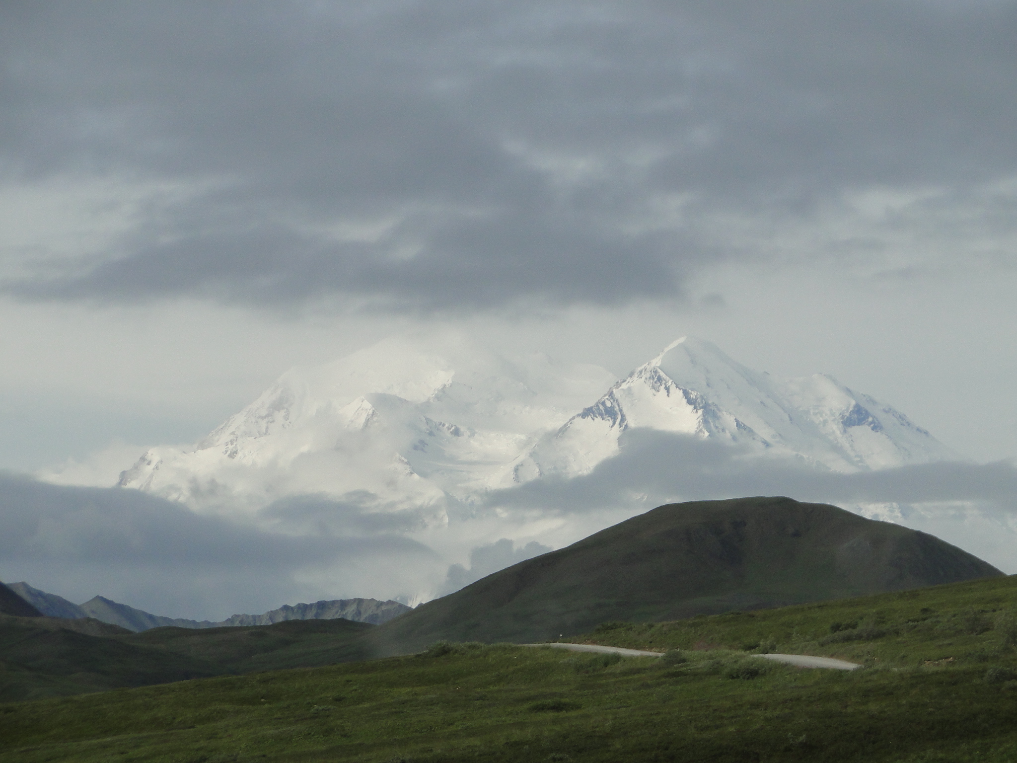
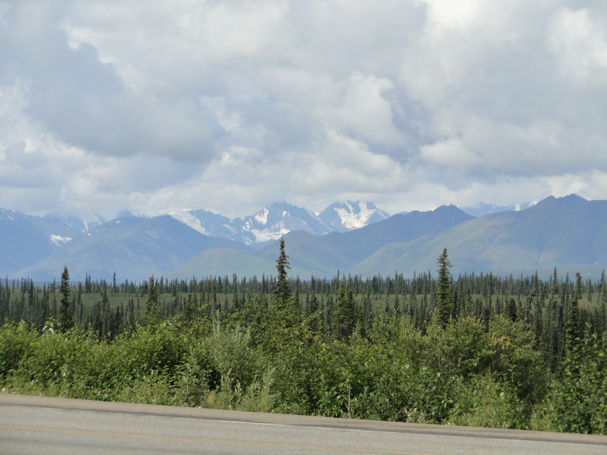
After spending 4 days in the park we made our way south towards Anchorage. As you travel the Parks Highway, named for George Parks, the territorial governor from 1925-1933, you are repeatedly offered viewing opportunities to see both enormous panoramas of the Alaska Range as well as the mountain itself. On clear days it can even be seen from Anchorage, 237 miles away, but more often at least portions of the mountain are visible along the highway. As we drove south, the prospects for a viewing grew dimmer with the advancing cloud cover. However, as fate would have it, we got a great top of the mountain view from the Denali South parking area. The vertical rise that is visible at Denali (18,000 ft.) is greater than the visible rise of Mt. Everest as it rises from a 2,000 ft. plateau, whereas Everest rises from its base at 17,000 ft. (12,000 ft. vertical rise)
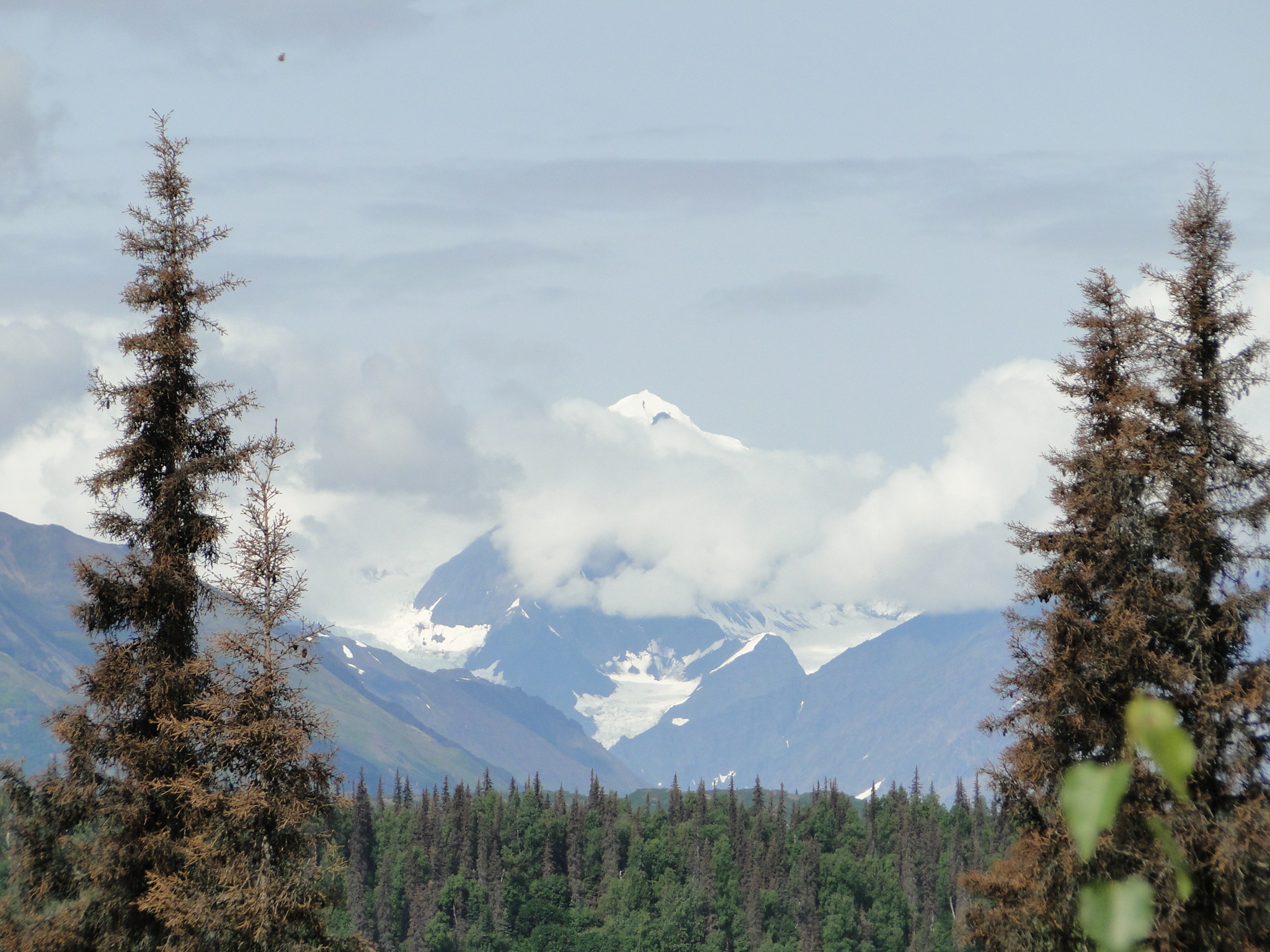
It is very difficult to convey the inner emotion we both felt when we saw this mountain for the first time. It will strike all folks differently, but I hope that if you travel here you get to experience this inner joy.
Not wanting to totally leave the park, we opted to camp just 27 miles down the road from the Denali Park entrance at the Cantwell RV Park. This was a comfortable site with good showers, power and water. The RV Park is situated on the road called the Denali Highway just west of the Parks Highway. The road to the east cuts a mostly dirt/gravel path for 134 miles across the tundra wilderness to Paxson. The editor of the Milepost book (which we will discuss later) describes this road – “if you want real wilderness scenery –vast tundra-covered valleys where caribou roam beneath breathtaking snow-covered mountains – then this highway is for you.” We drove about 15 miles onto the road and the road surface was hard packed in good condition. The road and the open valley are gorgeous and if time permitted, I would drive the entire length. Having said that, it is dirt and will take a considerable amount of time to travel all 134 miles.
Note: If you rent an RV, most rental companies expressly prohibit driving on any non-paved road surface due to stone damage.
We left Cantwell for our next campsite in Palmer, just east of Wasilla, the home of Sarah Palin. This next site was more or less a highway break and nothing terribly special. The Big Bear RV Park was comfortable enough with FHU and nice showers but was too close to the Seward Highway and we could hear the road through the evening.
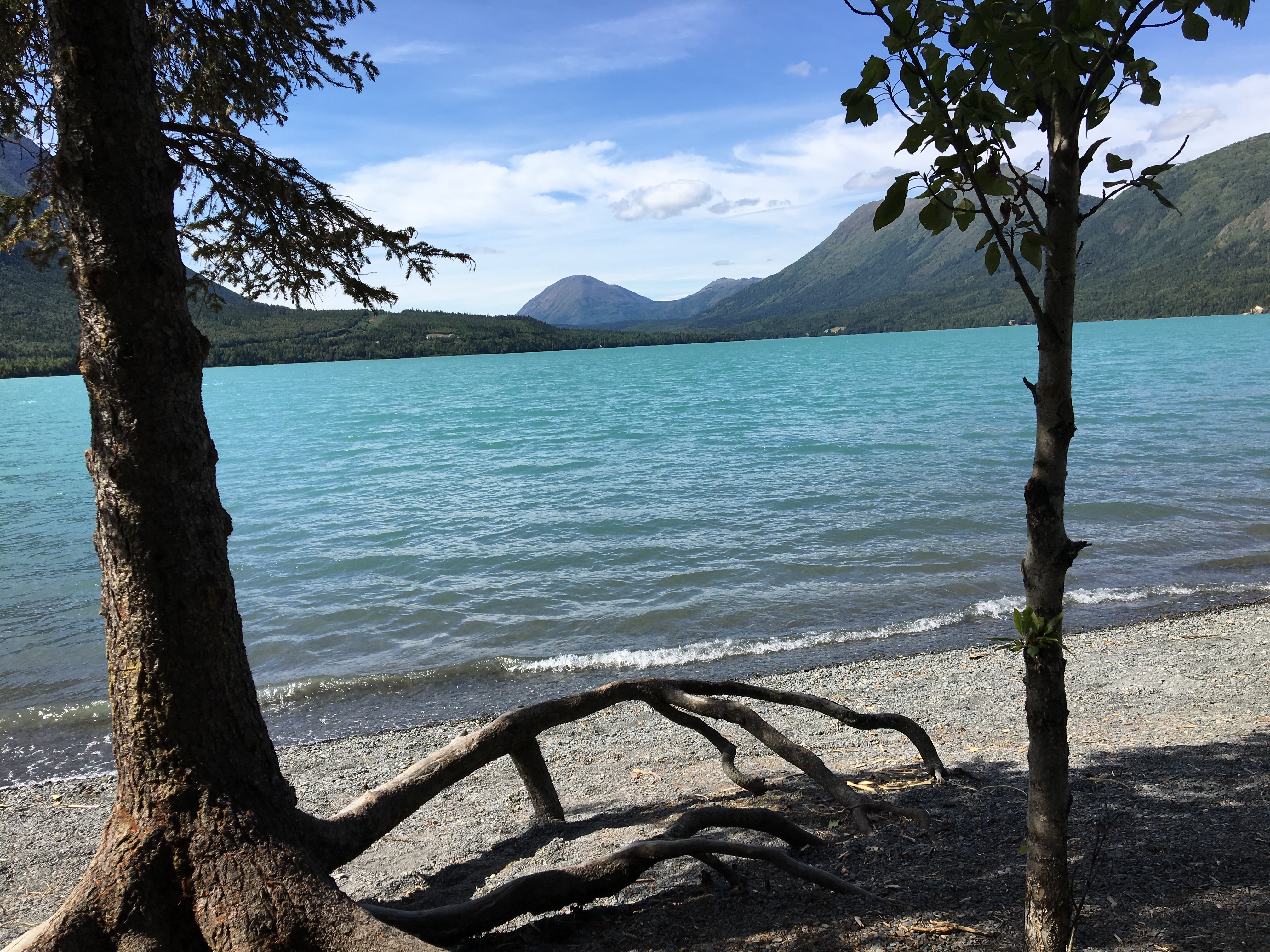
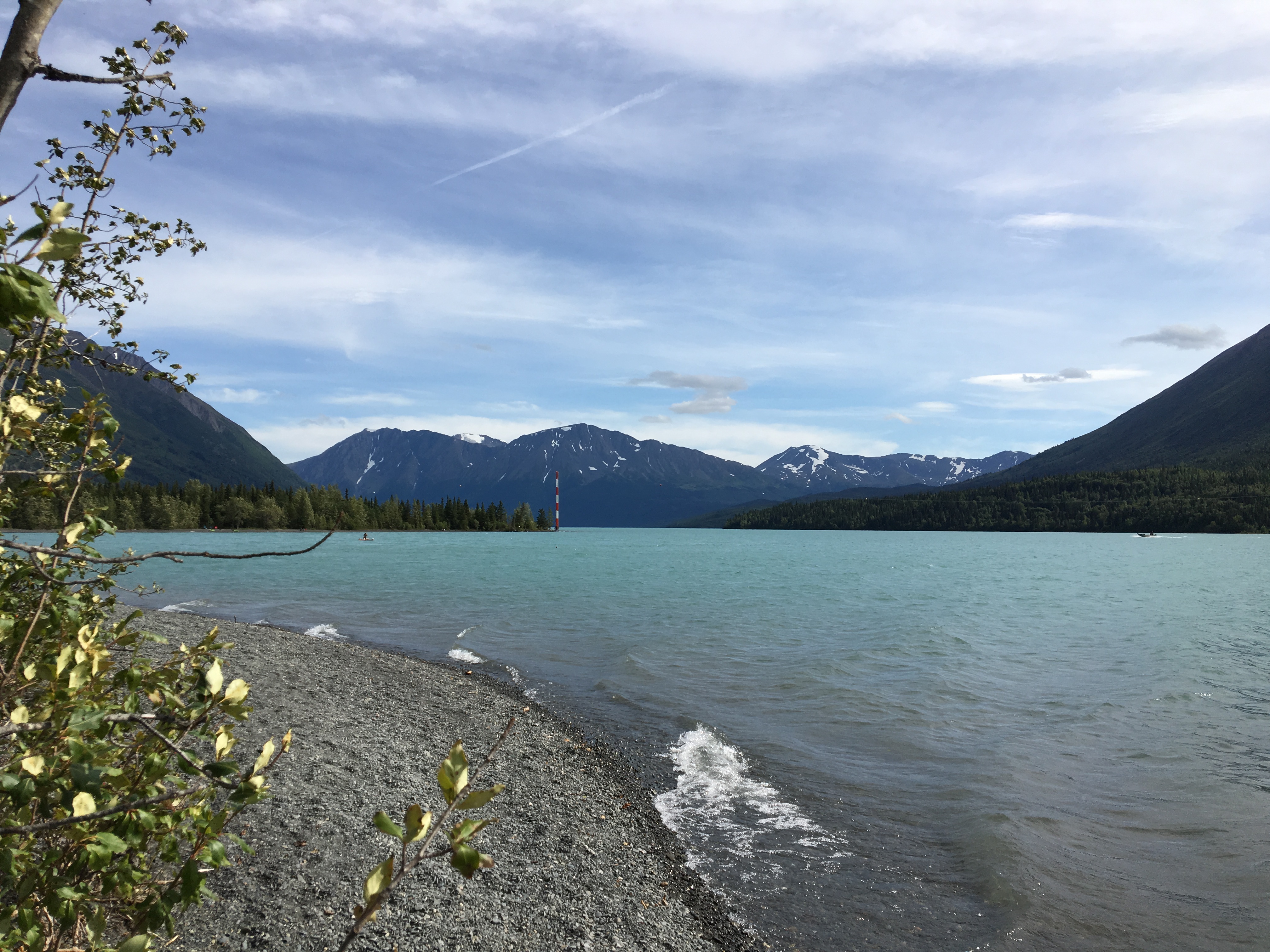
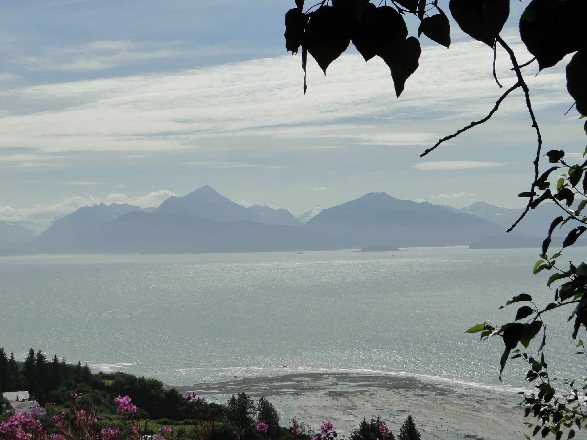
Next day was south onto the peninsula south of Anchorage known as the Kenai Peninsula. (Key-nigh) This region is passionately referred to as the “Playground of Alaska.” It is reputed to be some of best fishing in the world, has some of the most dramatic scenery and is a jumping off point for boat tours of the Kenai Fjords. On the east, down the Seward Highway is, naturally, the Town of Seward. On the west coast, across the Sterling Highway is the world-class fishing town of Homer. We first drive onto the Peninsula at the Turnagain Arm, noted for the tidal surge known as the bore tide, that can be a wave ranging from 6-10’ and allegedly occasionally sports whales surfing the wave. We camped near the Turnagain so we could time our evening to the tide charts as this particular day was denoted as good potential for large tidal surge. There are numerous turnouts along the road for viewing not only the tide but the magnificent backdrop of the mountains against this large body of mostly dry riverbed awaiting the tidal surge. From our vantage point above the river we could only discern perhaps a 2’ tidal wave but the surfers who prepare and lay in wait were given a nice ride.
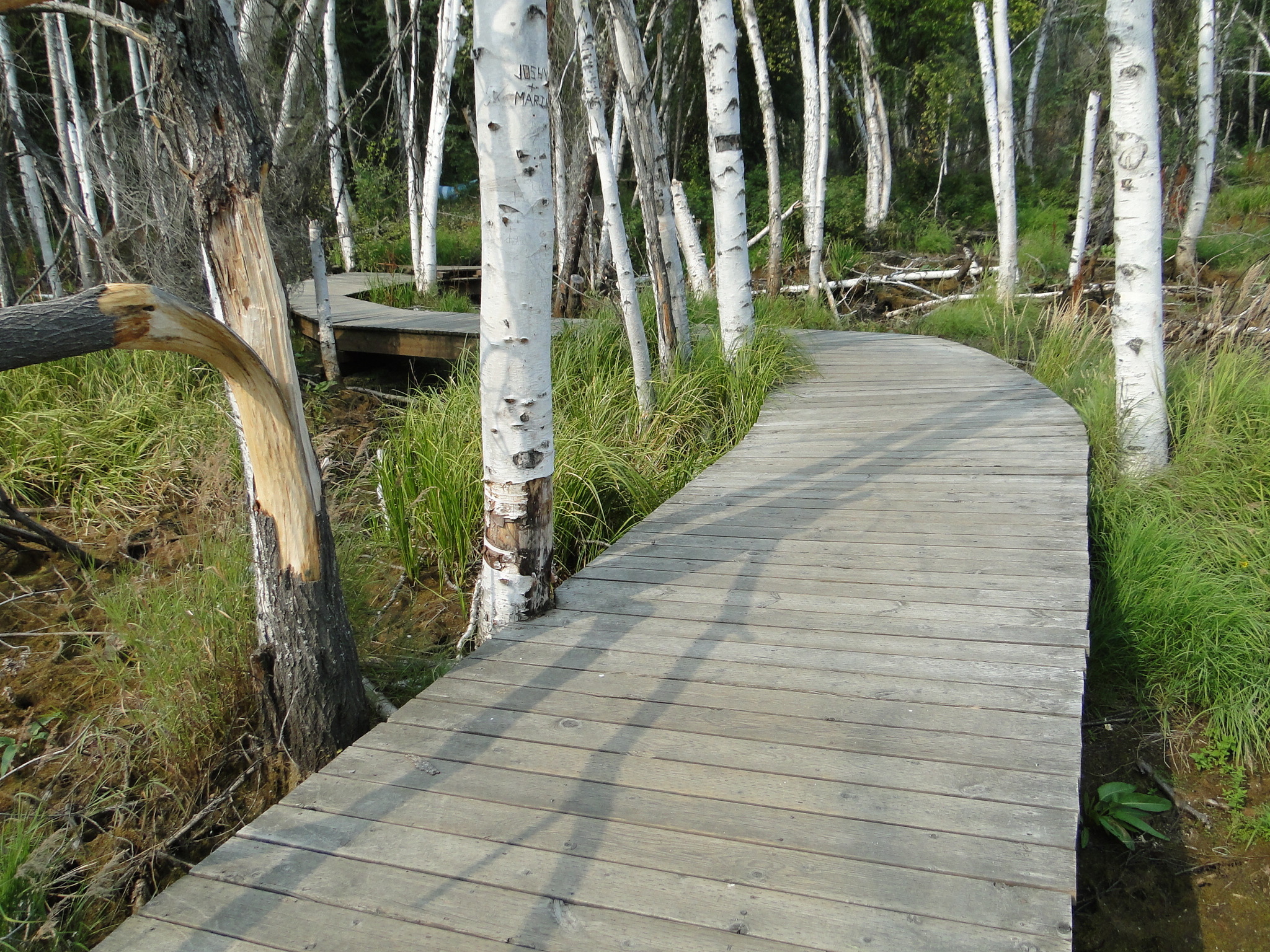
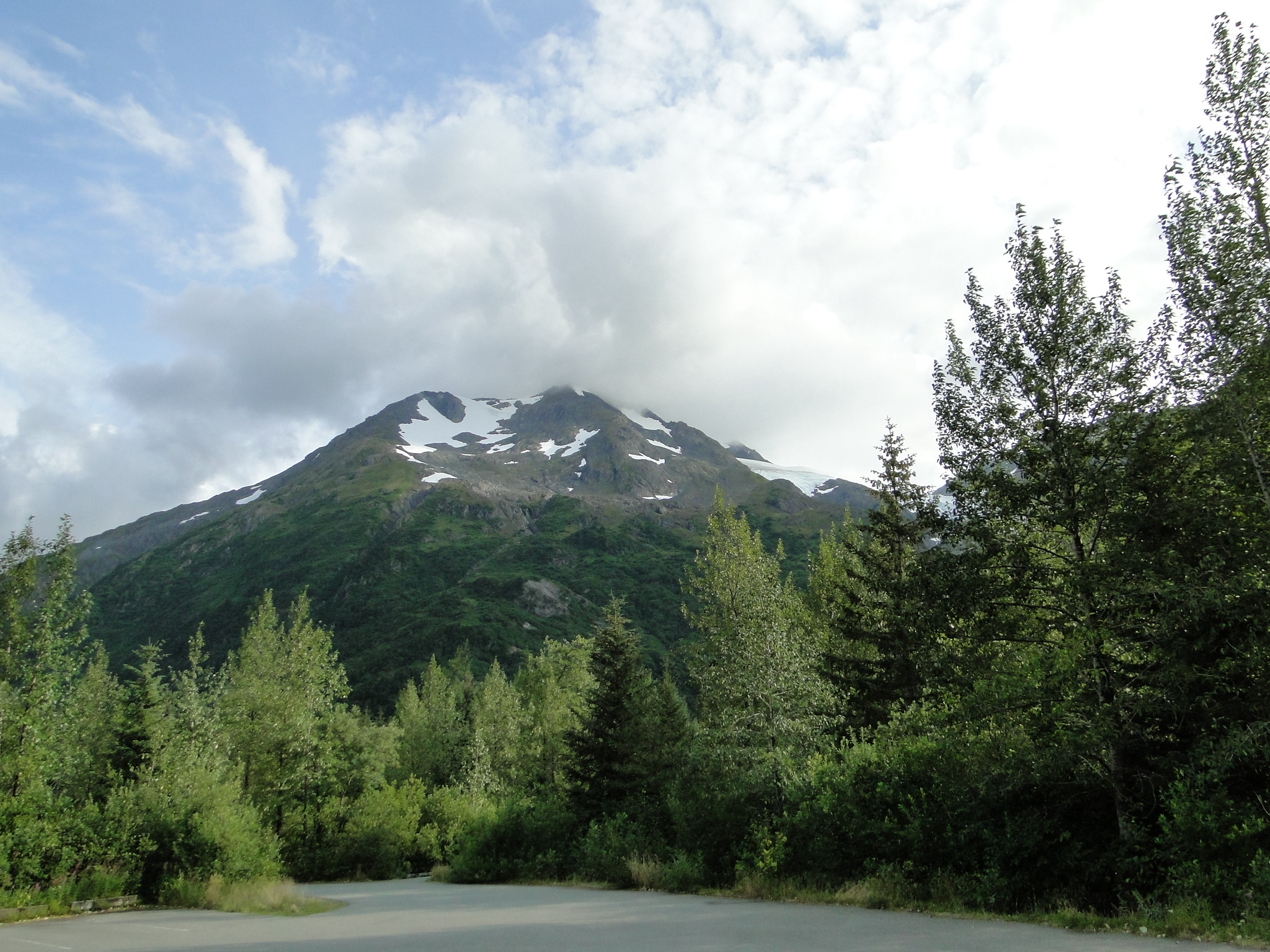
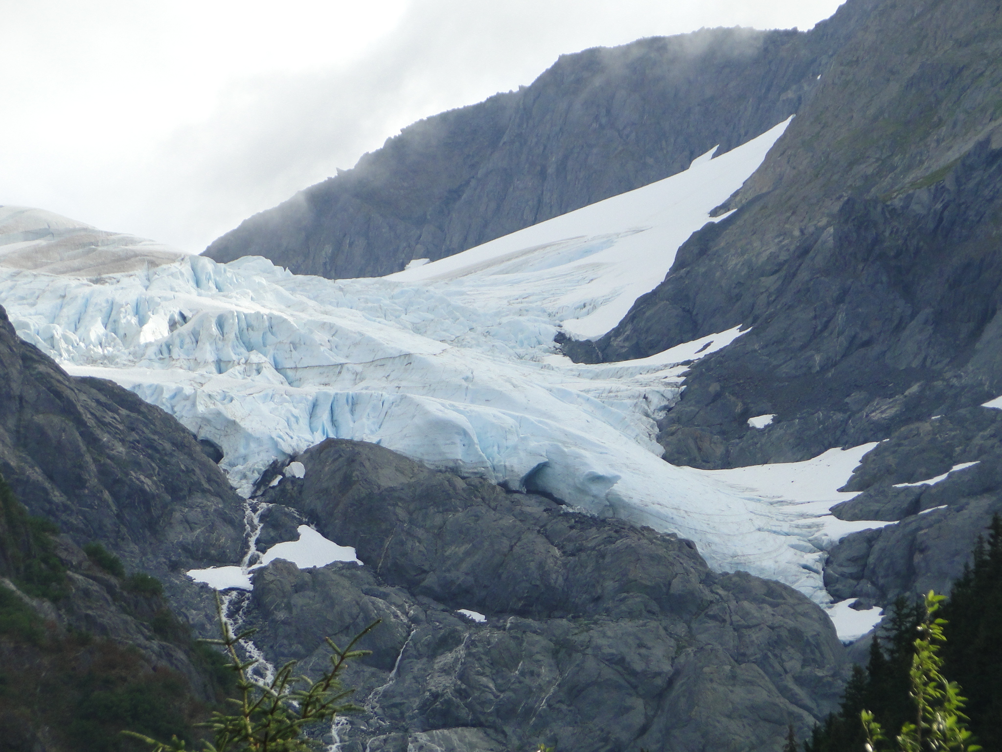
Camping that night at the Williwaw National Park Campground on the Portage Road was an exceptional find. This primitive campground is surrounded by steep jagged mountains topped with glaciers and is adjacent to a glacial stream runoff from the Portage Glacier. The sites are beautifully designed for very nice privacy, have pit toilets and beautiful walking trails that include a wooden boardwalk over a marsh complete with two suspension bridges. The trail system is called “The Blue Ice Trail”. While there we visited the Portage Glacier and did a bit of comparison with how we saw this glacier 8 years prior.
2011 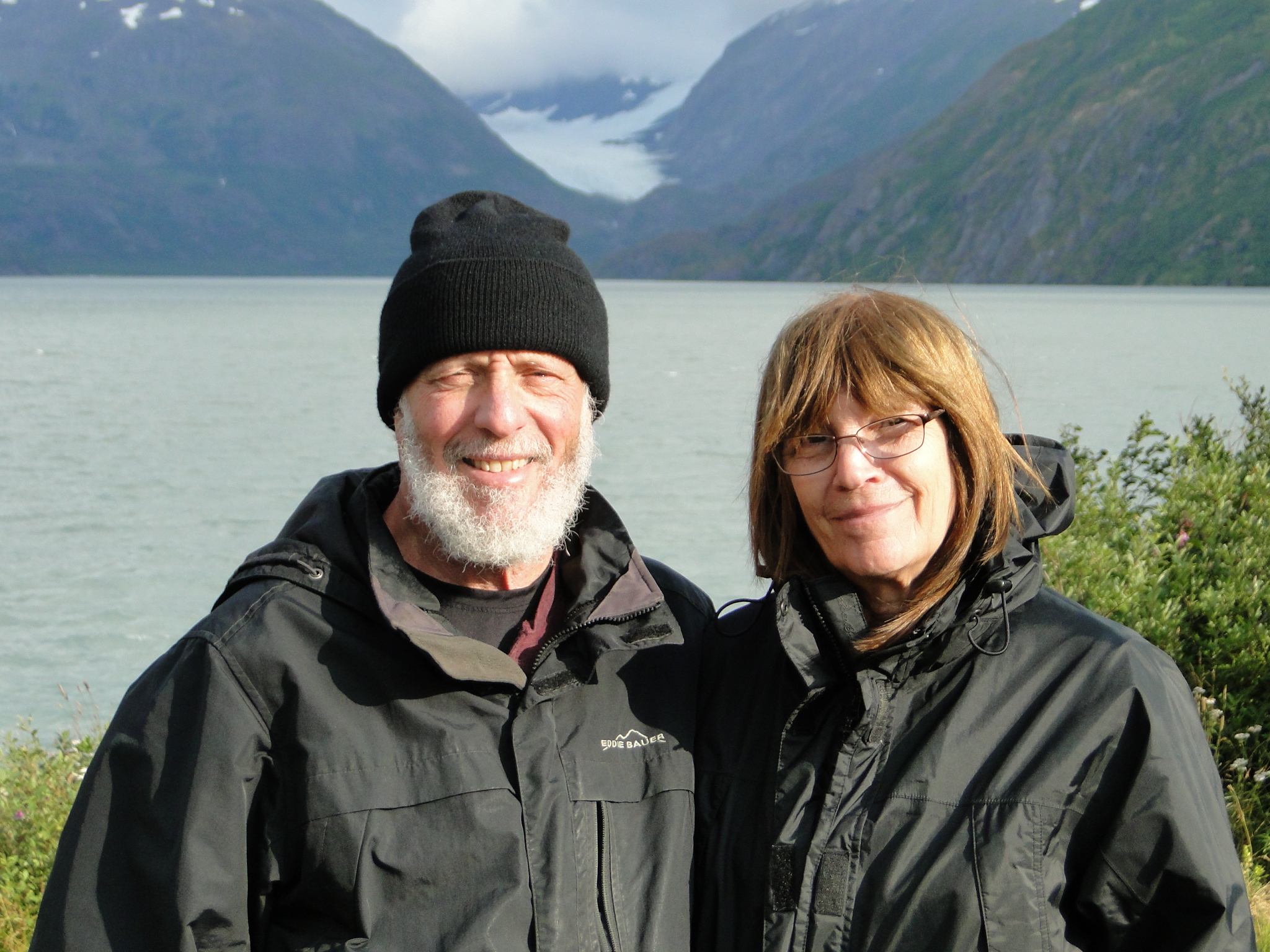
2019
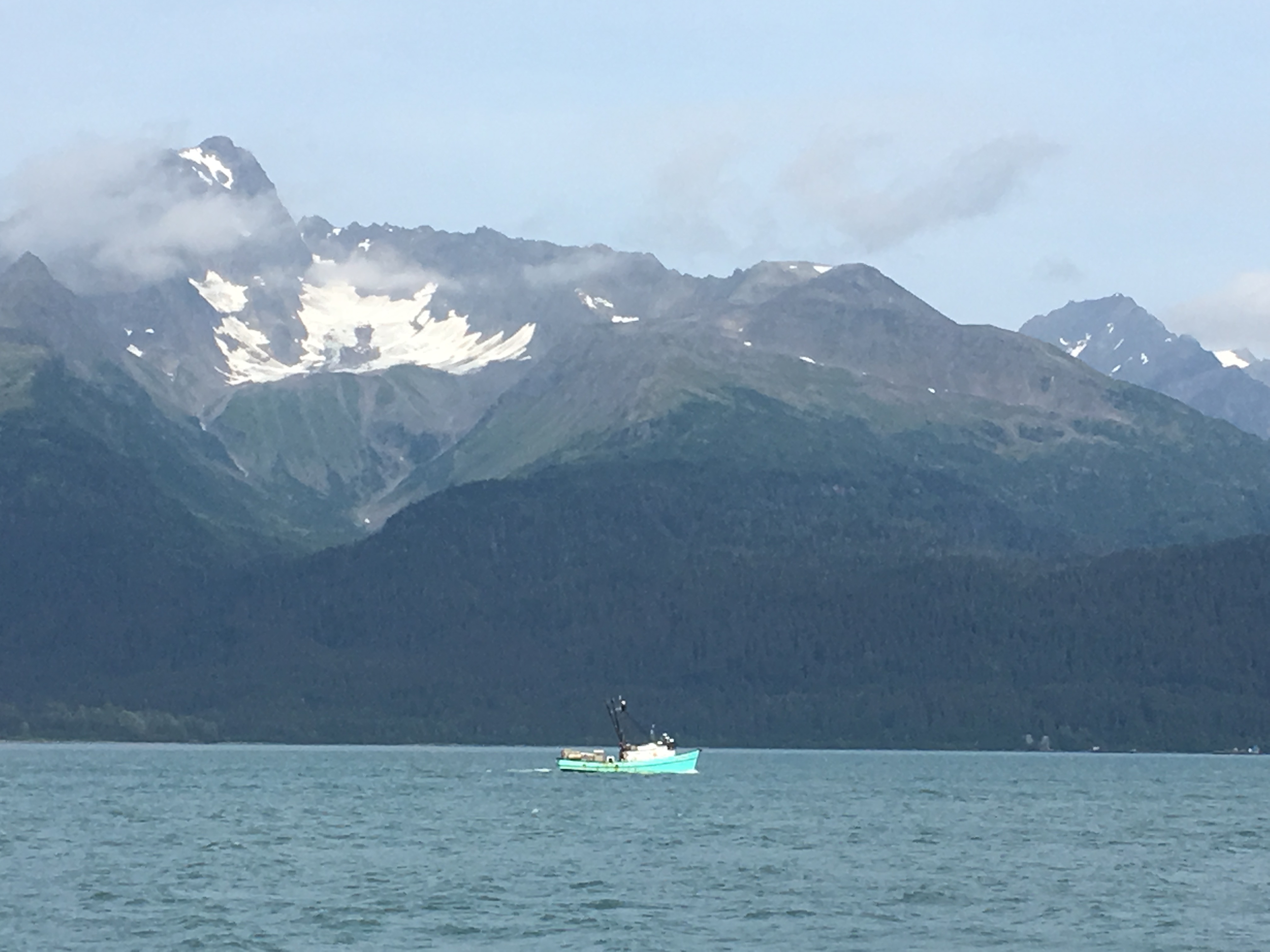
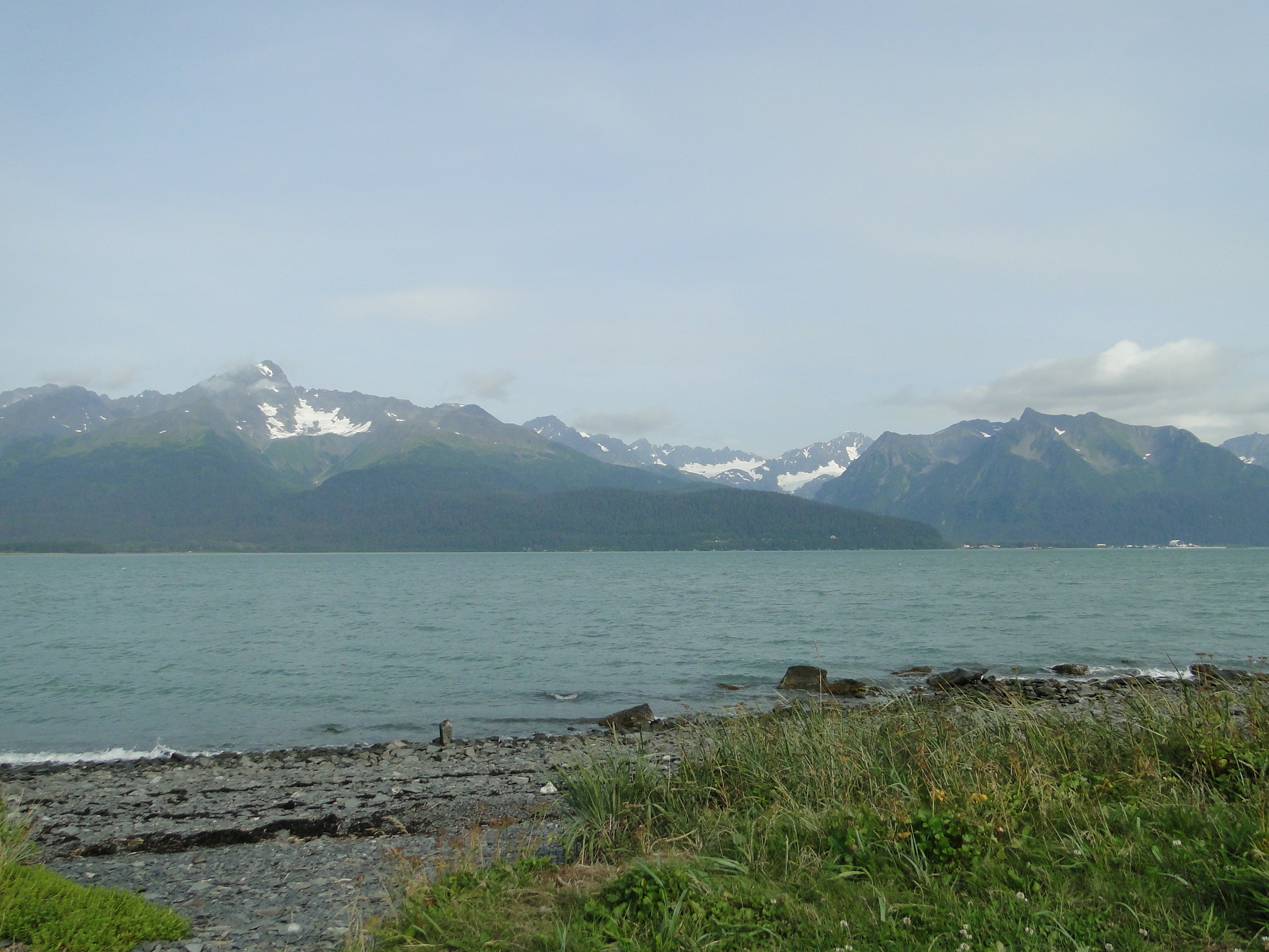
After a beautiful evening at this magnificent campsite, we headed south on the Seward Highway to the public campground at the Seward Harbor on Resurrection Bay. This is a very crowded parking lot campground but situated on the Bay more than covers any claustrophobia. The trick here is to get a water-front site and that demands an early arrival as all sites are first come, first served. There are several harbor campgrounds, all contiguous, and offer various levels of amenities. We were fortunate to get a water-front site with no hook-ups, $20/night. The photos from our campsite below barely capture the emotion of sitting on this body of water.
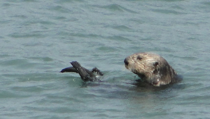
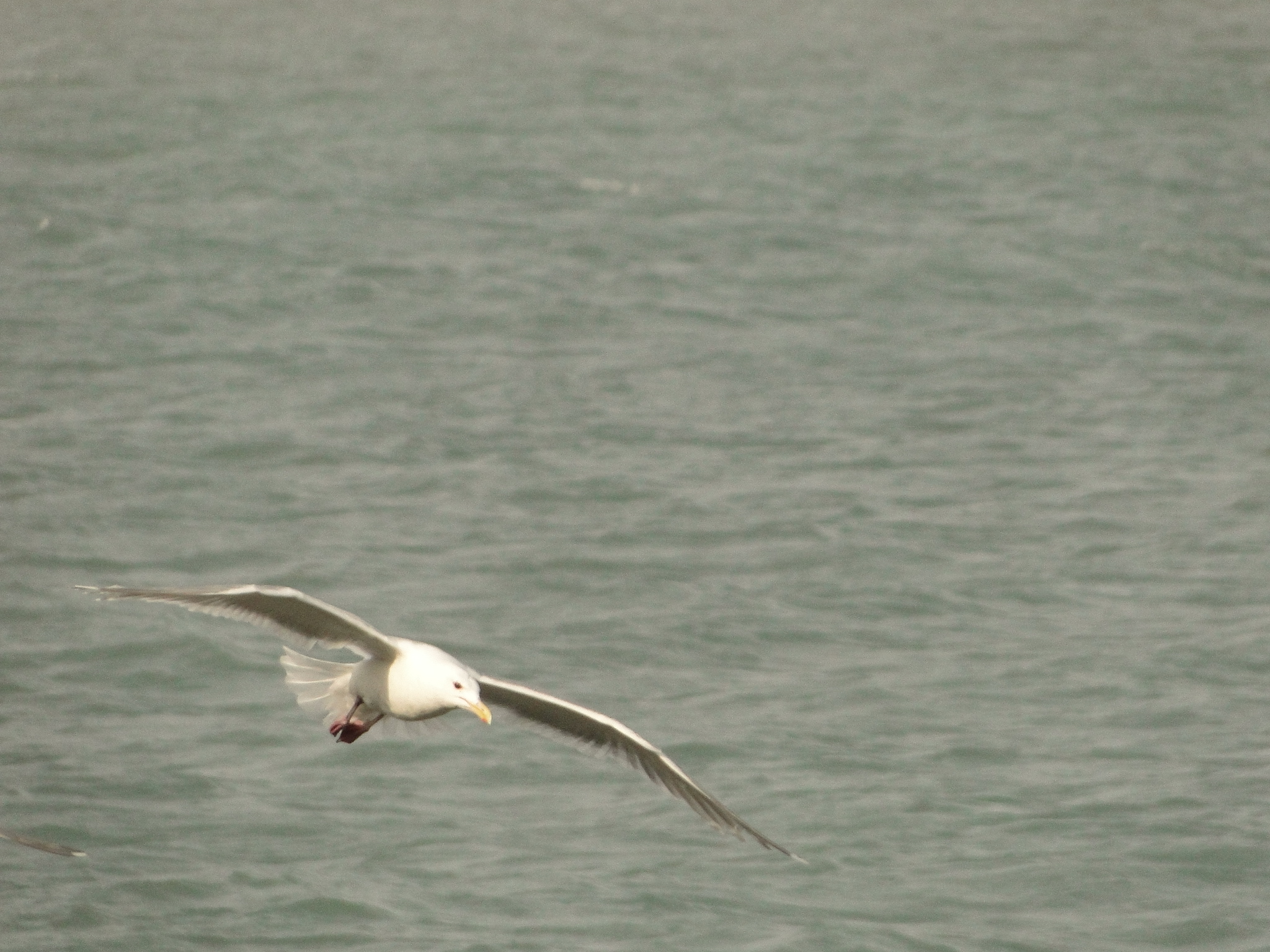
From Seward, you can take a narrated cruise out to the Kenai Fjords National Park. We took this tour the last time we were here and it was absolutely spectacular. You are virtually assured of seeing Orcas, puffins, bald eagles, sea otters and glaciers, many glaciers. Highly recommend this tour if the weather is good. The cruise takes you out into the Pacific Ocean as you maneuver into the Fjords so rough seas can be an issue if the weather sees fit. This is an all- day adventure but one of the top items that we can recommend.
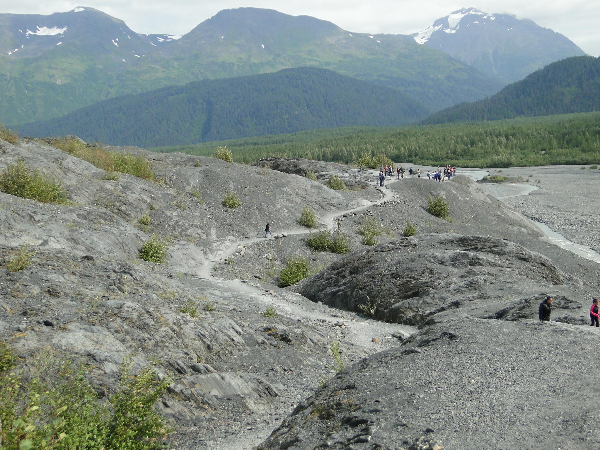
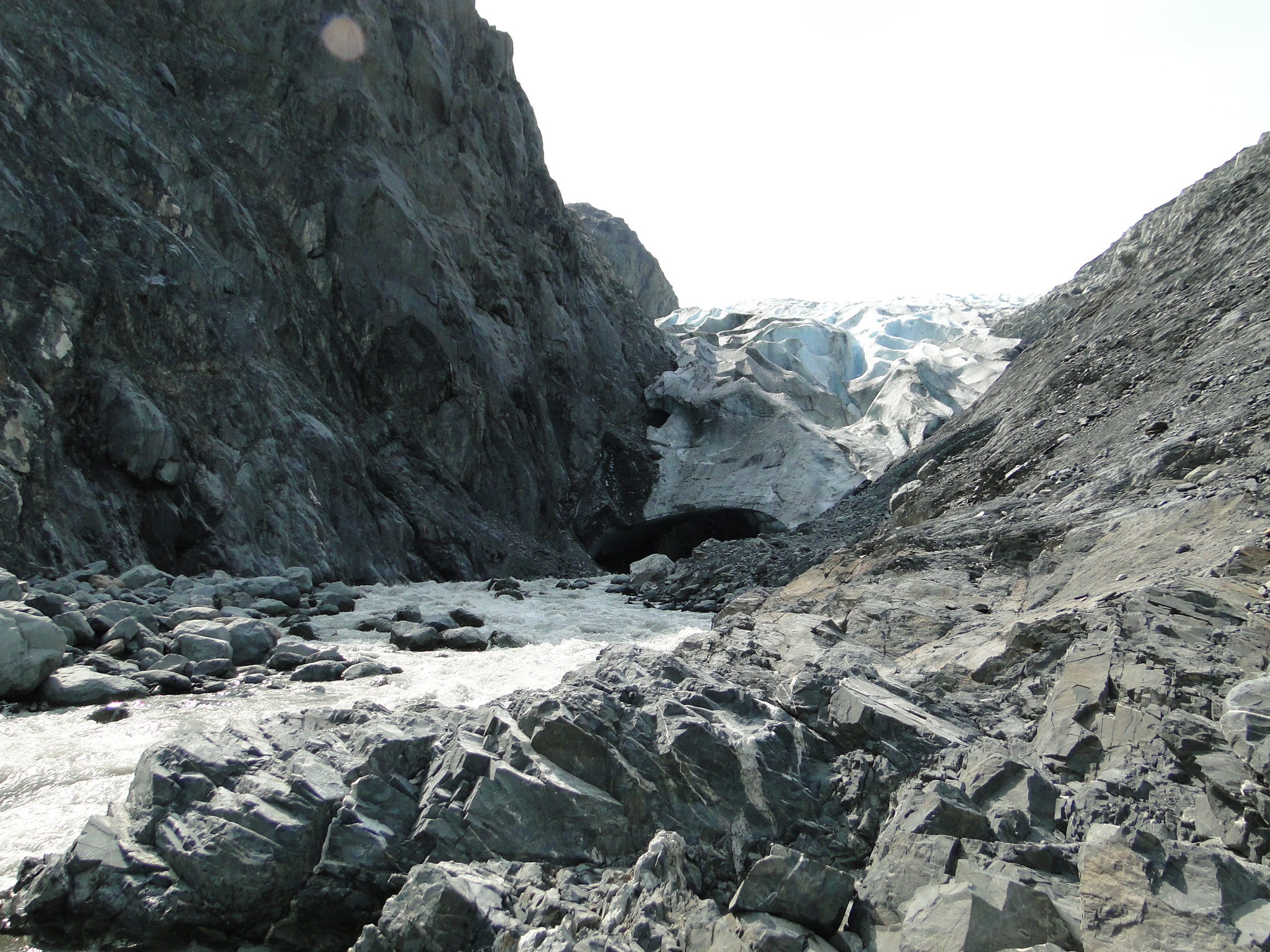
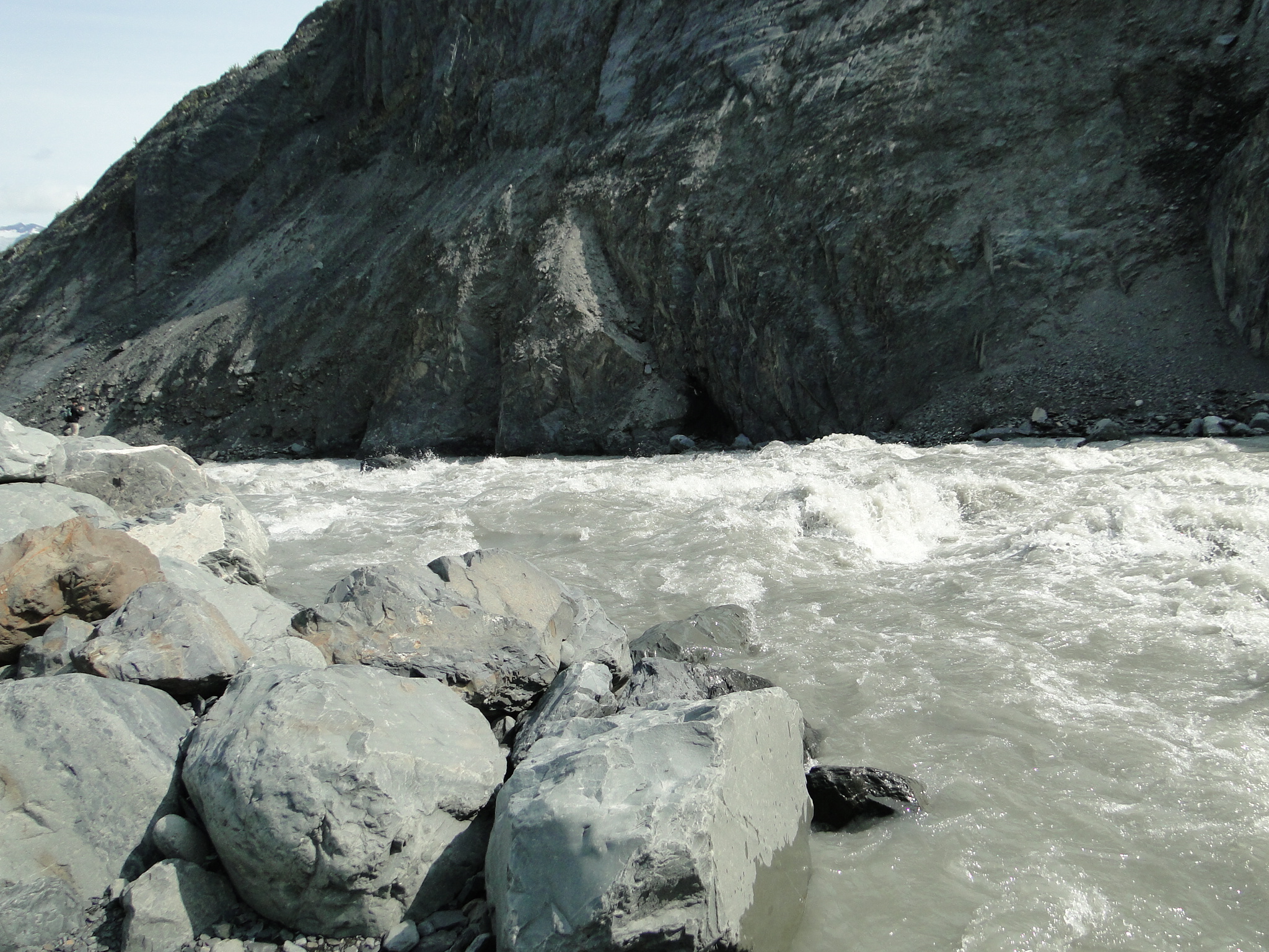
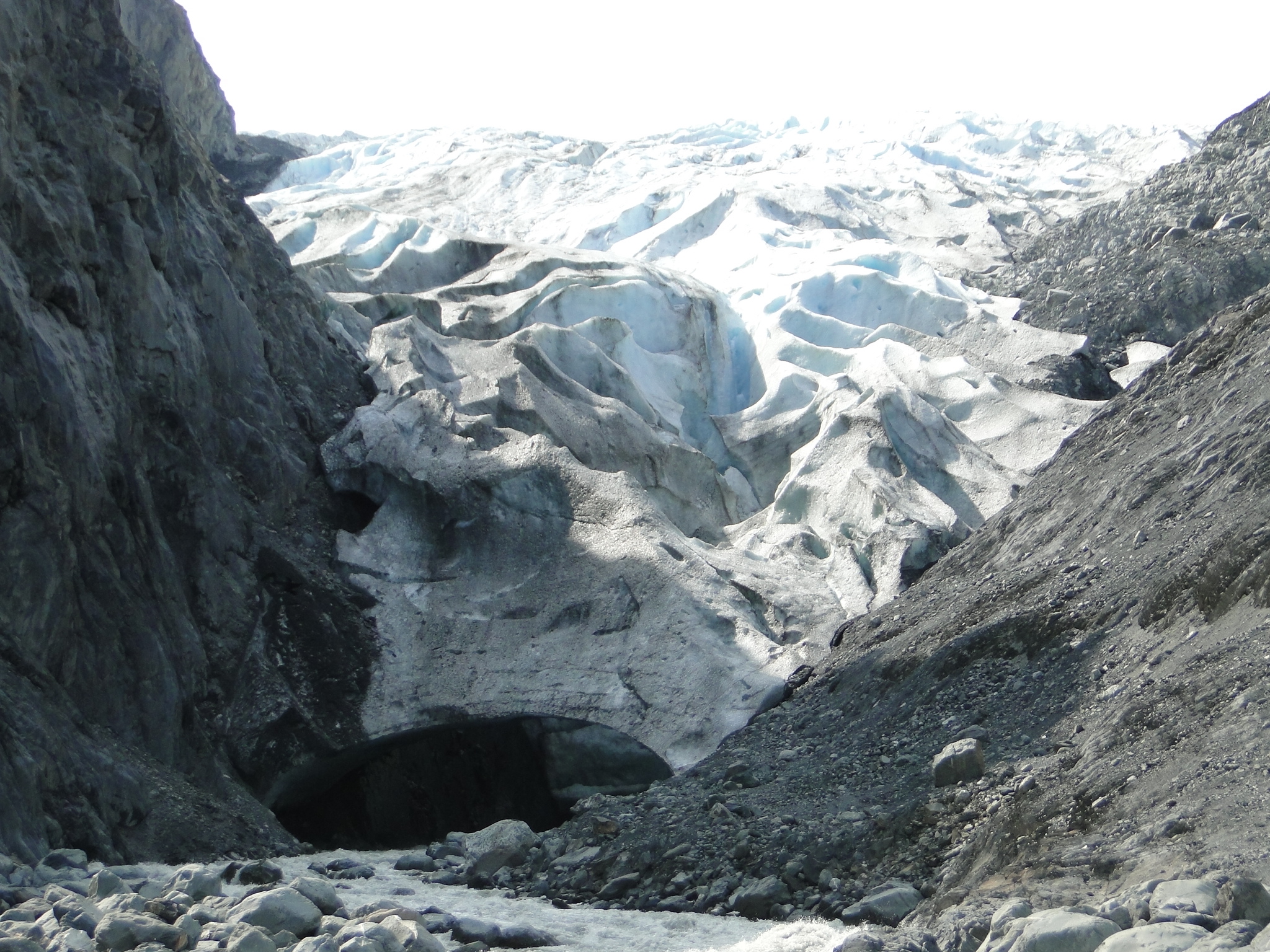
While in Seward, we have twice now hiked to Exit Glacier, one of the most accessible glaciers in Alaska. One can view the glacier from several vantage points involving some moderate hiking. There is also a wheelchair accessible path that happened to be closed at this time as a mama bear was in the vicinity with her cubs.
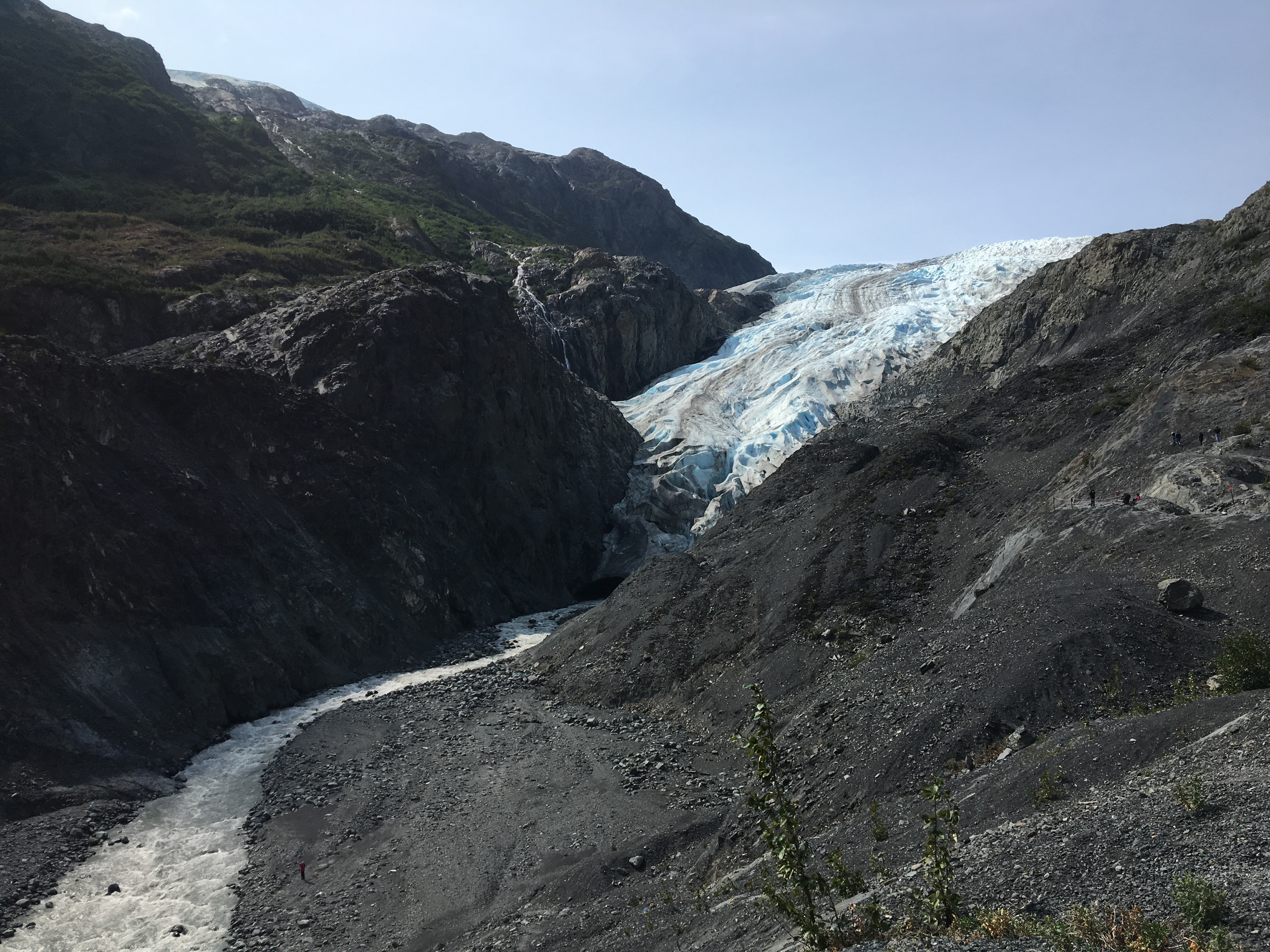
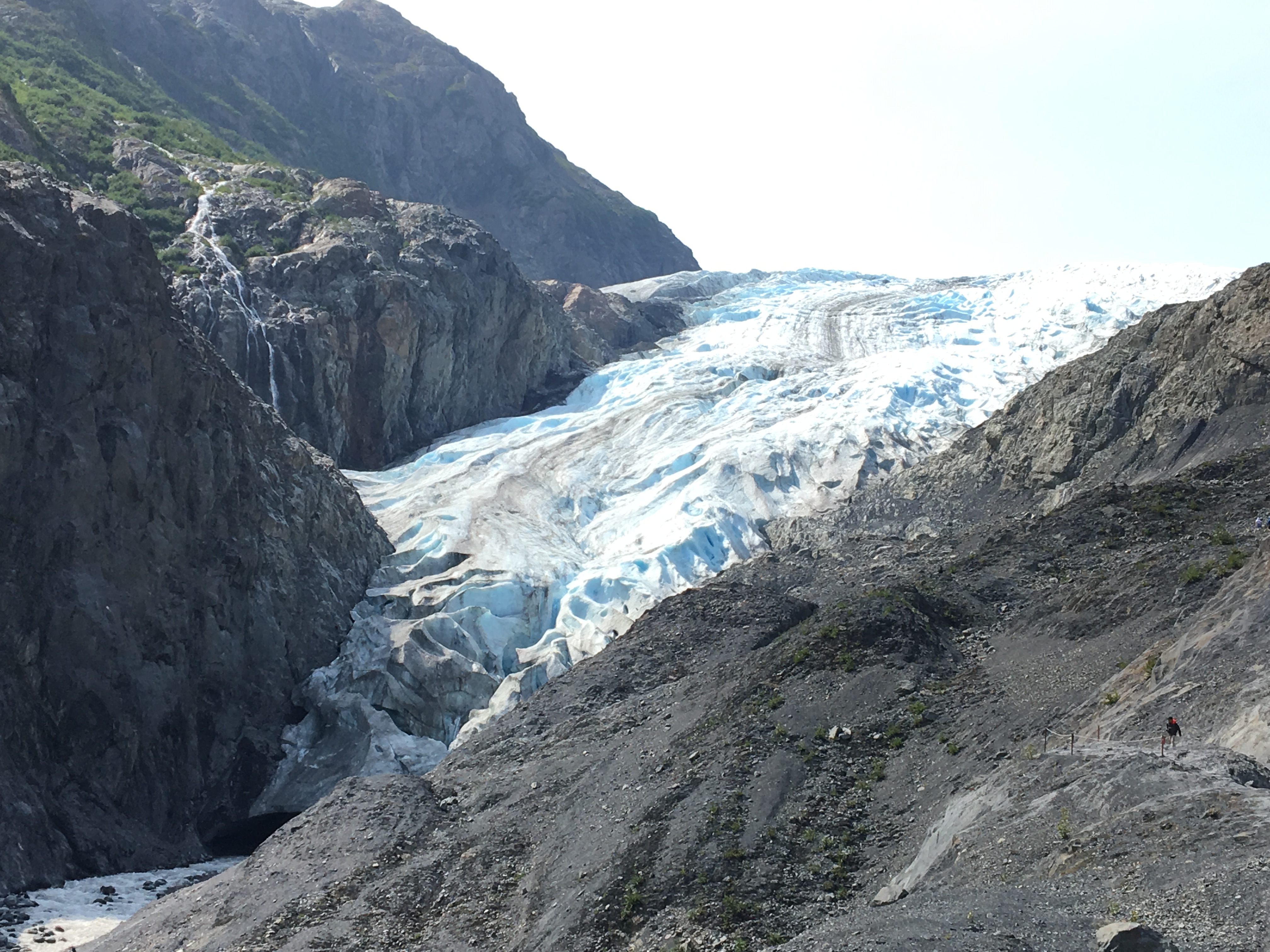
The hikes vary in length and difficulty but a more serious challenge can take you to stunning views to grant you access to the top of the vast Harding Ice Field, an 8.2 mile hike with 3,000’ of vertical gain. The Harding Ice Field feeds over 40 glaciers and the day hike to the top of the field is considered one of the most spectacular day hikes in Alaska.
As we hiked back down from the view point, we continued further to the glacier wash area and eventually scrambled our way to a remarkable view of the glacial toe. The amount the glacier has receded since 2011 was dramatic and we show the difference in the photos below.
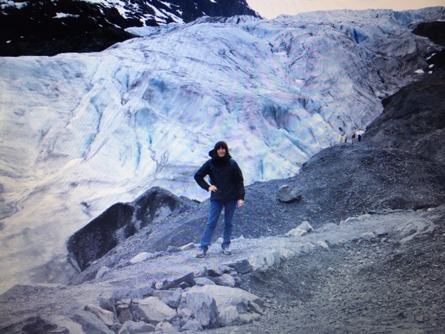
2011 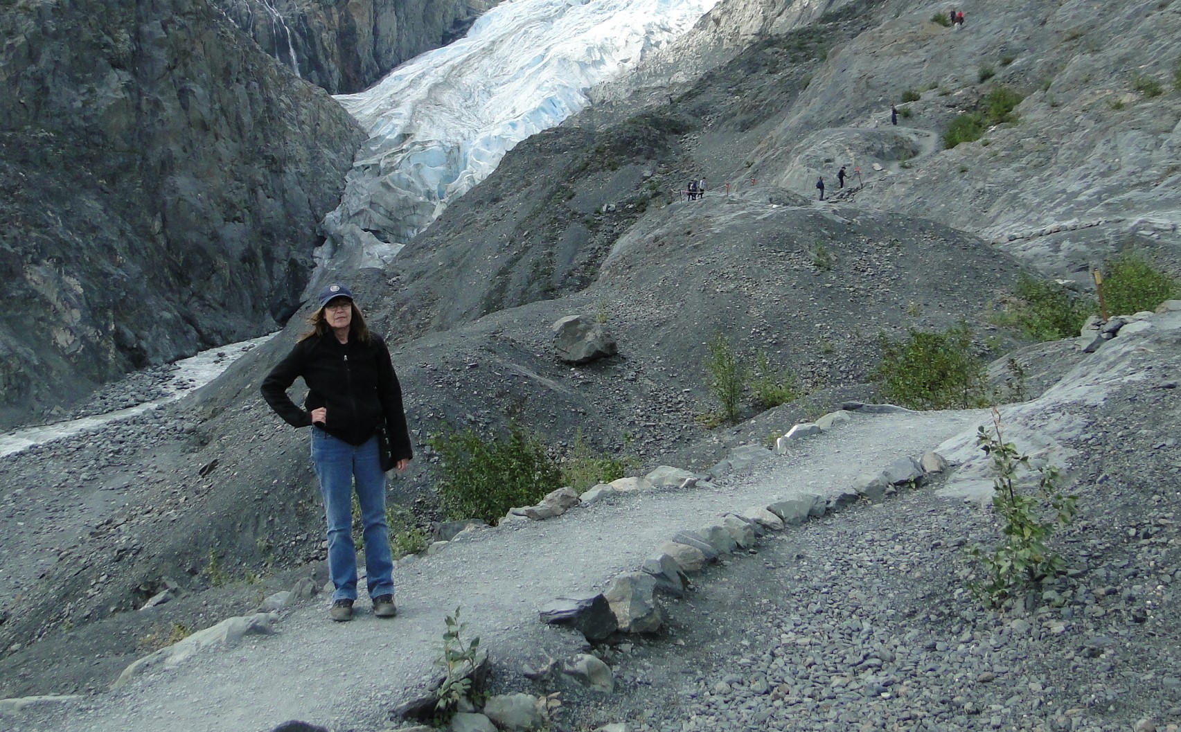
2019
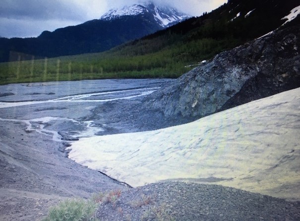
2011 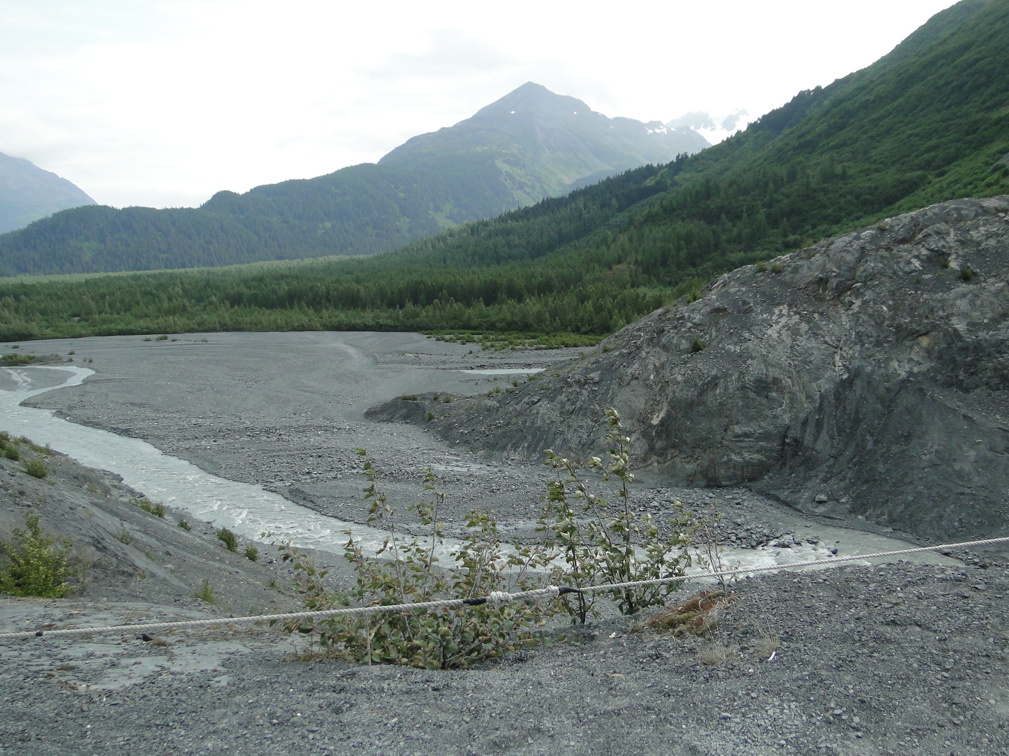
2019
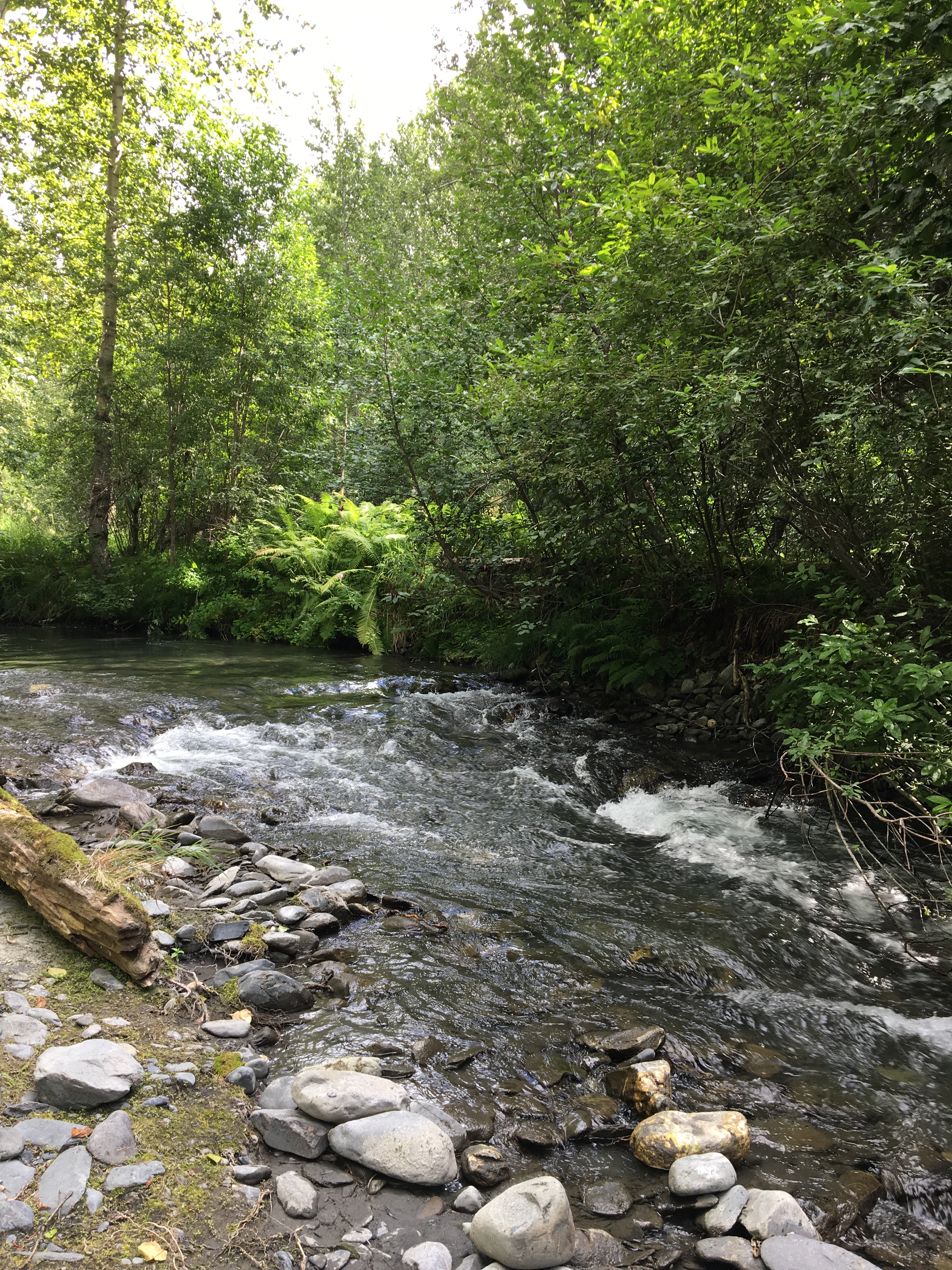
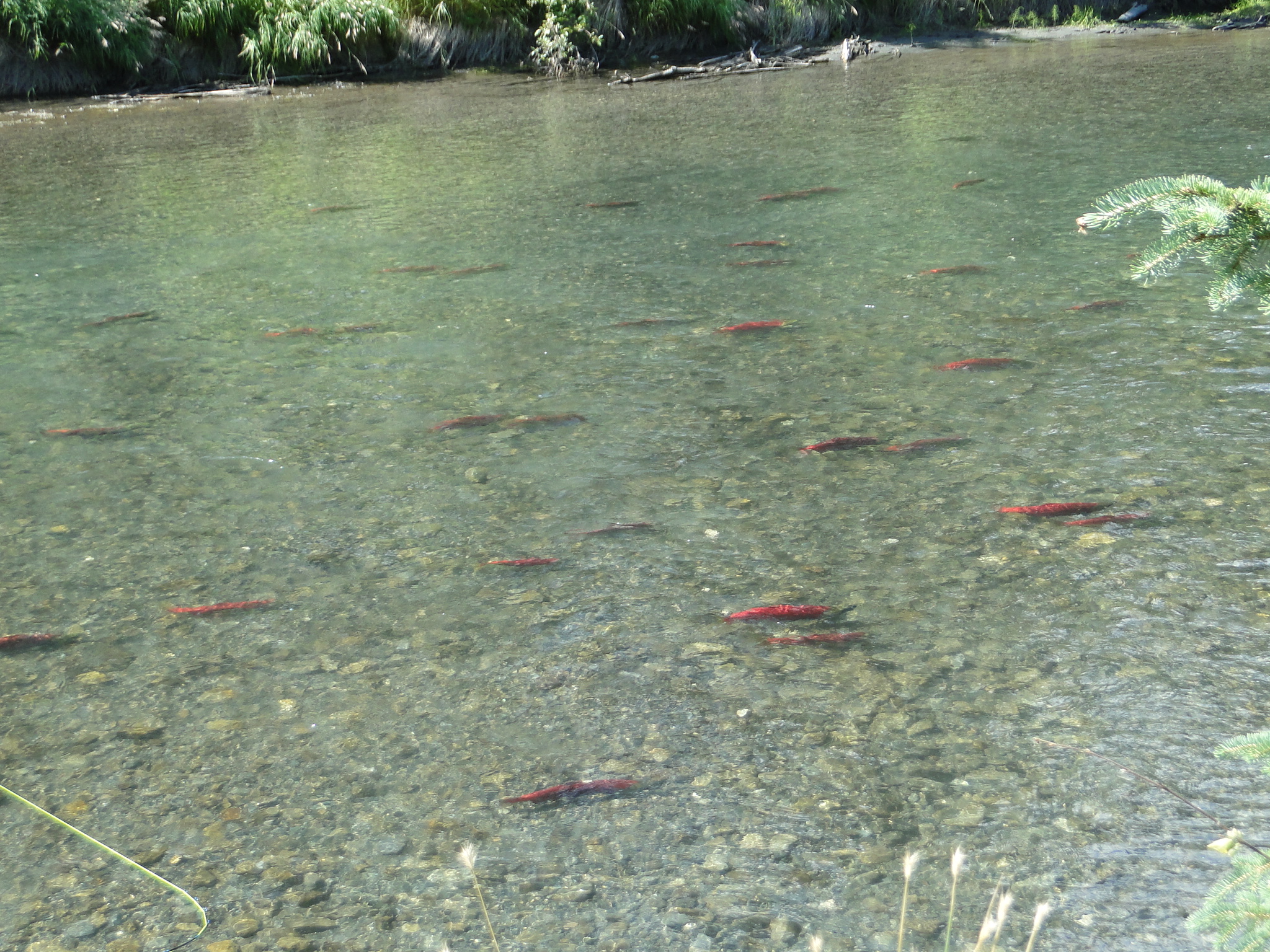
After two days in Seward we moved back north to pick up the Sterling Highway running east/west across the Peninsula and found our way to the Crescent Creek Campground, another dry campsite that is nestled in a tight coniferous forest adjacent to the beautiful Crescent Creek. In this creek we see King Salmon in their last days as they are spawning and thus off limits to fishing. This gem of a campsite is very limited in numbers and we were fortunate to have nabbed the very last site. ($7/night with America the Beautiful pass)
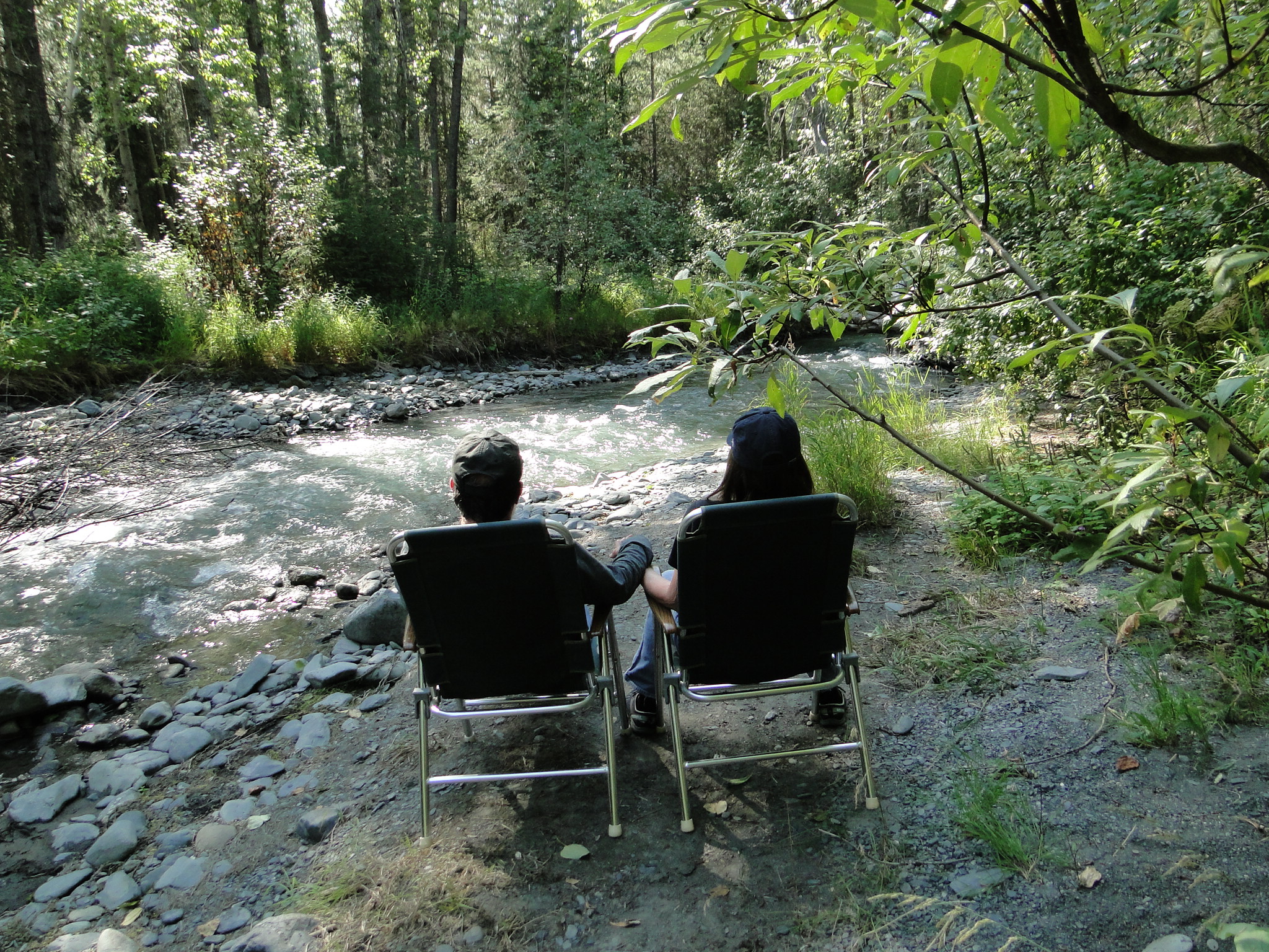
While staying at Crescent Creek for two nights we were able to spend the second day at Kenai Lake, at almost 14,000 acres, forming the headwaters of the Kenai River. The lake and the river are famous for world class fishing and attract people from all over the world.
From the Kenai Lake area we continued heading west on the Sterling Highway to visit the mouth of the Kenai River just north of the actual town of Kenai. Just before we get into Kenai we happen to meet up with a rather large moose walking along the road and eventually crossing the road with traffic coming to a halt.

Continuing south now on the Sterling, we begin to see the rising volcanoes across the Cook Inlet as we near Homer. Redoubt Volcano (Mount Redout) at 10,197 ‘ is an active stratovolcano that last erupted in 2009. Mount Iliamna, a glacier covered stratovolcano stands at 10,016’. Iliamna last erupted in 1876, though as part of the Pacific Ring of fire, these volcanoes are never considered dormant.
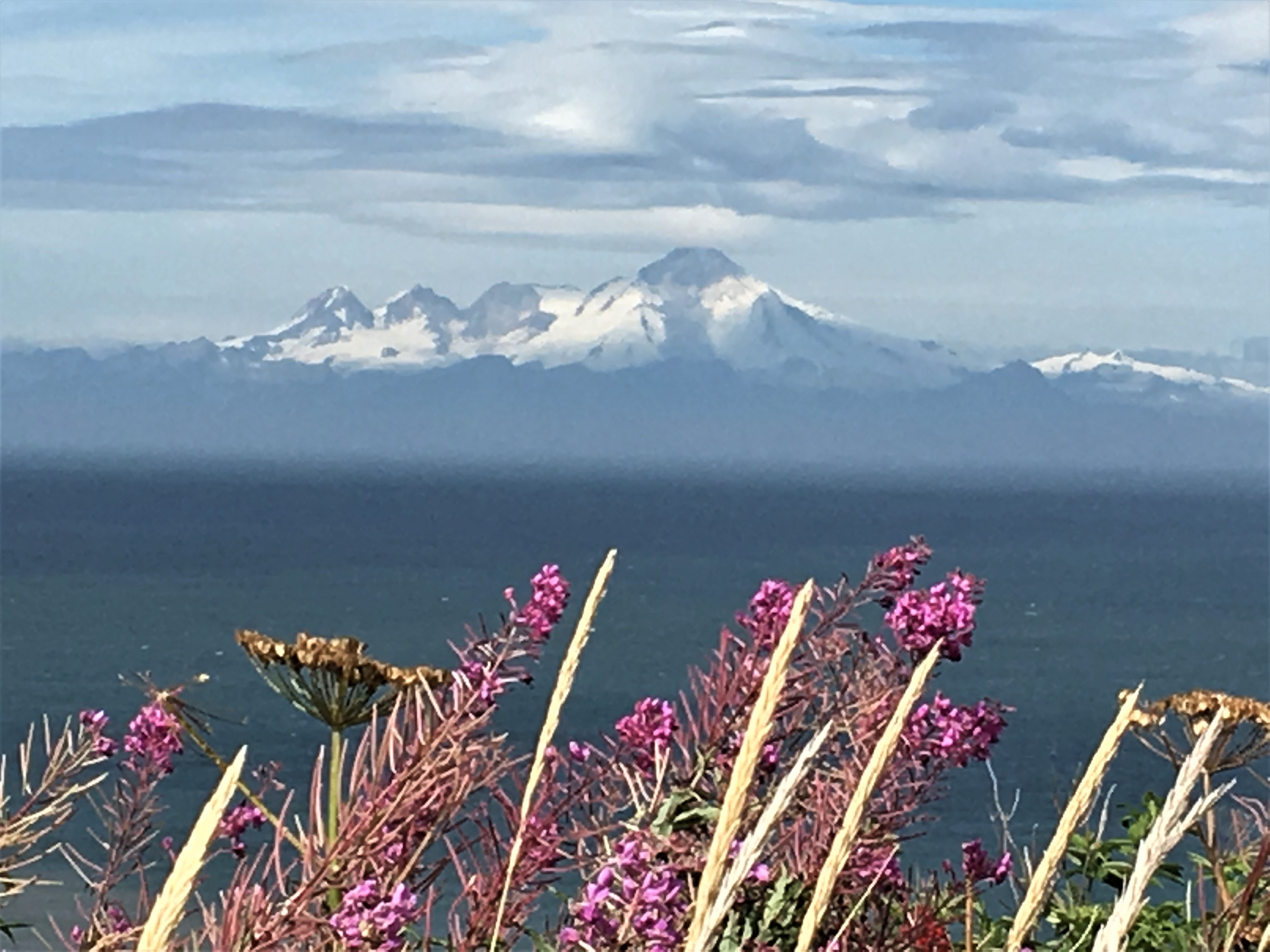
A stratovolcano is a tall, conical shaped volcano consisting of layers of hardened lava, tephra and volcanic ash.
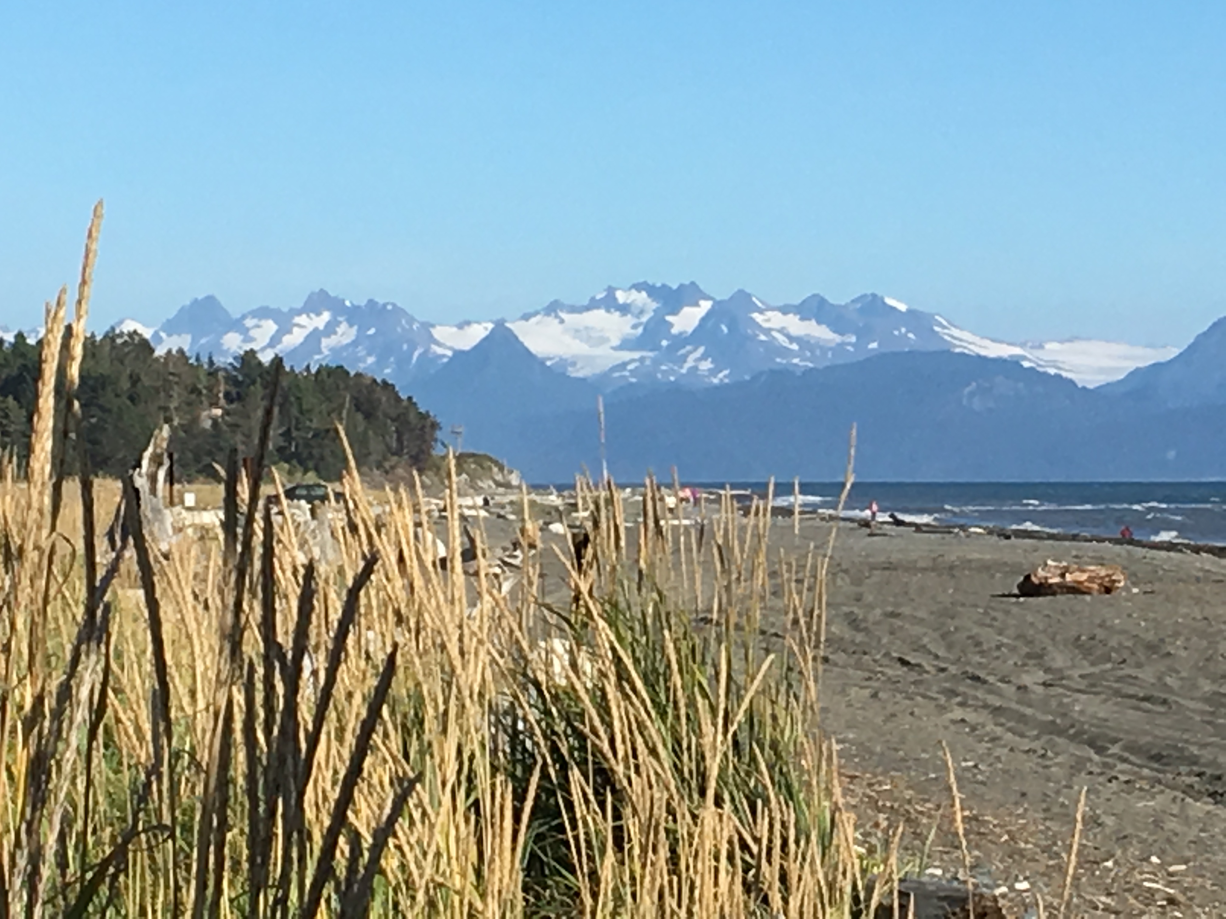
On our downhill drive to Homer we pass Anchor Point, the western most point in the North American highway system. Homer, the destination point for the next few days lies at the southwestern end of the Kenai Peninsula on the Kachemak Bay. The town is surrounded by glacial mountains and magnificent tidal waters. We chose to stay at a FHU campground as we planned to stay for three nights at the Driftwood Inn and RV Park, camping with our front windows facing the bay. The price for these amenities and the view is steep. ($55/night)Though this is a very small and close RV park, the amenities are excellent and the view is….. well here it is.
I will close arriving at Homer and detail our adventures from here in the next posting.
Peace, Jay

Thank you for the magnificent photos. The wildlife you captured just keeps getting better! Way to go bro!
LikeLike
It was a great recap on our dwindling glaciers. What a wonderful trip.
Ken
LikeLike
Thank you again for sharing the spectacular scenery with us. So glad you are having a wonderful adventure. Enjoy!
LikeLike
A wonderful travel experience and nice photos on the shrinkage of glaciers.and you guys of course
Love, Bobbi
LikeLike
Great pics and descriptions! Be safe
LikeLike
Every post has had incredible pics and words showing us there are still things to marvel at in the world and specifically on this continent. Denali has to be a spiritual experience. Keep on keeping on, and stay safe and sound.
Gary & Cindee
LikeLike
Another great post and pics ! Thanks for including info on your camping sites. We will use this as we plan our Alaska trip.
LikeLike
Apparently you got out of Banff in the nick of time, too!
https://www.washingtonpost.com/nation/2019/08/14/banff-national-park-wolf-attack-american-family-campers/
LikeLike
Glacier, too! https://www.cnn.com/2019/08/14/us/glacier-national-park-fatal-rockfall/index.html
Please stay safe.
LikeLike
Once again, totally captivating! Beautiful, beautiful. Love how you describe the “inner joy”. It makes my heart happy to hear that (-:
LikeLike