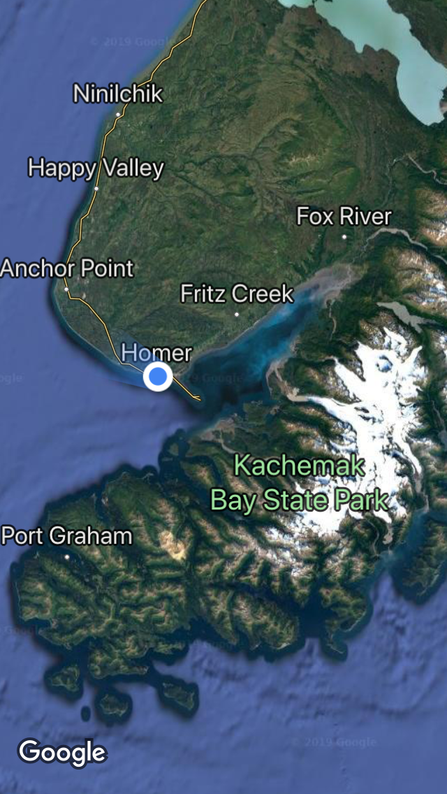
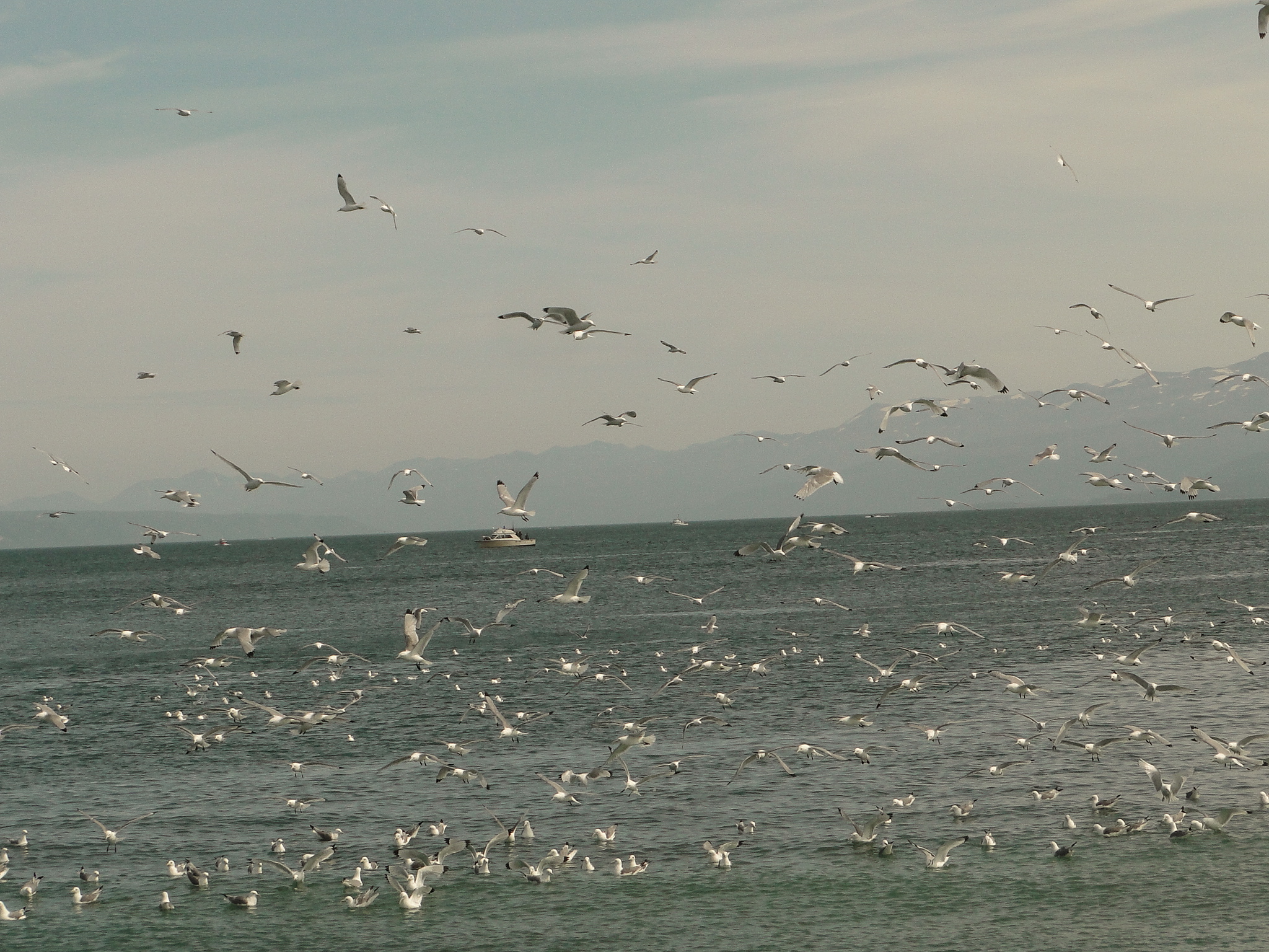
No At the southwest corner of the Kenai Peninsula lies the beautiful fishing village of Homer, Alaska. 225 miles from Anchorage, Homer is known as the “end of the road”, the furthest one can drive in a southwesterly direction in Alaska. From Homer, access to the Kodiak Islands or the Aleutians is only by boat or plane. The village is situated between the Kachemak Bay to the east and the Cook Inlet to the west, and features some of the premier fishing in all of Alaska. (In particular halibut and salmon) It is also a well- known and popular wildlife viewing destination.
Beluga Lake and the nearby mudflats offer great opportunities to watch waterfowl and shorebirds. In the waters off of the Homer Spit, at the very end of the peninsula, tour operators offer trips into the Kachemak Bay to observe the marine life, including sea lions, otters, seals, porpoises and whales. There are also water taxis to ferry you across the bay to the Kachemak Bay State Park where one can hike with relative ease to the lake at the foot of Grewingk Glacier. We had actually booked a water taxi and canceled due to fog in the mountains. Though they were willing to transport us across the Bay, the lack of visibility dimmed our enthusiasm for this hike.
Walking the Homer Spit is an activity that includes gift shops, fishing charter companies, restaurants, flightseeing operators and beach fishing. Occasionally cruise ships dock at the port and of course the sudden influx of thousands of additional tourists does tie up the walkability of this mercantile area.

In Homer we also visited the Islands and Ocean Visitor Center, a wonderful wildlife museum housing interpretive and interactive exhibits that provide a marvelous introduction to this rich biological environment. The Center is also adjacent to and partnered with the Alaska Maritime National Wildlife Refuge.
With the abundance of fishing opportunities, we did explore the cost to catch and ship salmon back home but by the time all of the extra fees are added, a 50 pound box of salmon would have cost over $700. So, rather than ship it home, we opted to eat as much as we could while in Homer and it was quite special though we found it impossible to buy fresh salmon. All of the fish processing facilities flash freeze their fish for market immediately and do not sell it before the freezing process. However, purchasing this fish and thawing it still offers essentially fresh caught salmon and it was delicious.
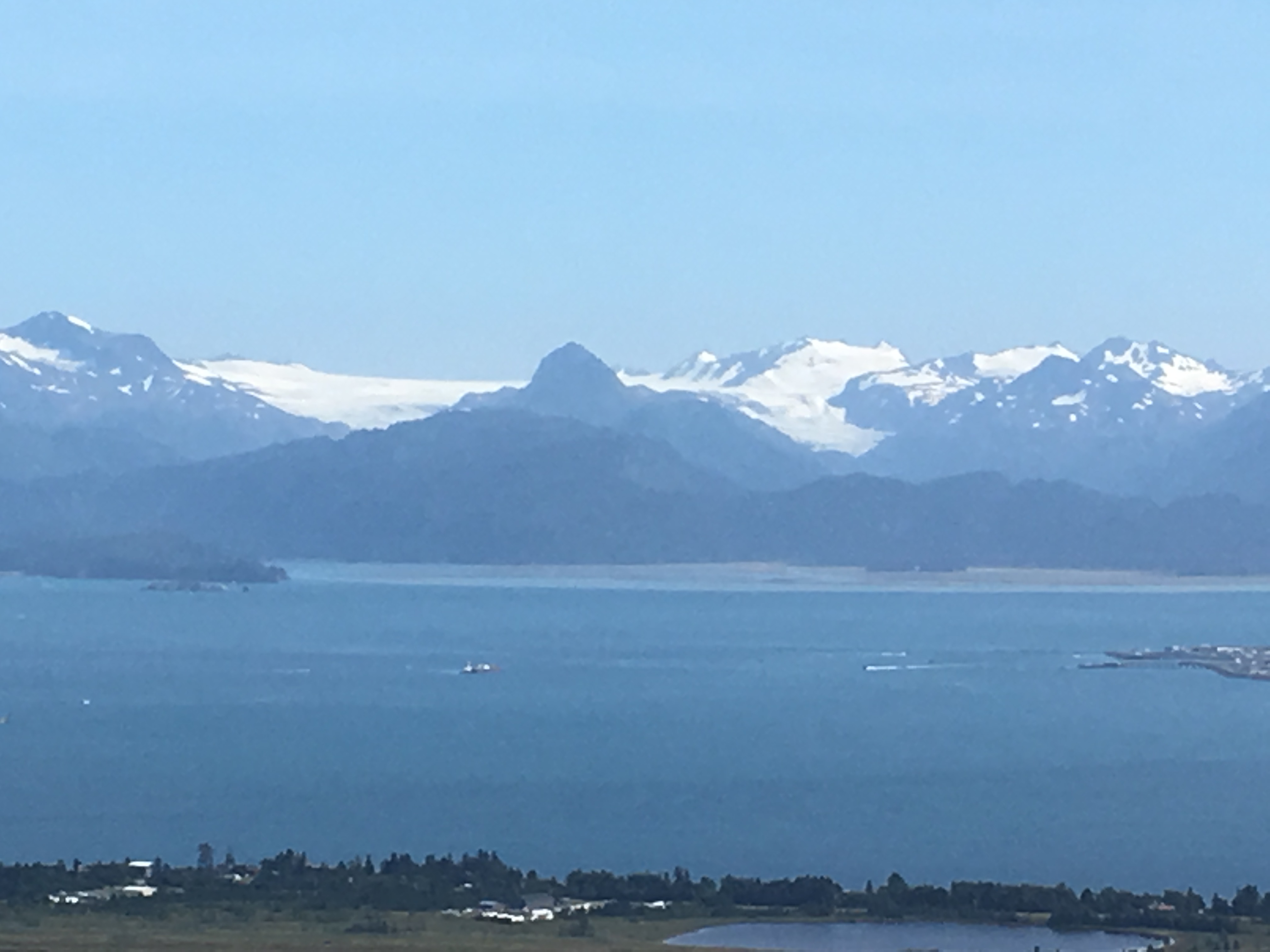
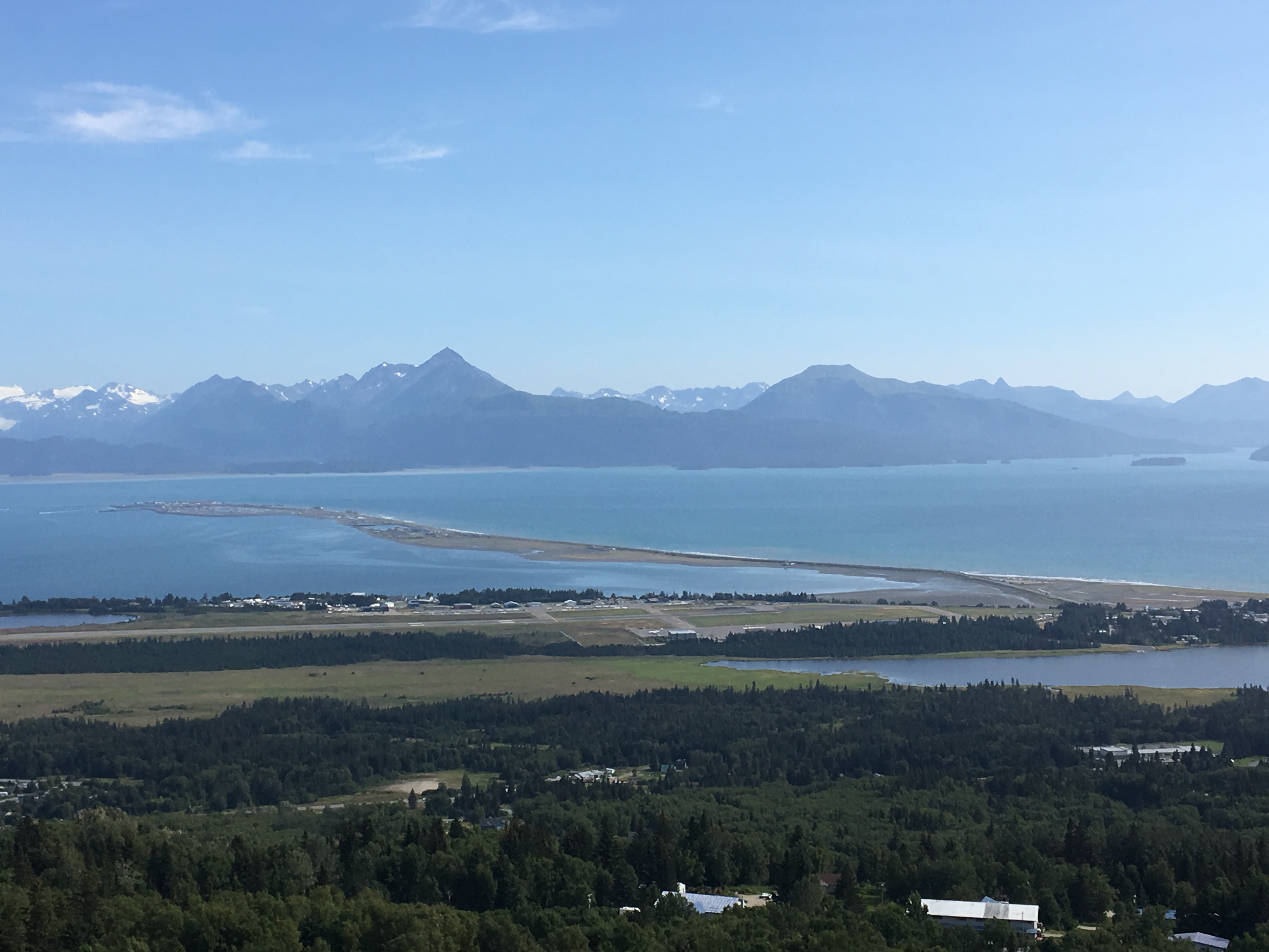
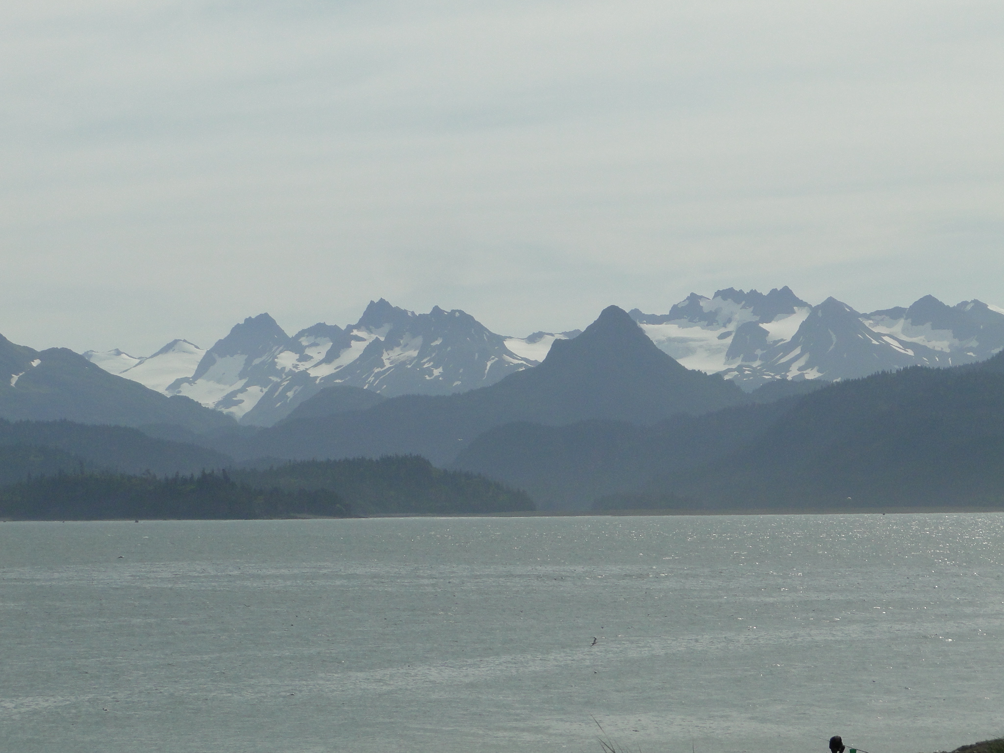
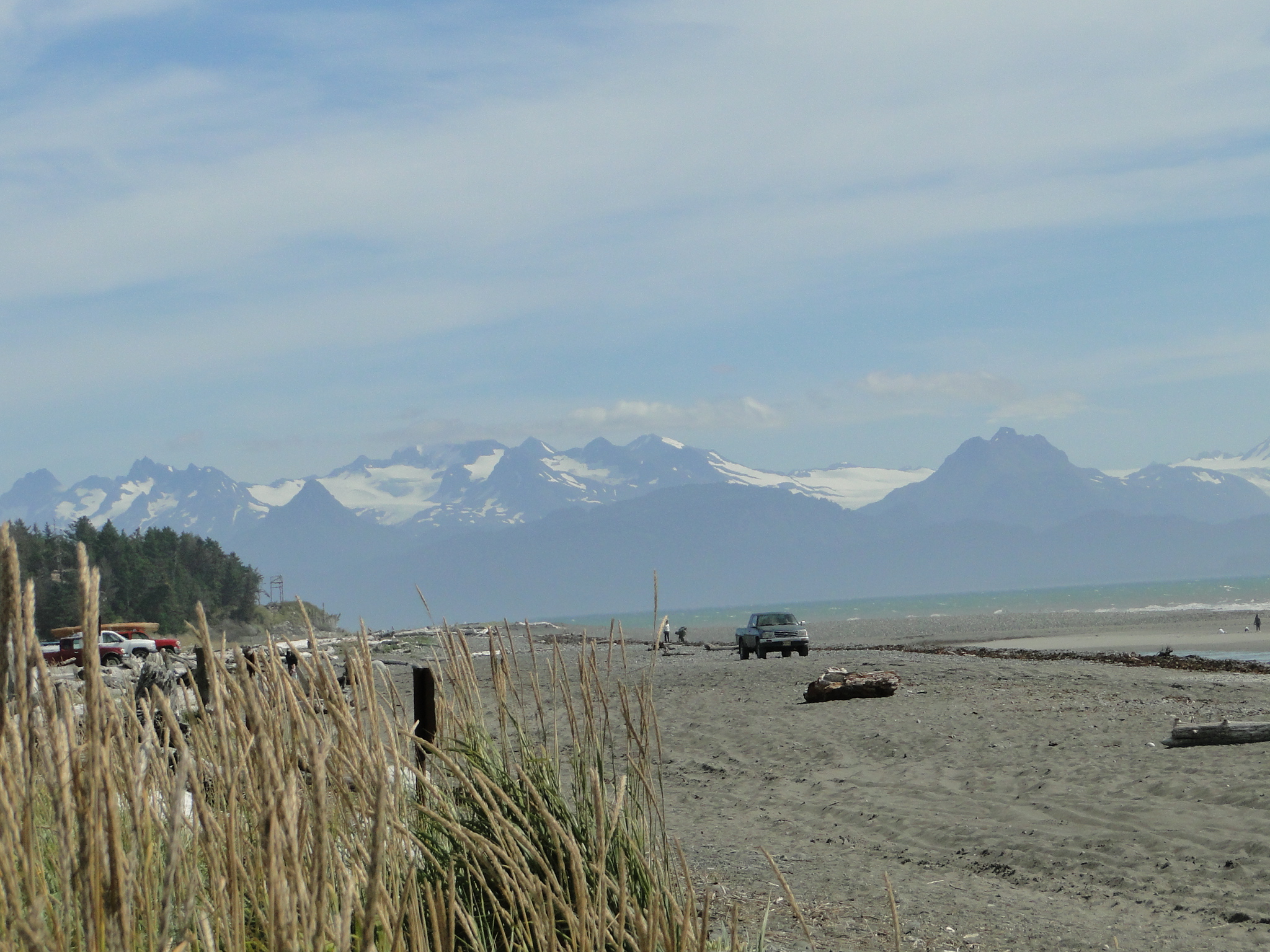
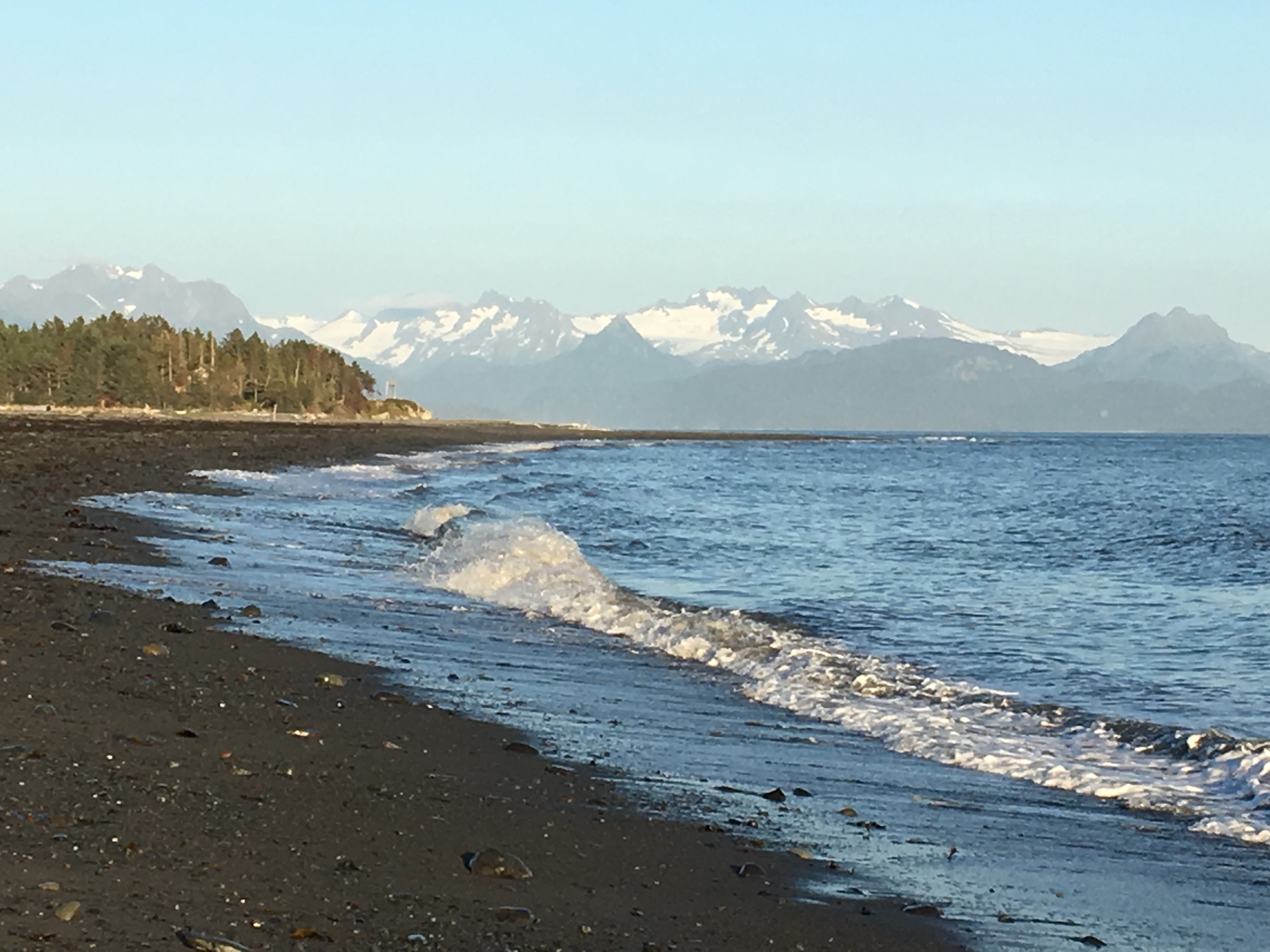
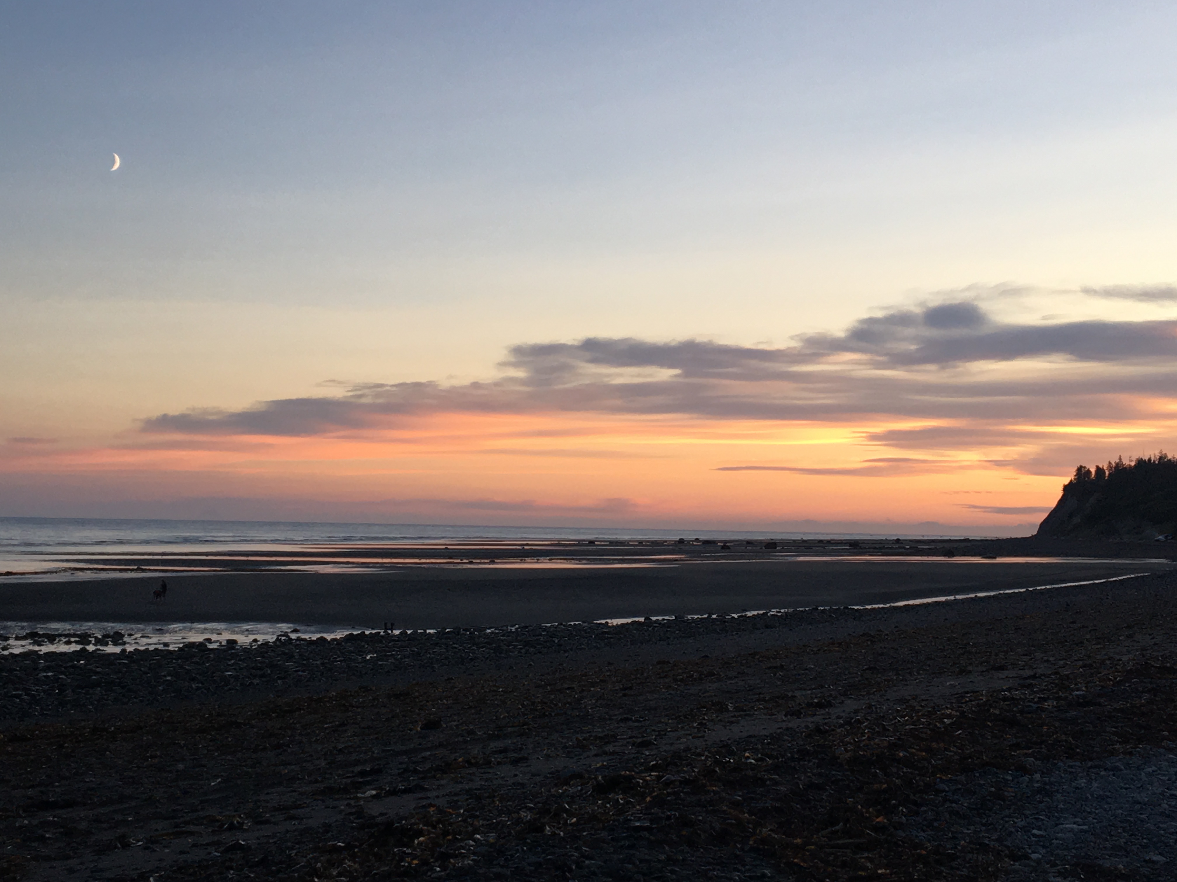
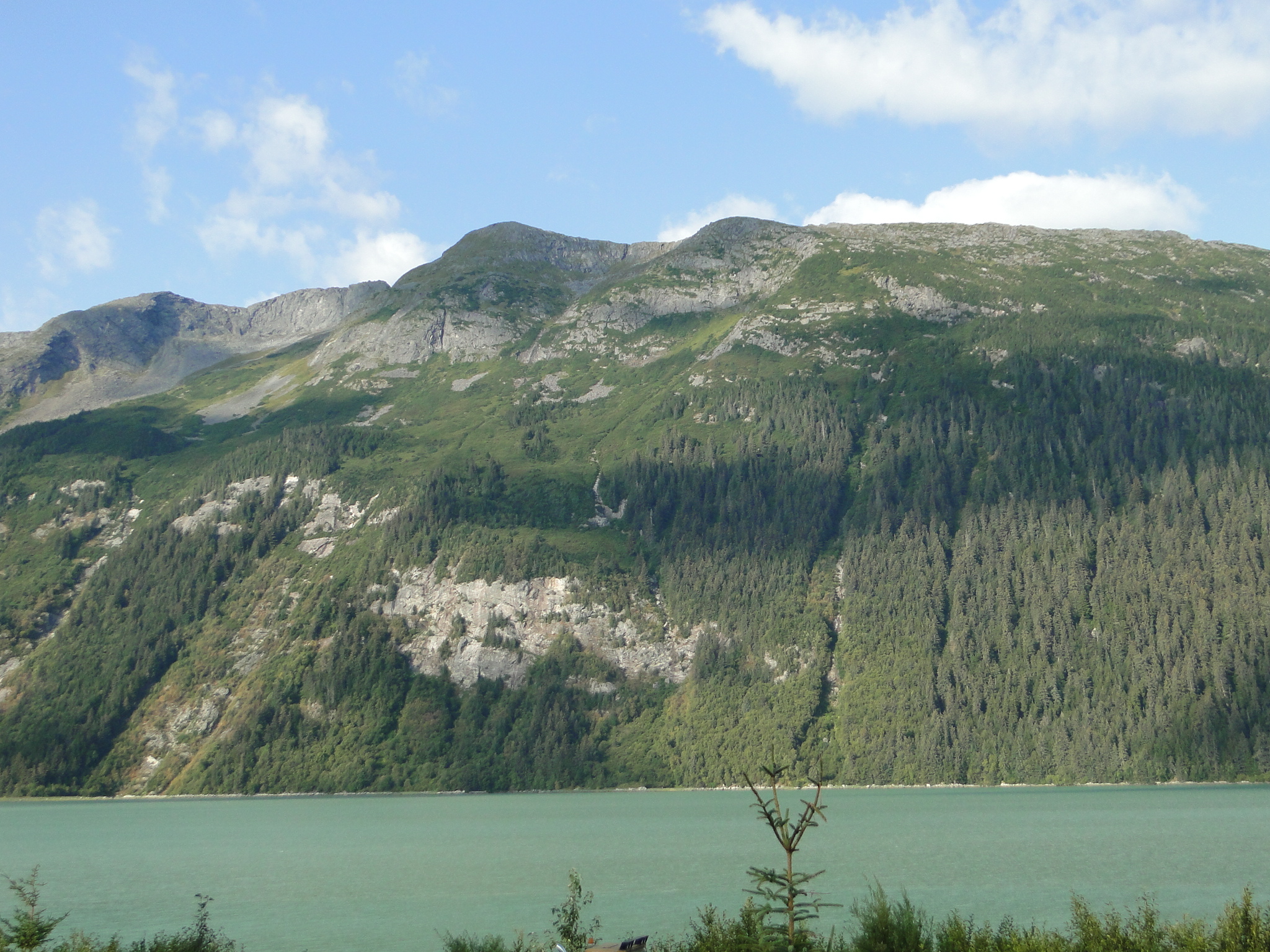
For viewing the town and surrounding waters, the Skyline Drive roadway is mandatory. This road, high above the town, offers spectacular views of the entire region and is easily accessible. In addition to this vista, the beaches offer unparalleled beauty and walking the beach in front of our campsite was a regular activity while we were in Homer.
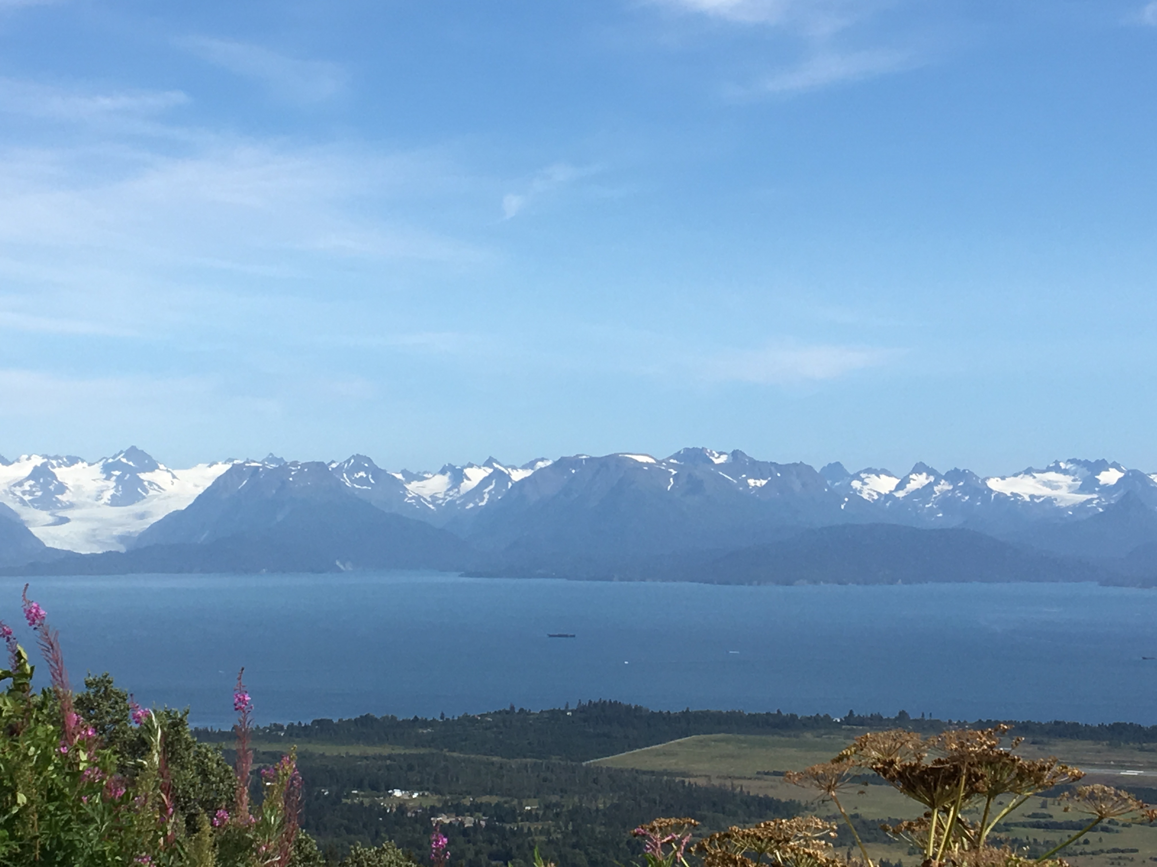
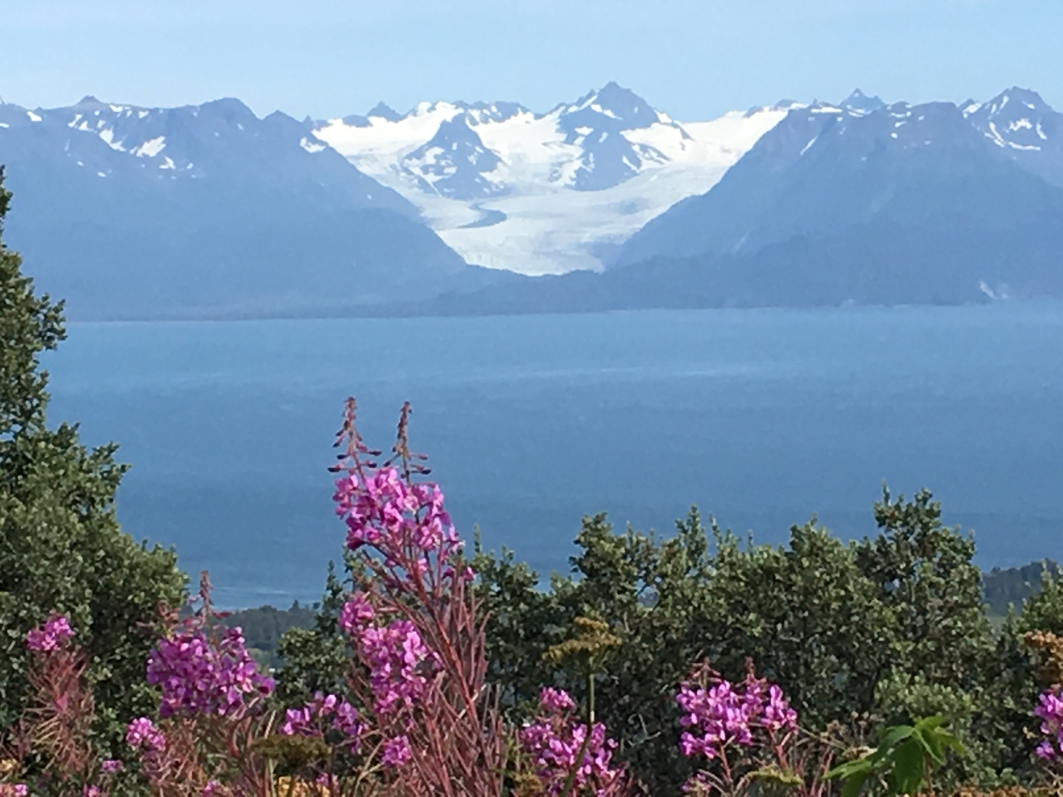
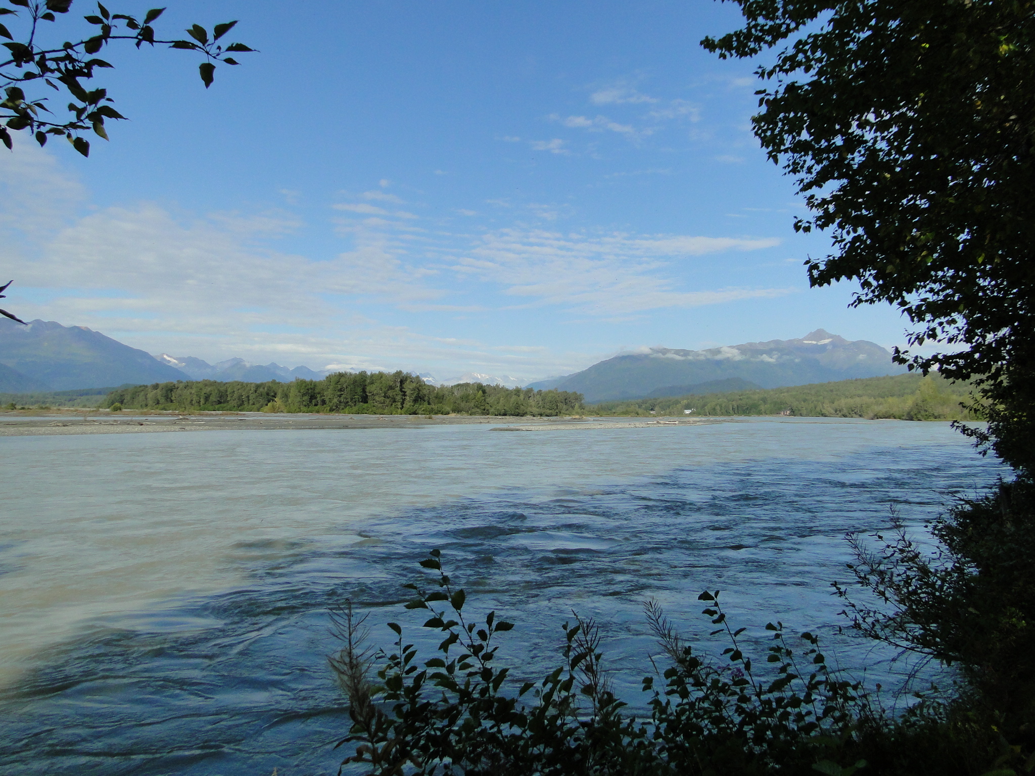
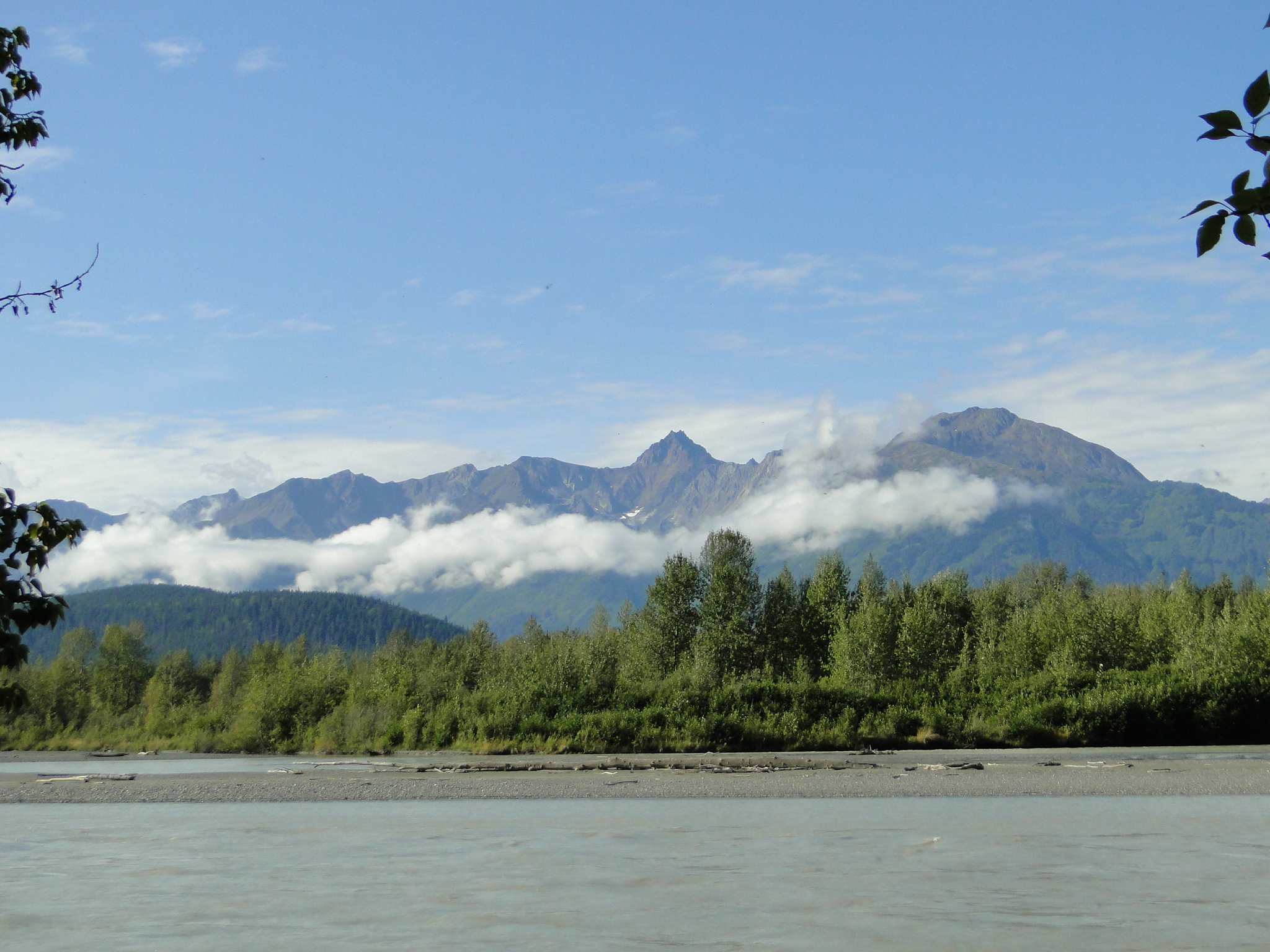
The views below are from our campsite, perched on the Bay.
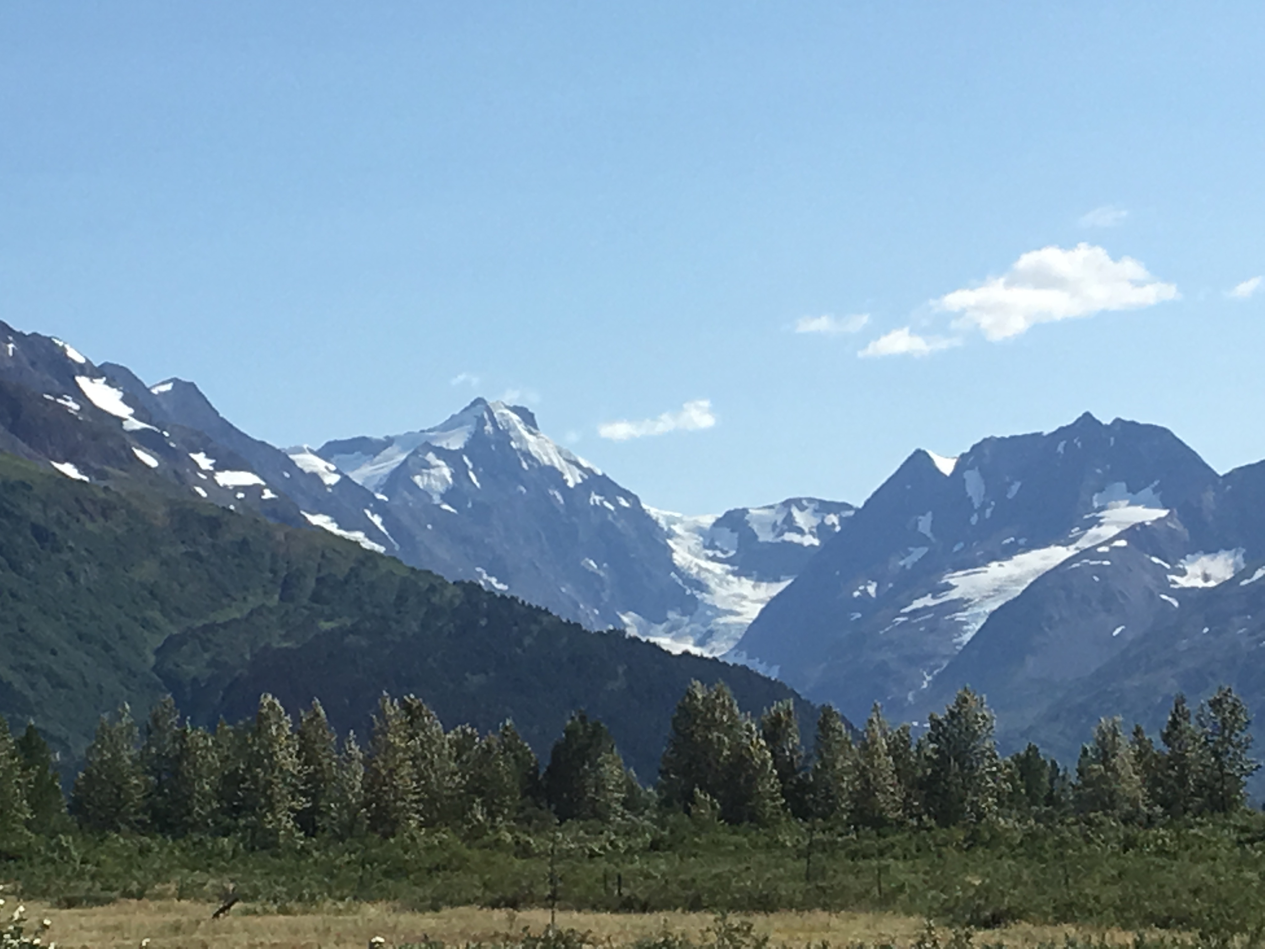
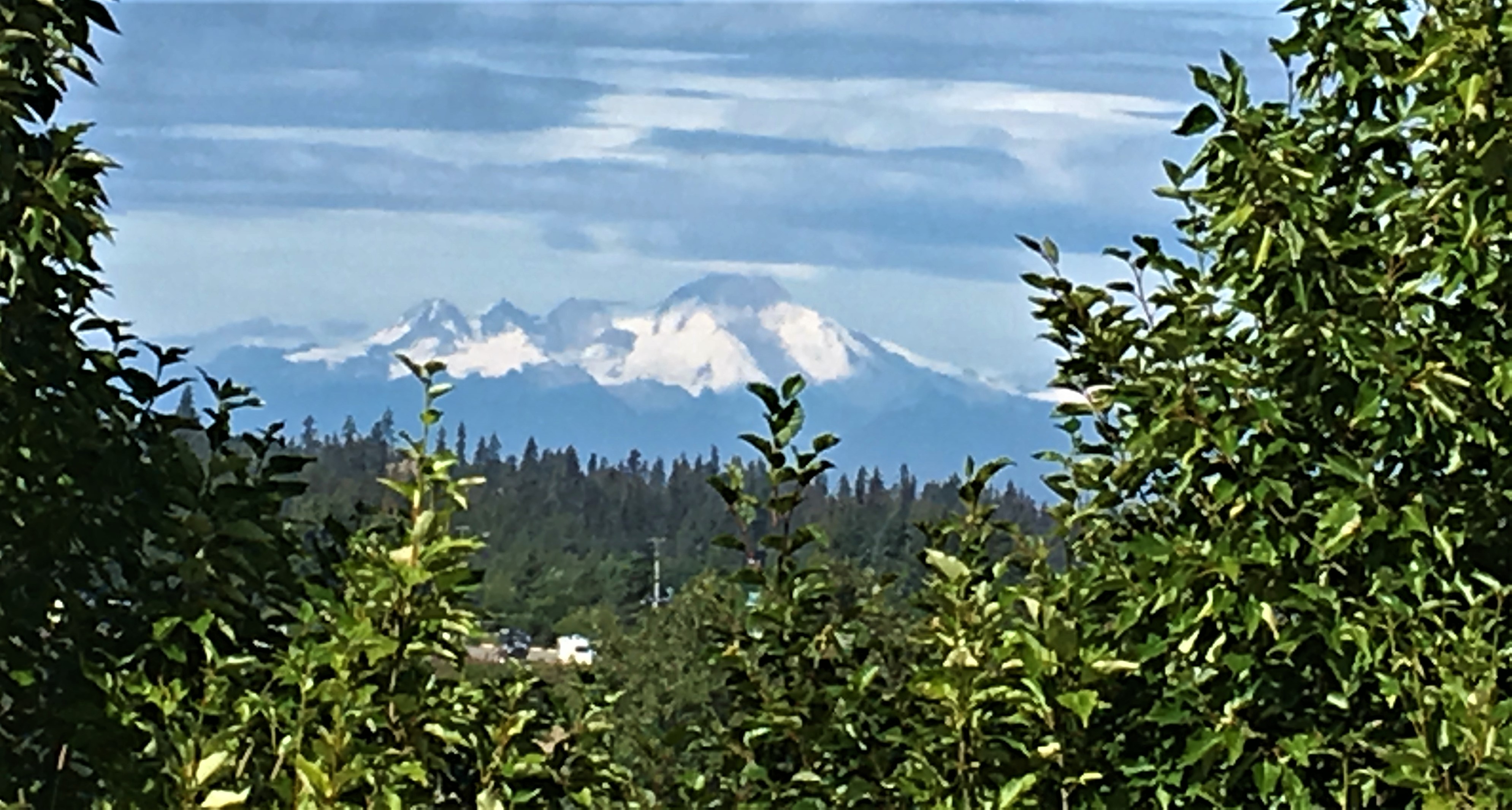
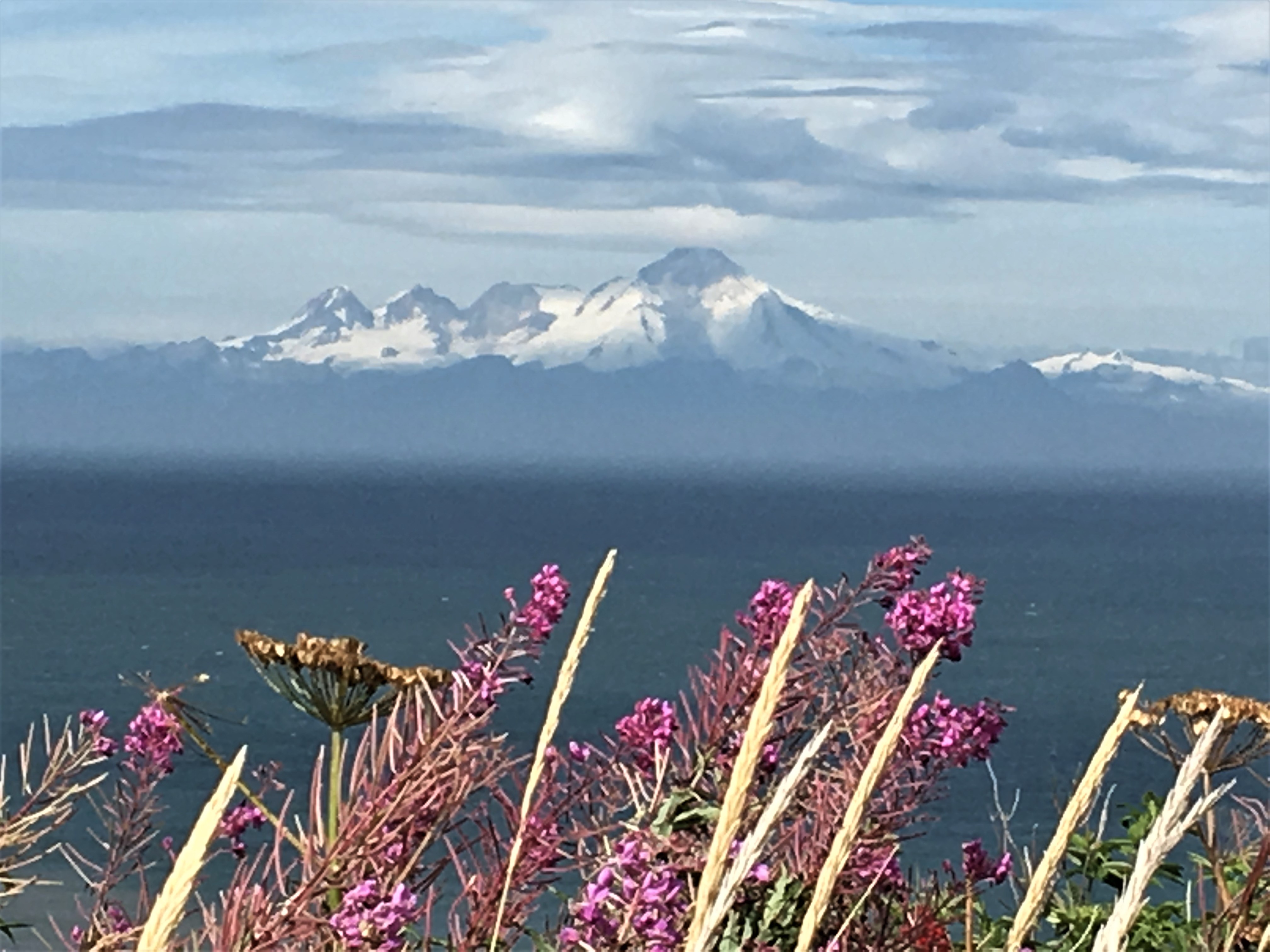
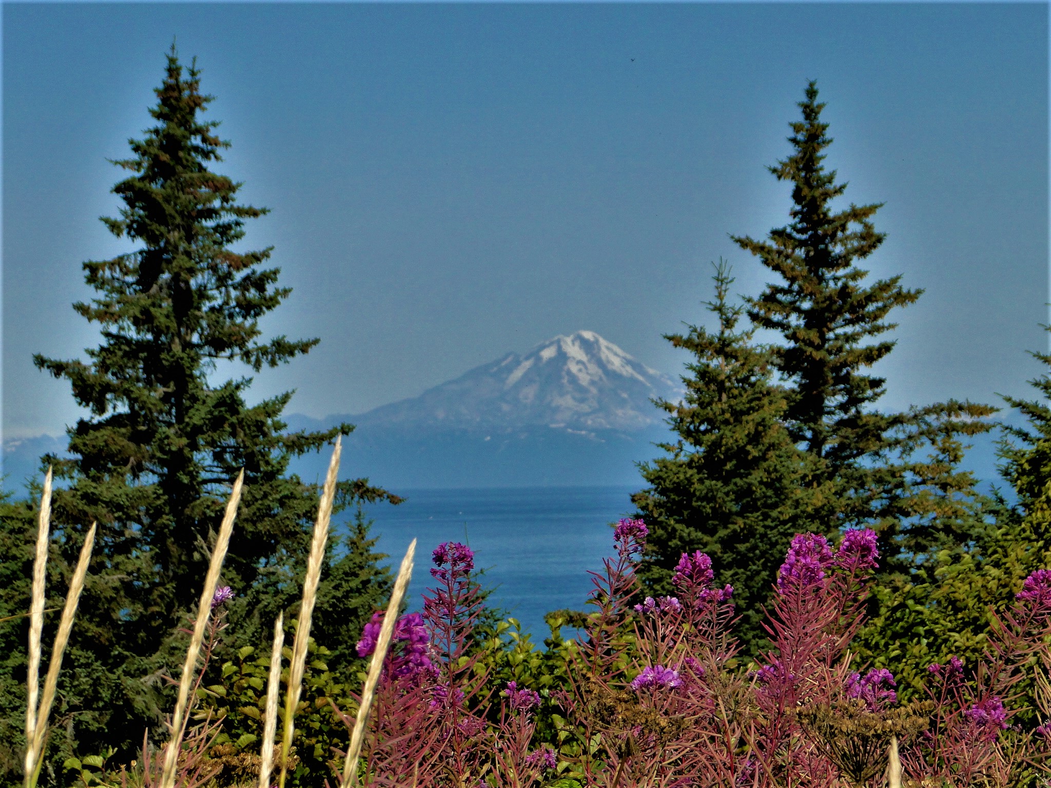
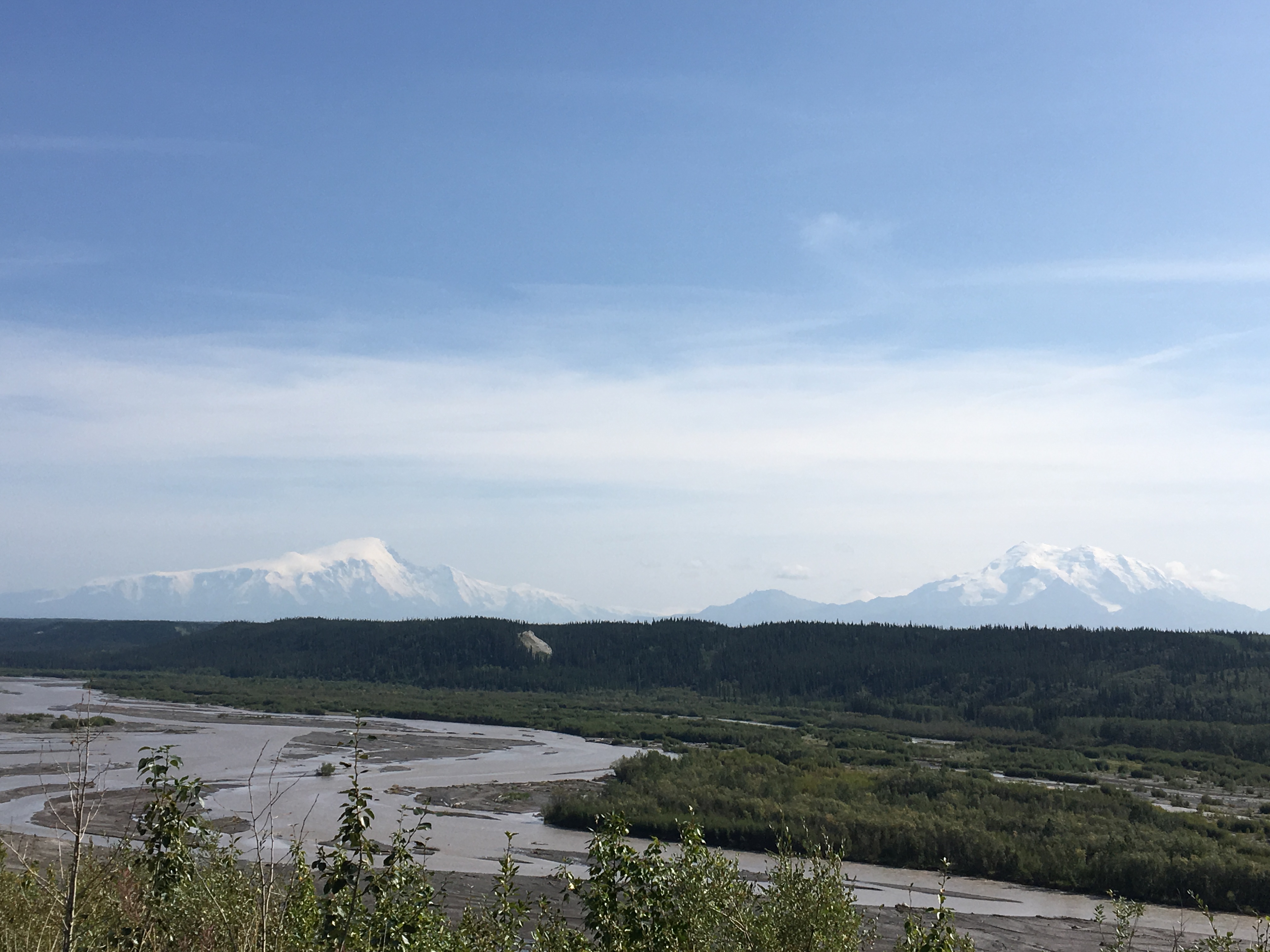
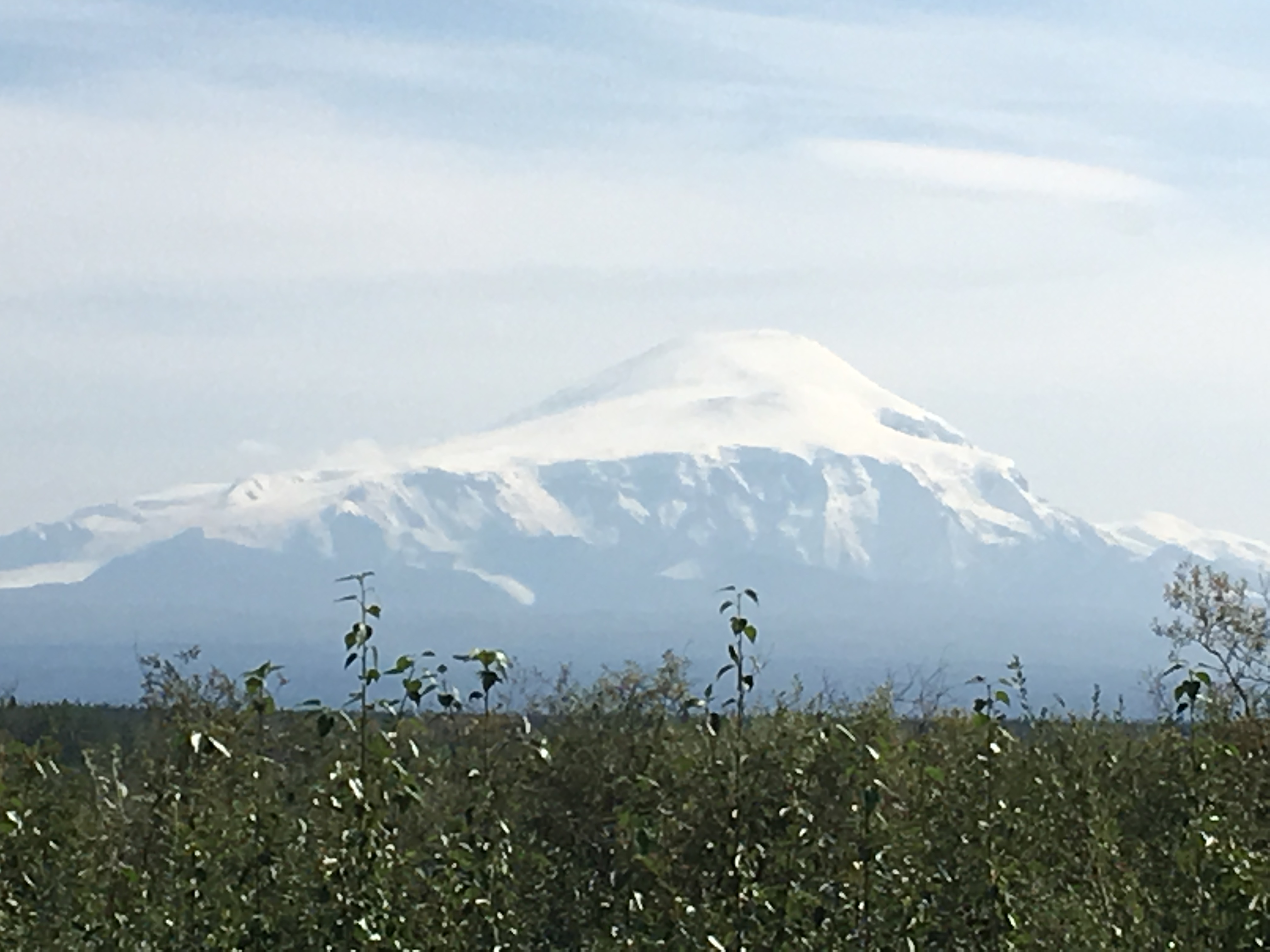
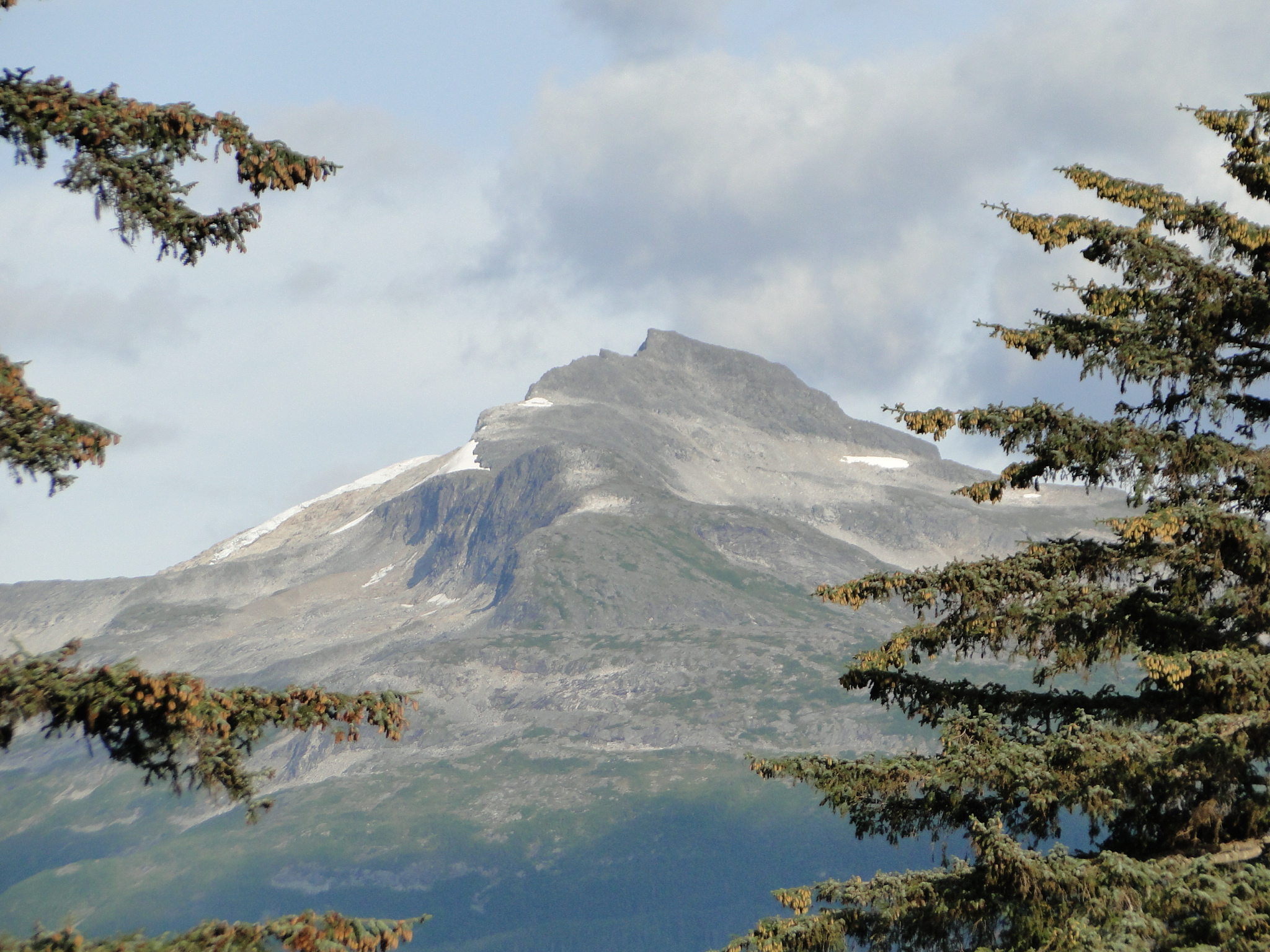
After three days there we headed back north on the Sterling Highway, the only road that travels to Anchorage, our next destination. We once again faced the volcanoes that we had passed on our trip south and again they did not fail to amaze.
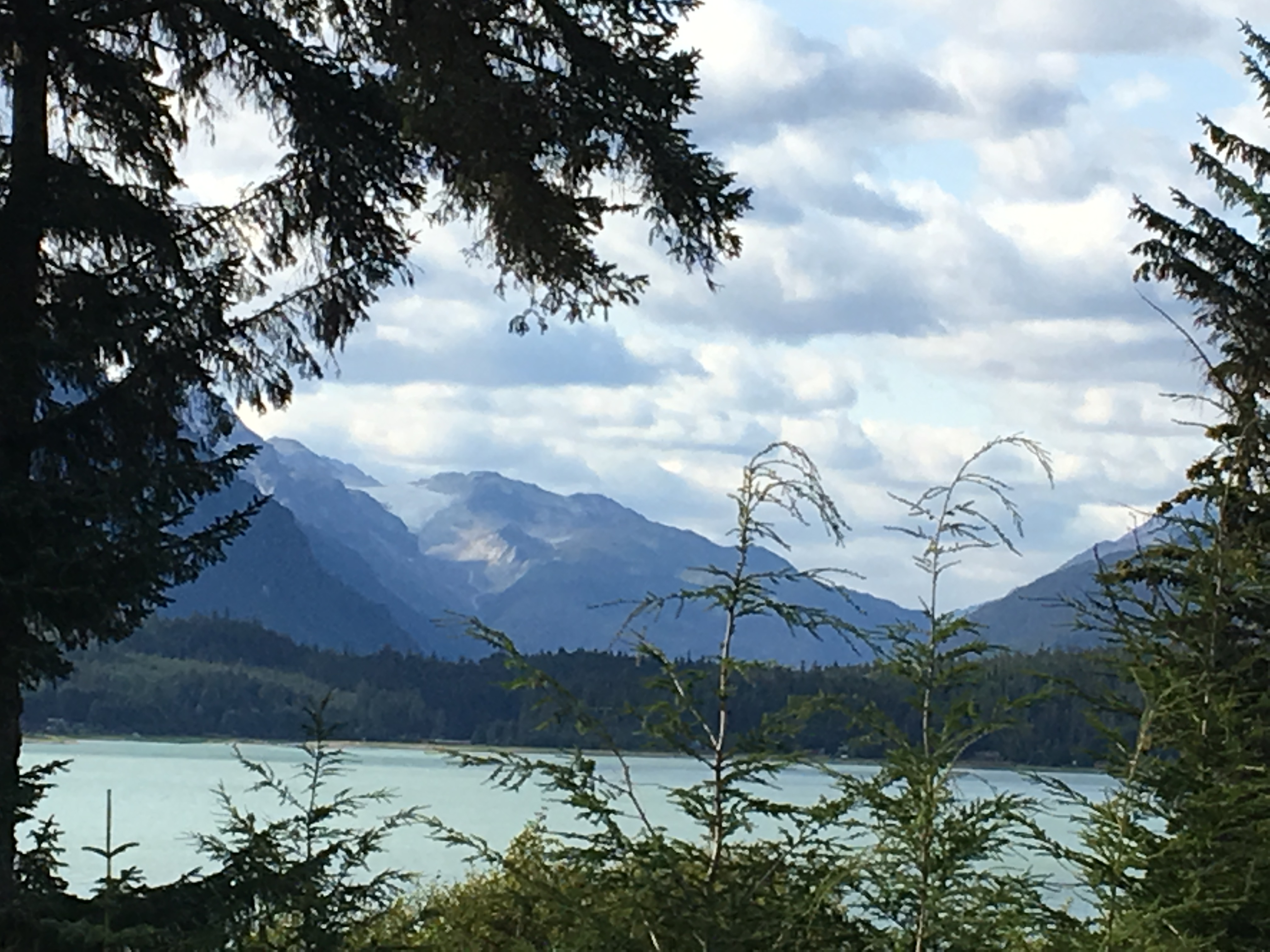
Once back in Anchorage we visited Earthquake Park, named for the devastating quake that hit in 1964, hoping for a view of Denali. We were denied, though we did have some exquisite views of the Cook Inlet, the same body of water that traverses Homer. While there we hiked the Coastal Trail, a lovely paved bike and walking trail that parallels the entire waterfront.
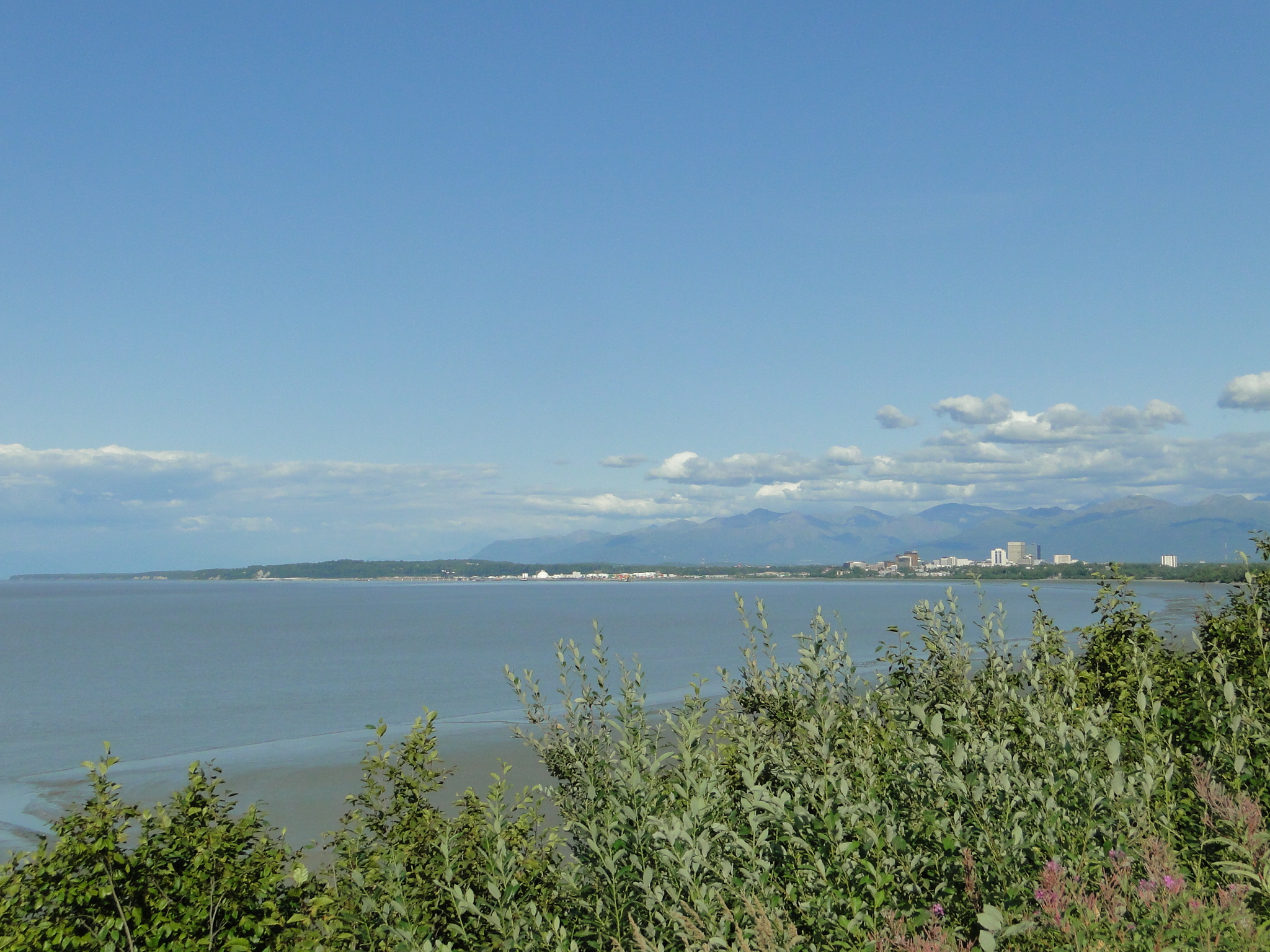
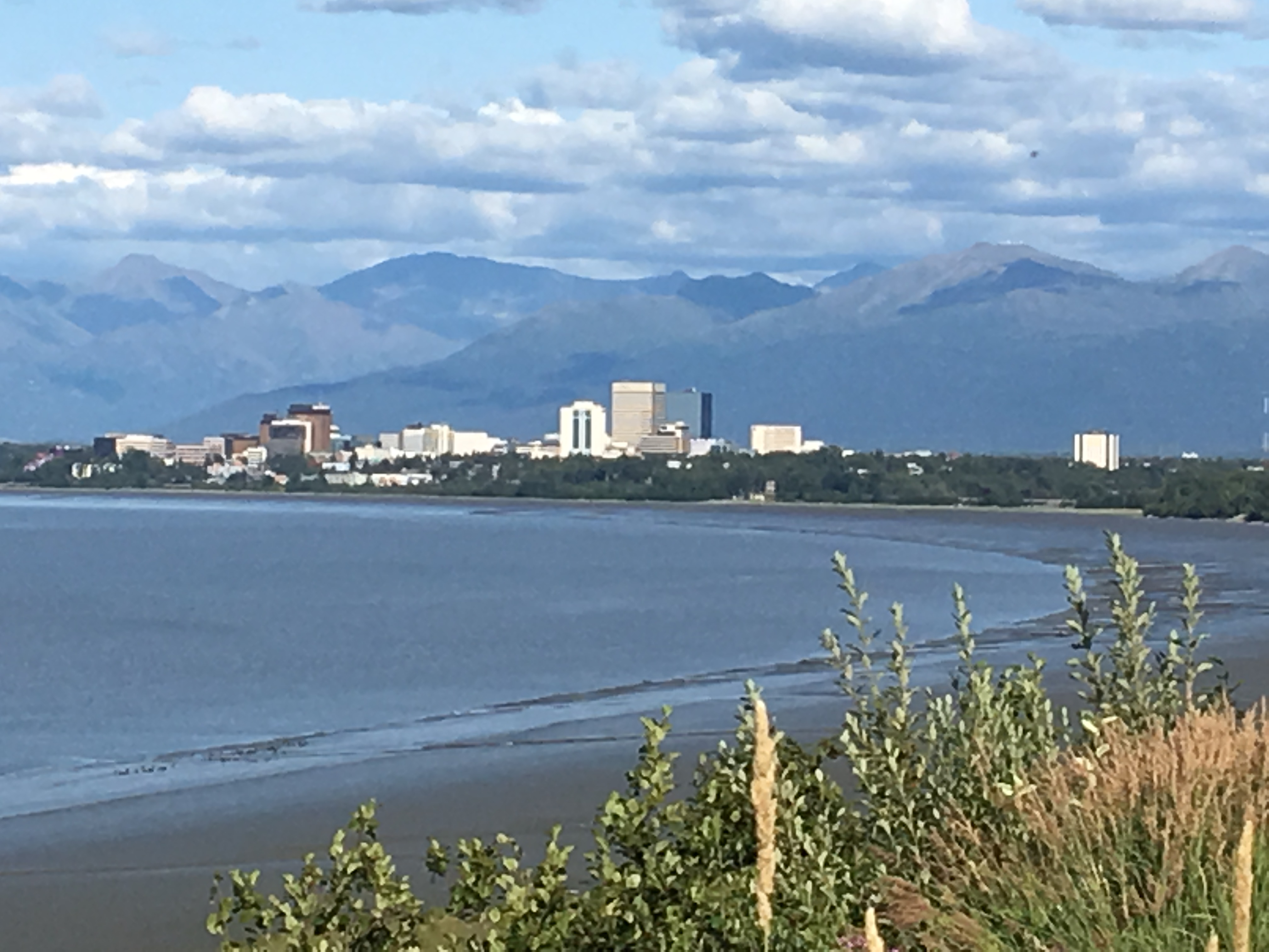
Anchorage, the largest city in Alaska, is home to an estimated 294,000 people, more than 40 % of the state, second only to New York City for the highest percentage in the state living in the largest city.
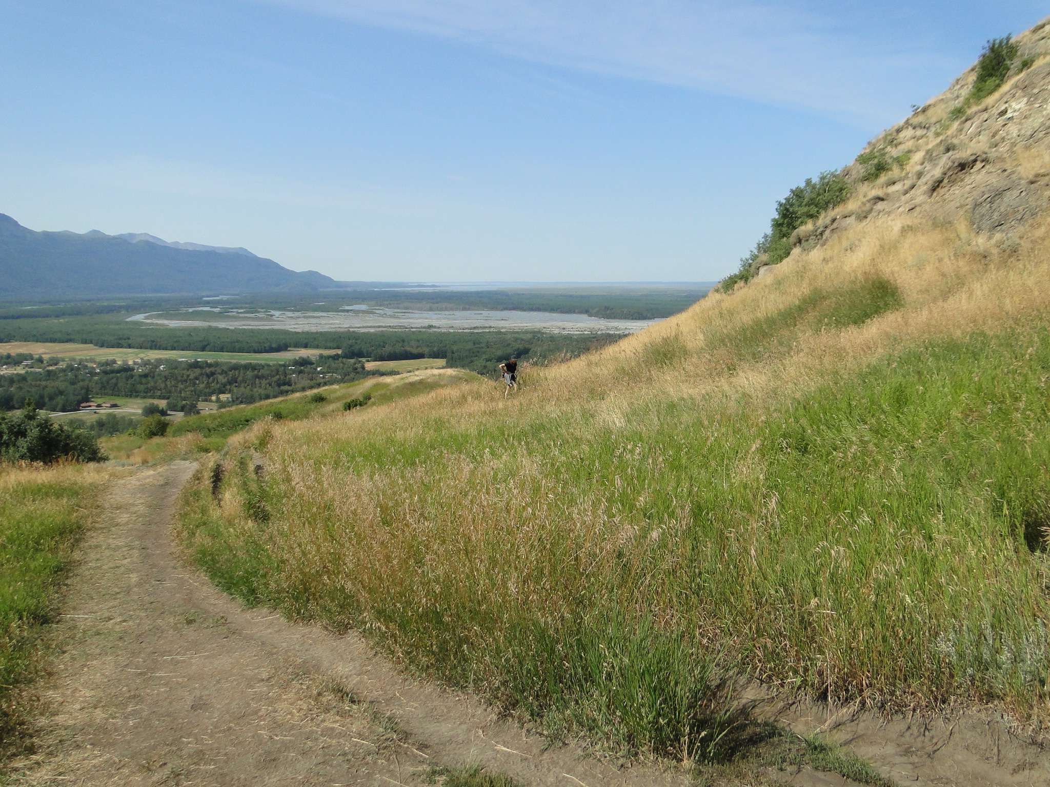
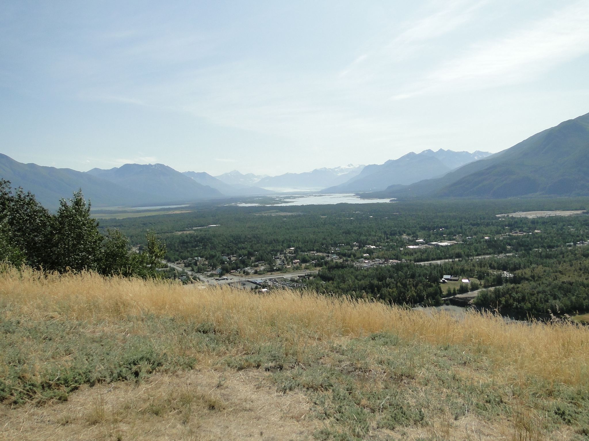
We spent just one night in Anchorage visiting with some family friends and then headed east towards the Glenn Highway, one of the major reasons we returned to Alaska. First stop was to hike The Bodenburg Butte, a one mile loop trail in Palmer, just 35 miles northeast of Anchorage. This trail offers exceptional views of the Knik River valley. The trail, though relatively short, is incredibly steep from the eastern entrance and quite demanding. We did not realize that there was a western approach that was not quite as strenuous but fortunately met three delightful women who offered us a ride from the western parking lot, so needless to say, we hiked out in that direction.
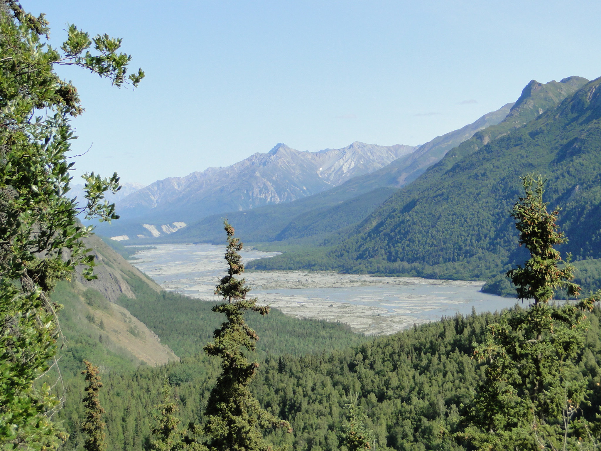
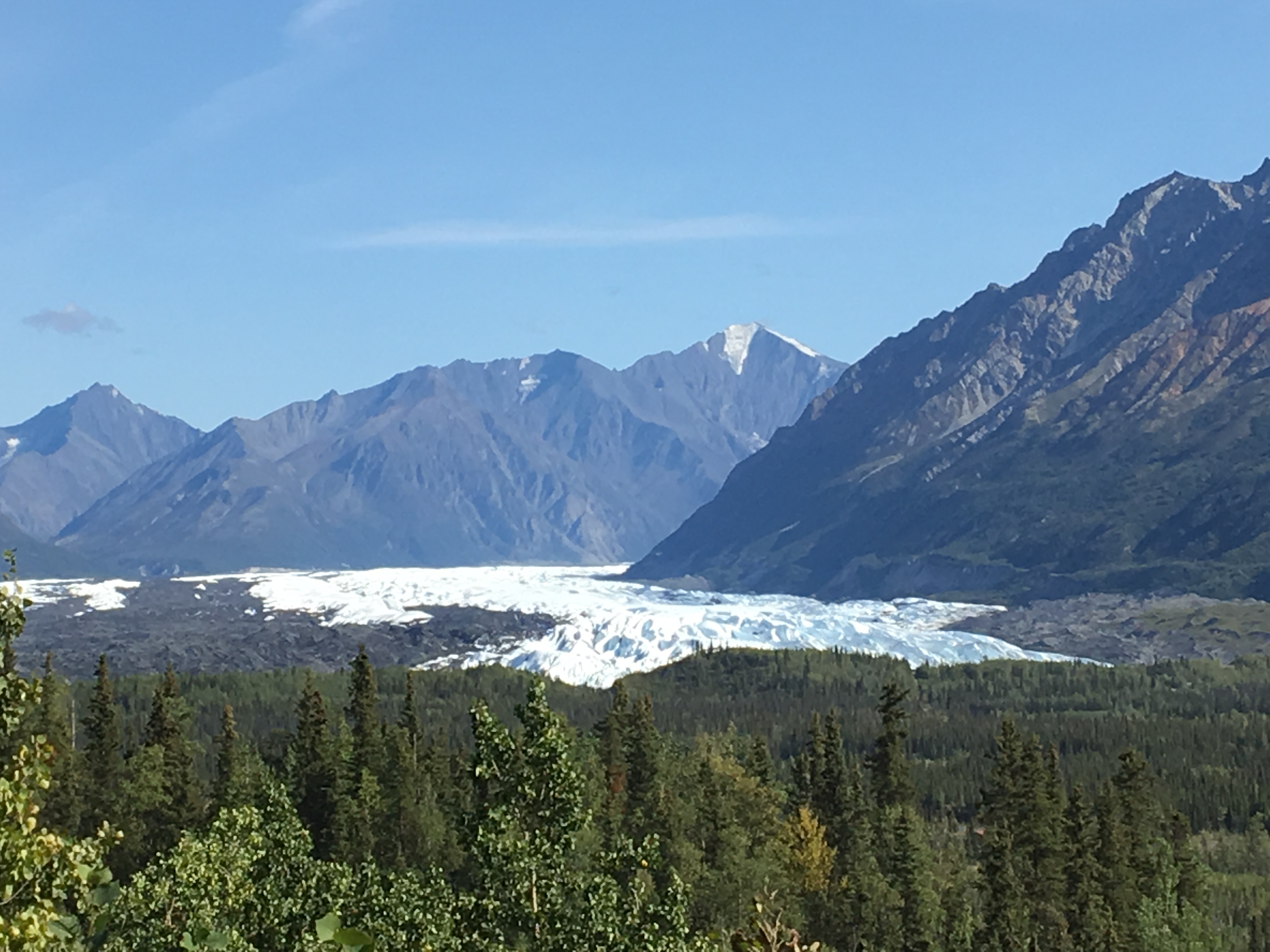
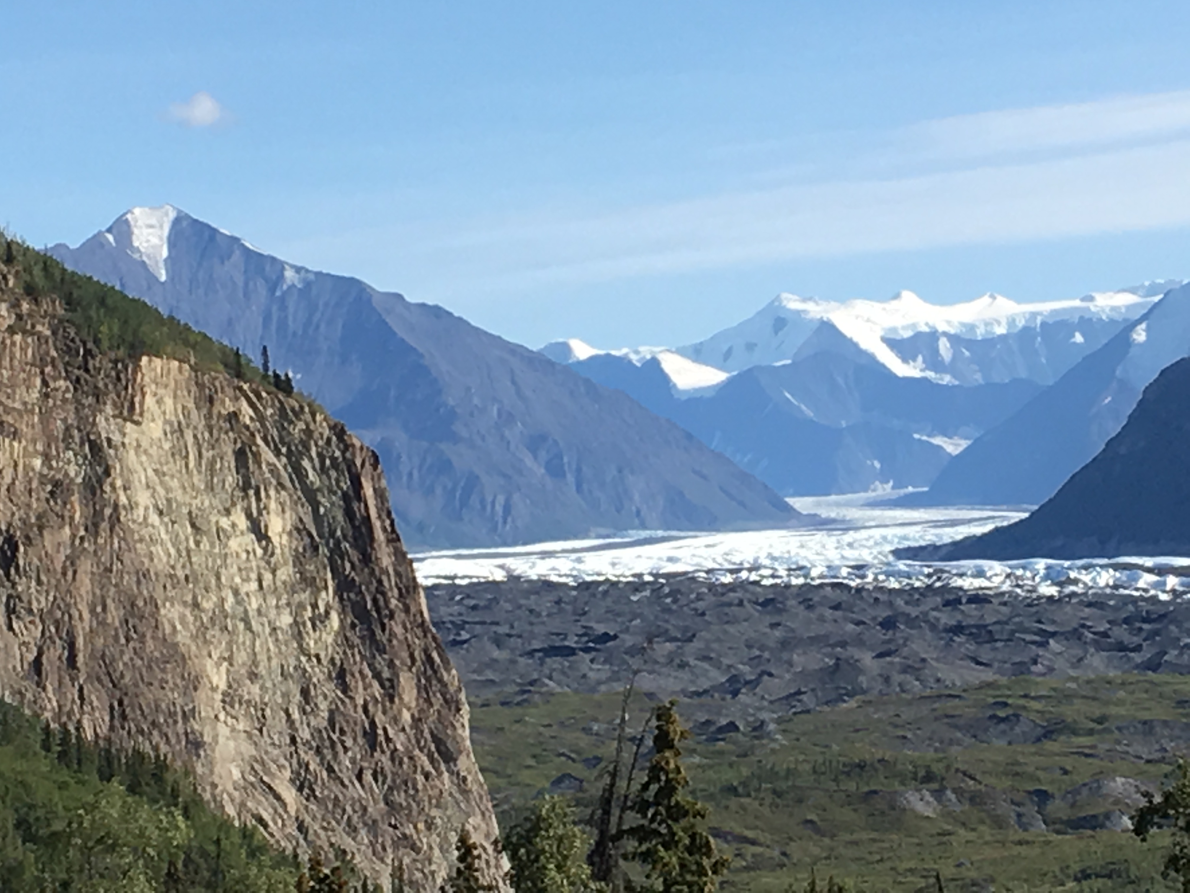
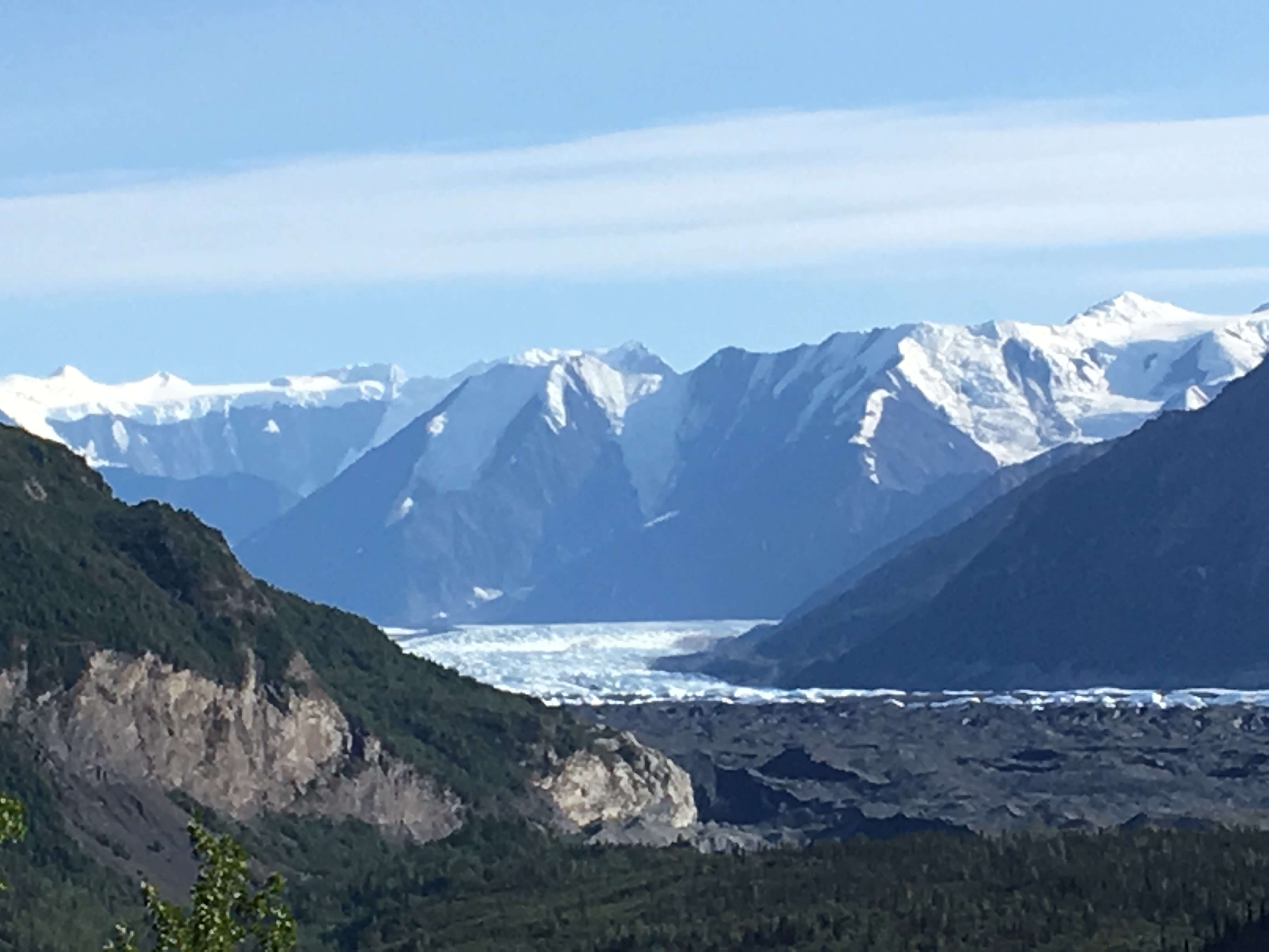
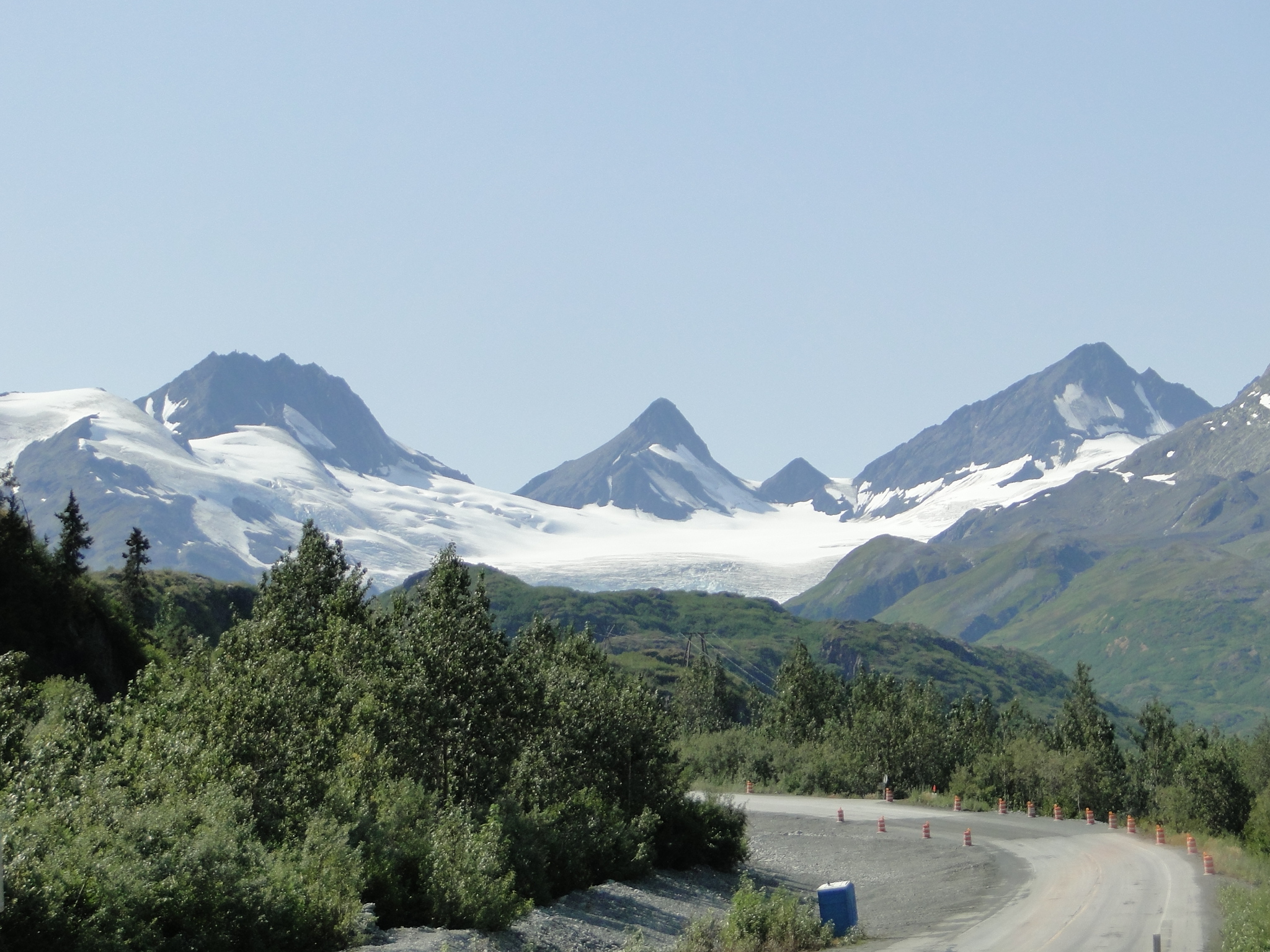
The Glenn Highway was as magnificent as we envisioned 8 years ago when we barely caught a glimpse. The road winds through the southern end of the Mat-Su Valley of steep pointed mountains and eventually leads to the Matanuska Glacier, the largest glacier in Alaska that can be reached by road. It is 26 miles long and 4 miles wide at its terminus. The glacier can be accessed via the privately owned Matanuska Glacier Park for a $20 fee, but can be seen from a close distance on the road.
Note: Alaska has an estimated 100,000 glaciers. There are more active glaciers and icefields in Alaska than the rest of the inhabited world.
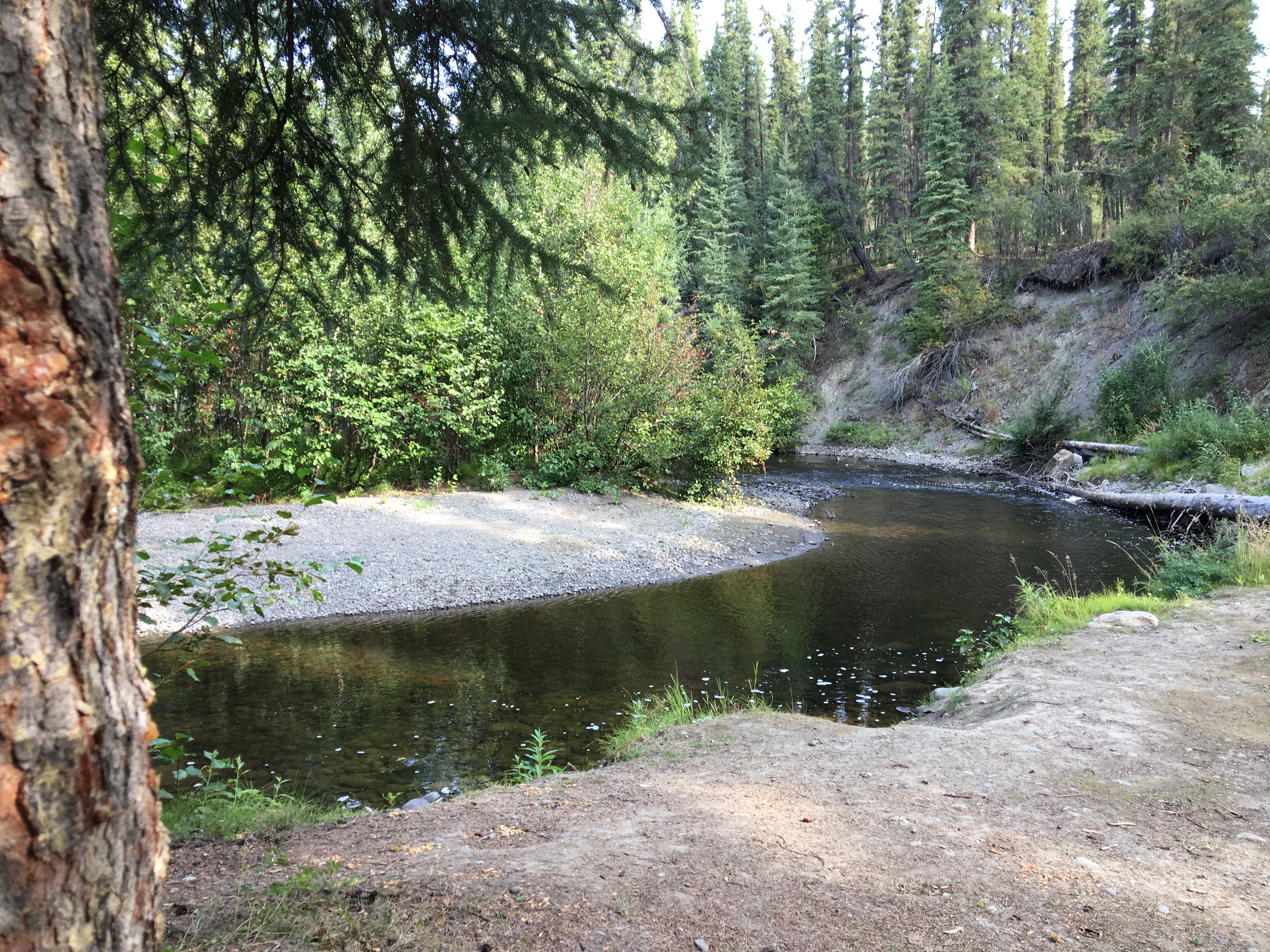
Our campsite destination for this night was the Tolsona Wilderness Campground near Glennallen. This was a beautiful wooded campground with all sites along the small creek that ran through the area. FHU and showers are included and with Good Sam Club a total of $32/night.
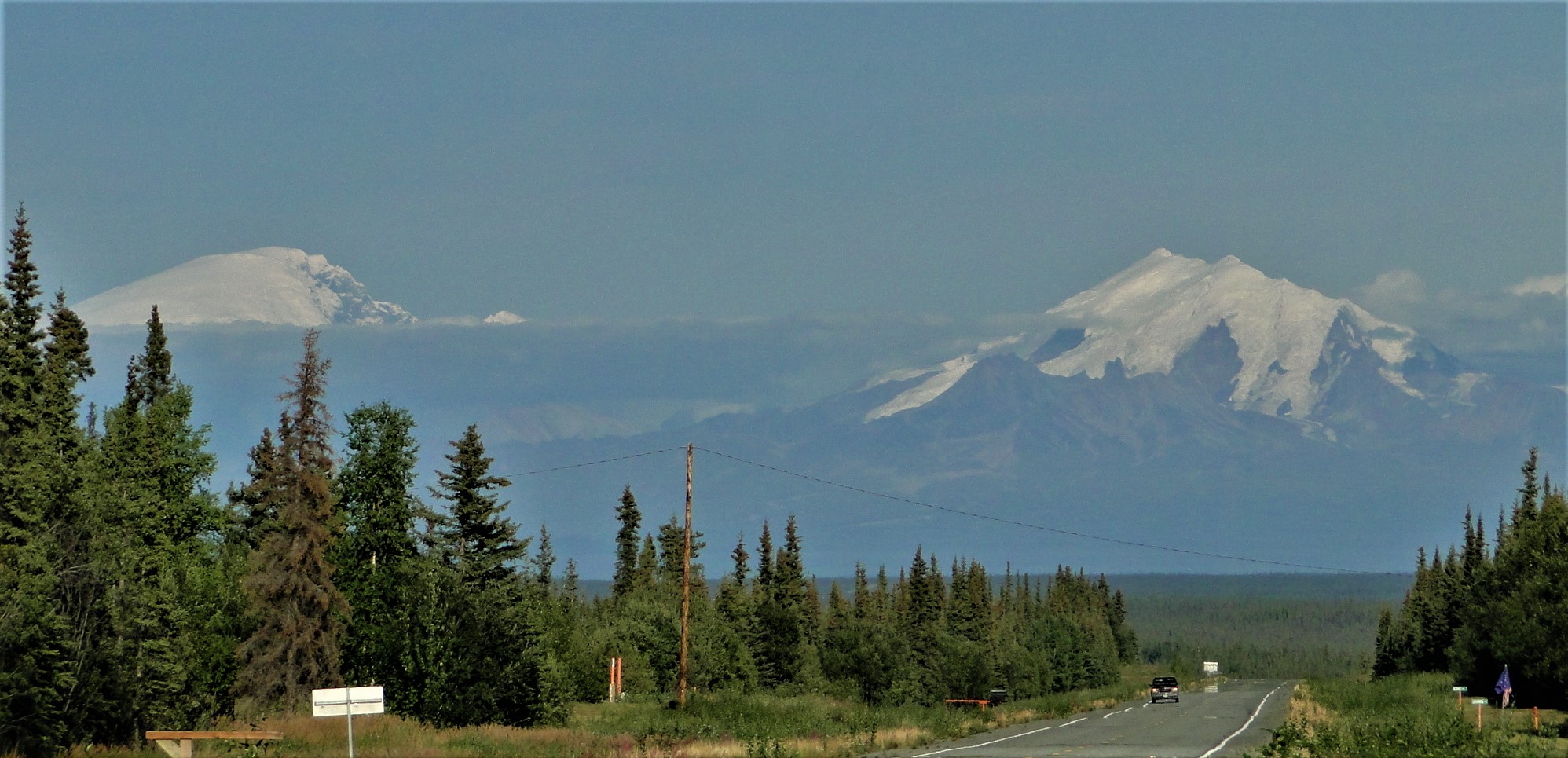
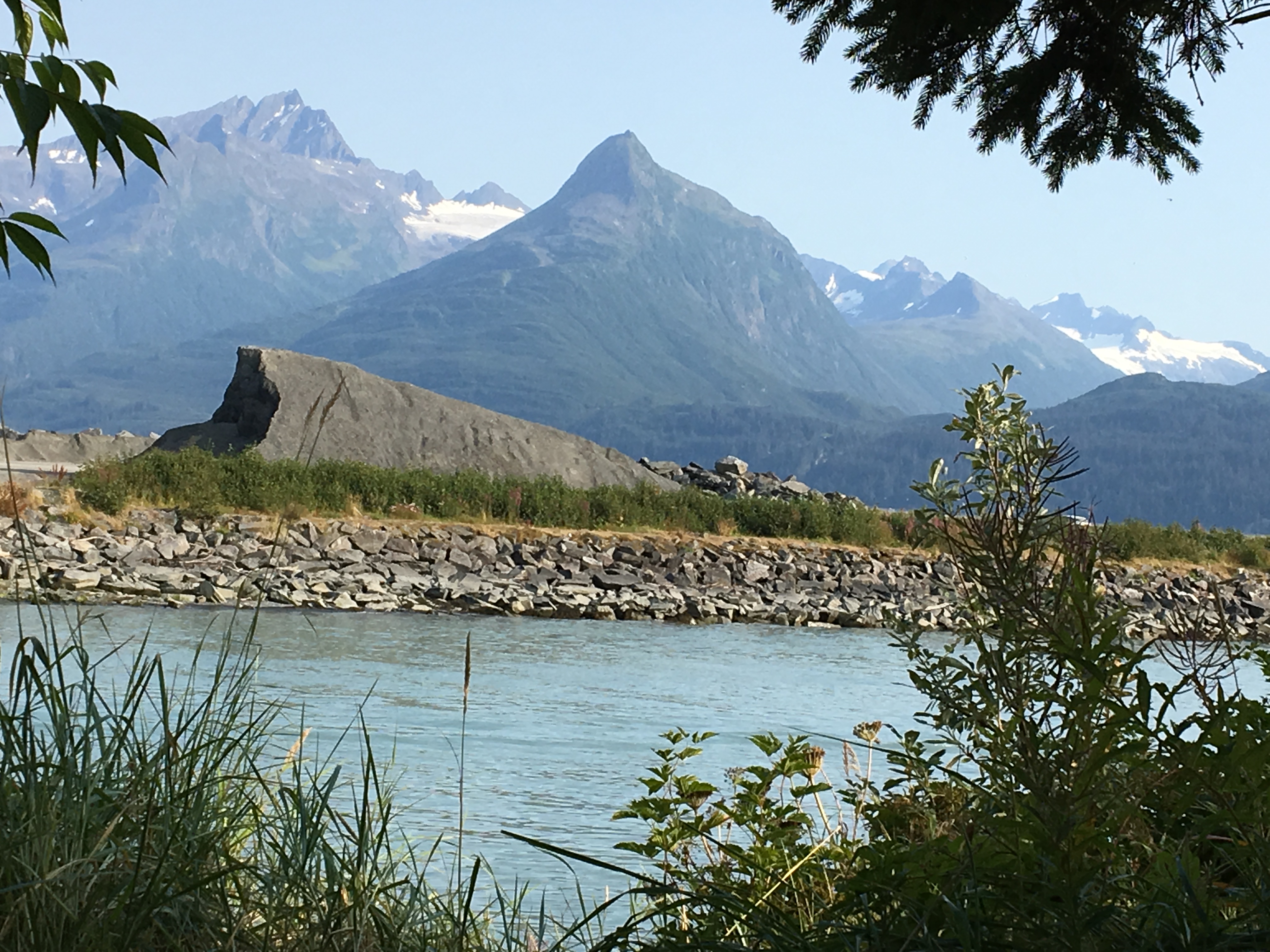
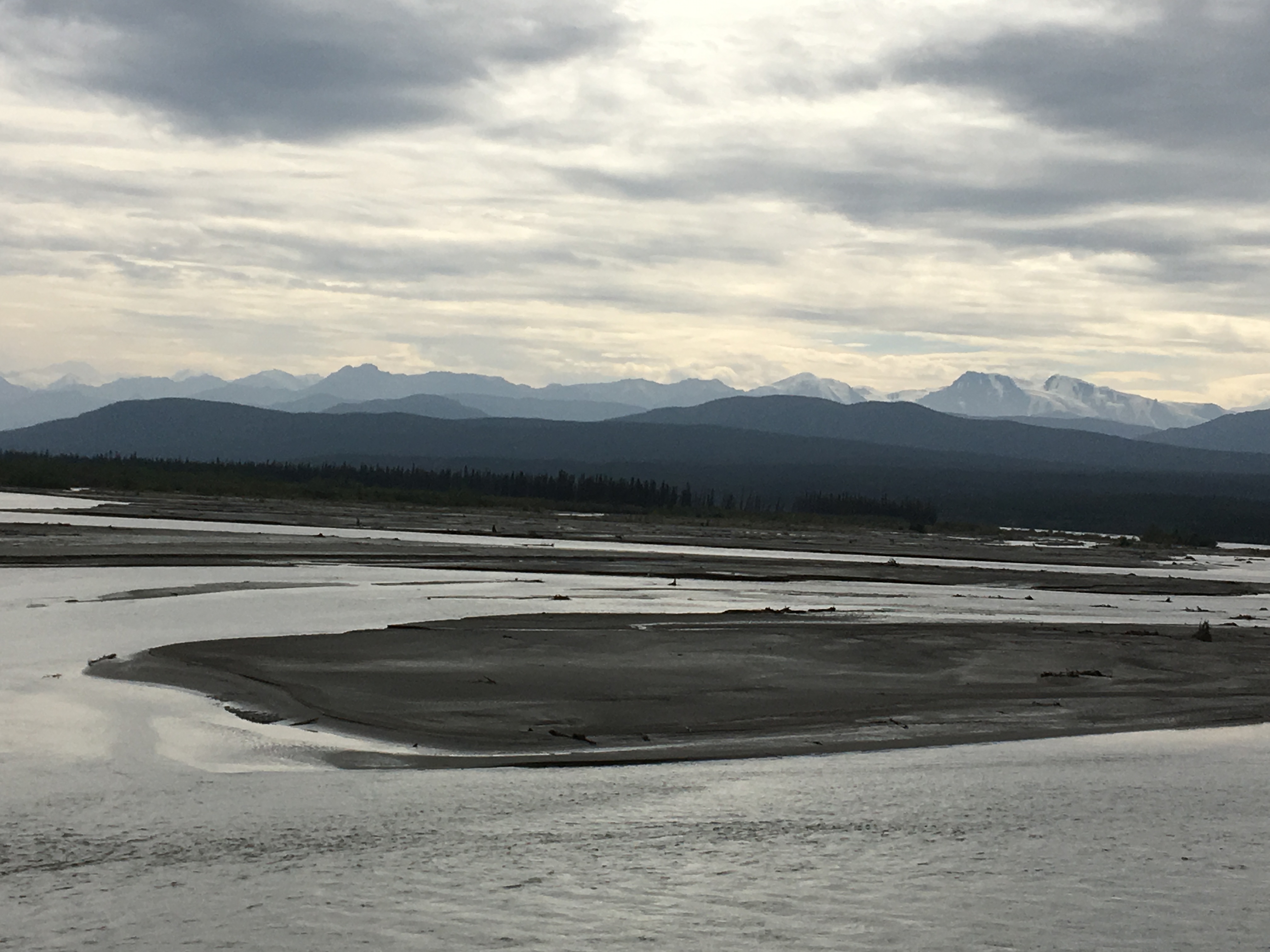
After a brief stay at Tolsona, we continued in an easterly direction to the intersection of the Glenn Highway and the Richardson Highway that will take us to Valdez. As we approached the Richardson intersection, we are facing directly into the enormous Wrangell Mountains towering over the landscape. Mount Sanford at 16,237 feet, Mt. Drum at 12,010 feet and Mt. Wrangell at 14,163 feet welcome you to the Wrangell-St. Elias National Park, the largest national park in the country. Southbound on the Richardson, following the Copper River, we stopped at the very new Wrangell Mountain Visitor Center that features several wonderful buildings that include a hands-on display, a NPS interpretive film, a bookstore, restrooms and a boreal hiking trail.
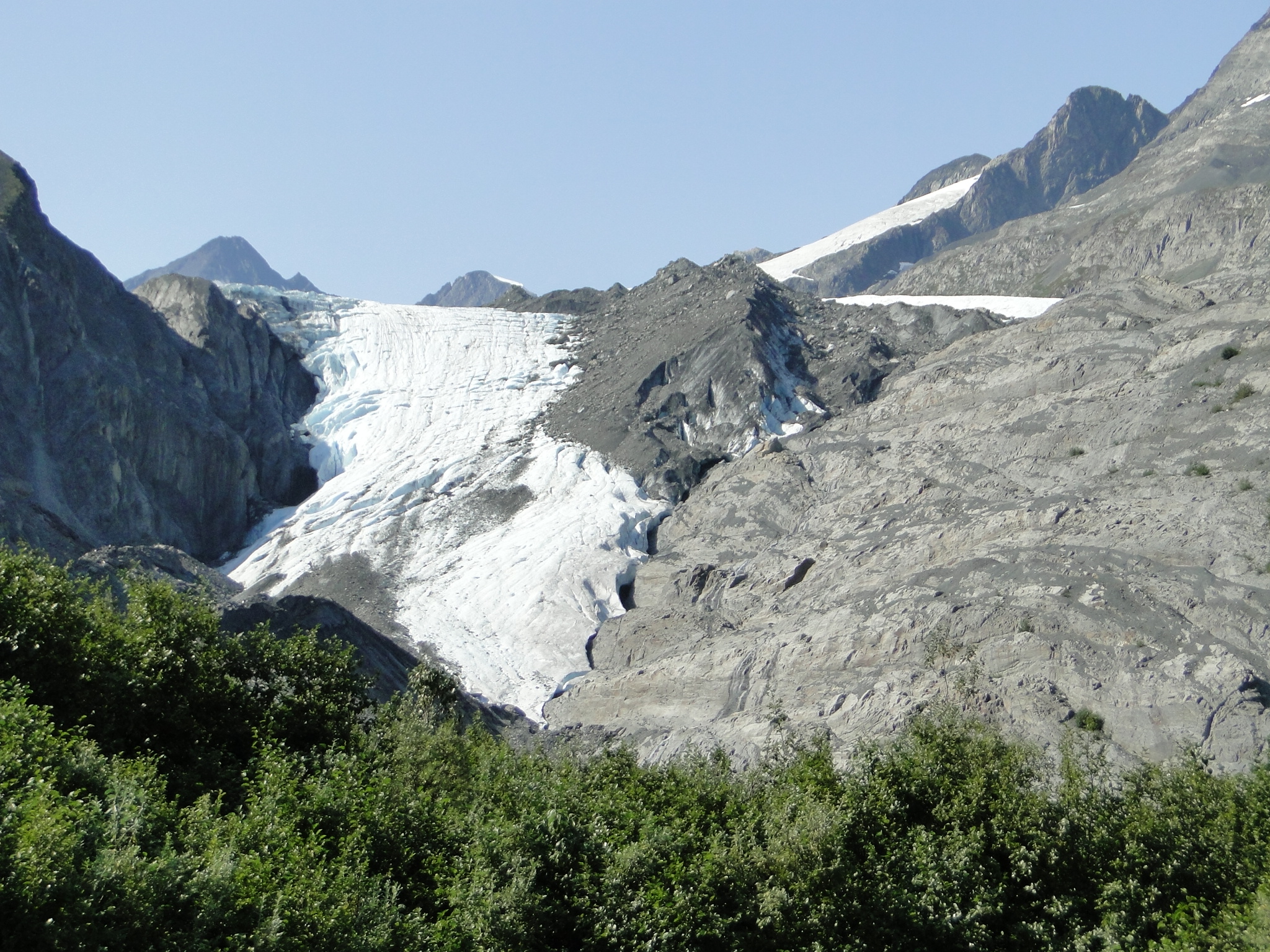
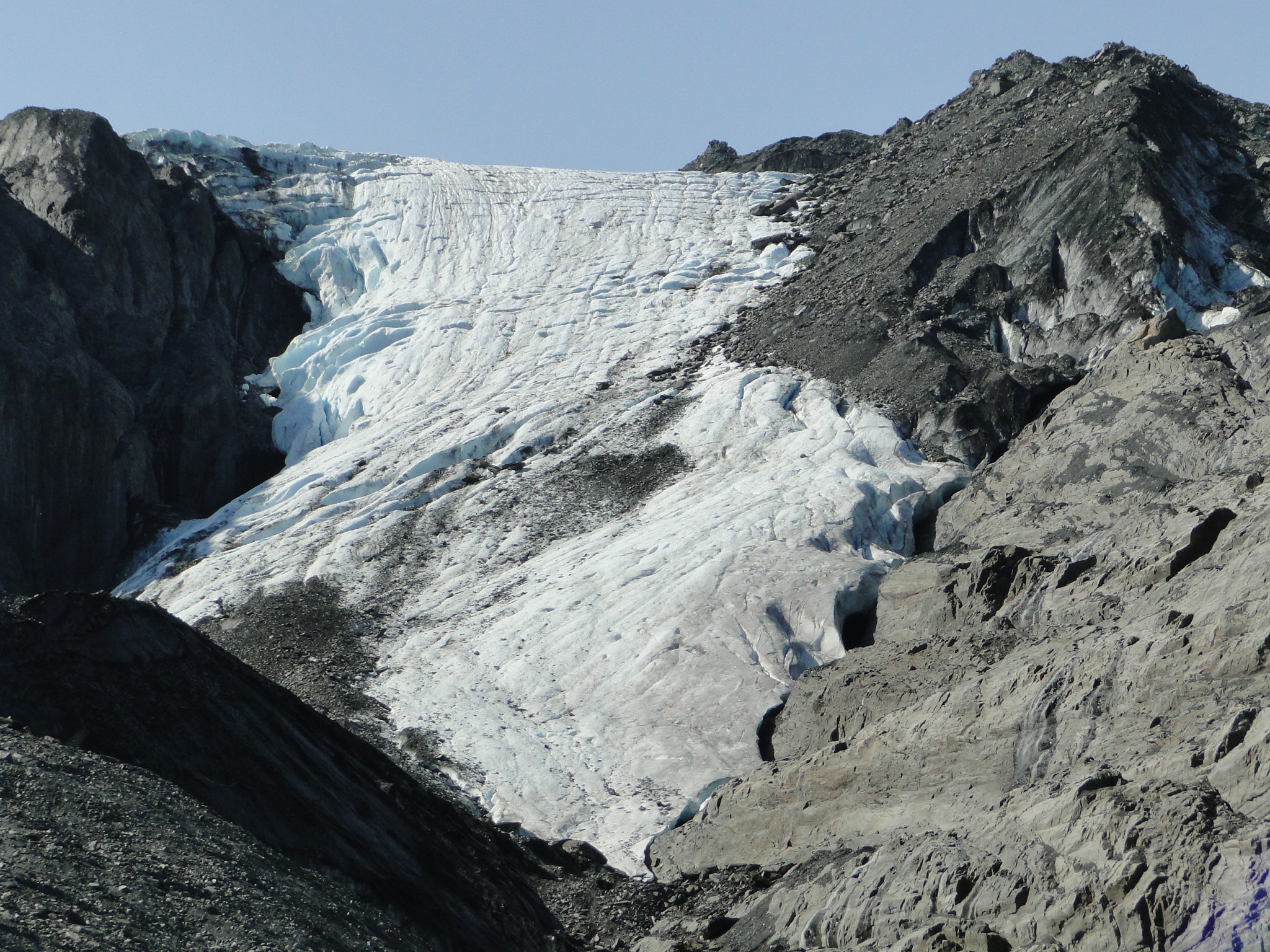
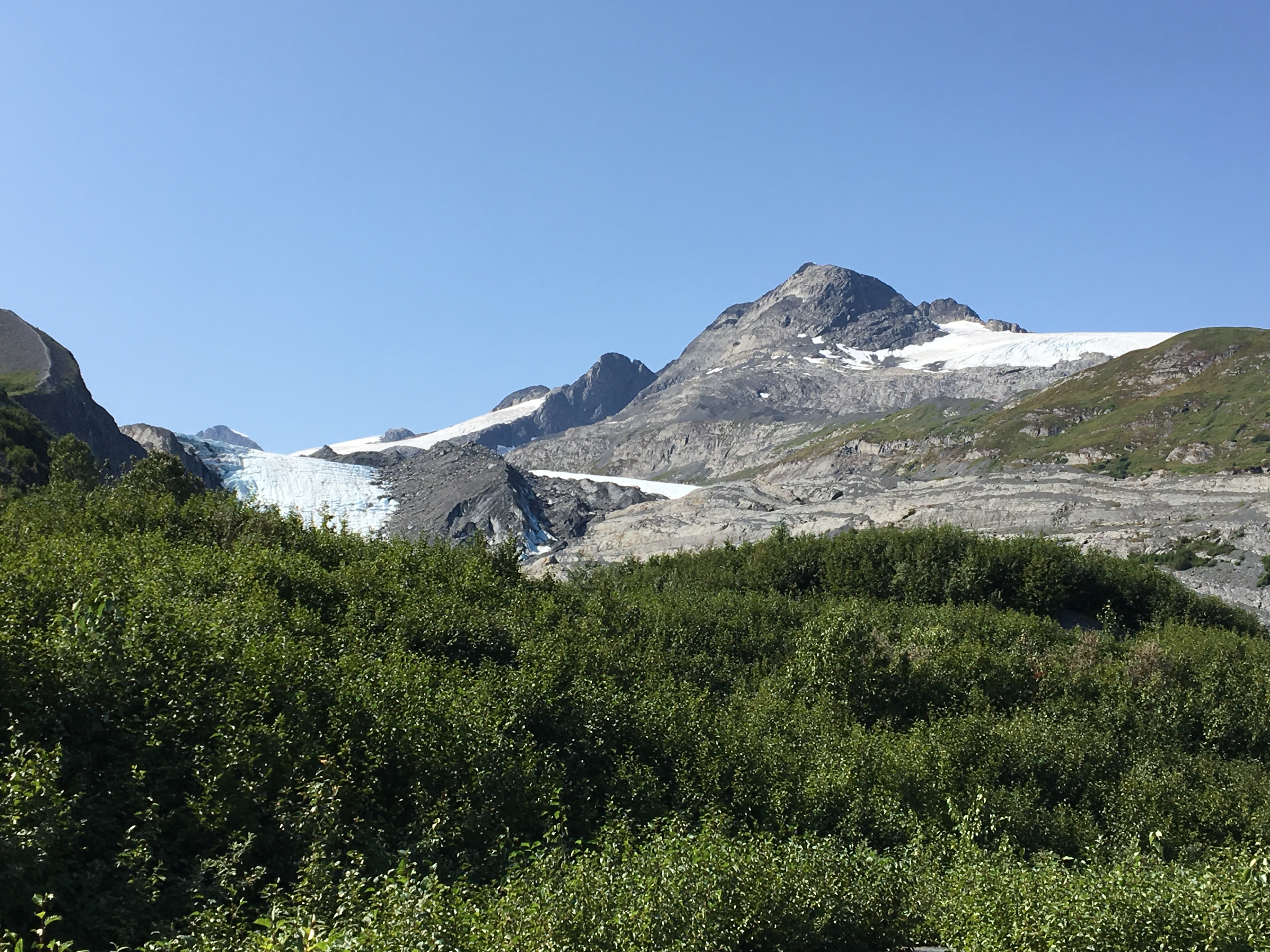
Continuing south on the Richardson, we begin to make the long descent into Valdez. The road is once again a panorama of jagged peaks dotted with glaciers. This scene, though repeated often in our journey, is always a joy to behold. The first major stop coming down into the valley is the Worthington Glacier. This glacier is quite easily accessible from the parking area with hiking trails to the base as well as the hill adjacent where you can access an enormous view from above the glacier.
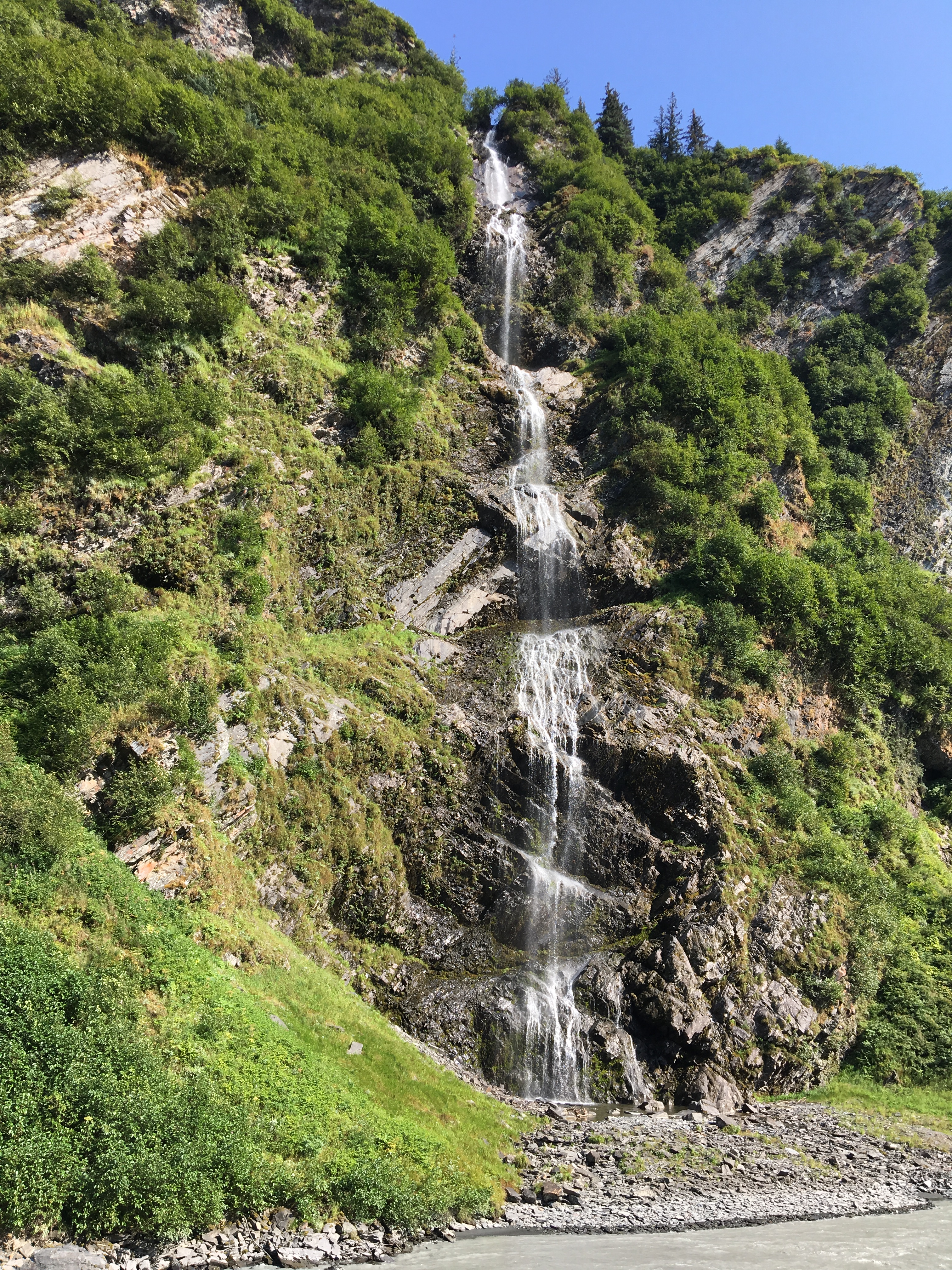
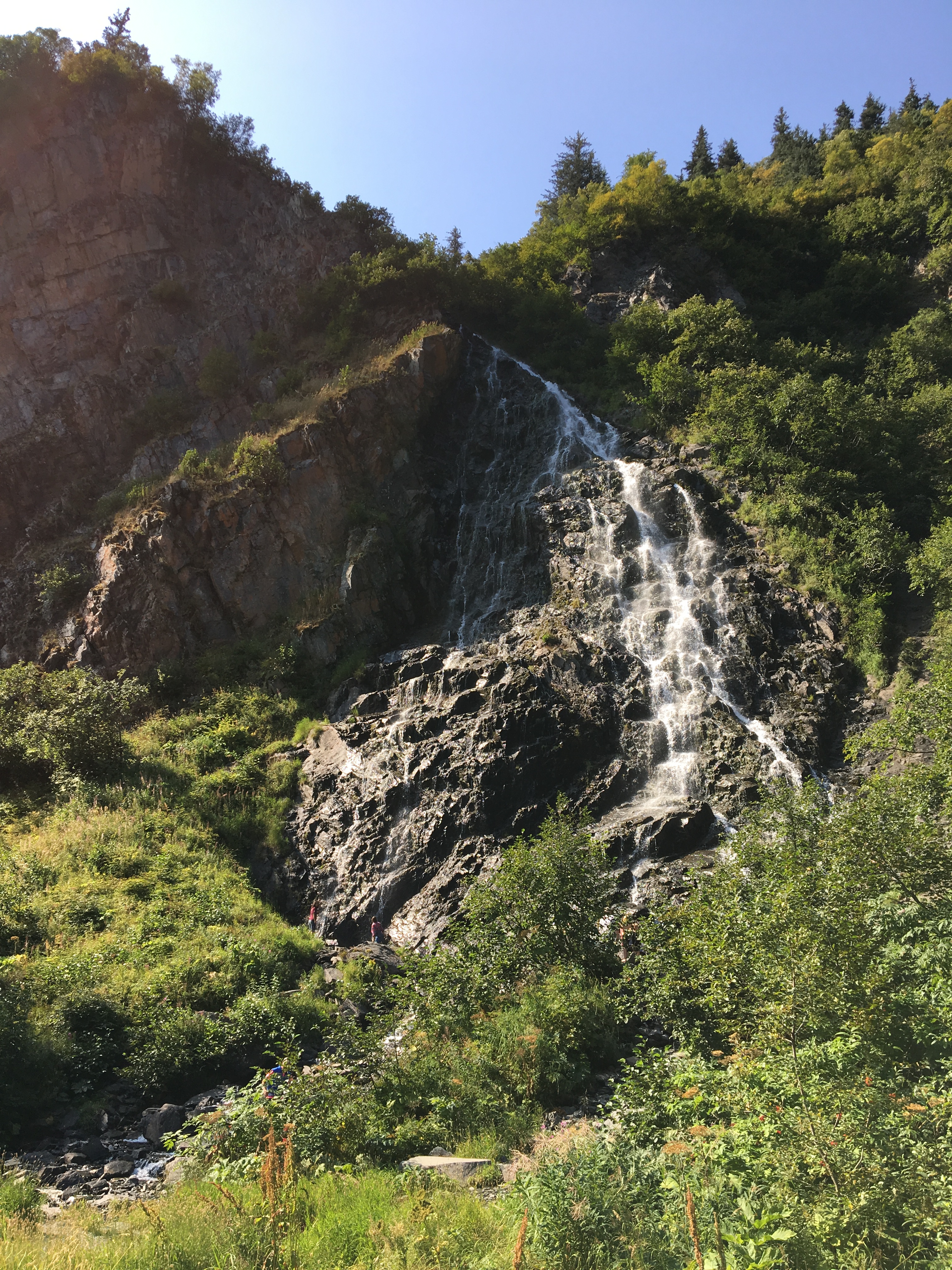
Continuing into the valley we dive deep into the Thompson Pass with its breathtaking views of the Chugach Range and the Copper River Valley. The elevation begins to drop dramatically here, plunging 2,678 feet in less than 10 miles. The Keystone Canyon, next, is the doorway onto the valley floor, a narrow slot piggybacking the Lowe River with two waterfalls that greet you with their beauty. First the Bridal Veil Falls and then the Horse Tail Falls cascade towards the road with ample parking and great photo opportunities.
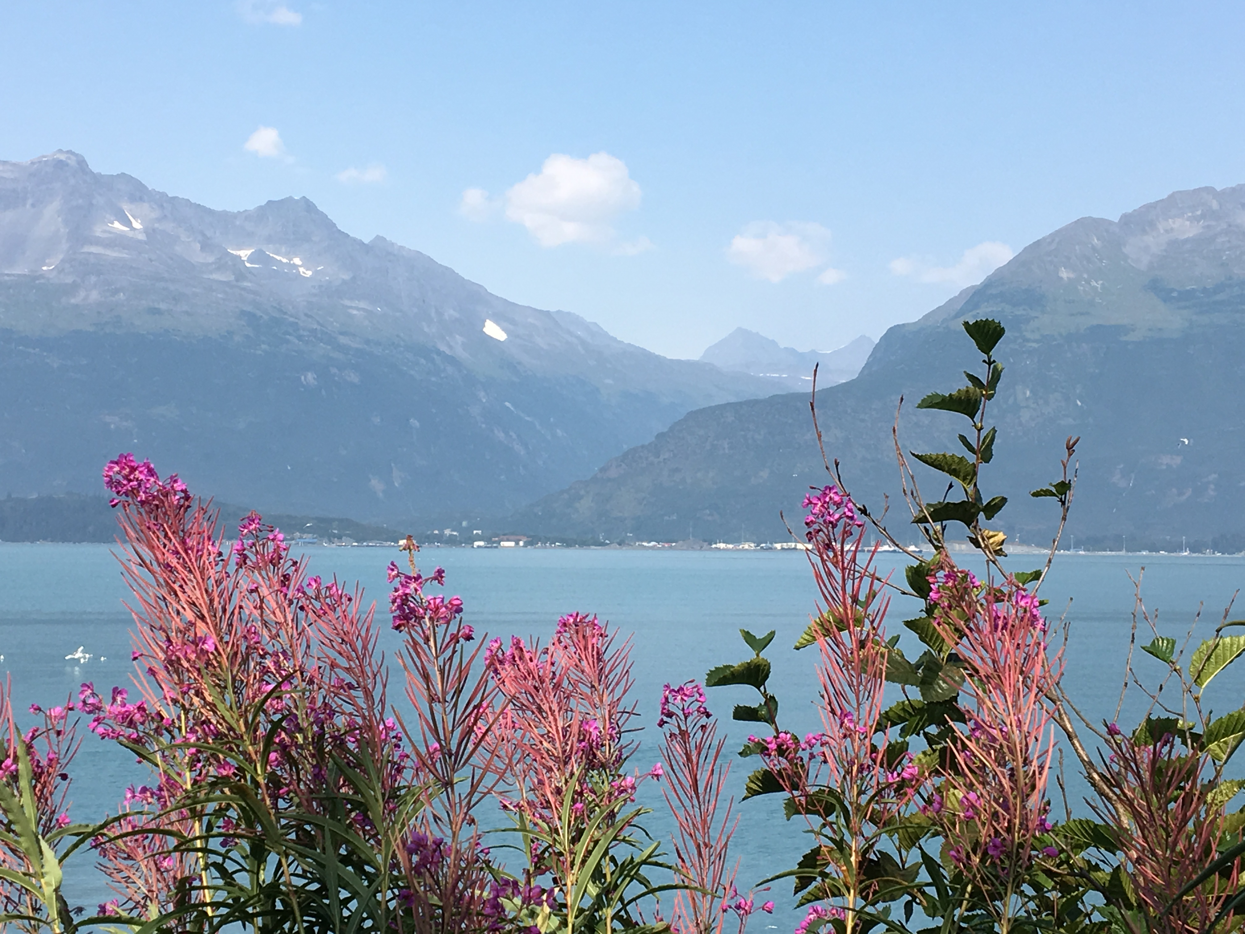
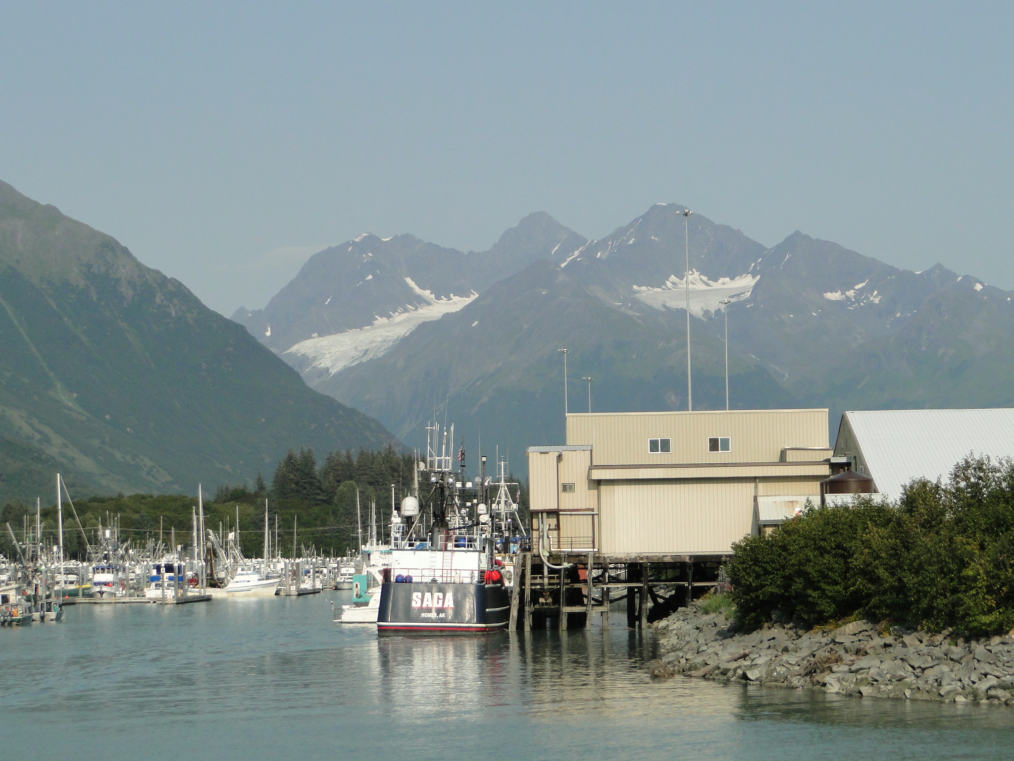
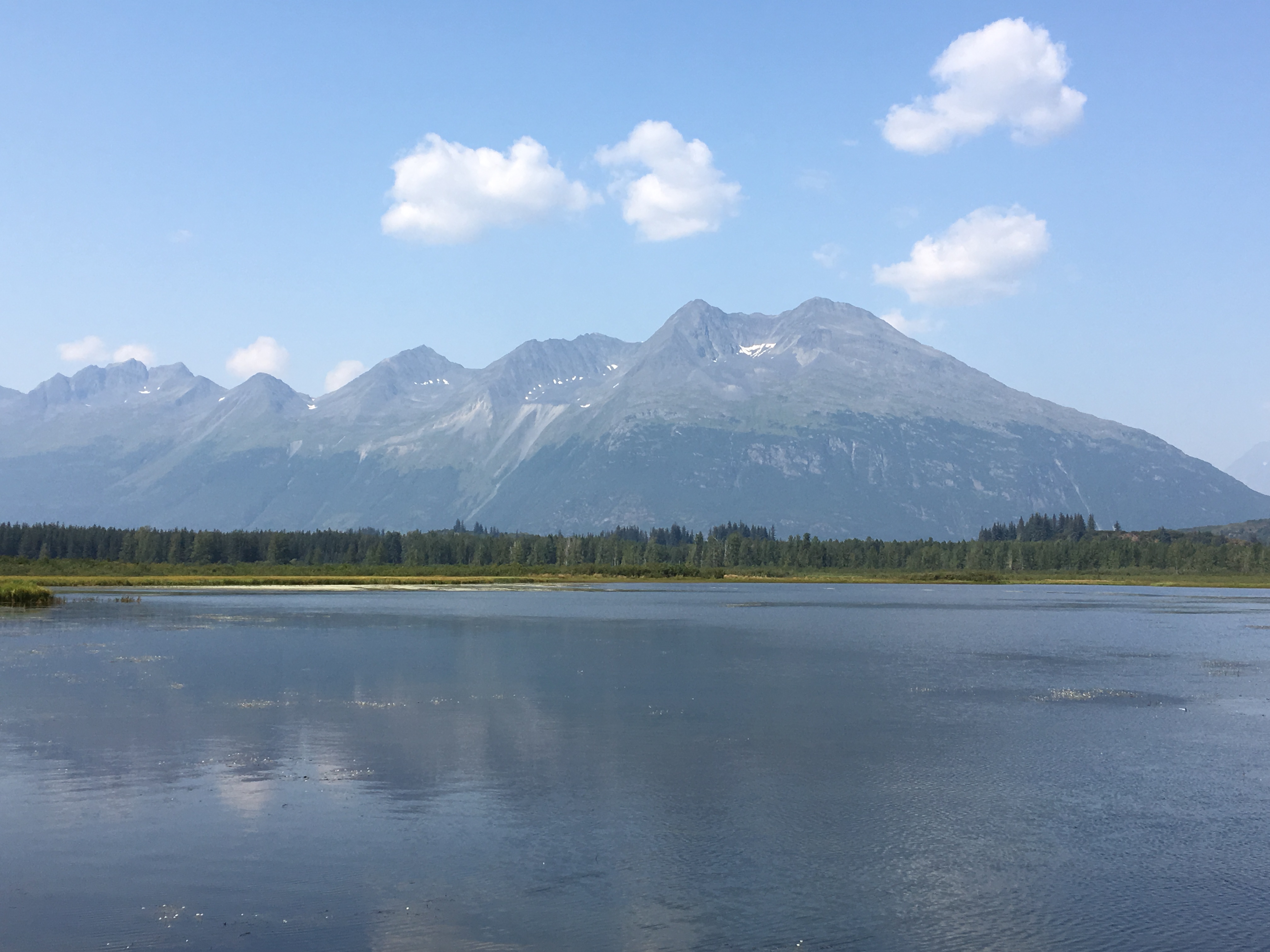
The highway finally reaches sea level as we enter Valdez (Pronounced Val-Deez) and begin to see the developing landscape. The town is situated on the Valdez Arm, a protected bay on the Prince William Sound, and is surrounded by towering mountains capped with snow and glaciers. We are camped at the Bear Paw Adult Campground (rather than their family area) on the channel for the small boat harbor. Due to the amazing fishing in this area, there is always some type of fishing derby occurring and while we were there was the Women’s Silver Salmon Derby. All of the fishing charter boats had been reserved over a year in advance for this competition, taken very seriously by the locals. The area offers an enormous array of activities from glacier tours to white water rafting, sailing and fishing charters.
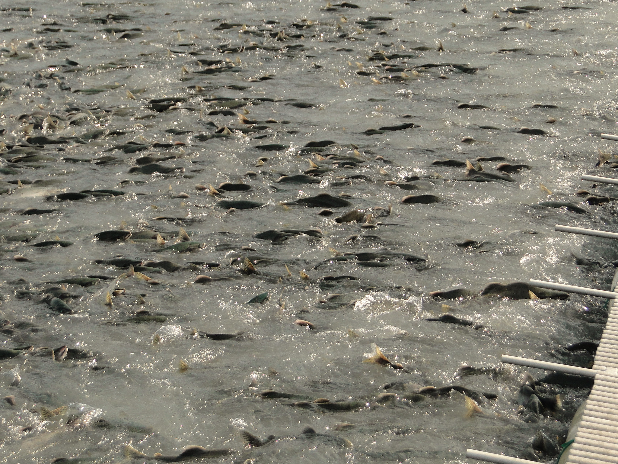
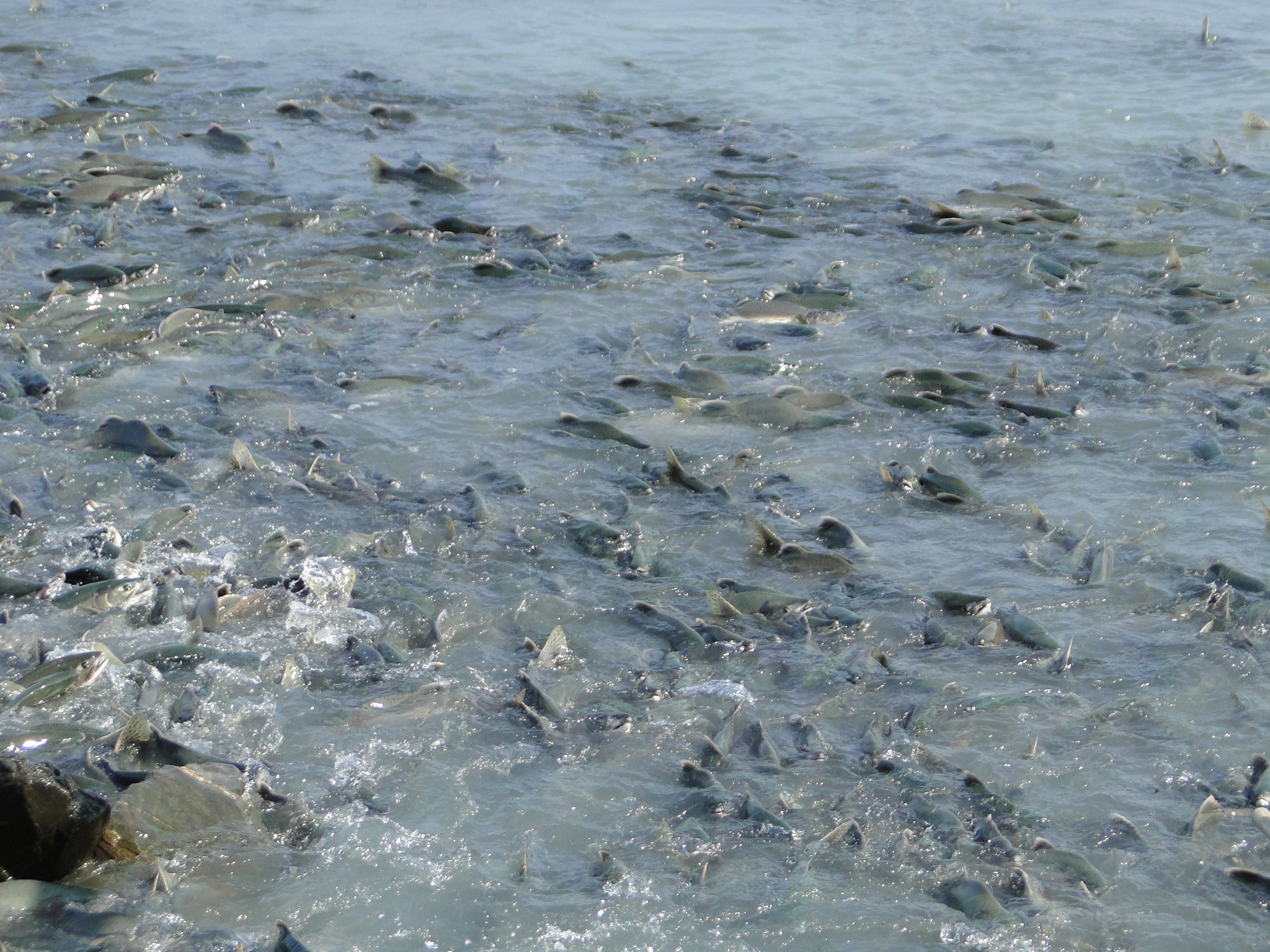
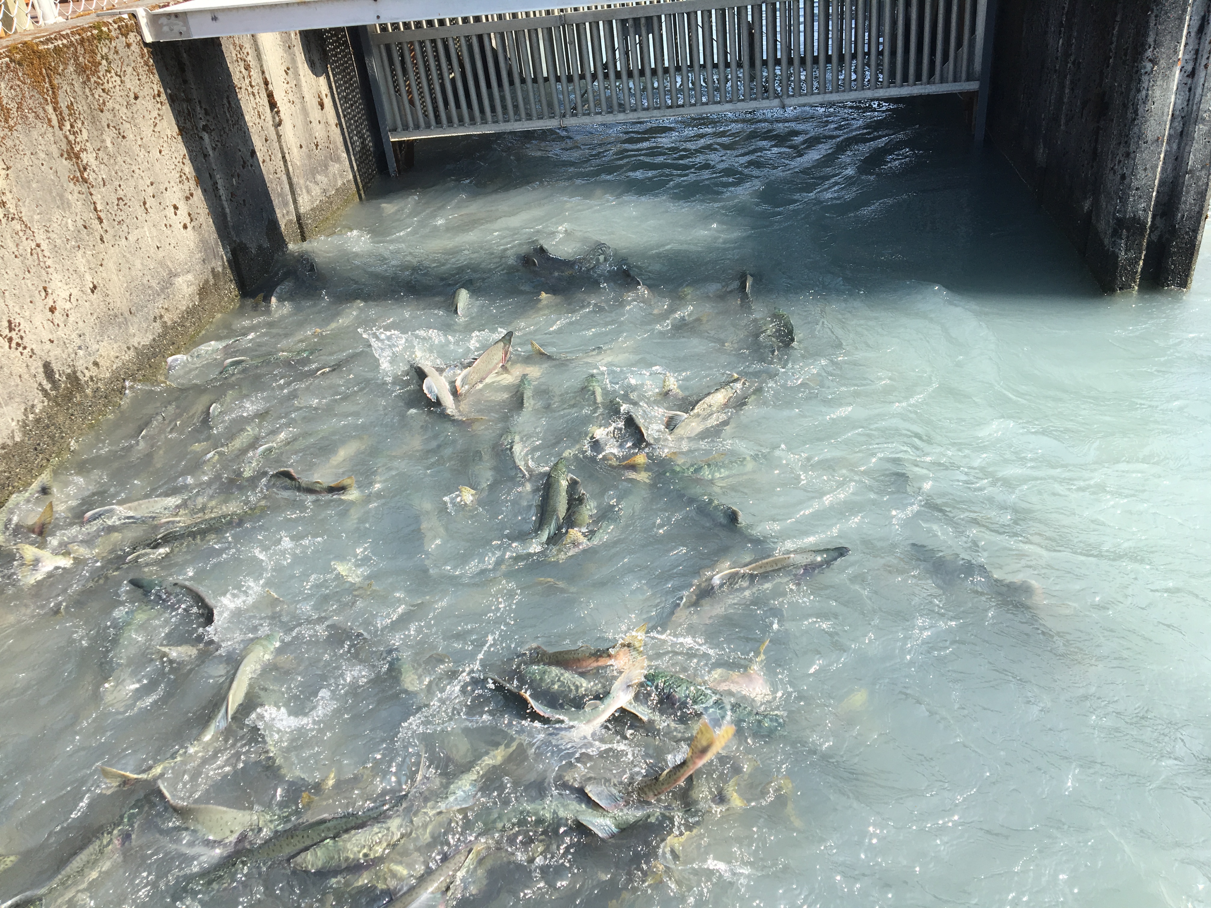
The Solomon Gulch Fish Hatchery on Dayville Road is an extraordinary opportunity to see thousands of salmon returning to spawn where their life first began.
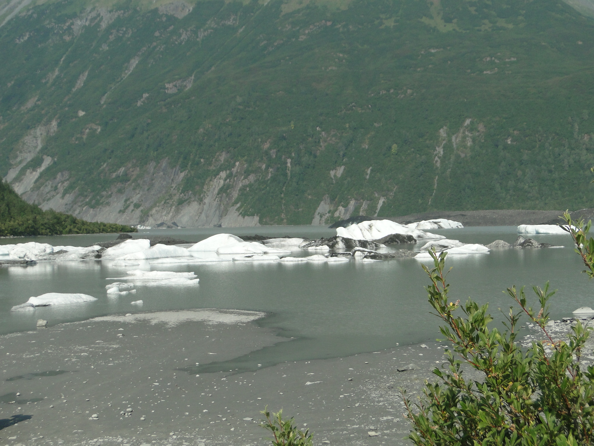
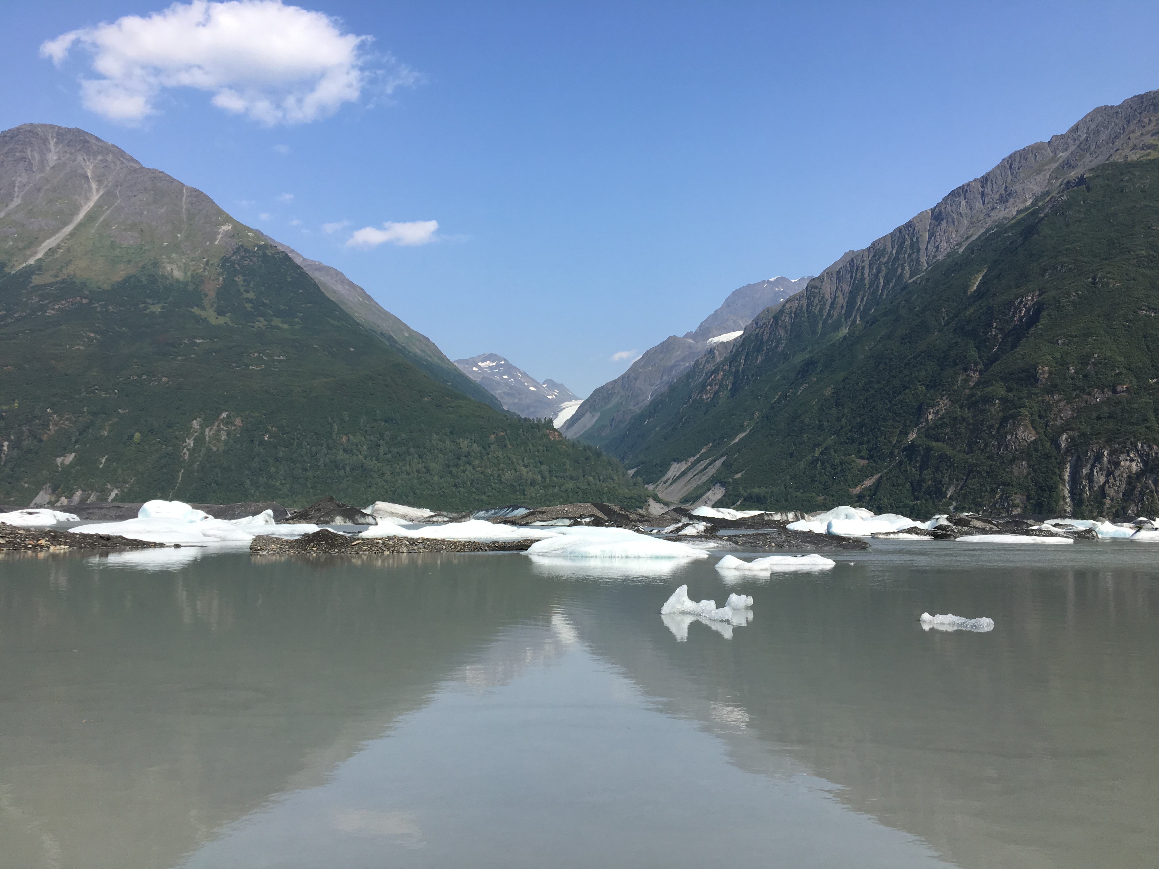
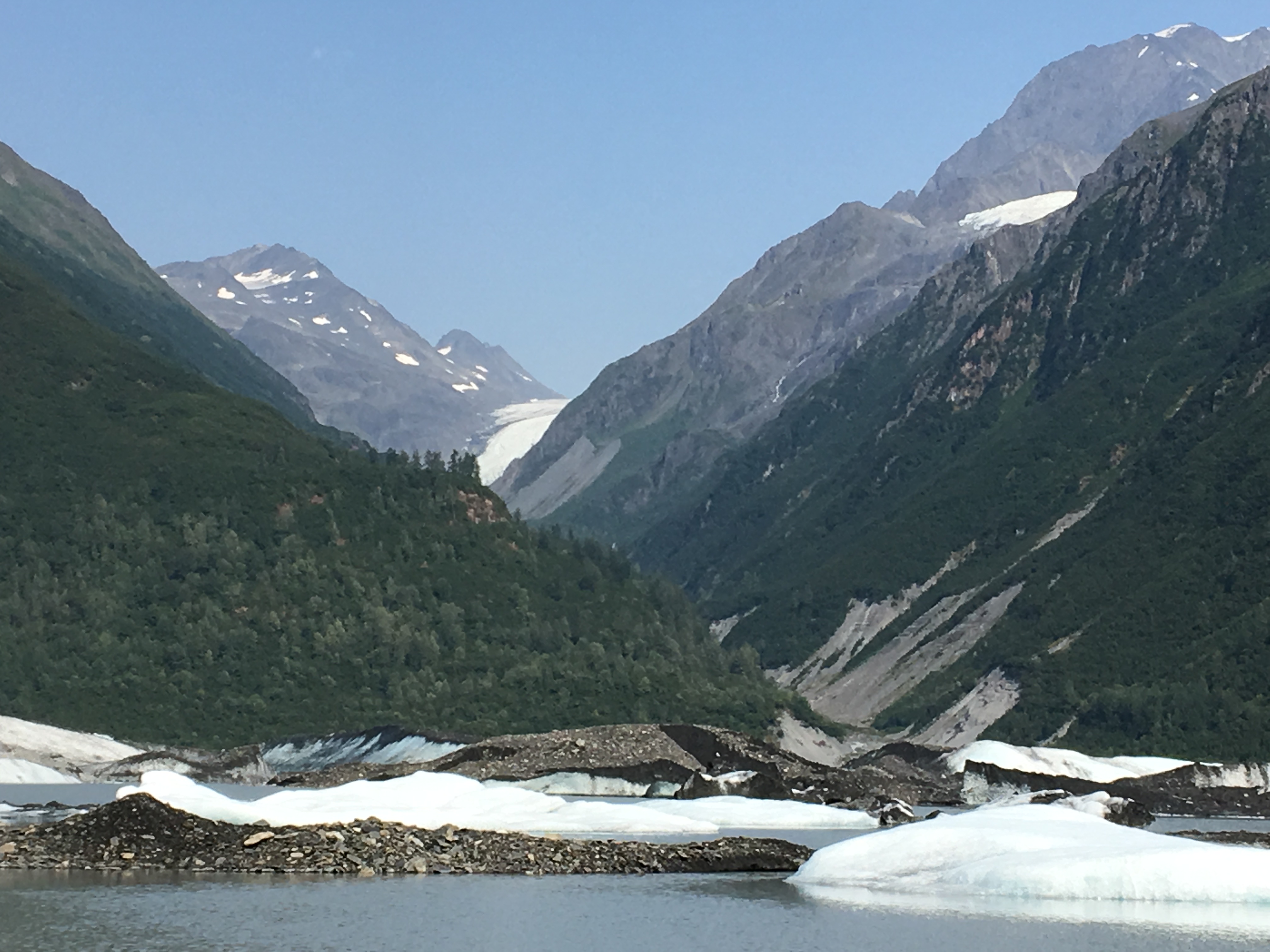
The Valdez Glacier at the end of the Airport Road is another golden opportunity to see a glacier and its floating icebergs up- close and personal.
Robe Lake, a beautiful mountain lake, is an excellent option for flat water kayaking or swimming as its waters are a bit more seasonal than the glacial lakes that abound.

The town of Valdez was moved to higher and more stable ground after the devastating earthquake of 1964 and the remains and history are well documented for the history enthusiast to explore both at the museum and the driving tour.
After several very relaxing days camped on the water, we began our journey back north on the Richardson Highway to the town of Tok where we will head northeast on the Tok Cutoff. The next southbound trek puts us back on the Alaska Highway to Haines. Since we had camped in Tok on our drive northbound at the Tundra Lodge and RV Park, we decided to try another campground for review, this time the Sourdough Campground. This site was a very nicely laid out wooded site with power and water, very clean showers and a small but adequate camp store. ($32 with Good Sam Discount) As the nights have finally started to become totally dark, we were hoping for an aurora borealis display at Tok, however the night sky turned cloudy around 1:30 a.m. (The night before the owners had seen the aurora directly overhead)
Note: The Tok Cutoff Road was the worst road that we have traveled to date. There were several sections under construction, with long waits and many sections of constant frost heaves. (Think roller coaster ride) There were numerous sections of gravel only and your travel is reduced to 30 mph for long stretches. As they like to say in Alaska, “there are two seasons, winter and construction.”
From Tok, we were back on the Alaska Highway, this time headed south to Haines. We will travel back and forth through two time zones as well as cross the Canadian Border (into the Yukon and then briefly British Columbia) and then again, the US Border just north of Haines. (Reminder to travel with your passports if traveling into Canada)
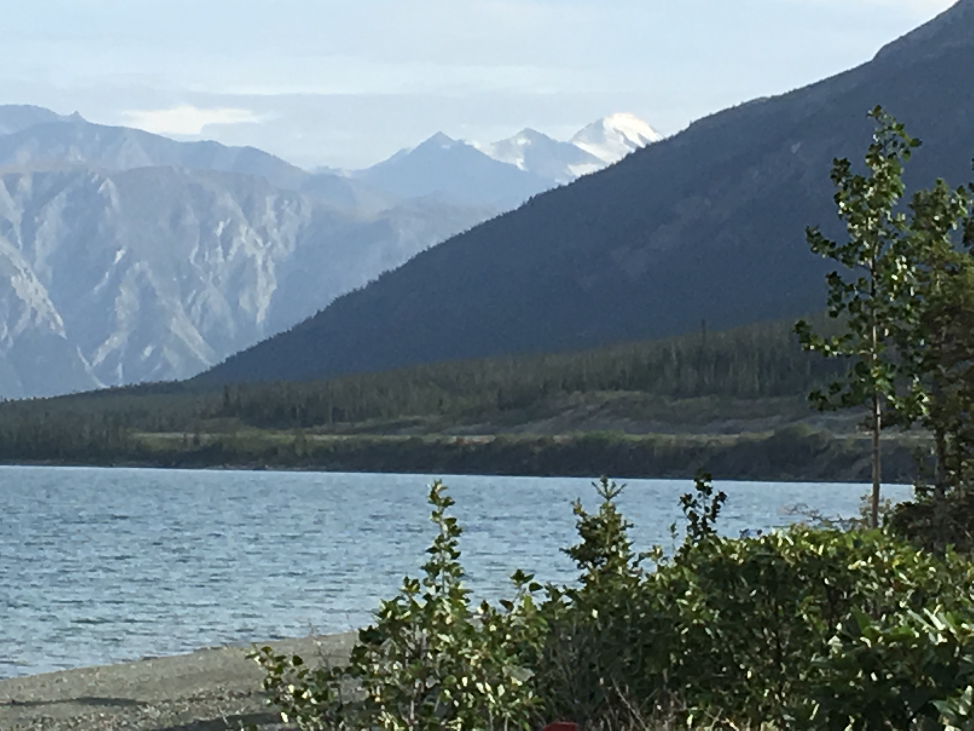
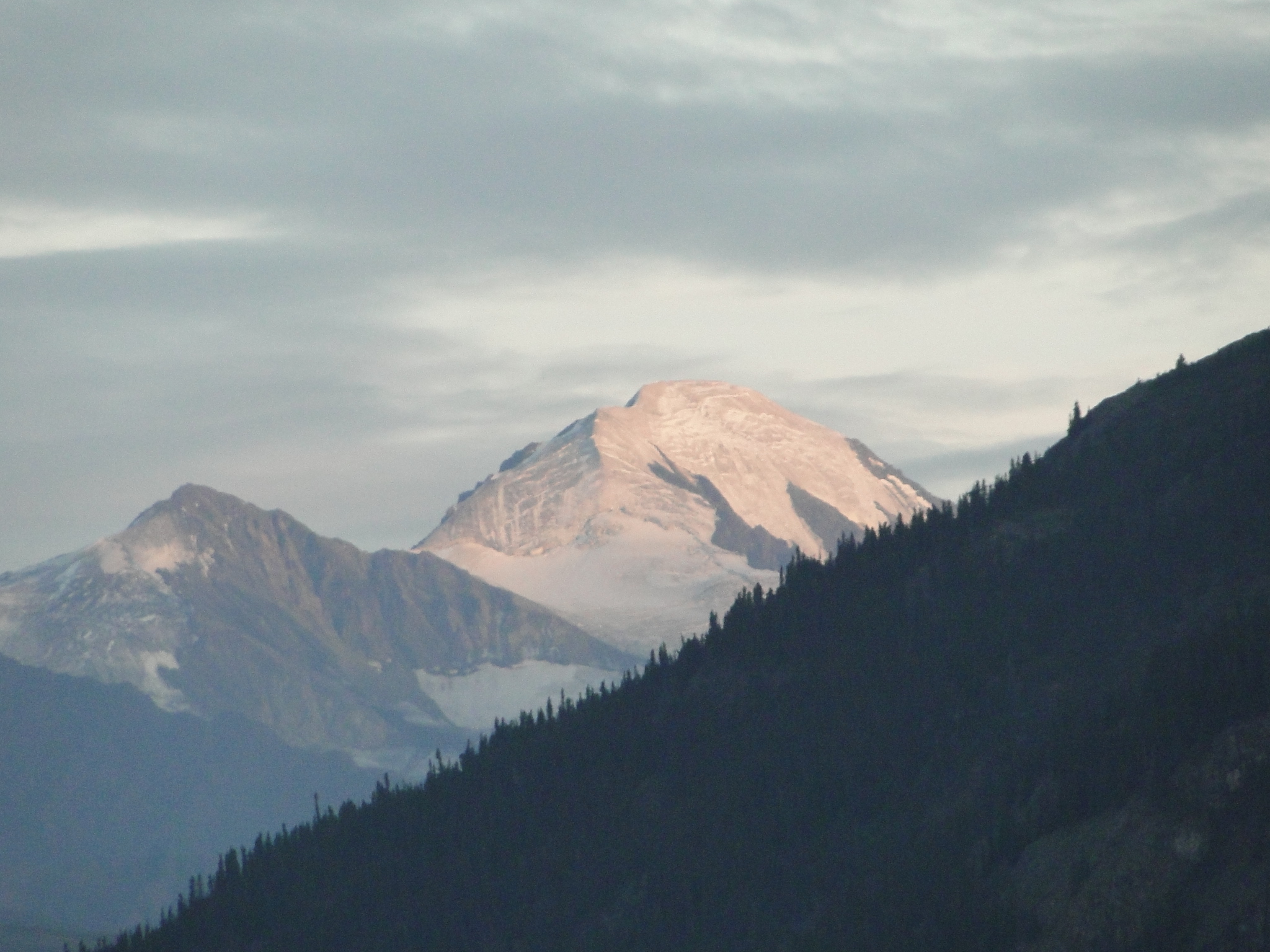
But the journey from Tok to Haines is a longer drive than we wanted for this day so we decided to revisit a remarkable campground that was enshrouded by low clouds, rain and fog almost four weeks ago hiding what we assumed were outstanding views of the Dawson Range. The Cottonwood RV Park at Destruction Bay is a gem of a park. The sites are close but sites along the water’s edge are very special. The Kluane Lake (pronounced Claw-knee) did provide the views we missed and more. We even discovered a glacial topped mountain that we weren’t even aware of last trip here. (High recommendation for the beauty, grandeur, panorama, quality and peacefulness of this location. To us, it proved very special twice and we’re already discussing how we might make this lake a destination in the future.)


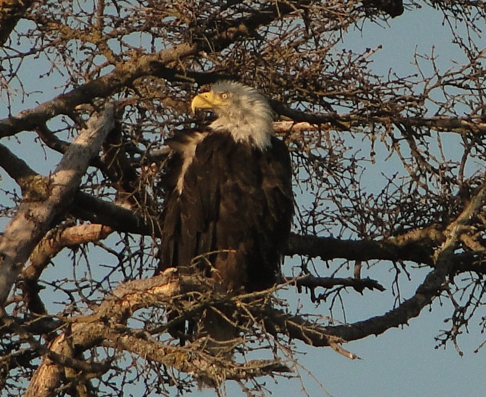
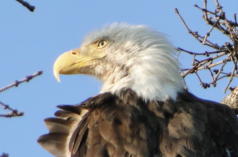
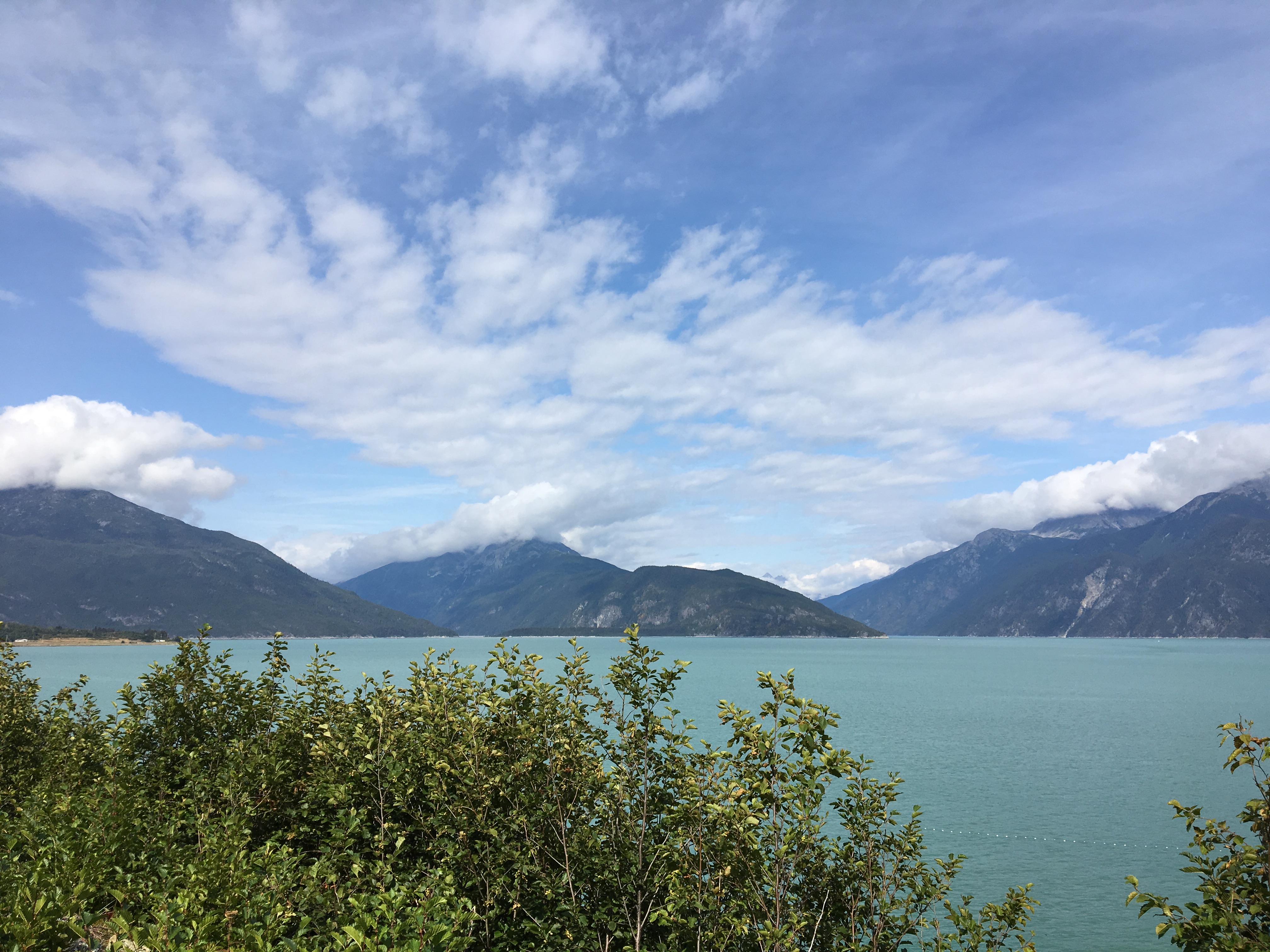
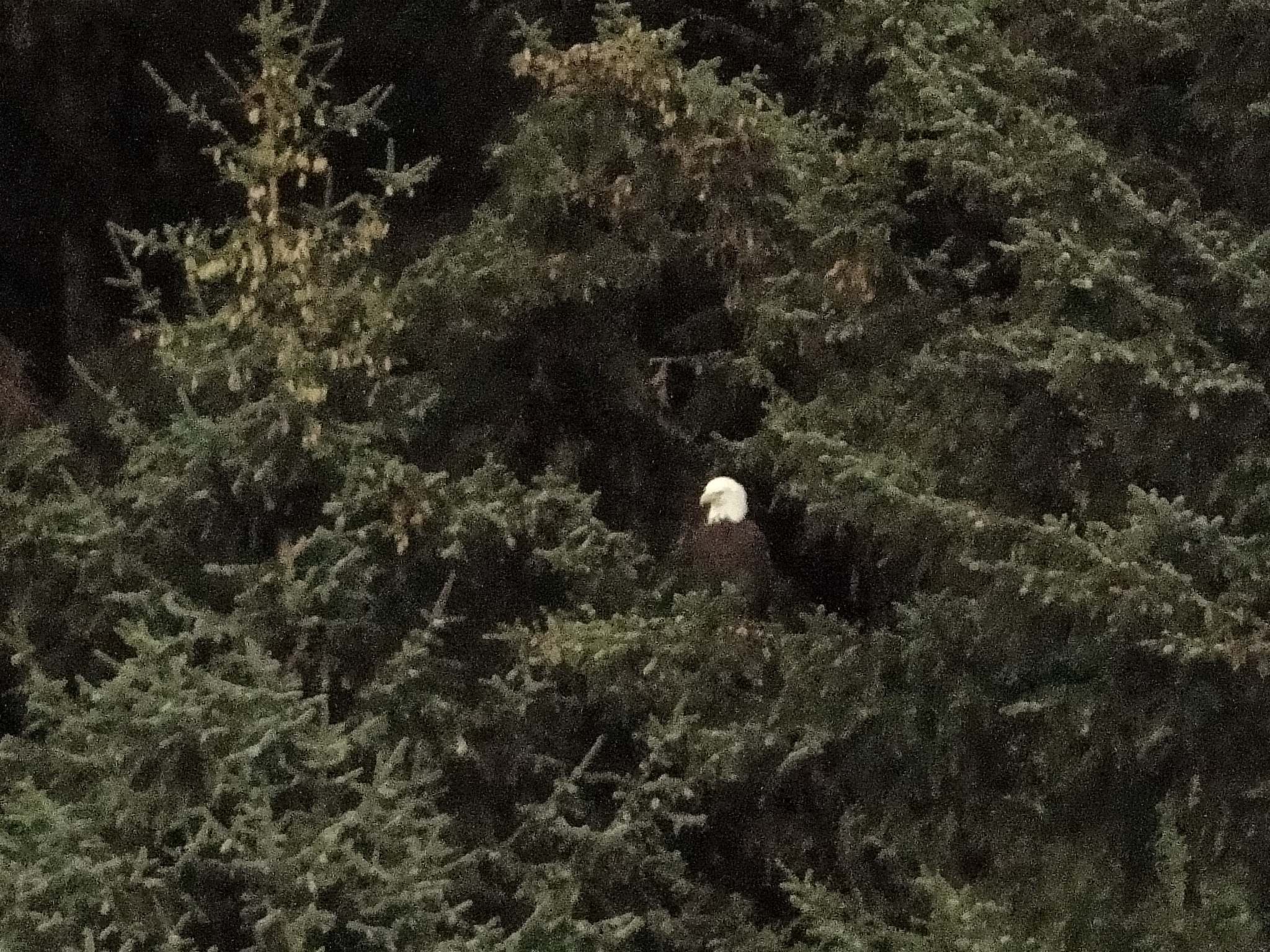
After our wonderful Cottonwood, Part Deux, we traveled the remaining miles of the Alaska Highway before it departs from our route at Haines Junction heading east towards Whitehorse. At that point the southbound road is known as the Haines Highway. Haines is another few hours south but the road, like most Alaskan Highways, is filled with wonder and amazement, if not with potholes. Incidentally, this portion of road was the smoothest highway we have been on since Montana. First major stop in the Haines area is the Alaska Chilkat Bald Eagle Preserve. The Chilkat River crosses and then follows the highway into the village of Haines and is a natural nesting location for the bald eagles that frequent this valley in large numbers. From mid- October through December is the annual gathering of over 3500 bald eagles and is celebrated in November with the Bald Eagle Festival.
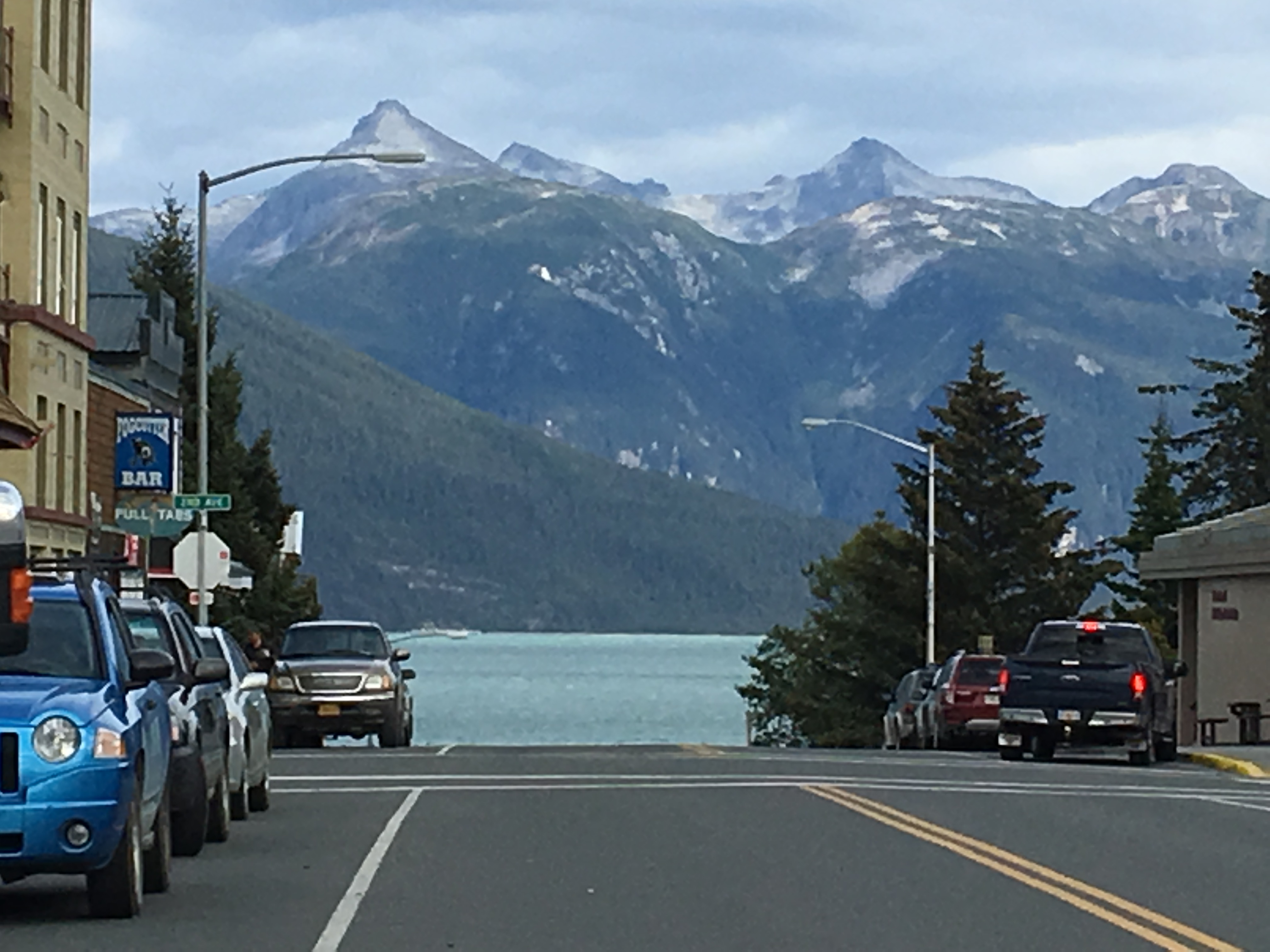
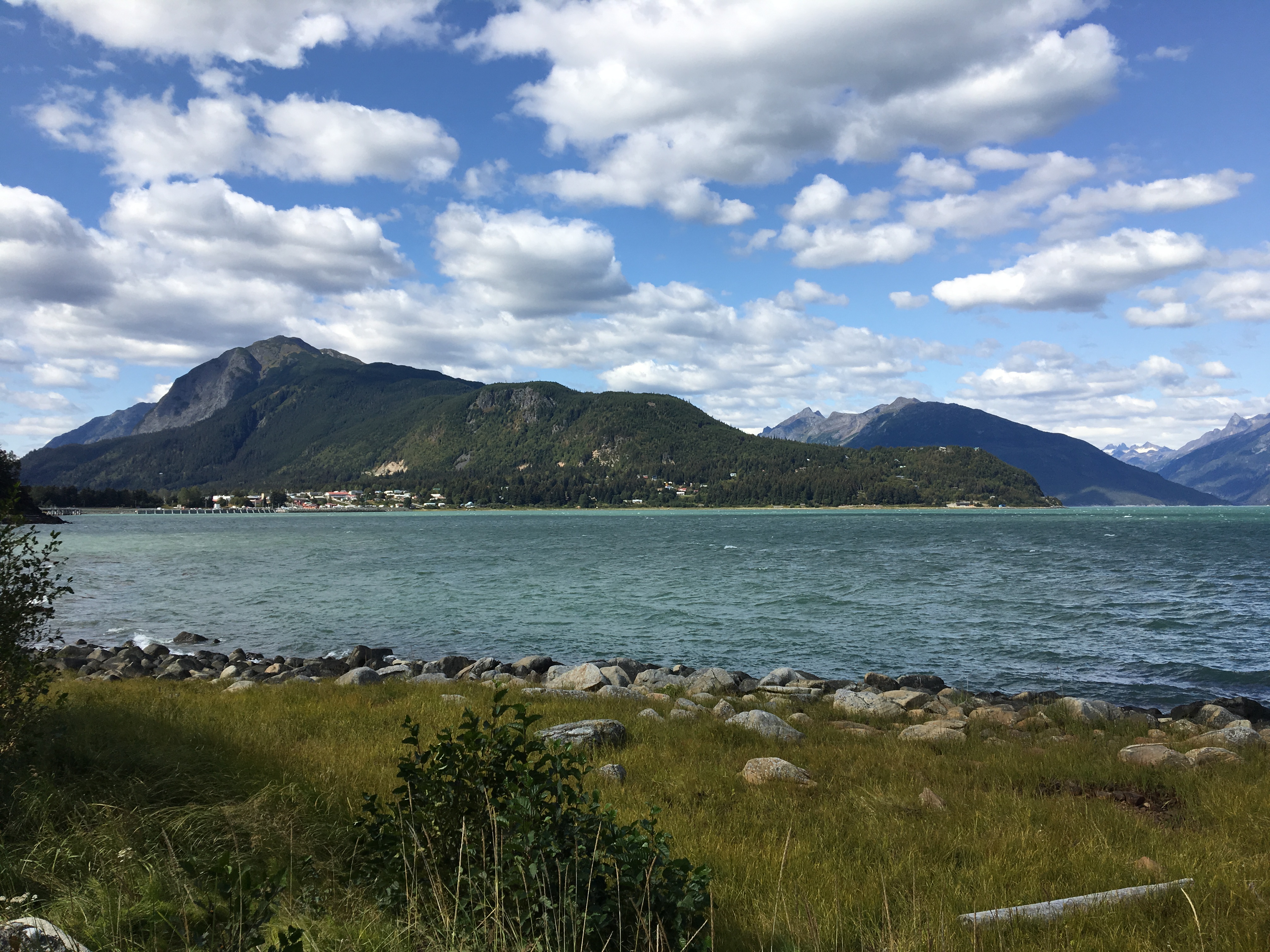
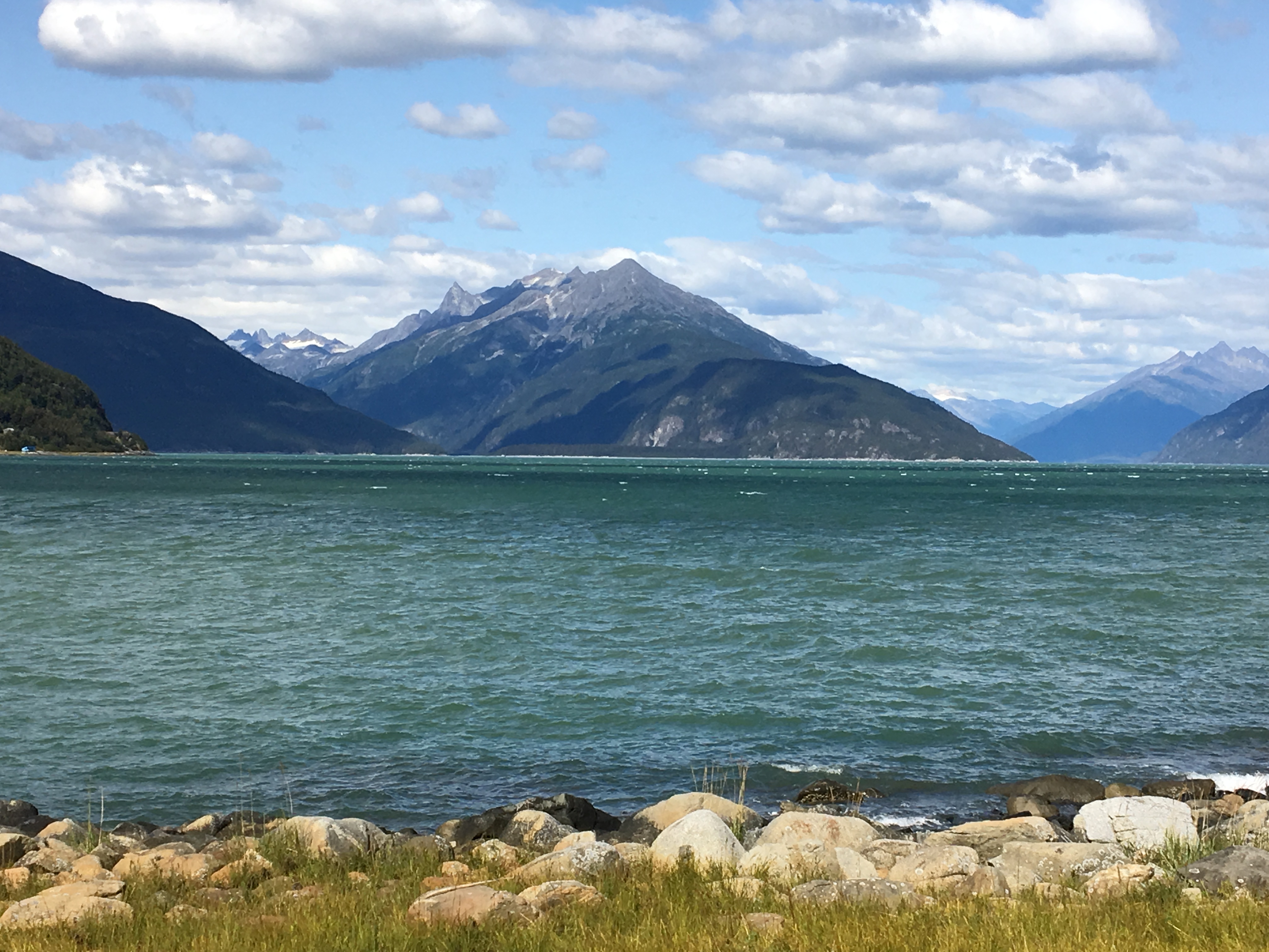
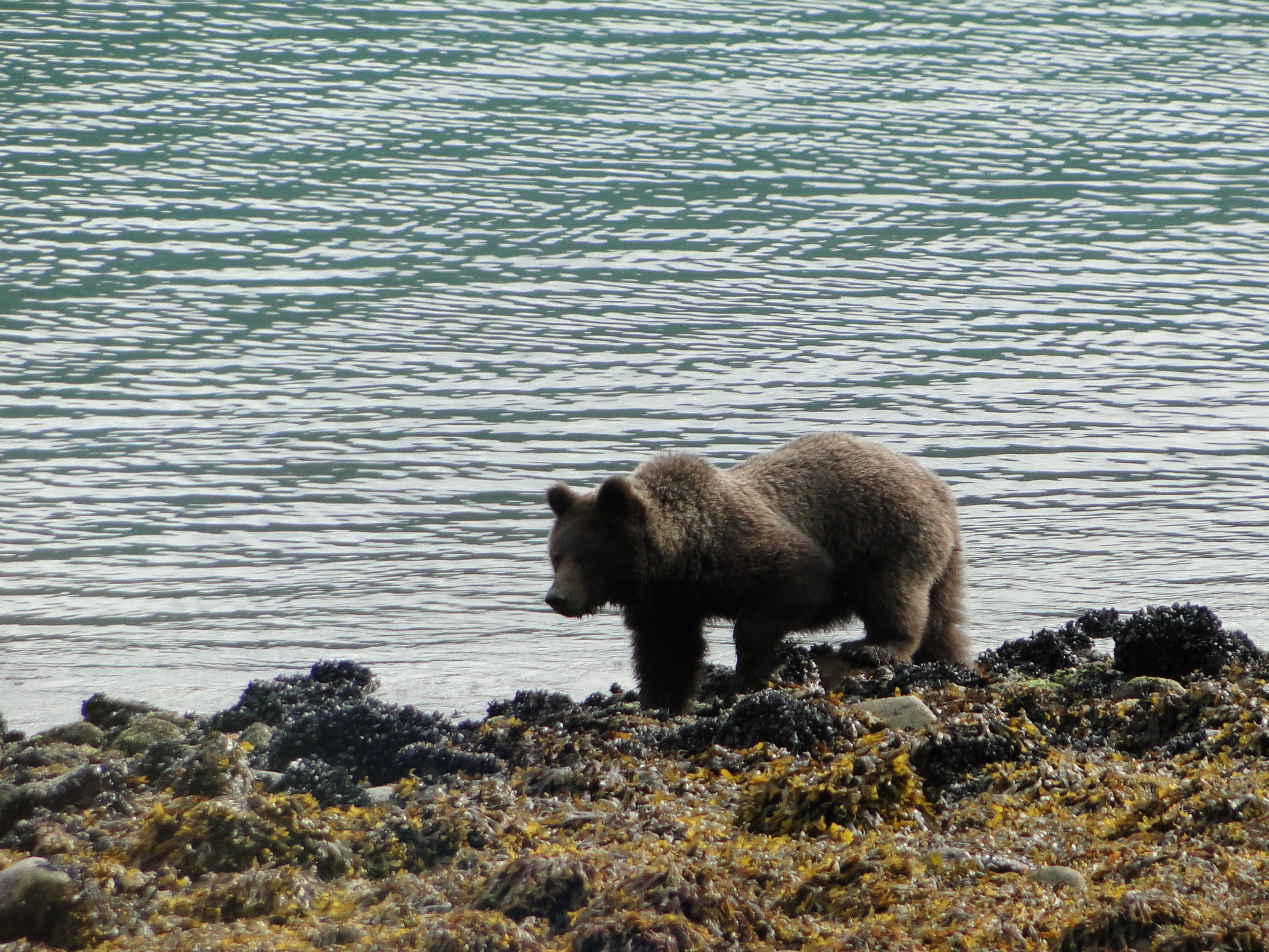
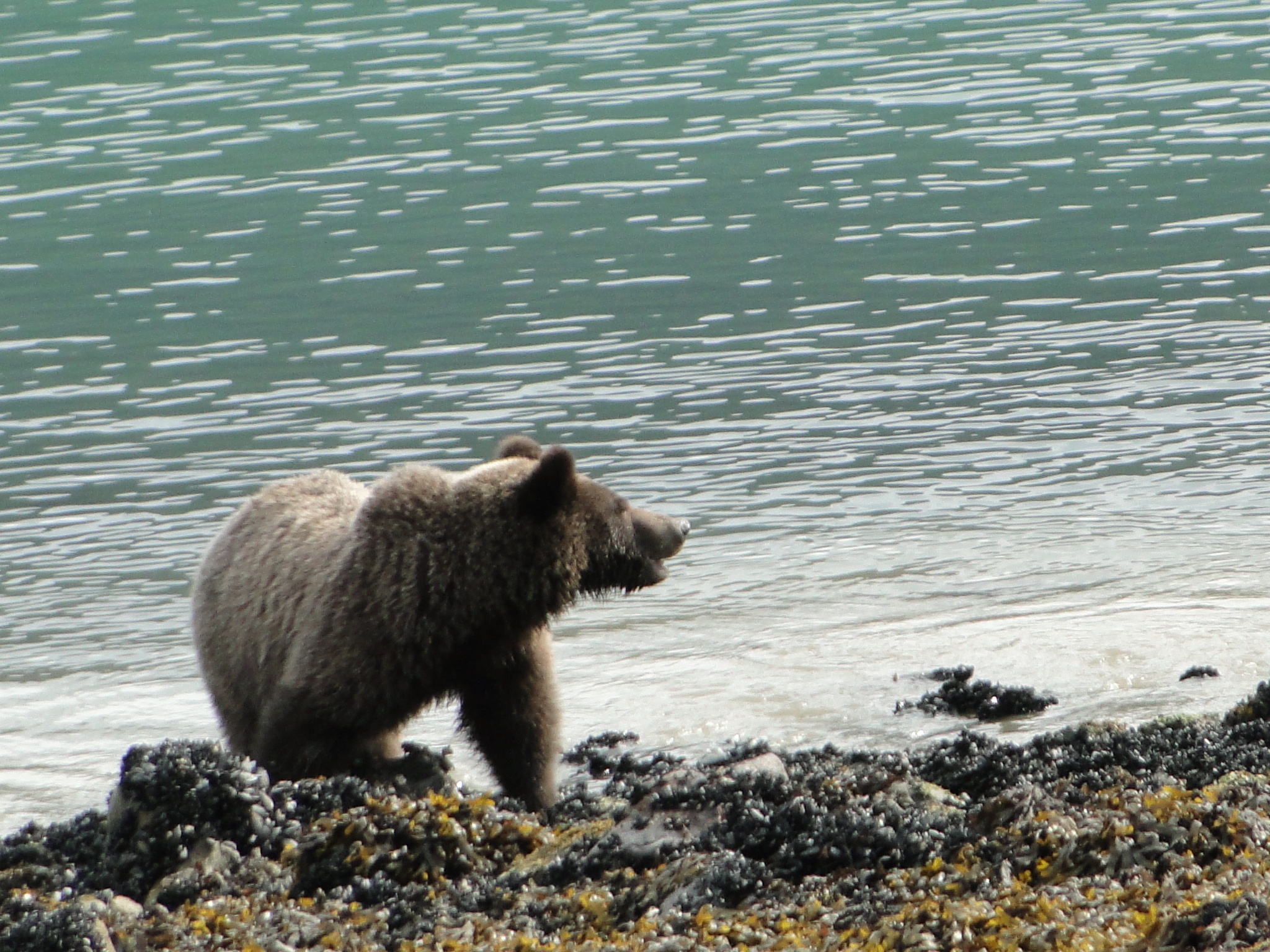
We settle into the Haines Hitch-Up RV Park but realize quickly that it is too much parking lot and since it’s not on the water, we immediately begin looking at the three other campgrounds that we knew about. Hitch-Up is extremely clean and neat but the location, while close to the water, leaves a little something to be desired. We booked three nights though for the convenience factor, primarily laundry, groceries, and proximity to the library for high speed WIFI before we leave on a 4 day ferry ride back to the Lower 48. Night one in a new location always involves a bit of reconnaissance to find and understand your location. Walking the town of Haines found virtually every store and many restaurants already closed by 8 p.m. The town, though surrounded by an abundance of beauty is not terribly attractive and feels a bit rundown. To the west at the harbor is where the cruise ships dock and to the east is where the Alaska Marine Highway System ferrys dock. Just beyond the ferry terminal is the beginning of the Chilkoot Inlet that leads into the Chilkoot Lake, a famous feeding ground for brown bears and bald eagles.
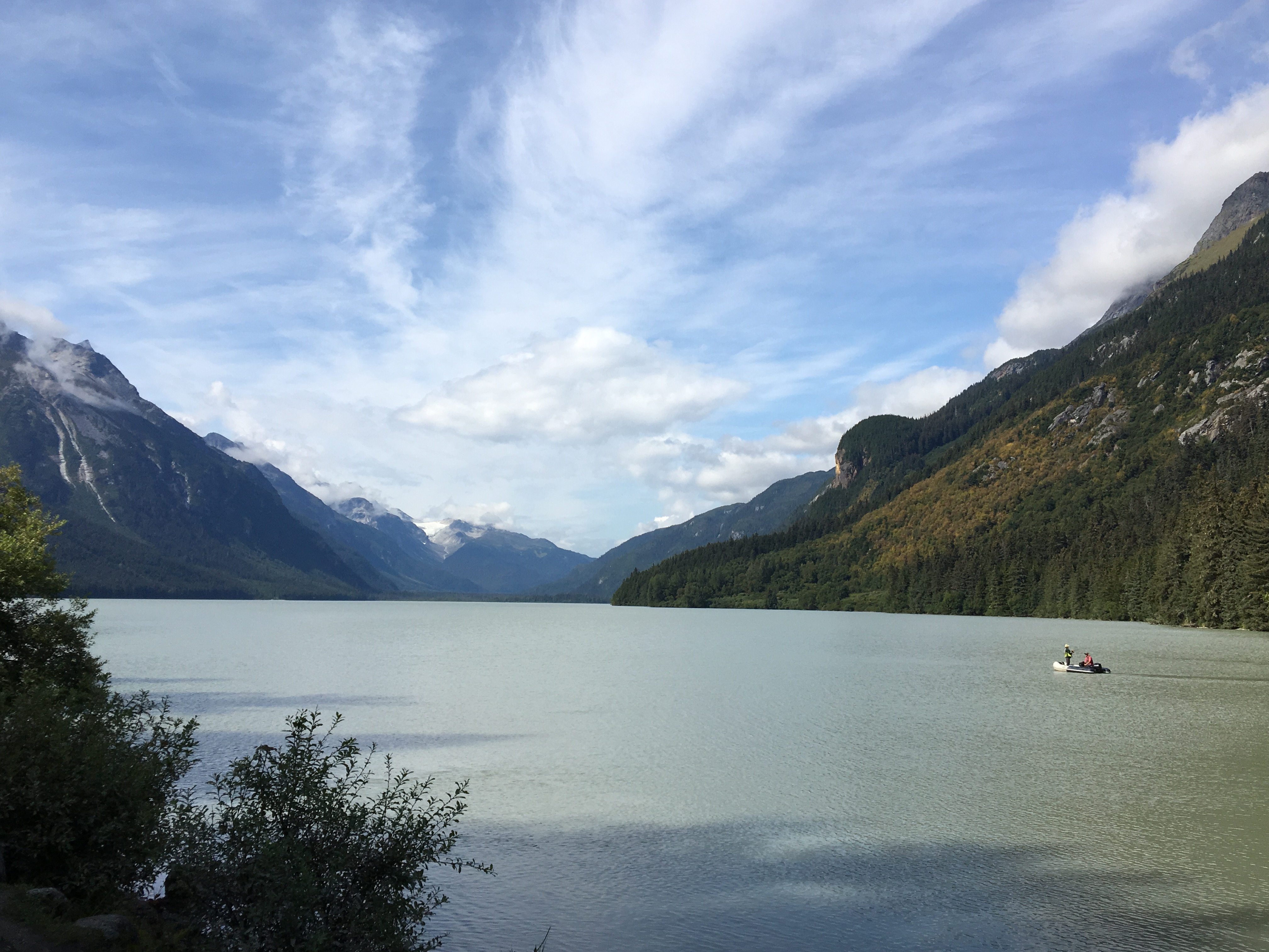
Our afternoon visit there on the first attempt yielded only one sighting of a bald eagle but no bears. We decided to move to a campground located on the Inlet in three days so we could spend more time in search of bears and eagles. The next day we plan to leave out early for the Bald Eagle Preserve, back 20 miles north on the Haines Highway. Birding is usually an early morning endeavor but unfortunately we don’t get out quite as early as initially planned. There are a number of pullouts along the road adjacent to the area designated as the Preserve, but milepost 20 is noted as “prime” eagle viewing. There is a boardwalk built over a wetland there that leads to a beautiful overlook of the Chilkat River. While there we see three different eagles feeding along the river but they are quite far for camera range, only visible in the binoculars and the telescope that is mounted at this overlook.
Returning to town we drive out the westerly direction around the harbor on the Mud Bay Road on advice of a store proprietor. This road leads past the Fort William H. Seward Historic District and winds around to the Chilkat Peninsula and Chilkat State Park.
The next day we visited the wonderful American Bald Eagle Foundation Natural History Museum and Raptor Center. This unique museum features over 200 specimens of fish and wildlife in a life- sized diorama and houses a remarkable collection of injured raptors including several bald eagles, peregrine falcons, hawks and owls. The trainers are constantly working with these birds for strength conditioning as they are limited in their movement due to the severity of their injuries and the training is offered up when an audience presents itself. The trainers are all well versed in the biological sciences and behavioral training and are engaging and extremely personable with their audience.
The next day we move to Salmon Run Campground, a small site with only 15 sites on a bluff overlooking the Chilkoot River Valley. Salmon Run has power hook-up only but has very clean bathrooms and coin operated showers. The view; however, warranted the move to this new site.
After dinner we make another foray up the Chilkoot River in search of bears and bald eagles. This evening we spot three eagles at the same time perched high above the river. Unfortunately their distance was past the limit of the telephoto lens.
At the fish weir, we were fortunate to be able to speak with the Fish and Game manager about bear sightings. He informs that most of the activity has been in the middle of the night as he believes that the increase in tourists has changed the bear behavioral patterns in the last couple of years. He tells us that when he arrives at 6 a.m. daily he finds fish carcasses and bear scat all along the boardwalk above the weir. ( the weir is a fencing system that is used to manage the fish migration for spawning and is installed just for the spawning season)
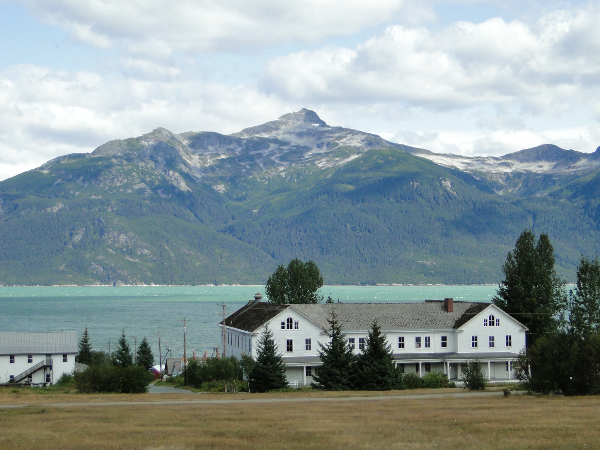
This day we also walk the grounds of the Fort William H. Seward, a national historic site. The fort, carved out of the Alaskan wilderness in 1903, was built as a necessity to control the lawless nature of the region as the Klondike Gold Rush was winding down. Though the army deactivated the fort in 1946, a group of WWII vets purchased the post with hopes of creating a small business cooperative. The cooperative failed but the land still thrives with several small businesses, condos, a B&B and the Hotel Halsingland still operating.
Our day wound down with perfect evening weather perched on our site above the Chilkat River. Tomorrow we leave on a 4 day ferry ride south to Bellingham, Washington as we return to the lower 48. We will bid a fond farewell to the Alaskan interior with a heavy heart, but look forward to the ferry ride along the inside passage. The Alaska Marine Highway System (AMHS) is a less expensive method of traveling the waters that so many folks do via cruise ships and our next posting will report the next phase of this amazing journey into the Pacific Northwest.
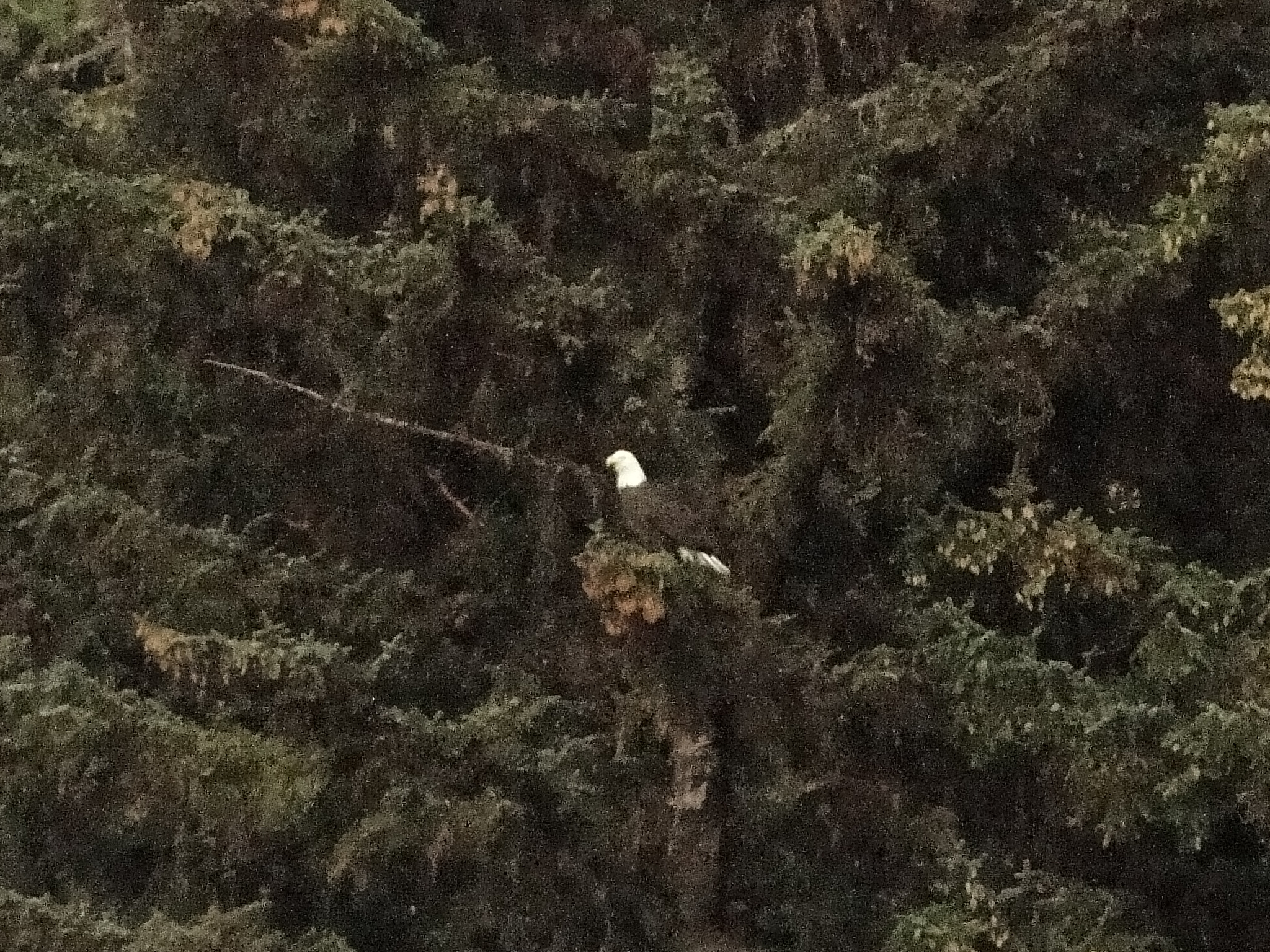
P.S. This post was essentially wrapped last evening as we had to check in at the ferry quite early in the morning. However on our way to the ferry terminal we ran into this little guy and well……. I’ll let him take us out. Until the next time, peace.
Ellen & Jay


Dear El and Jay
What an extraordinary state, or should I say representative of our planet. Loved the pics and your wobderful photos and al the amazing wildlife you saw
Love. Lin and Ell
LikeLike
Fabulous pictures and blog,we loved the Homer Spit when we were there,took the boat across.Your pics of the bear at the end was cool.Enjoy the rest of your trip,thanks for the campsite news,we still tent camp,but did more cabins when we were there in 2014.
LikeLike
Terrific pictures. Enjoy your trip on the ferry and write or call when you can, cb
LikeLike
Great to read your trip is going so well. ENJOY! Btw, any reason you didn’t stop by Sarah Palin’s place and have dinner with her clan of deplorables? A picture of Russia would have been cool.
Take care,
Marc
LikeLike
Wonderful, amazing! The mountains by themselves, and the lakes, by themselves, are stunning. Together, as in most of your photos, it is just astounding. Thank you so much for sharing it all! Looking forward to hearing, and seeing, the ferry ride, and while I know it was hard for you to leave Alaska, I will be happy to have you back in the lower 48!
LikeLike
Your trip has become Homeric. How did you bribe the grizzly and eagle to pose for you? Your blog and pics would make Marlin Perkins jealous. Continue to stay safe and sound on your journey.
Gary & Cindee
LikeLike
Fabulous journey. Outstanding pictures. Brings Alaska alive.
Enjoy.
Ken
LikeLike
I enjoy following your journey. Looking forward to your stop in DE!
LikeLike
Spectacular! We must get to Alaska while Barry still has his sight!
So glad you were not affected by the Denali mudslides. Another friend was on the last tour bus that got out before the sludes hit.
What a fabulous trip and so much helpful info.
LikeLike