Leaving Alaska after a spectacular month was an emotionally draining experience. Our time there had been as glorious as we had anticipated. However, we were able to ease the pain by departing via ferry, the MV Columbia. (Motor Vessel) This is the largest vessel in the Alaska Marine Highway System (AMHS) fleet and includes 45 four-berth and 56 two-berth cabins as well as 3 wheelchair accessible cabins. (The cabins include full bathroom)
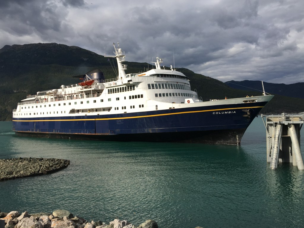
Though this is not a cruise ship, the amenities do include a full service restaurant, a snack bar that is open 22 hours/day, a movie theater, a covered heated solarium, indoor observation lounges as well as outdoor deck space, showers for patrons that have not rented a cabin, laundry, play area for children and quiet lounges. Customers are also allowed to pitch a tent in designated areas on the decks. This four- night journey from Haines, Alaska to Bellingham, Washington was a calm, relaxing break from our daily routine of driving, setting up camp and living in our RV.
This method of travel is not cheap, though we did save on camping, mileage and associated costs of driving what would have been about 1500 miles. (Slightly over $4,000 for vehicle and cabin) We tried to bring as much food along in a cooler so that we were not forced to buy the food on the boat as you are only allowed to visit your vehicle at certain times of the day or in port and you are required to turn off your propane refrigerator while your vehicle is on the boat. (Note for pet owners: non- service animals must stay in the vehicle and you are only allowed to visit and/or walk your pet at these certain times and while in port)
Note: Plan this portion of your trip well ahead of time. Booking early saved us a fair increase and also secured us a preferred cabin with a table and seating area)
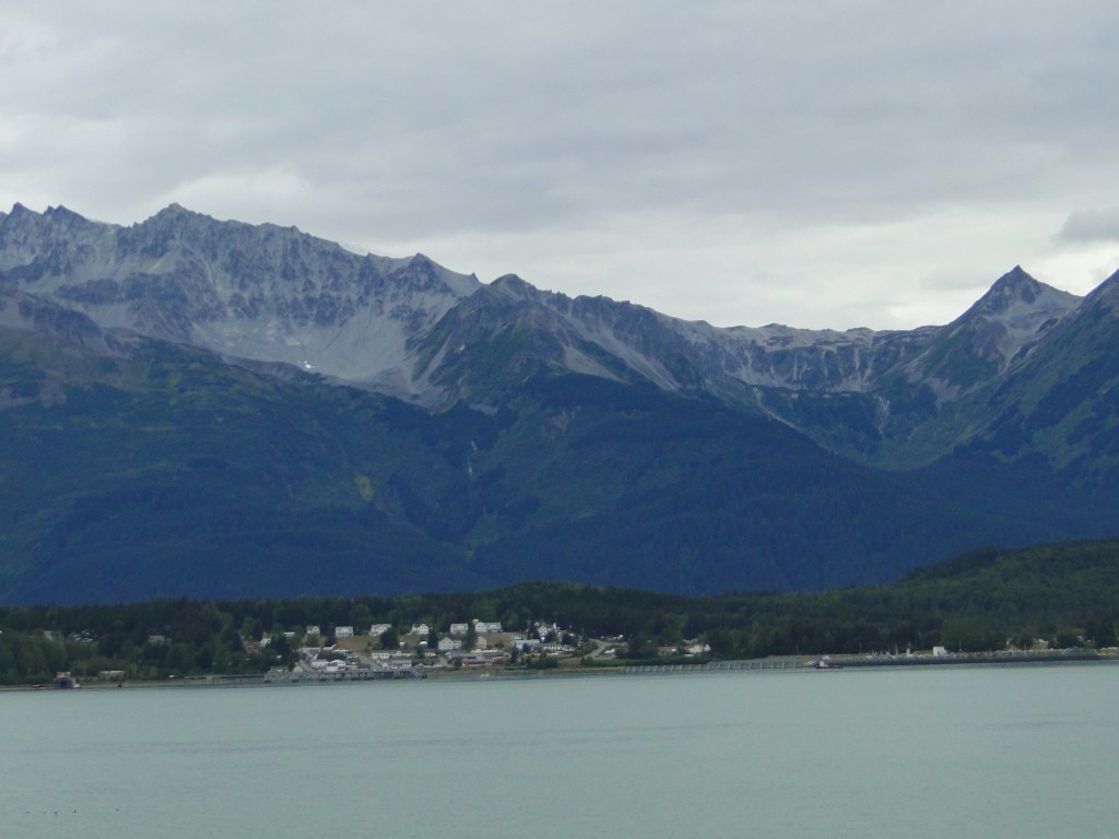
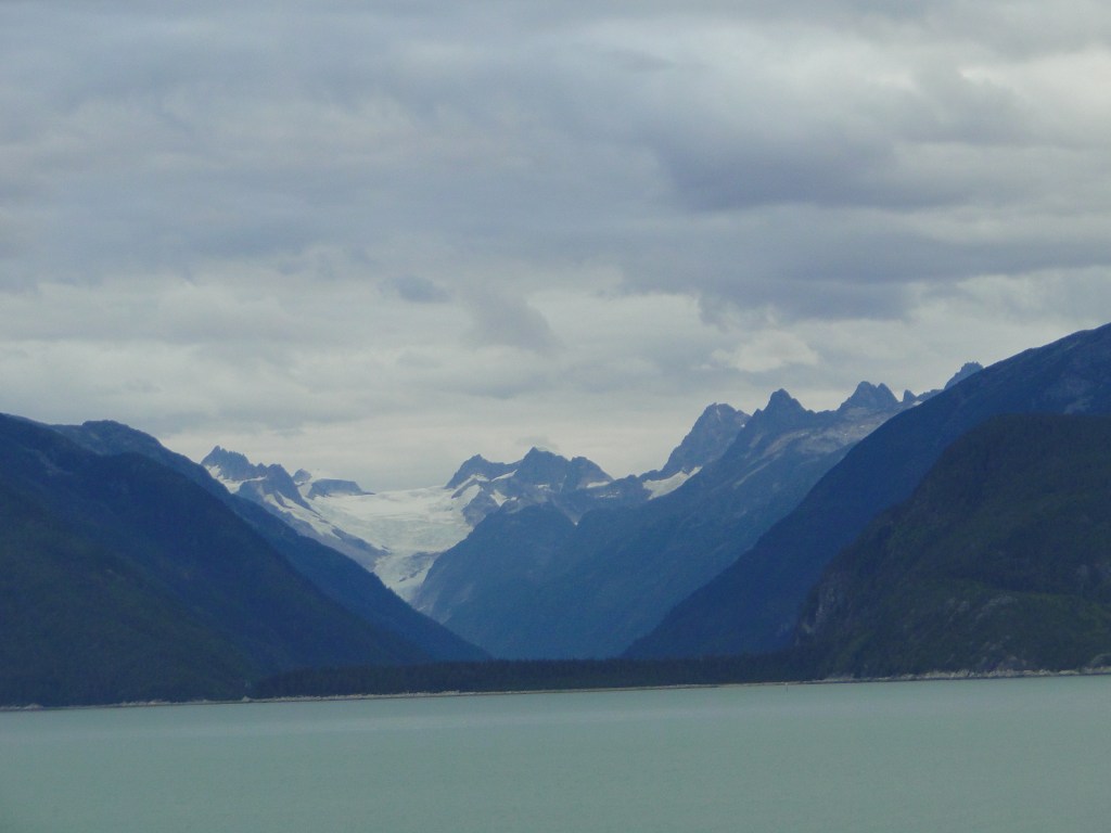
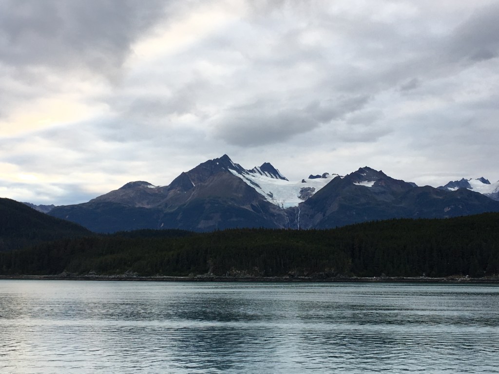
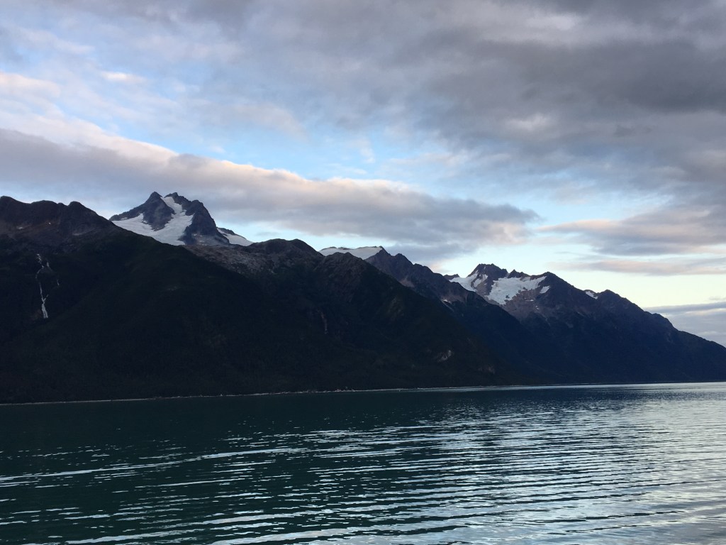
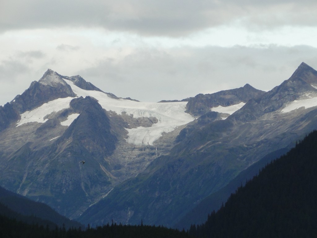
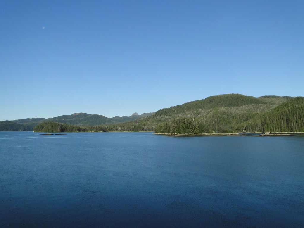
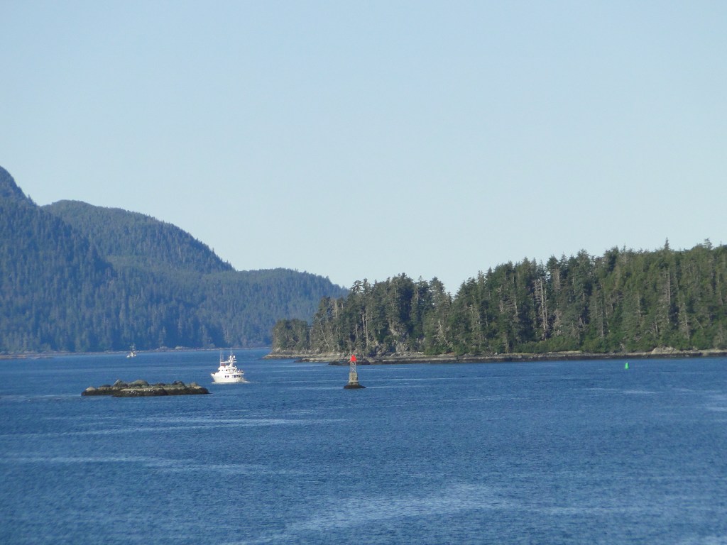
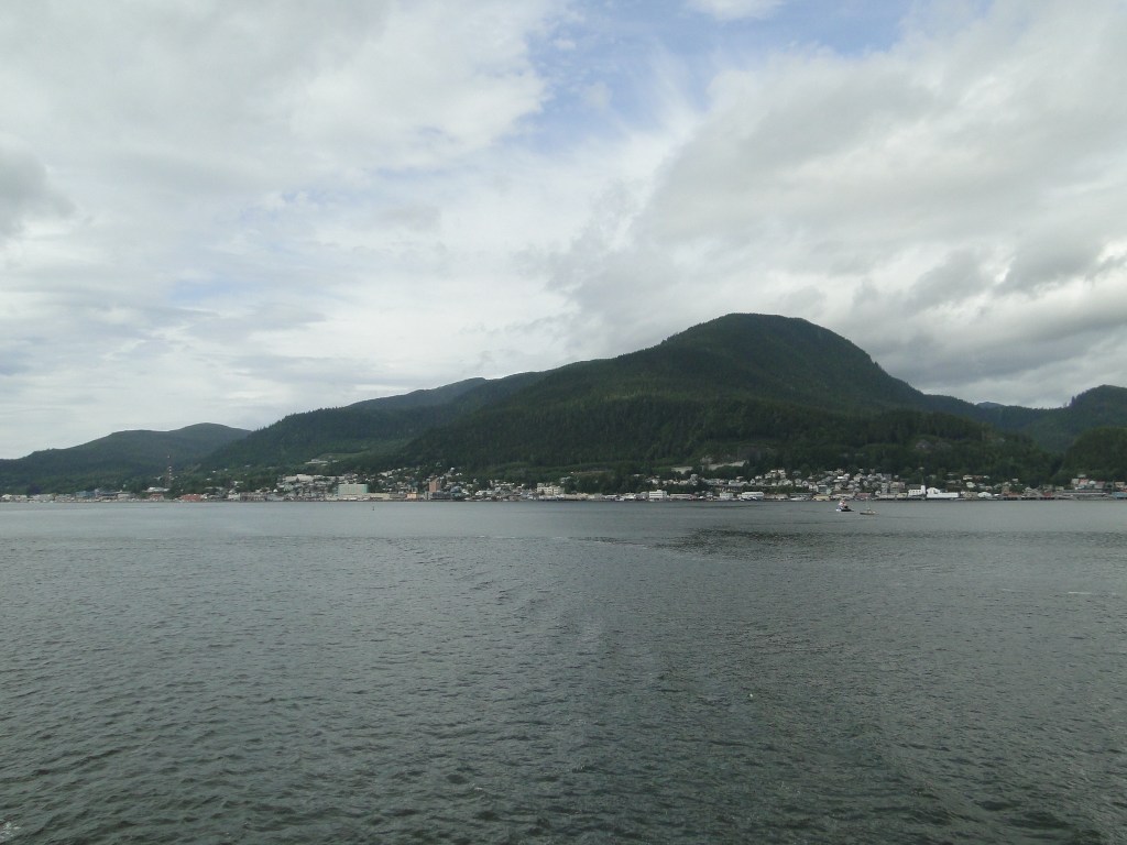
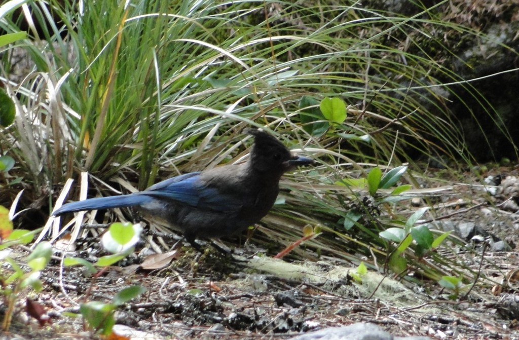
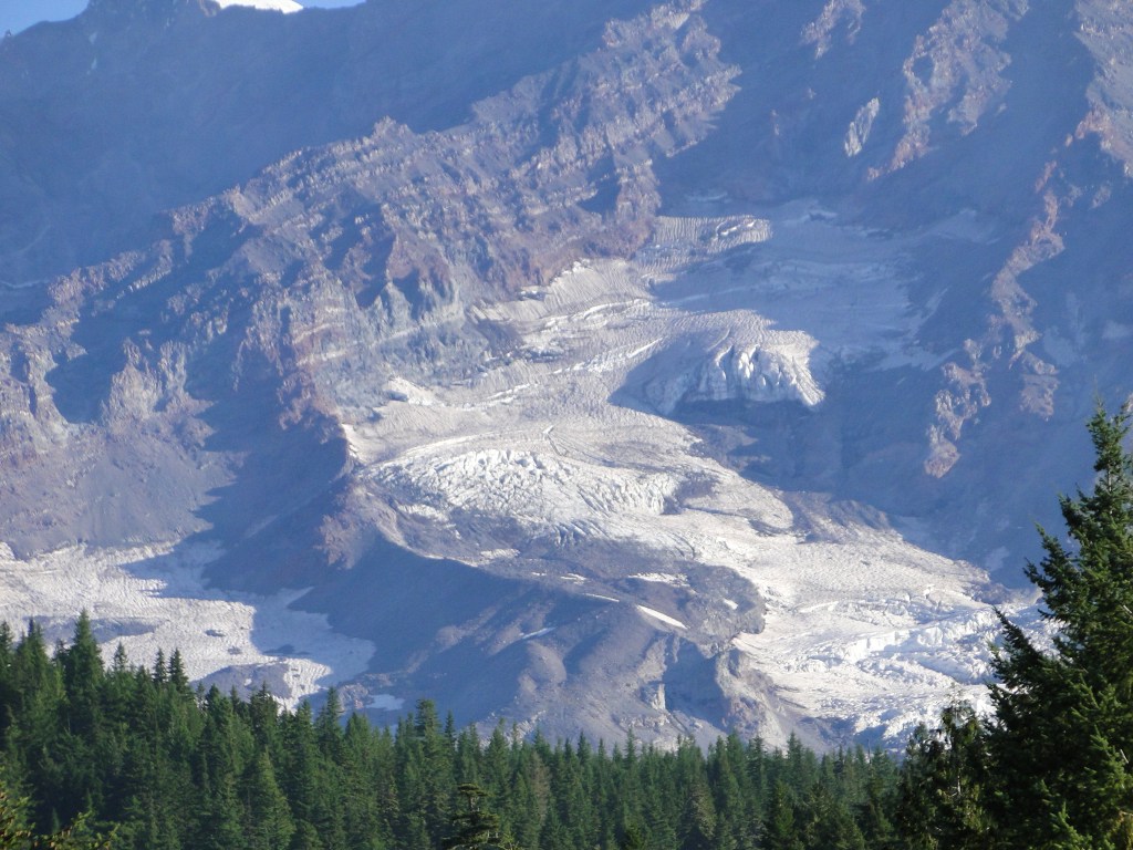
Our desire was to see the inside passage that so many folks fall in love with when they cruise to Alaska. Though the ferry system does not follow the exact path that the cruise ships sail, we were treated to a beautiful ride through the islands that are the Alexander Archipelago, the Queen Charlotte Sound, and the Straits of Georgia between Vancouver and Vancouver Island. This passage also stopped at several towns along the way including Juneau, Sitka, Petersburg, Wrangell and Ketchikan, though visiting the towns was determined by the time of day and how long they were docked. We were able to disembark at Sitka for a hike along the harbor and a short, forested trail and Ketchikan only briefly to do some grocery shopping for the next leg of our journey. If your interest is to invest time in any of these towns, then the AMHS is not the proper method of travel. Of particular note was the passage through the Wrangell Narrows, a 21 mile long channel that leads to the fishing village of Petersburg. The channel is lit with green and red lights and is so narrow that the boat speed is reduced from normal cruising at 20 knots to about 10. The Purser on the boat informed that this channel is a sight to behold and that the lights look like a Christmas tree. Naturally we passed this way at 2 a.m. but we dutifully set an alarm as we did not want to miss this recommendation. Unfortunately, this advice was not warranted as the lights were not terribly exciting to see and we never even left the cabin as we could see from our window that this was a bust. A day time passage in the Narrows is most likely beautiful. Our daytime views were quite dramatic. Interestingly, we both felt that the soft roll of the mountains, the islands and the water had a similar look as the Adirondack Mountains and lakes.
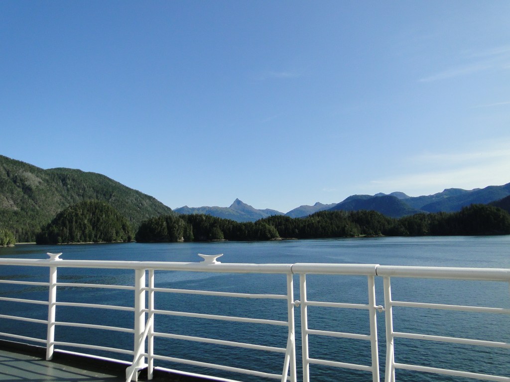
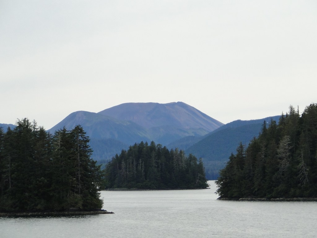
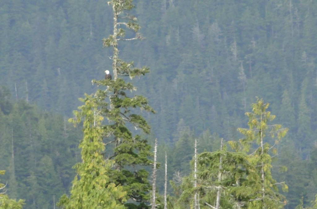
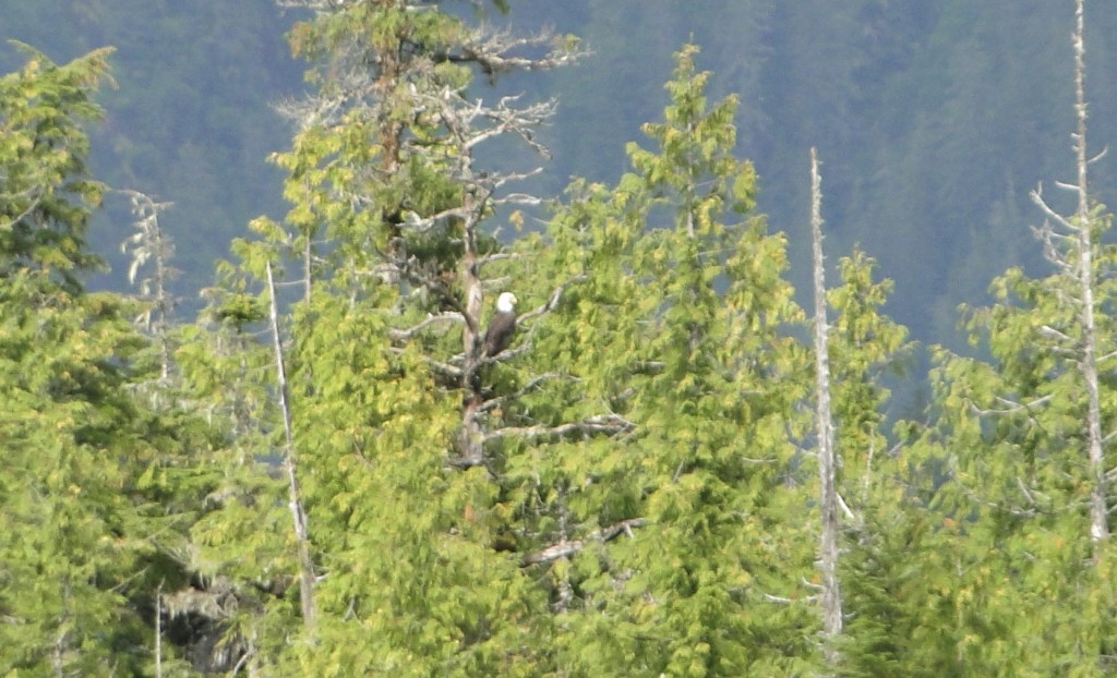
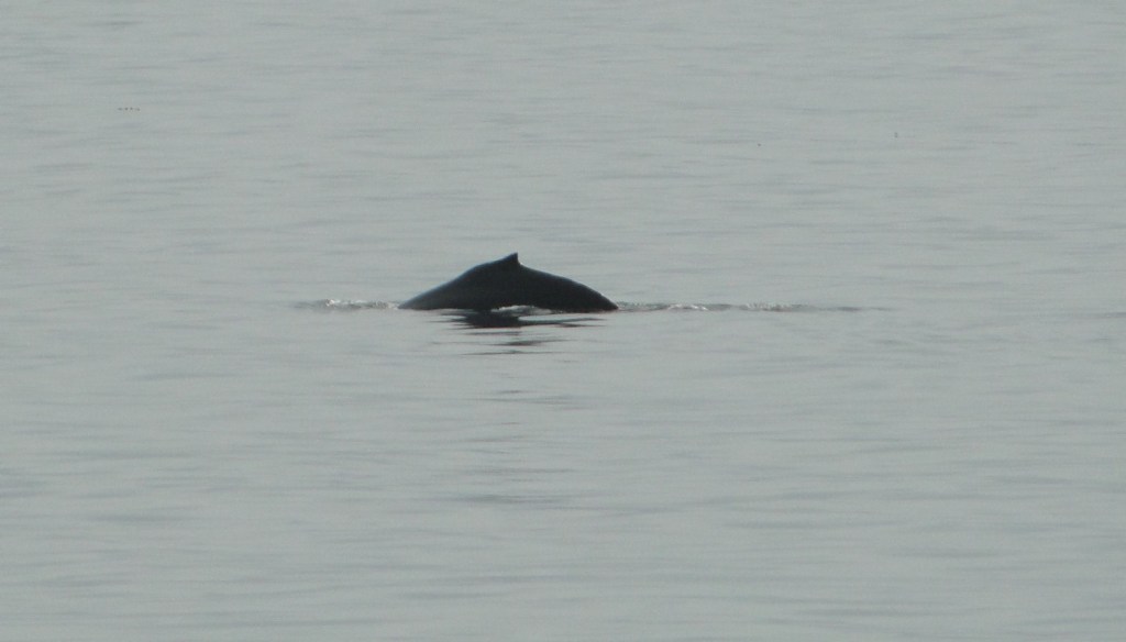
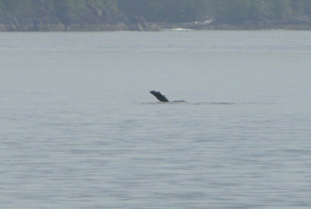
Daylight on this ride; however, did prove to be worth the cost as the landscape, mountains, bald eagles and occasional whale sightings all made this a worthwhile departure from the paved road. It also provided a nice slow transition from the wonder that was the Alaskan Interior.
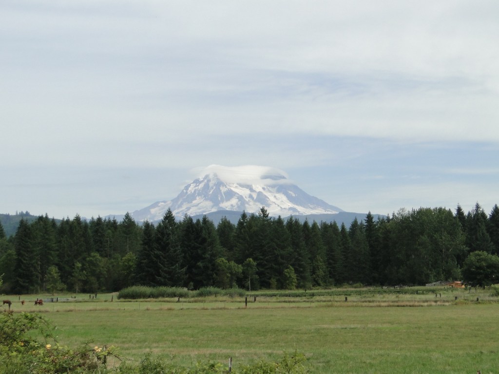
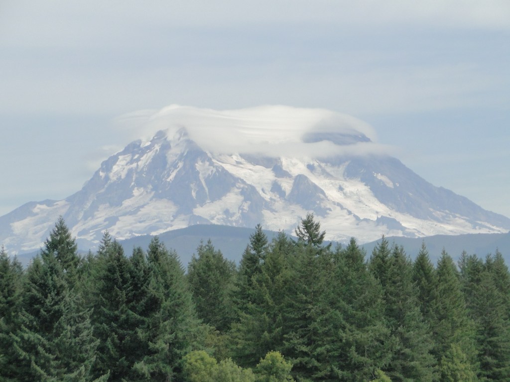
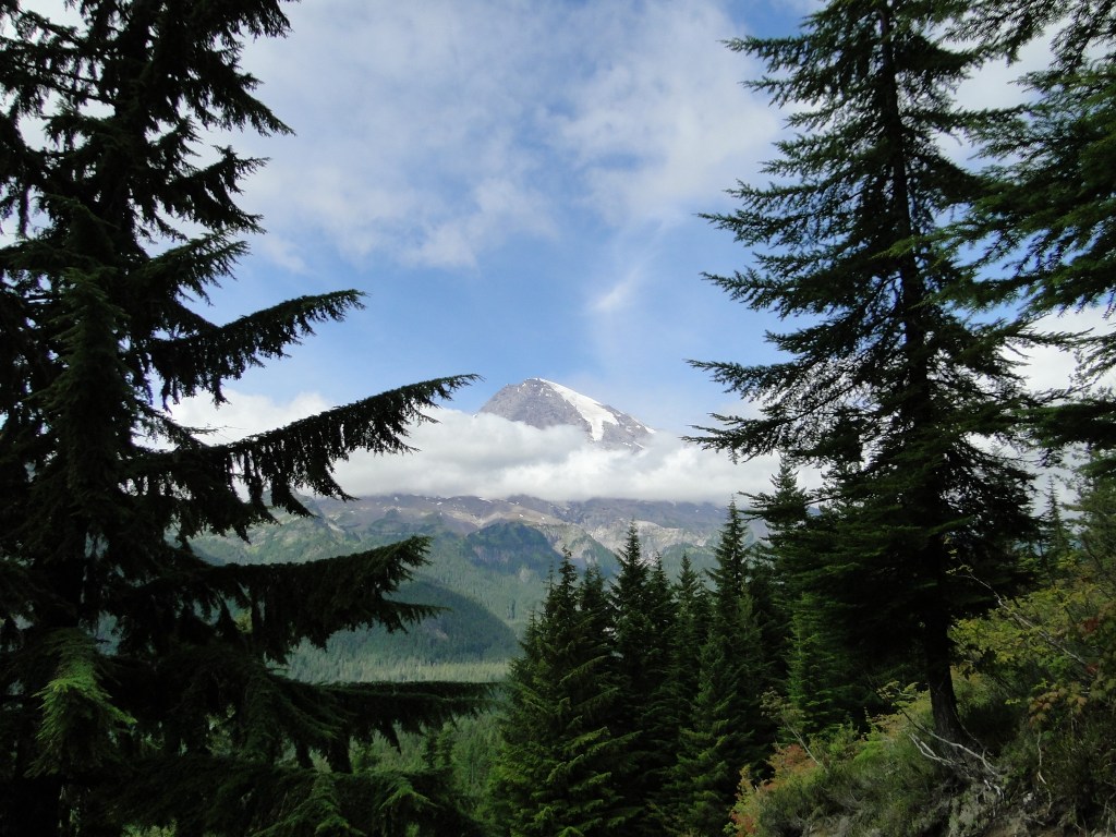
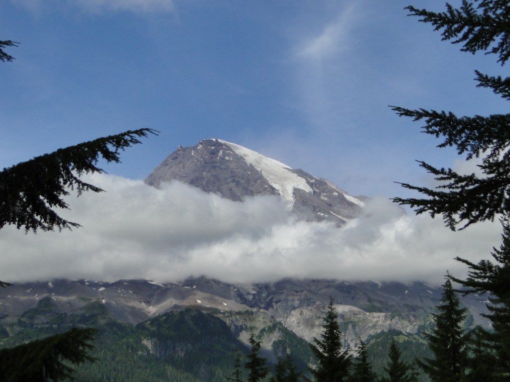
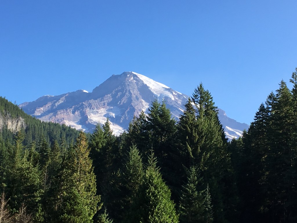
Arrival in Bellingham was at 8 a.m. so the call to your vehicle is at an early 7:30. Leaving port back on the road, we headed directly to Mt. Rainier National Park, about a 3 ½ hour drive. At 14,410 feet, Mt. Rainier is the tallest volcano in the Cascade Mountain Range and is the most glaciated peak in the continental United States. This behemoth of a mountain, rising like a lighthouse, can be seen from Seattle as well as the surrounding area for miles. John Muir, the naturalist and environmental philosopher, said of Mt. Rainier, “Of all the fire mountains which like beacons once blazed along the Pacific Coast, Mount Rainier is the noblest.”
The beauty of this park is more than just the peak that stands a mighty watch over the region. There are hiking trails for all levels of difficulty, back country hiking/camping by permit, three drive-in campgrounds, and two inns within the park. Plan your visit well in advance as this is a heavily utilized park and while we were there, the campgrounds that are reservable were full. (This is a National Park – so camping fees are significantly reduced with your America the Beautiful Pass. Entrance fee is $30/vehicle or free with your pass)
The campsites in the park are beautiful, primitive sites with plenty of privacy and space between sites. There are flush toilets with running water but again, primitive, so no power or water at your site. The campground that we chose is Cougar Rock on the west side of the park. We selected this site as it has a dump station, potable water, is reservable in advance (some are not), is located on the western front where we were coming from, and is located at a moderate elevation of 3,180 feet. (I previously had been snowed out at the White River campground at 4,232 feet in the summer.)
Day one on the ground we hiked to the Longmire Visitor’s Center, 1.7 miles on the Wonderland Trail adjacent to the beautiful Nisqually River.
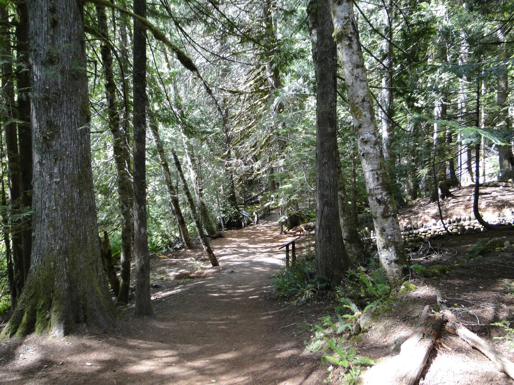
At the Longmire complex is the National Park Inn, the Longmire Museum, the Wilderness Information Center, and general store. The trailhead for several trails is also located at the Longmire complex and we jumped first onto the Trail of the Shadows, an easy 1 mile trail that leads to the Rampart Ridge trail, a 4.6 mile loop considered moderate to strenuous. It was strenuous! Our objective was to get to views of the mountain and this thick coniferous forest does not give up these views willingly. The trail is a steep loop with constant switchbacks that travels through a gorgeous forest of ancient Douglas Fir and Cedars.
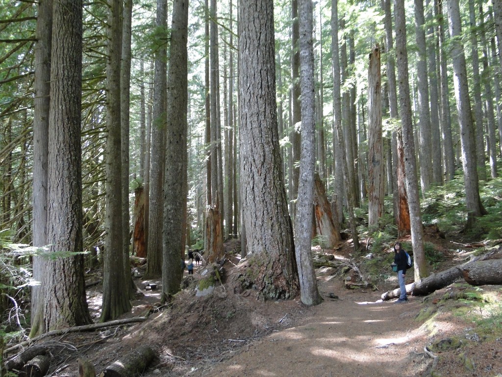
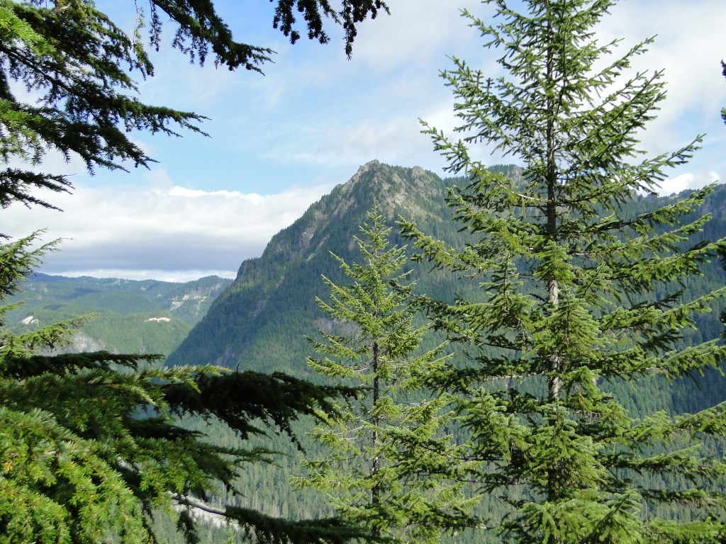
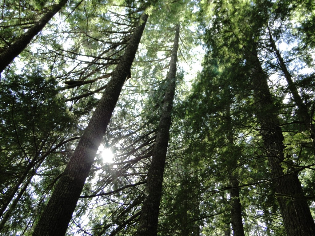
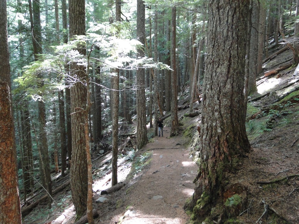
The park literature estimates some of the Douglas Fir at 1,000 years old and the size of both the Fir and Cedars is reminiscent of the Redwoods in northern California, where we will be in a couple of weeks. The trail has only one view point at the summit but shows the mountain a bit more at the beginning of the descent.
The return to camp, mostly downhill, was a welcome change of elevation after this 10 mile hike.
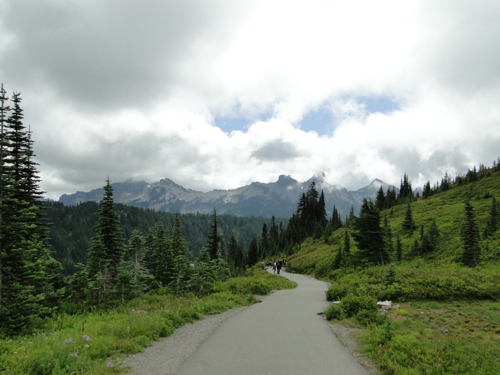
On day 2 we drove to the area called Paradise, about 12 miles uphill, east of Cougar Rock. The road through the park is extremely steep and winding with constant switchbacks to guide you in your vertical path. At the Paradise Visitor Center on a Sunday morning we were greeted with a nearly full parking lot.
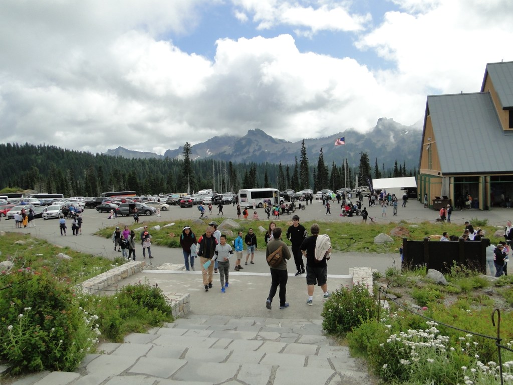
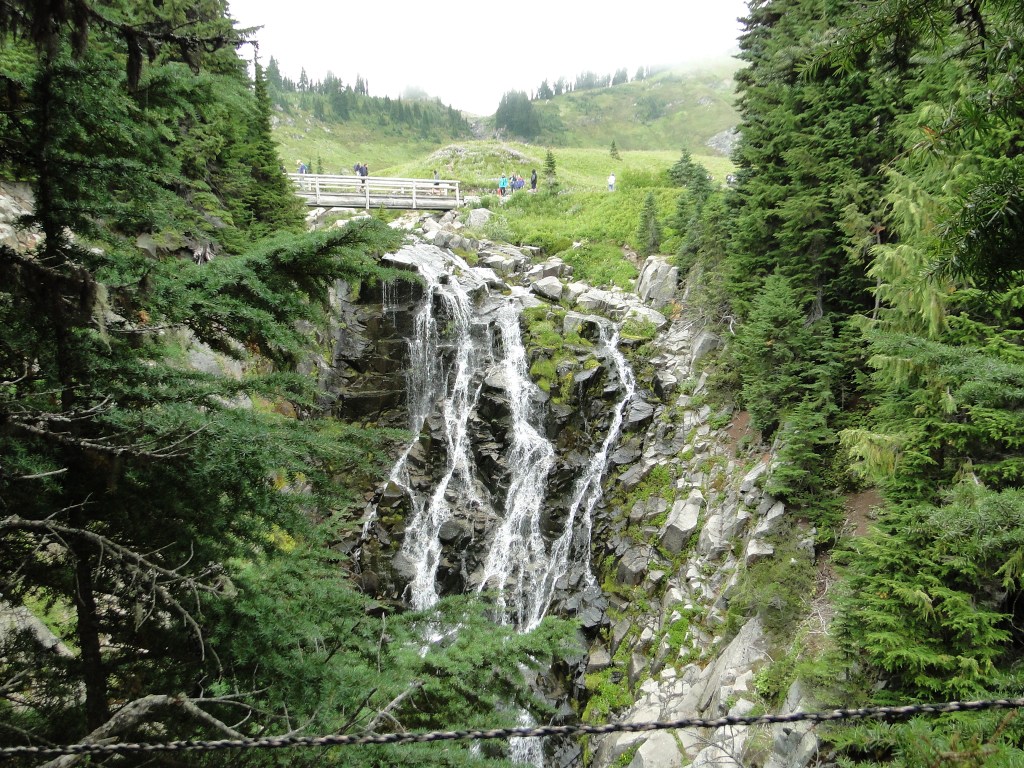
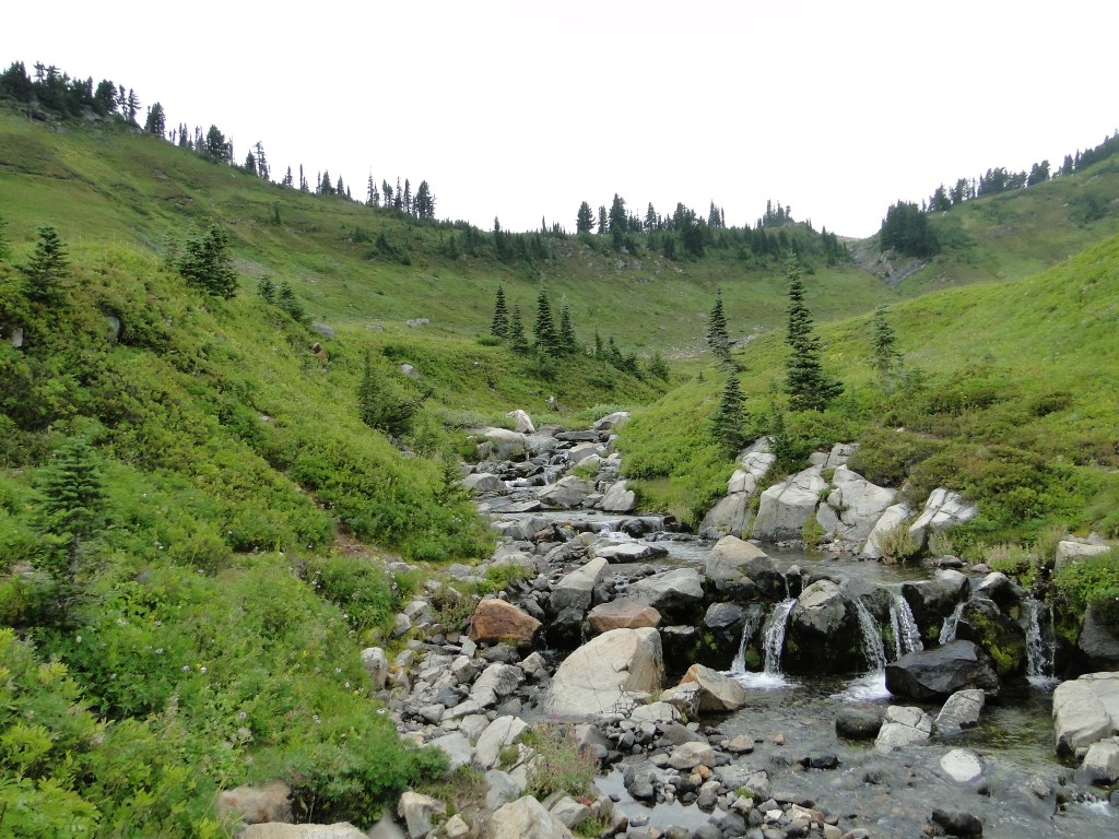
As we’ve discussed before, traveling with a large vehicle can often times present challenges at crowded venues and Paradise was no exception. Fortunately, we were able to find a spot and visited the very crowded Visitor Center where we spoke with a park ranger about the various hiking trail options. We decided to hike just a couple of short trails as the mountain was obscured by clouds and a pending storm was approaching the summit. (Whiteout conditions were predicted above 10,000 feet for the afternoon) The Myrtle Falls Trail, less than a mile round trip, and a portion of the Skyline Trail was all we felt comfortable with considering the approaching ominous clouds.
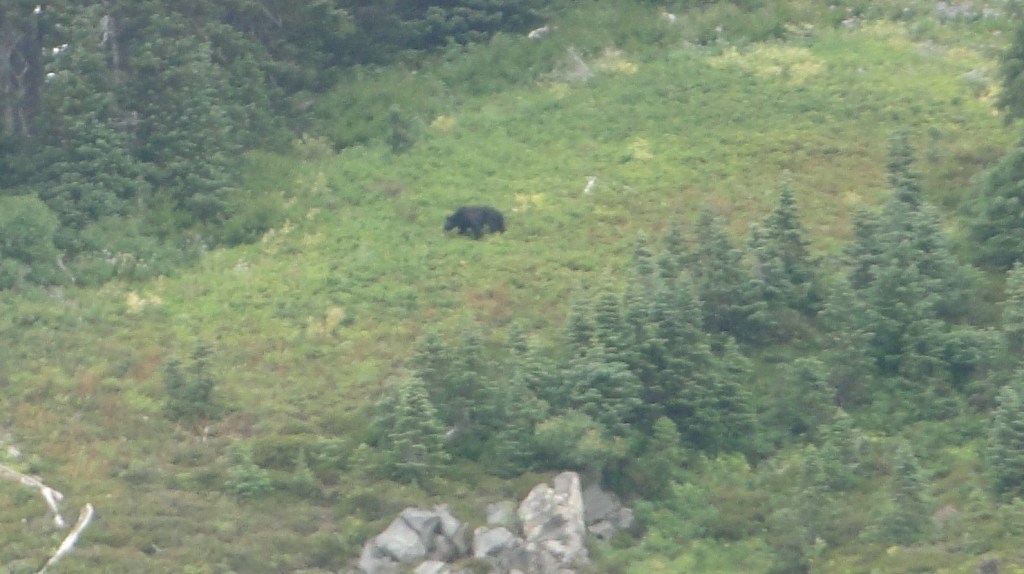
We did get to see a black bear on a distant ridge however, thanks to a very observant local hiker.
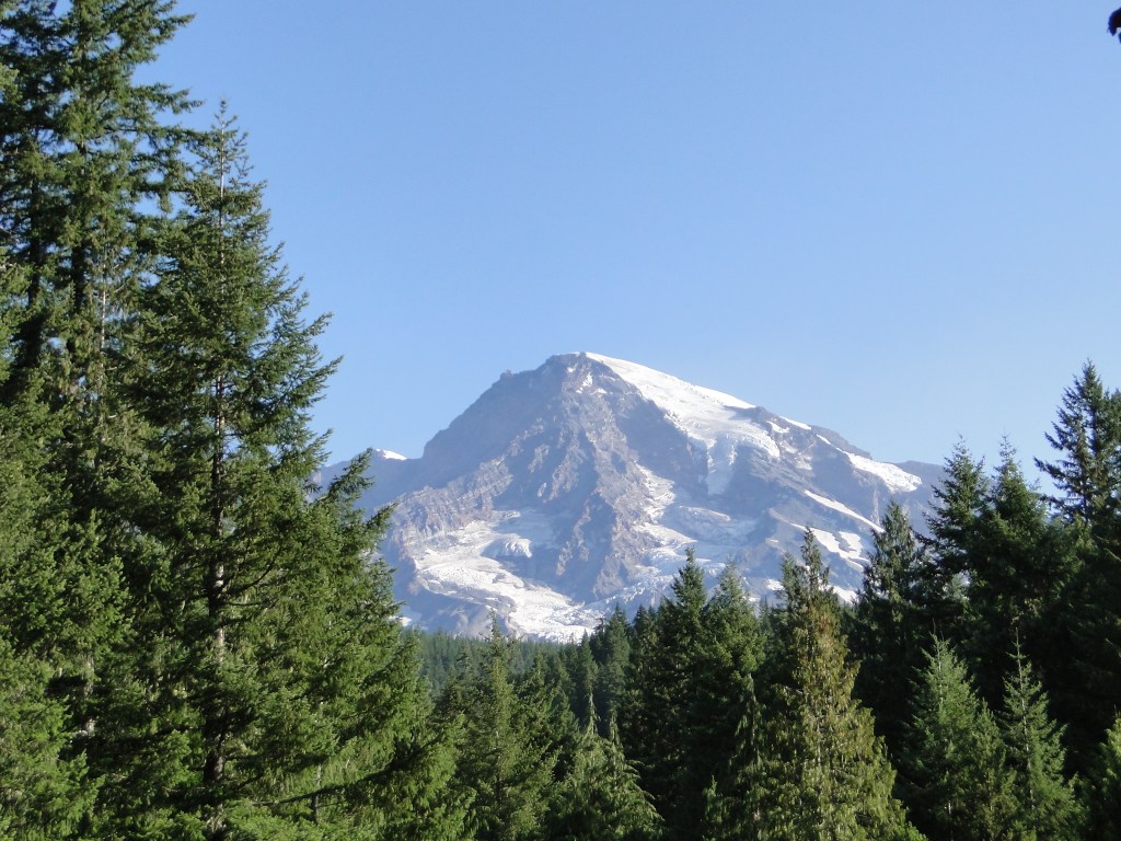
Later this same evening we noticed that the weather front had completely passed and that the sky was a dazzling blue. This could only mean that the mountain may be visible so another quick drive back to the Longmire complex (where there is a clear view) proved our theory. The mountain was out in all its glory once again.
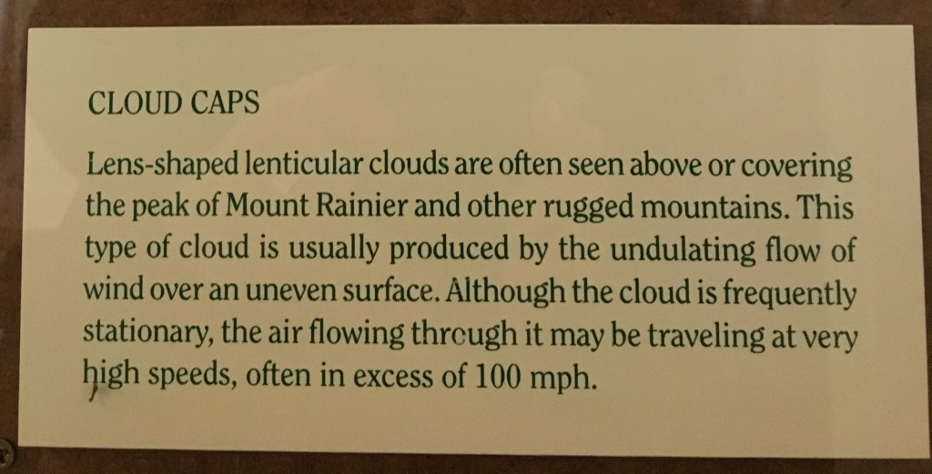
Note: Mt. Rainier, like Denali, is a weather maker. Since these mountains are so tall, they create weather patterns, in particular, clouds, and are often obscured. If you plan to visit mountains of this stature, be sure to leave enough days in your itinerary to be able to withstand cloudy or rainy days. Also, know in advance where the best locations are for viewing the mountain. If you get a clearing, you may need to jump to the favored spot in a hurry.
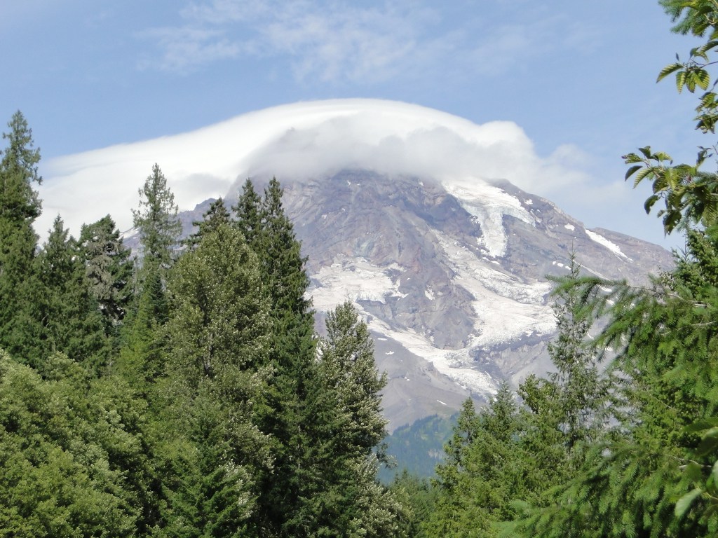
The next day was a travel day but fortunately the day dawned a perfect clear, blue sky so on our drive out of the park, we had a few more views of the mountain.
Our next destination was Mt. St. Helens, about 2 hours south of Mt. Rainier. We chose to camp at Silver Cove RV Resort, about 5 miles from the Visitor’s Center. This is a full- service RV park with FHU and sits on a canal system that feeds into Silver Lake. There are wide, level sites, very clean showers included and kayaks available for rent. Silver Cove is part of a vacation company called the Highway West Vacations, and thus their rates are very high. ($50/night with no discounts)
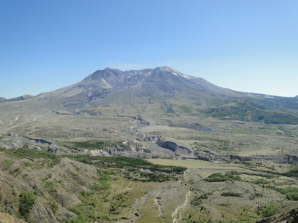
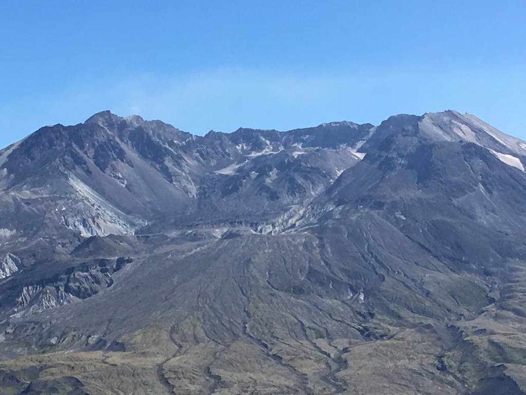
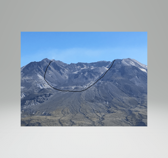
After checking in at the RV Park, we headed to the Visitor’s Center and on to Mt. St. Helens. The story of the 1980 volcanic eruption is certainly well known but seeing the mountain and the cavity that is left is quite remarkable. There are two major centers to visit when you approach the mountain from the west. The initial Visitor’s Center on Rt.504 near Silver Lake is a good stop to orient yourself. However, they had just had a power failure as we arrived so we cannot speak to what was available there other than maps for traveling further into the mountains. Of course there are numerous viewpoints along the 35 mile road to the Johnson Ridge Observatory, at the end of the road. The Observatory is a fee based stop, though the America the Beautiful Pass is accepted here as well. The information, exhibits and film there are all worthwhile, but the essence of this stop is the view of the mountain. There are a number of hiking trails from the Observatory that all present remarkable views and if adventurous, one can hike to the summit, an all- day hike that must be completed in one day. There is no camping allowed on the mountain. At the observatory and other view points along the road are volunteers with telescopes trained on the mountain. One telescope was zeroed in on a couple of elk grazing and word was that a herd was in the vicinity, however; not visible to the naked eye.
Though the Observatory was quite crowded (4 tour buses pulled in right behind us), the stop is quite worth the effort. To see and totally comprehend the power of this blast firsthand was a remarkable experience.
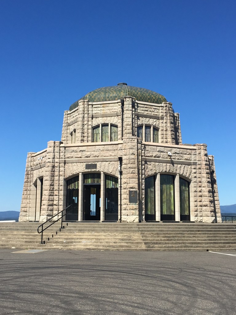
The next day we headed to Mt. Hood, another of the volcanic chain in the Pacific Northwest. The drive takes us through the Columbia River Gorge, a magnificent environment that we have wanted to visit for years. Though there is a major highway that parallels the river, the old Rt. 30 is the more scenic, though challenging, drive as it is quite narrow, winding and steep at many points. The first stop along the route is the Vista House, a gorgeous stone visitor’s center that sits high above the river. As we approached the gorge from the north, the wind had begun to howl and the visit at the Vista House was truly an adventure as it sits wide open to the valley below. The winds were clocked at 45 mph at the time and we were told by a ranger that they close the house at 50 mph. Needless to say, we were not able to casually stroll around the hillside.
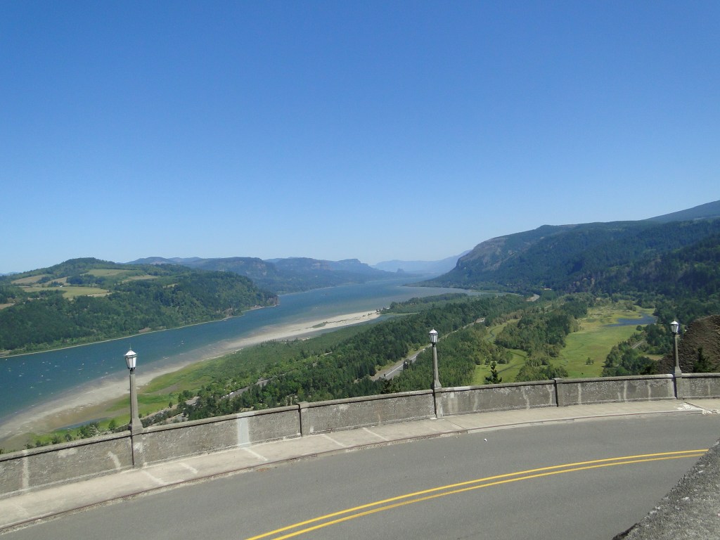
As we traveled the historic Rt. 30 a bit lower on the gorge and with less wind, we were able to view several waterfalls where we could find a parking space. Several view points do not have RV parking but the views of the gorge and the falls that we did see warranted the windy adventure.
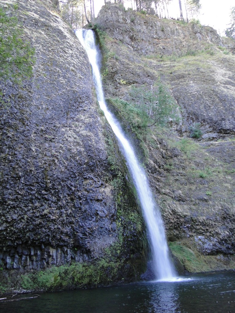
Though we were able to hike to several of the falls along this route, the most famous, Multnomah Falls, has no parking for RVs and thus we had to pass right by the trailhead.
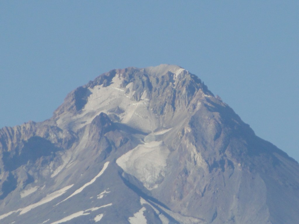
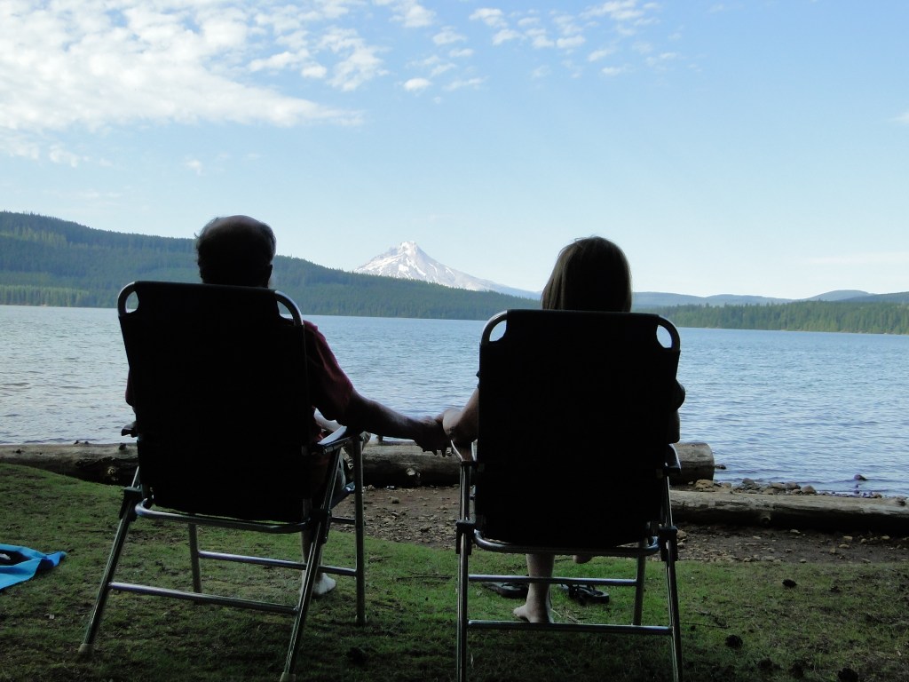
Though the gorge continues eastward, we began heading south at Hood River, a beautiful town at the confluence of the Hood and Columbia Rivers. Our target for the next few days was the Hoodview Campground on Timothy Lake. We chose this campground due to its name with the hope that we would have an unencumbered view of Mt. Hood. As you can see below, we did.
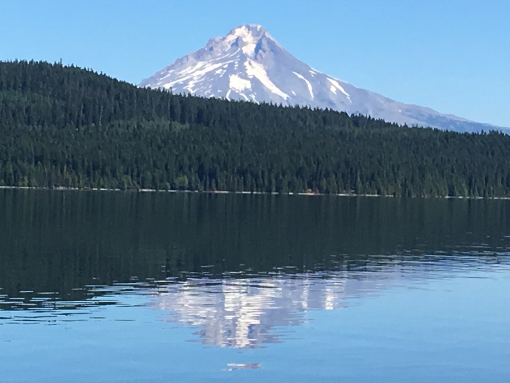
This campground is an absolute gem on the shores of a gorgeous, warm Timothy Lake and provided a wonderful few days of hiking, swimming, and lounging all in the shadow of the magnificent Mt. Hood, another potentially active stratovolcano in the Cascade Volcanic Arc. The mountain, called Wy’east by the Multnomah tribe rises to 11,240 feet and is covered by 11 active glaciers. Attracting over 10,000 climbers a year, it is the most visited snow covered peak in America.
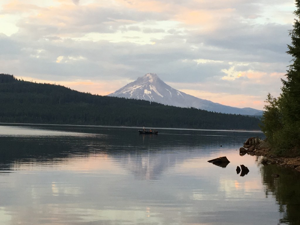
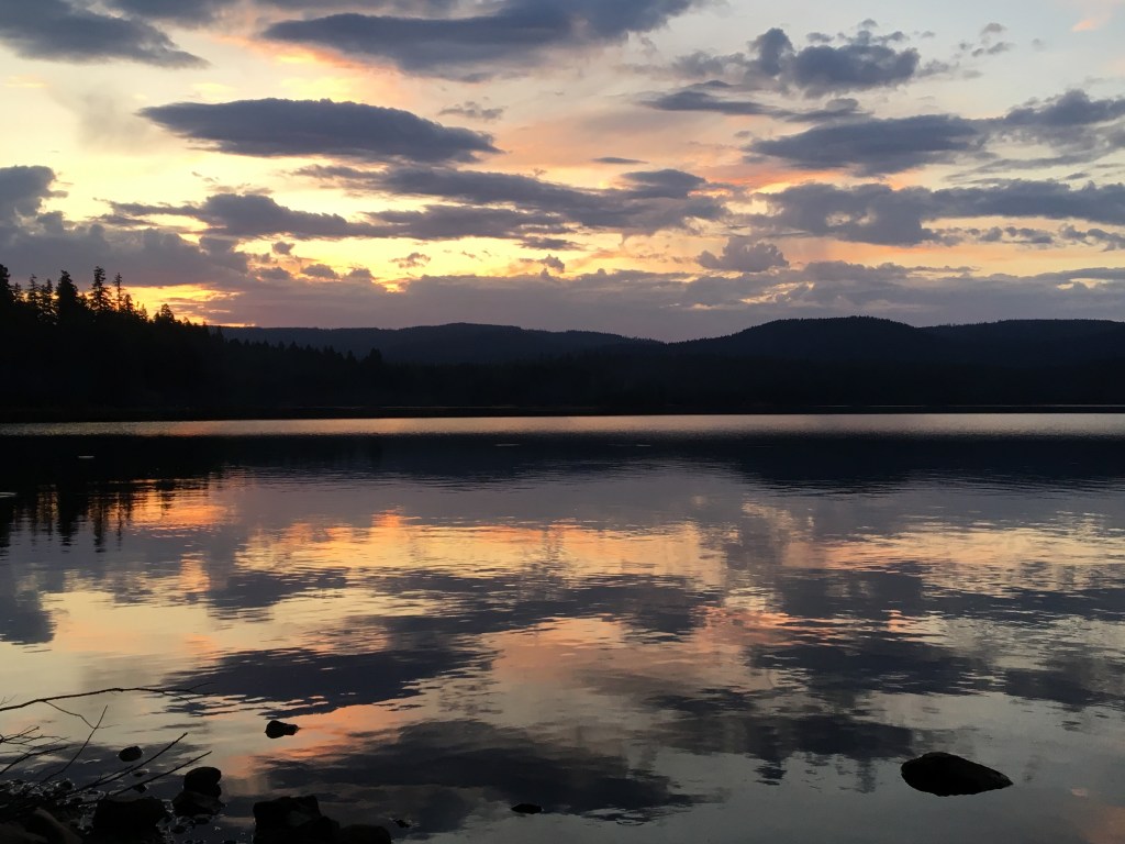
The campground is a primitive site that does have vault toilets and water spigots but the sites are quite private and wonderfully laid out. The lake is never more than a minute walk from any of the sites and the location of the park is devoid of any nighttime lighting, making the night sky one of the best that we have seen in months. The state has organized four distinct campgrounds on the lake with plenty of greenspace between and though the campgrounds were all full, it does not feel at all crowded on the lake or on the beaches.
After three beautiful days on Timothy Lake, we headed for Corvallis, Oregon where we will come off the road for a 4 day visit with some old friends and a few necessary minor repairs on the RV. Until the next time, peace.
Jay and Ellen

Wow – to think this is not as amazing as your previous month in Alaska. Glad you’re having such a great time.
Linda
LikeLike
Thank you J and E for some spectacular photos and description of the geography. We will share our Mt St Helen pictures with you someday; taken around 1985. Yours definitely have more green then ours do. Happy to hear how interesting and beautiful your trip continues to be.
Cb
LikeLike
Thanks again for letting me crash at your site on Cougar Rock campground! I just returned home after finishing the Wonderland Trail successfully! Meeting people such as yourselves was a blessing that I’ll appreciate for a long time. Safe travels and never stop exploring!
LikeLike
Thanks Jacob. The Wonderland Trail is beautiful. Glad you made it through. Glad we could help. Hope you enjoy the blog. Best regards to you and Hillary. Jay
LikeLike
Thanks for your fabulous descriptions and pictures of the Mt.St. Helen area.You have inspired our next trip😎You two are really enjoying your retirement!
LikeLike
Three months into a five month trip and every stop sounds incredible. Glad everything is working out as planned. See you in October!
LikeLike
Great to hear your venture is going well. A ferry that a accommodates RVs. Who would have thought…? Enjoy
LikeLike
Thanks for the update on your travels and for the spectacular photos as usual. I particularly love that one of the sunset. Enjoy your time in the northwest!
LikeLike
Fabulous pics. We love Mt. Rainier, and you got perfect weather.
Great adventure.
Ken
LikeLike
What an amazing transition from the wilds of Alaska, to the green rolling hills, and I agree, very much Adirondack-like! Mt. Hood holds a special place in my heart, a story I will share with you when we reunite in person. Thanks again for the wonderful narrative
LikeLike