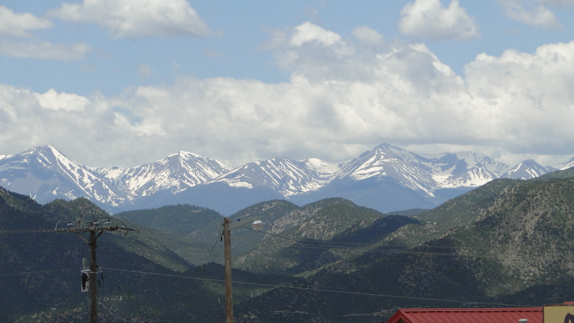
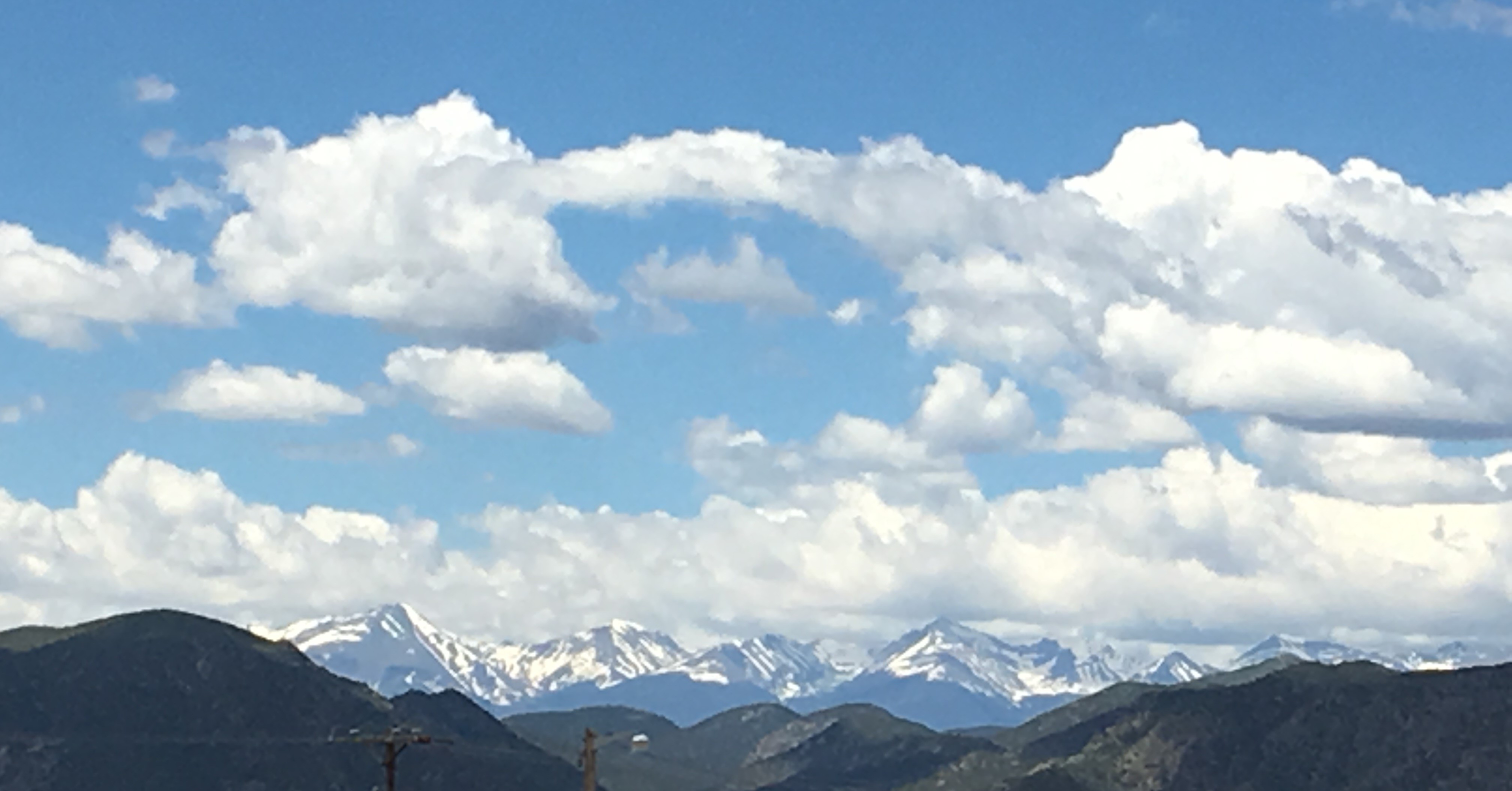
Leaving Canon City, Colorado after a wonderful 4 days with old friends from the Capital District, we made our way up the remarkably scenic Rt. 50 west towards the high Rocky Mountains. Our destination for this day was the Black Canyon of the Gunnison National Park. Rt 50 is a major east/ west corridor through the mountains and mere words cannot even begin to describe the majesty that would unfold in front of our eyes in the next four hours. The road rises rather quickly once you leave the 5400’ valley that is Canon City. Within an hour, snow- capped mountains begin to appear in the distance. We see Burned Timber Mt. at 10,086’ before we reach the first town of Cotopaxi. As we approach Salida and then Poncha Springs a sizeable, developed town on the route, ( fuel, supplies, food, etc.) we see Mt. Shavano at 14,229’, Mt.Antero at 14,269’, Mt. Princeton at 14,197 and more.
The earth has met the sky…….and we are spellbound. Though we’ve been through the U.S. and Canadian Rockies on a number of occasions, this view never ceases to amaze. Snow- capped mountains in the summer!! There is nothing quite as beautiful as the white peaks, green hillsides below, and the rich, blue sky wrapping its arms around the land below.
This developing vista first takes us over the Poncha Pass, a hefty 9010’ before we slowly climb the Monarch Pass at 11,312’ above sea level. The Monarch Pass is the continental divide, the hydrological divide of North America. The road climbs for miles as you approach the peak. At the summit where snow is still in abundance, is of course, a gift shop, a welcome relief to fatigued vehicles and drivers, for this climb is a nerve -racking business. It is slow, winding, and requires your full attention. At the summit is also Monarch Mountain ski resort and a gondola to carry summer visitors to the mountain summit.
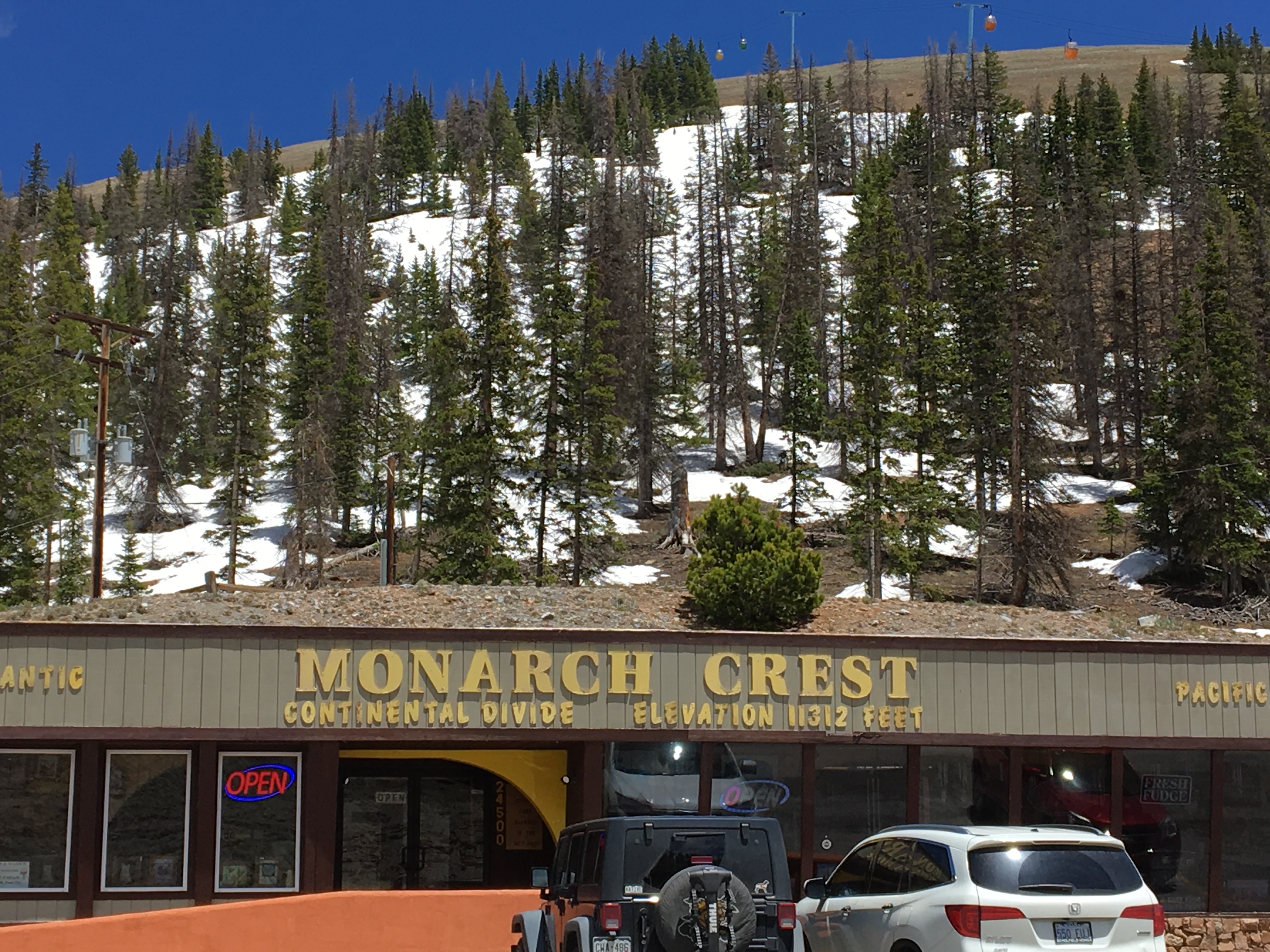
Note: At 11,312’ above sea level, due to decreased oxygen, one can begin to suffer from altitude related illnesses. Symptoms can include headache, nausea, persistent dizziness and disorientation. You are advised to stay well hydrated and stop driving immediately if these symptoms occur. Acclimating for altitude can take many days, and few people are able to prepare properly if only driving up and over the mountain. Use caution.
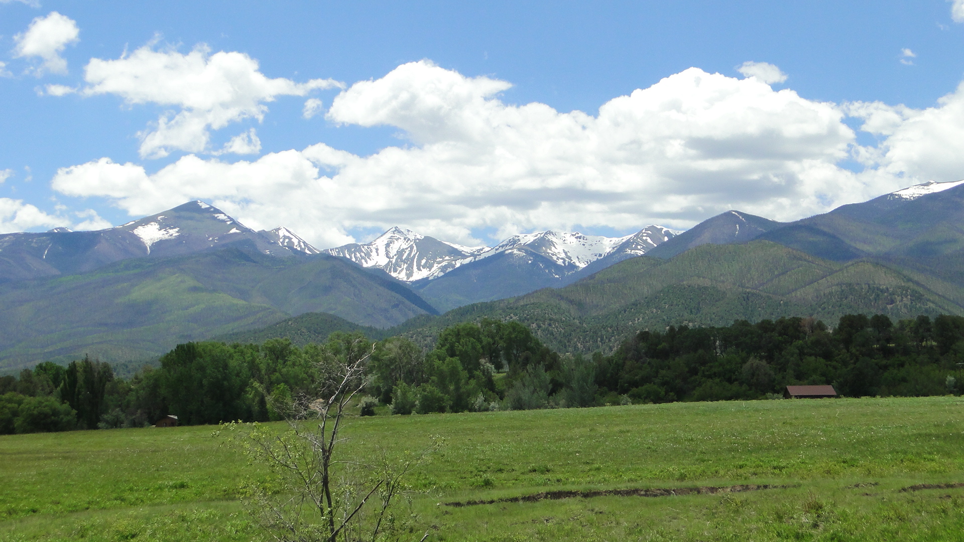
Now; of course, what comes up, must come down. The descent to the west is steep, very steep. It is also a gorgeous transition from the eastern slopes of the Rockies. Most of the rain that comes from the Pacific Ocean drops west of the hills or in the mountains, thereby leaving the east side quite arid. The western slopes however; are green and lush, creating an idyllic landscape as you come down from the snow at Monarch Pass. The wide panorama that unfolds as we descend is as dramatic as the upward climb was nerve wracking. The road; however, has dangerous switch backs, steep pitches and sheer cliffs with no guardrails. To the south we can see the southern swing of the continental divide range of snow- capped mountains. The line of the divide meanders quite a bit through Colorado and it is anything but straight, so you will see these imposing mountains at many different angles and locations.
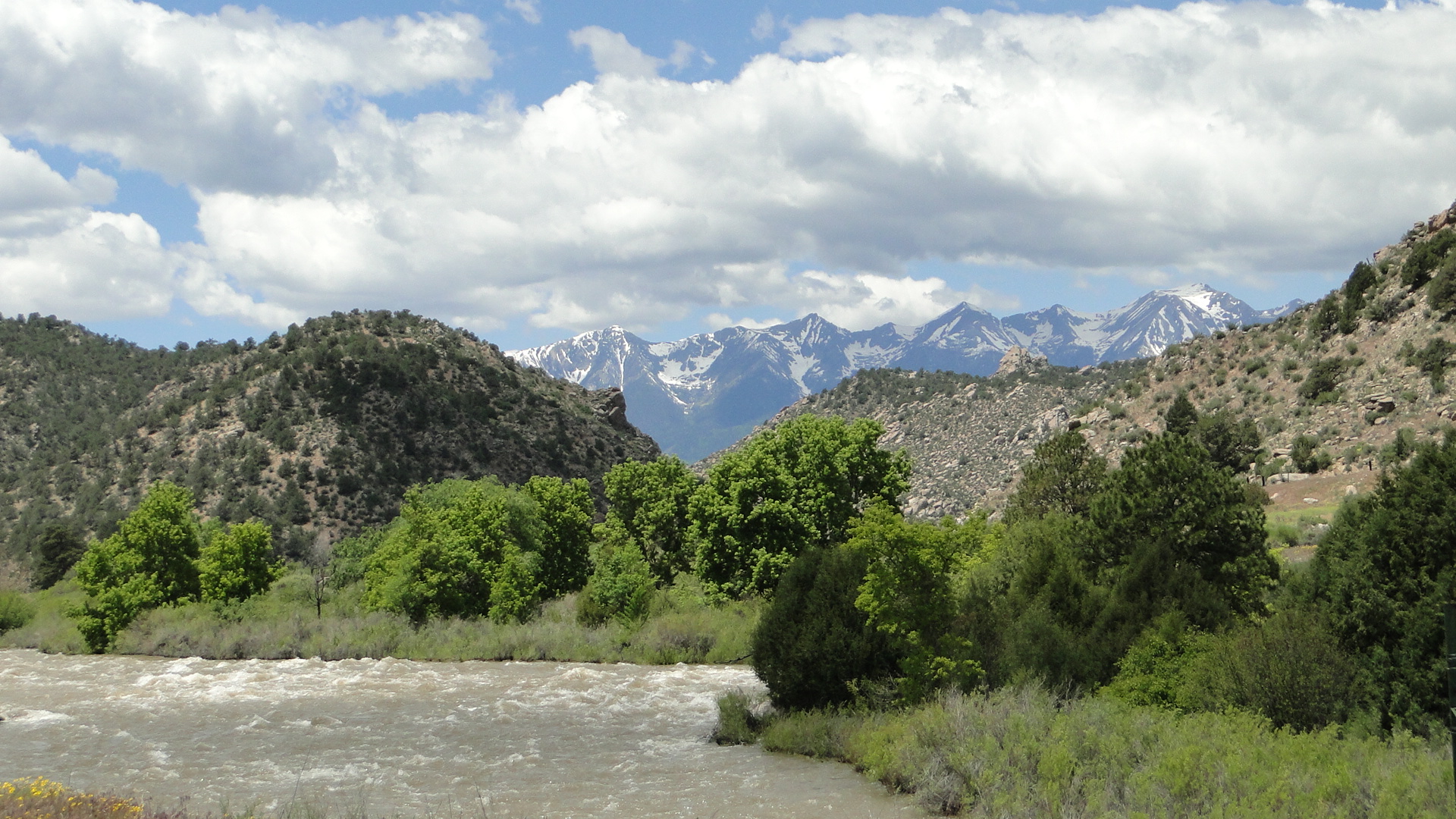
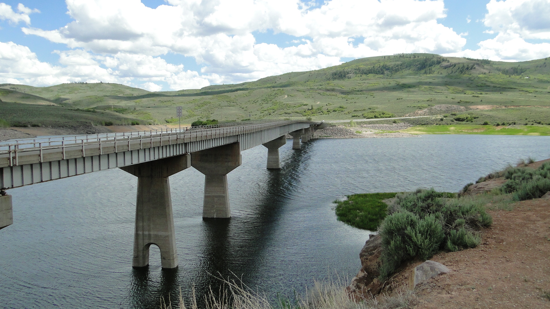
The valley floor has now given way to the Curecanti National Recreation Area, a network of three alpine reservoirs on the Gunnison River that follow Rt. 50 and provide an enormous recreation area for camping, fishing, hiking and boating. The Blue Mesa, Morrow Point, and Crystal reservoirs, constructed by the U.S. Bureau of Reclamation in the 1960’s are an exquisite contrast to the red rocky hills and ledges that surround the valley.
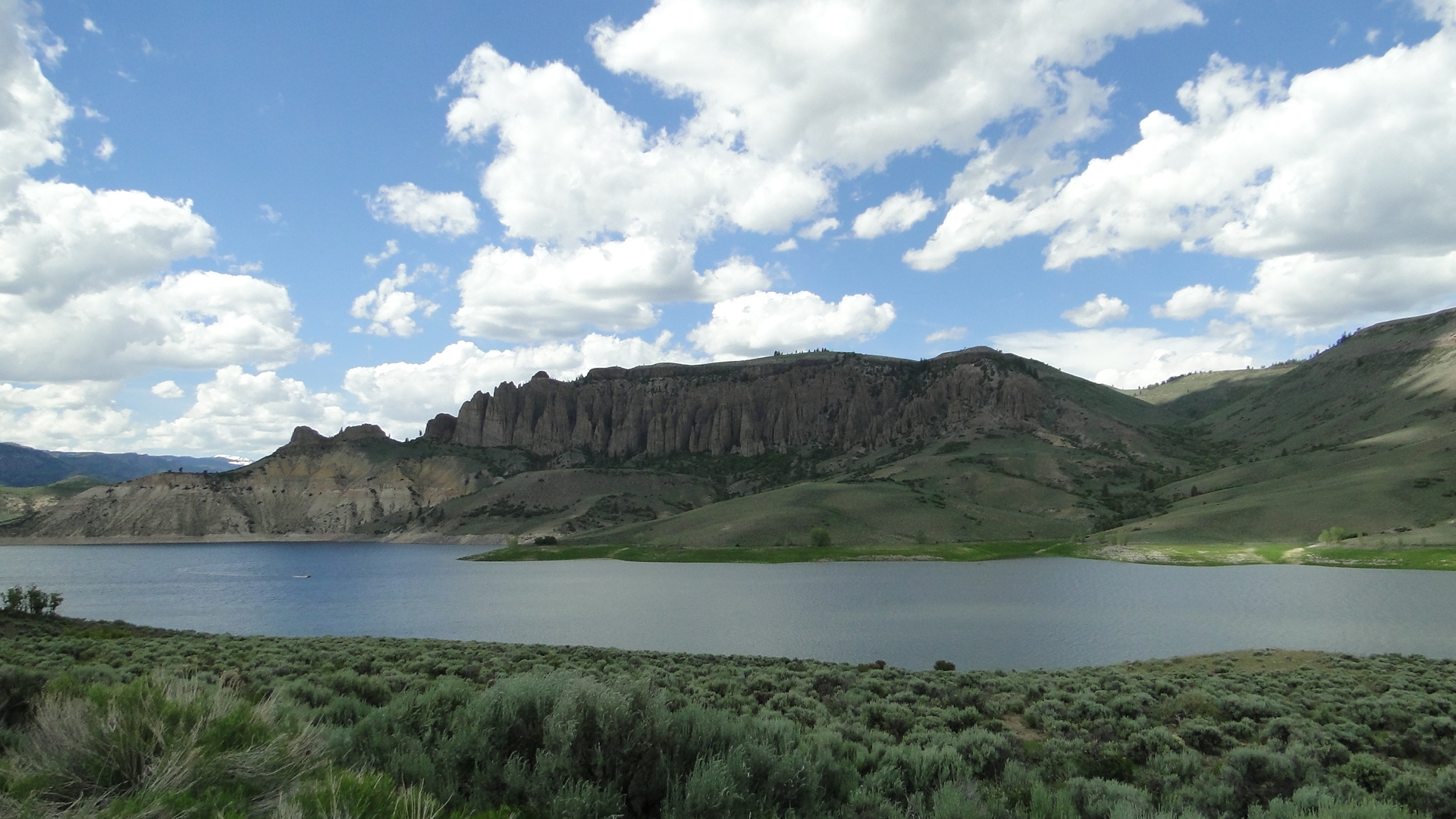
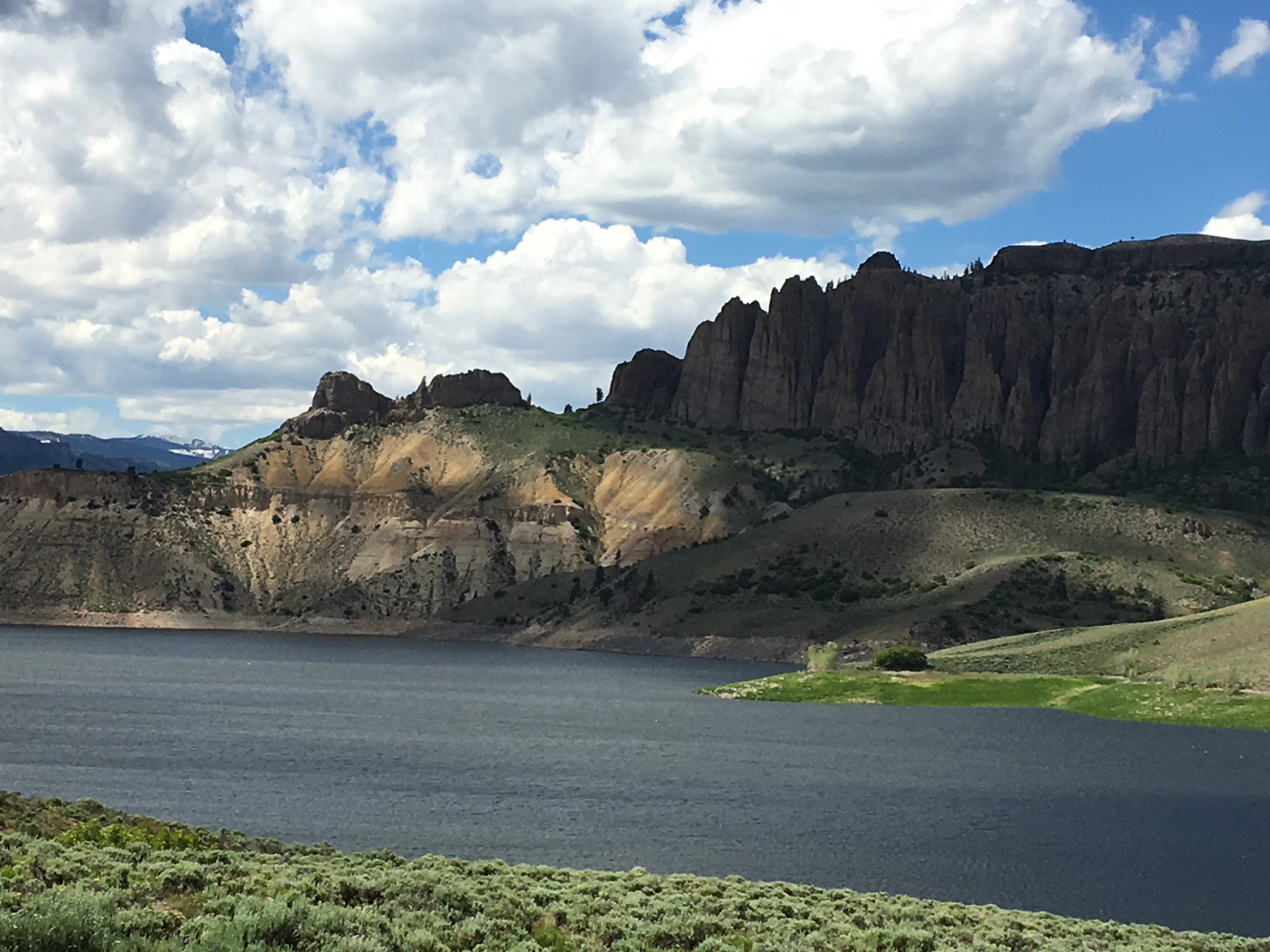
Just west of the Curecanti, the road begins to climb again as we approach the Black Canyon of the Gunnison National Park, our next destination. The Black Canyon at its tallest sheer cliff is 2,250 feet deep, but is only 40 feet wide at its narrowest point. The canyon owes its name to the narrow width which at some points only allows 33 minutes of sunlight per day and thus the walls appear to be black. Below, the raging Gunnison River drops an average of 43 feet per mile. For reference, the Colorado River only drops 7.5 feet per mile. The Ute Indians called the Gunnison, “much rocks, big water” and avoided the area due to superstition.
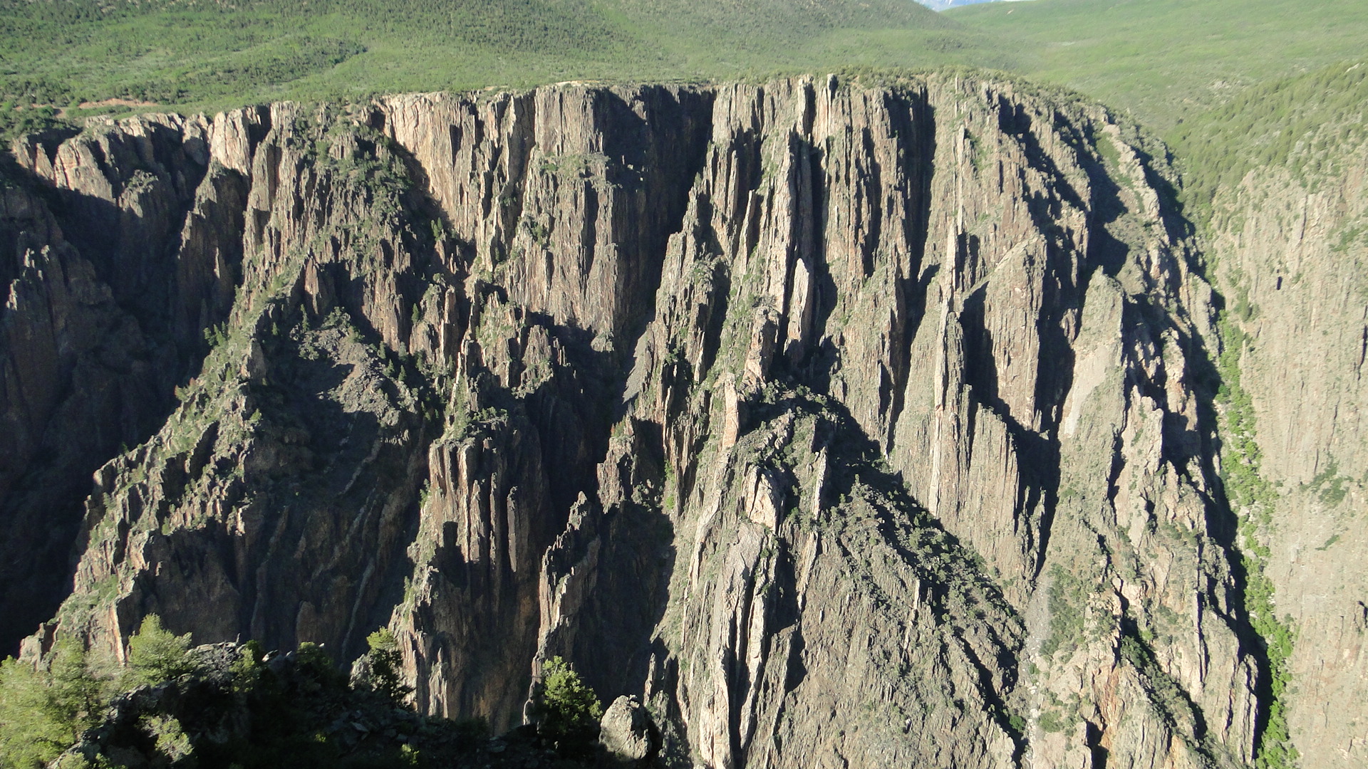
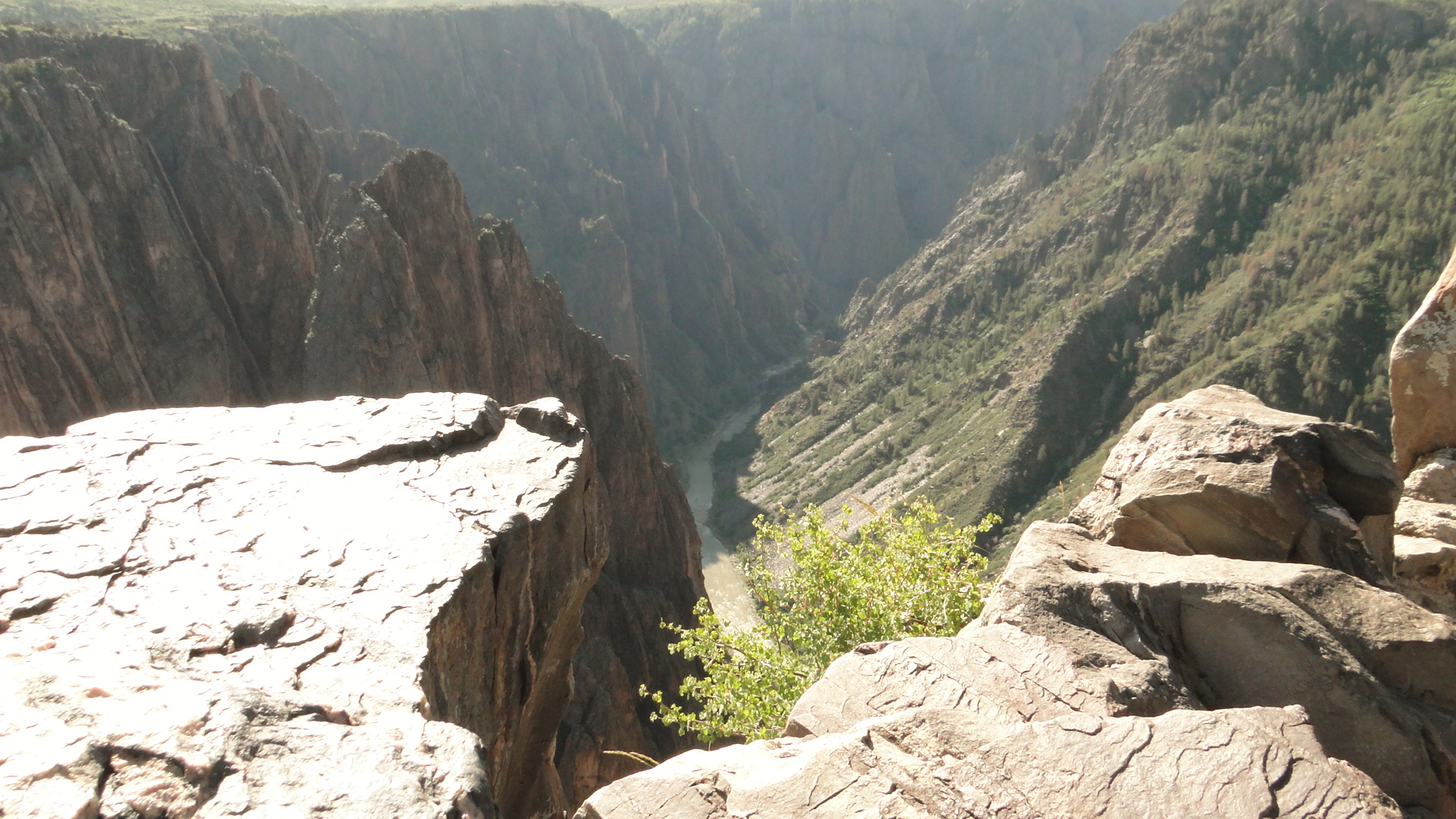
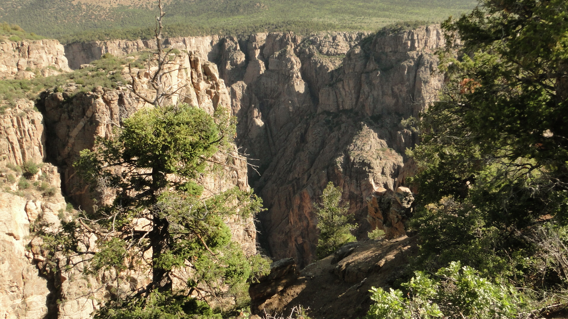
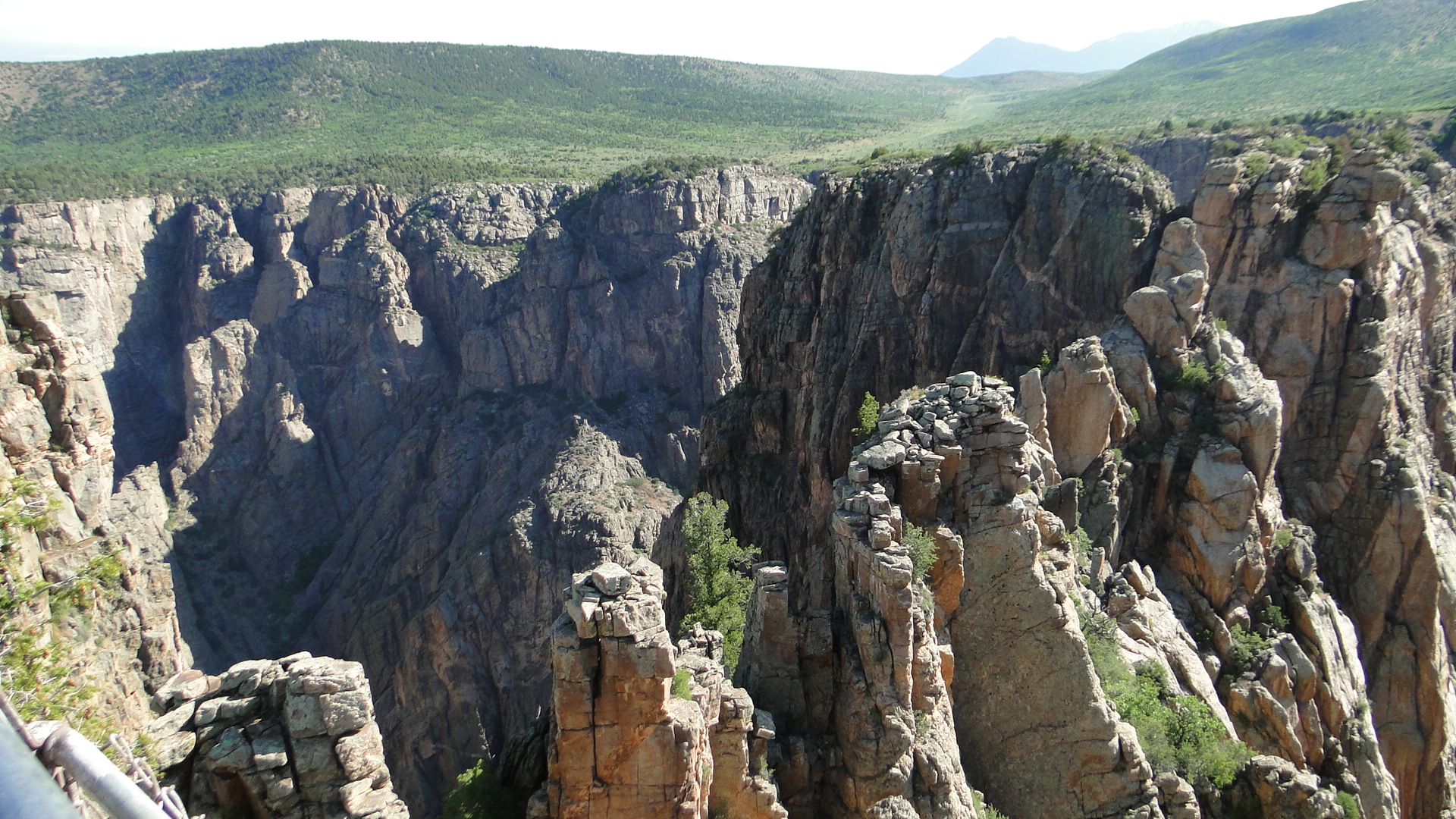
The canyon rim trail, adjacent to the campground is a moderate challenge, due to the elevation at 8,320’, but is well worth the effort. You are treated to dramatic views of the canyon that differ at each turn. The sheer cliffs across the gorge are black in view but include interesting striations of color due to the Precambrian gneiss and schist that make up the majority of the steep walls that formed some 1.7 billion years ago. The lighter colored pegamite dikes cross cut through the basement rocks that formed later during this same period.
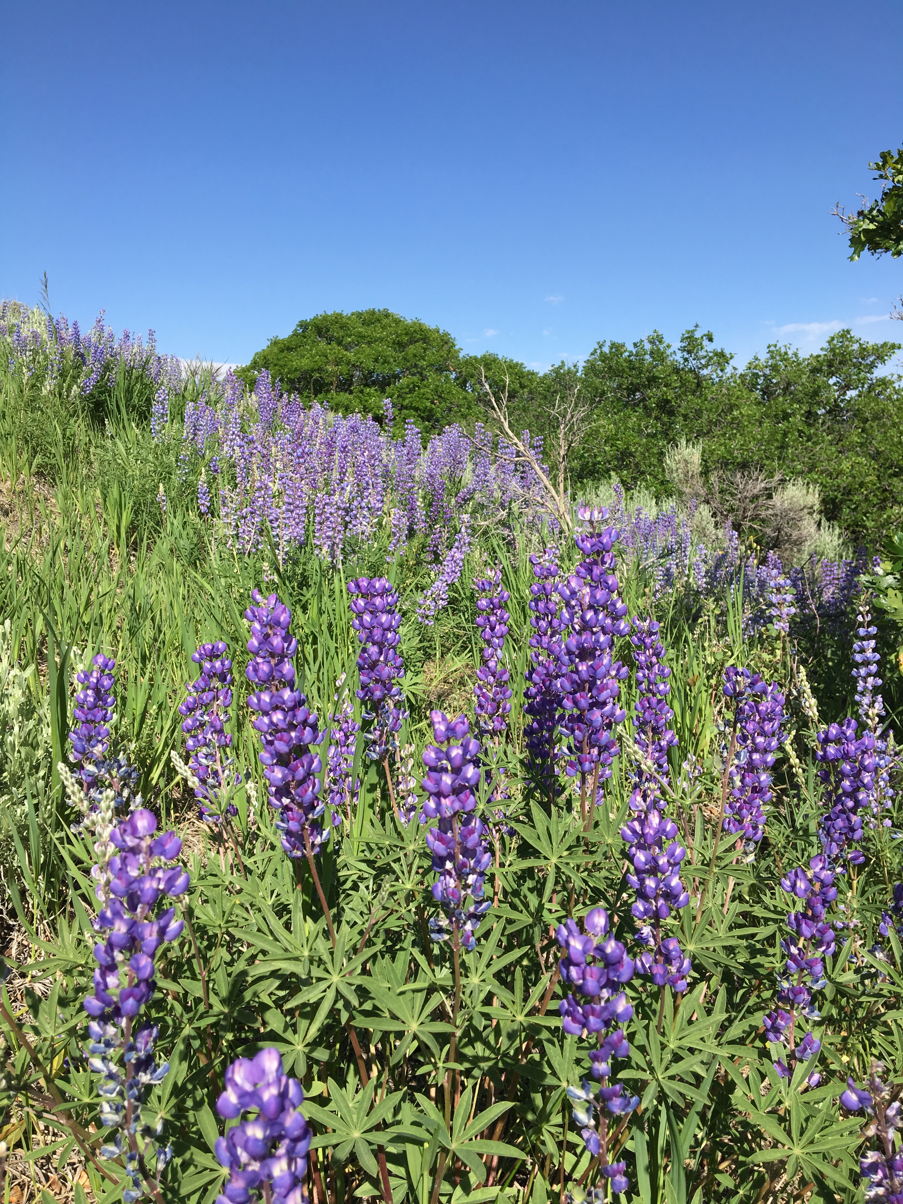
We were fortunate enough to be at this campground when the lupines were in full bloom, in fields and lining the road sides.
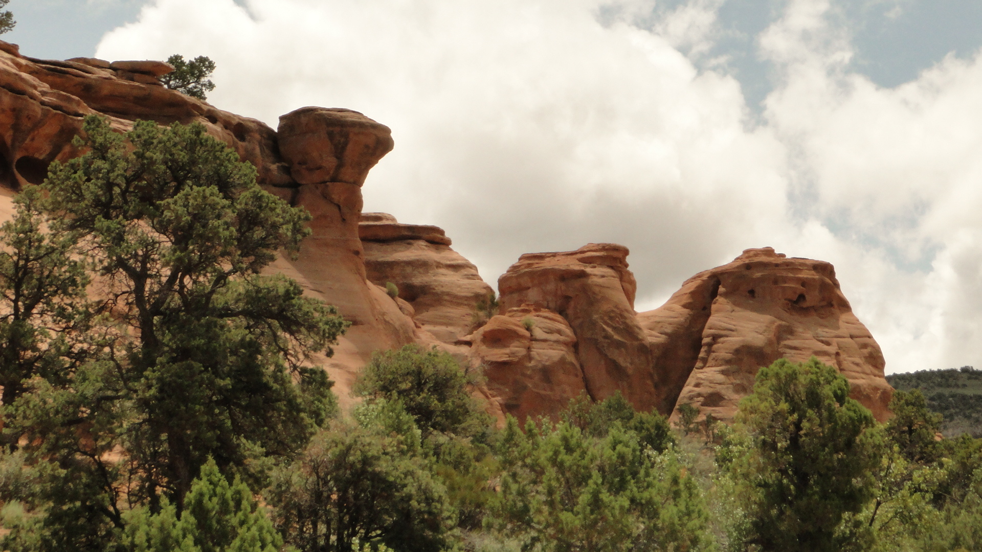
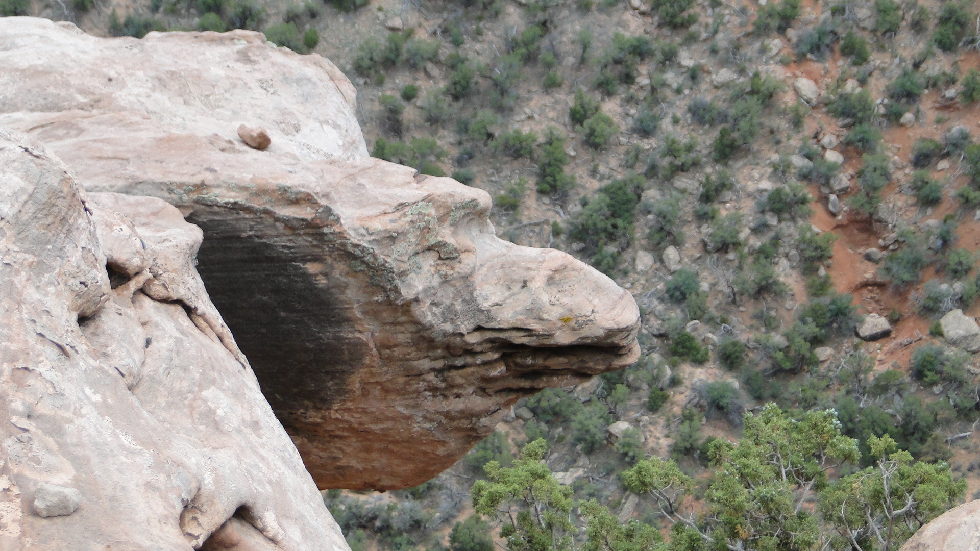
After two days at Black Canyon, we next drove west to the Colorado National Monument, a rather inappropriately named park, (since monument implies a granite landmark) near Grand Junction, Co. This park significantly differs from the sheer black walls of the Black Canyon. The rock walls are formed from sandstone and granite schist and broadcast a reddish hue that becomes more significant as we head even further west. The region is dotted with towering monoliths amid a vast plateau and enormous canyon panorama. The rim rock drive is a road to be driven from the east entrance at Grand Junction to the west entrance at Fruita. Whether you enter and/or leave from either entrance, do not miss this entire 23 mile long drive as the vistas amaze.

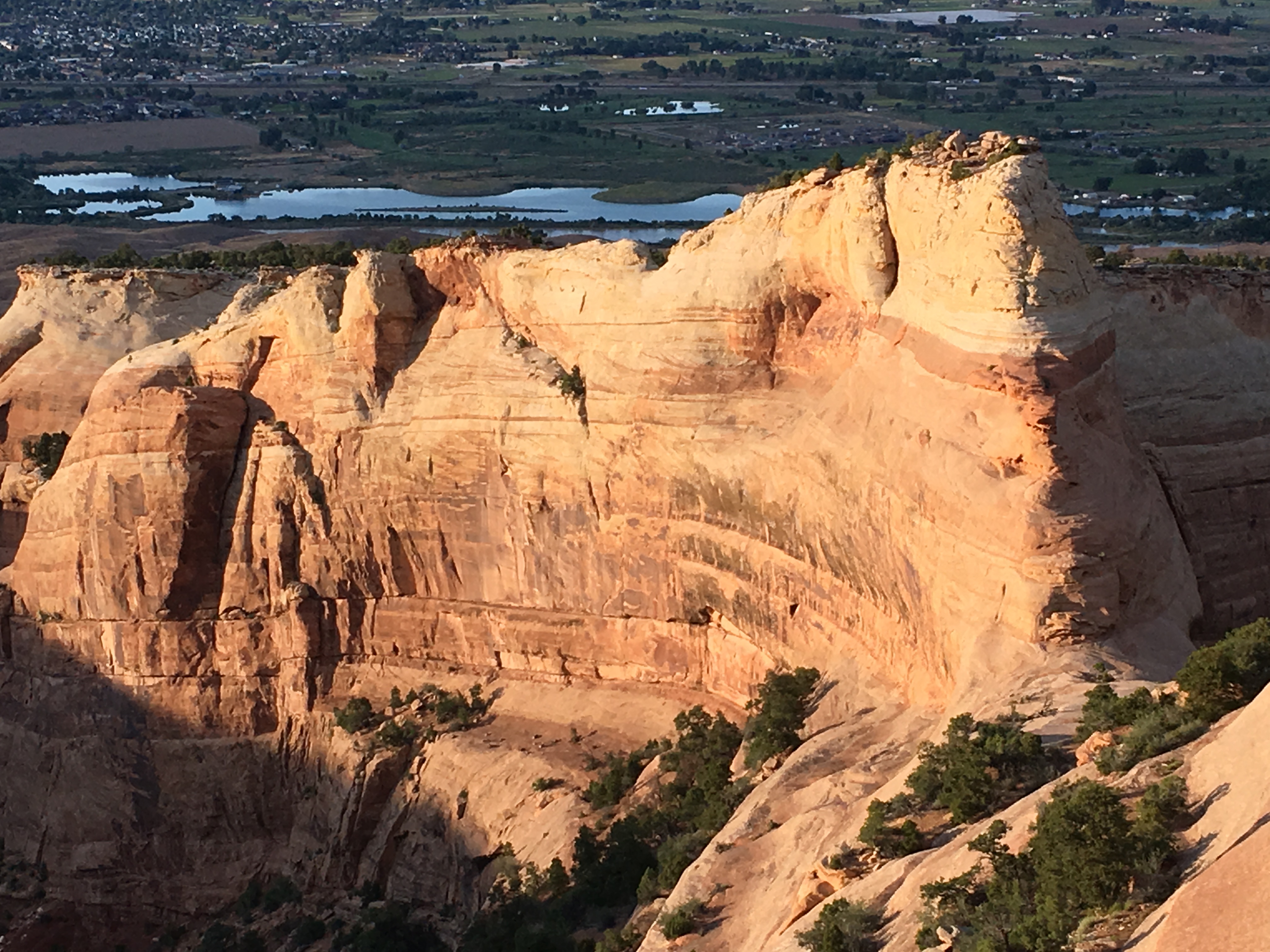
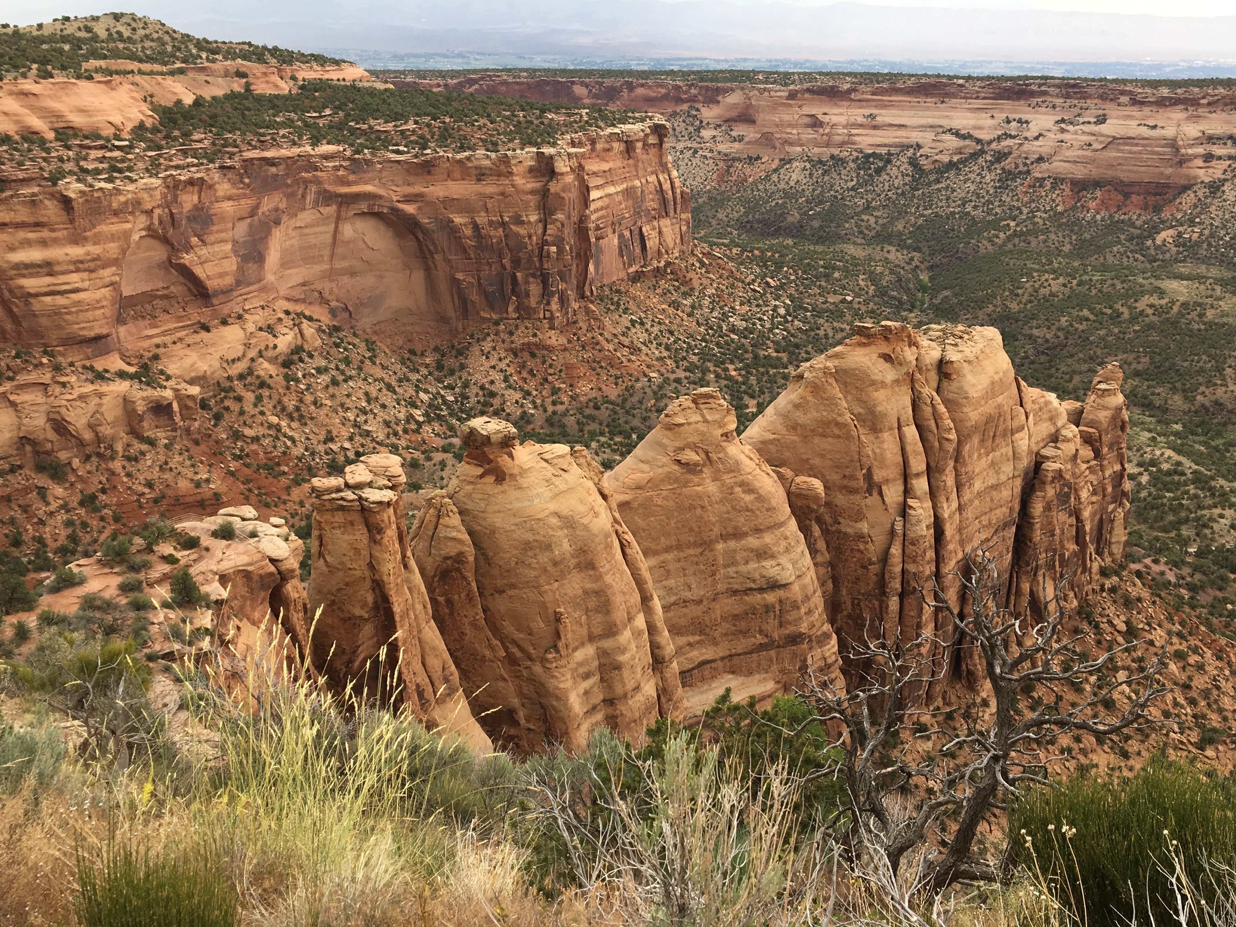
The camping at Colorado National Monument is considered primitive, in that there is no power. However, there are very modern clean bathrooms with flush toilets and sinks with running water. Our magnificent campsite was situated along the rim with an expansive view of the valley below and snow-capped mountains to the north.
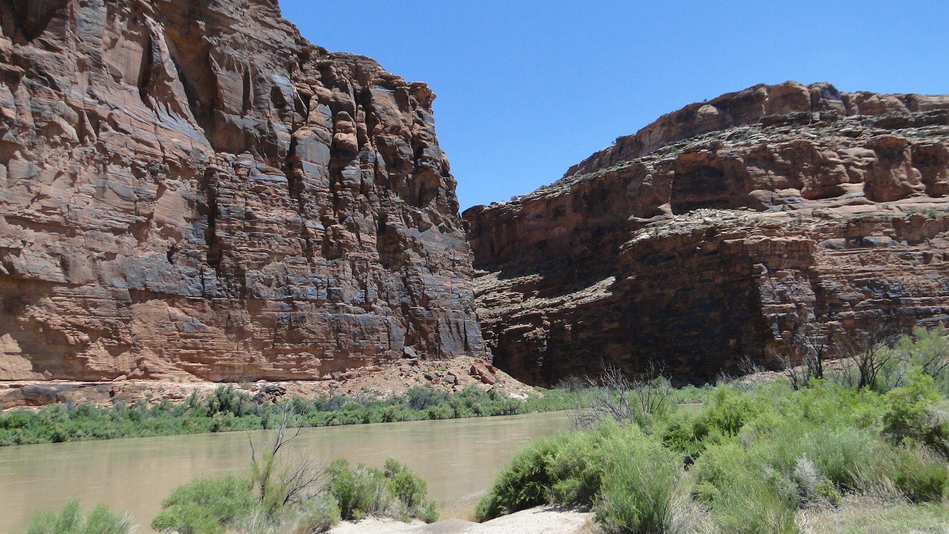
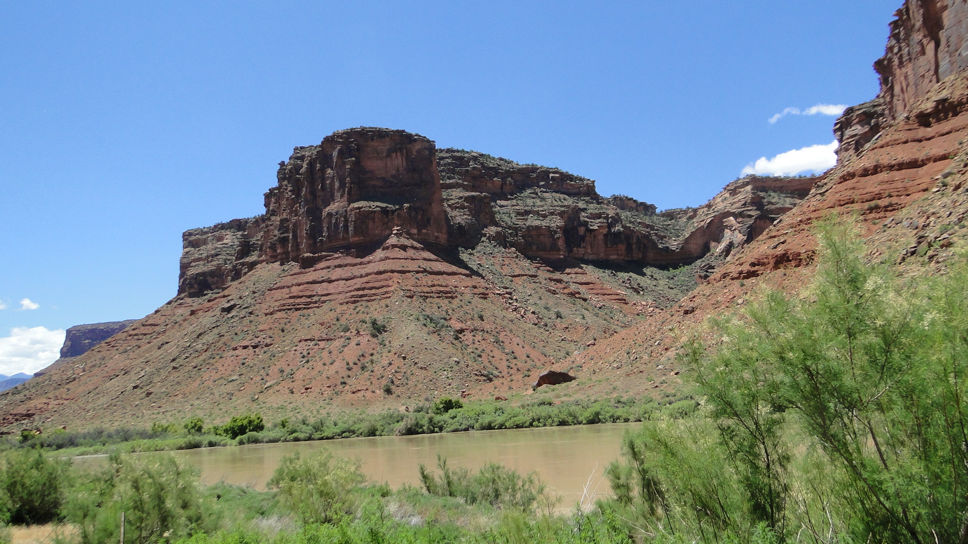
After two days at this magnificent site we headed west to Moab, Utah. The most direct route to Moab is Rt. 70 to Rt.191. However, on advice from some fellow travelers who know the area quite well, we selected a smaller road, Rt. 128 off of Rt. 70 through the abandoned town of Cisco. This proved to be very sage advice as this road (designated as a National Scenic Byway) follows a serpentine path along the Colorado River through a winding narrow canyon with sheer walls of red sandstone. The trip is a bit slower via this route, however the distance between our sites was only a couple of hours, so well worth this alternative path.
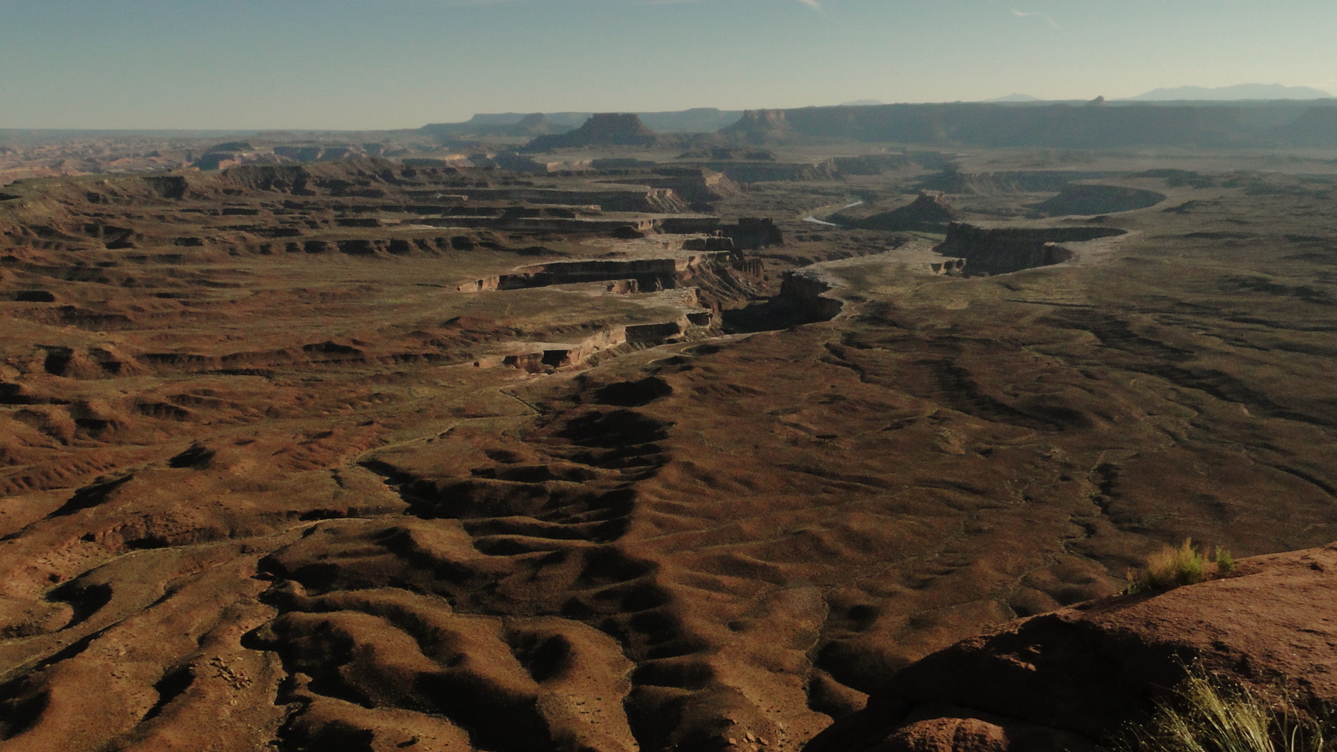
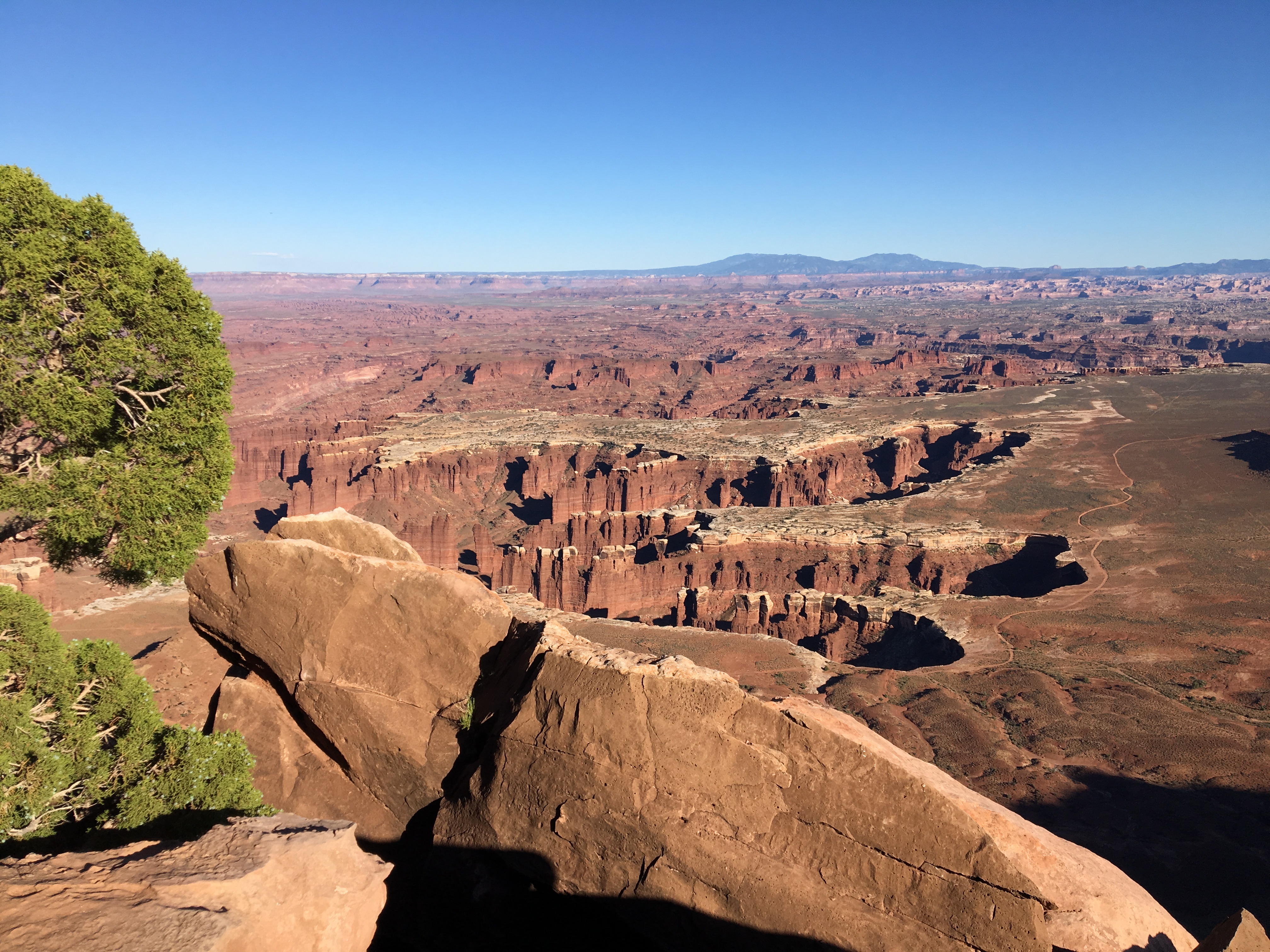
Our next stop was a small private campground that sits along the Pack Creek, 3 miles south of the town of Moab, Utah. Pack Creek Campground was a marvelous little find that had full hook-ups (FHU), very clean bathrooms, with showers, laundry room and is very close to Moab and Arches National Park, the reason we have come here. Arches is an enormous tourist draw and the parking areas at all of the trailheads and overlooks are rather small. We decided to rent a car for this area as our RV might be problematic at these parking areas. In Moab, there is only Enterprise Car Rental, with two locations, but only one agent based in town allegedly from 8-5, but out at the airport everyday from 4:30-6. (We never did reconcile the conflicting hours) There is one flight per day from Denver that they service so if you decide to rent a car you need to coordinate the timing with the agent. Since the airport is 24 miles north of town, we parked the RV at the camp site and called an Uber to take us to the airport. (Not sure, but Josh may be the only Uber/Lyft driver in town as we used him twice. Nice guy who shared regional information) This proved to be a valuable time saver as we were able to tour another National Park on our way south from the airport on Day 1 in Moab. The Canyonlands Park showcases the canyons of the Green and Colorado Rivers from an easily accessible paved road. There is a primitive campground there and the views are wide and expansive. Because the road is so high above the canyon floor, the views will vary with the angle of the sun and time of day. (This you will notice with all canyon viewing – angle of the sun changes the colors that you observe on the canyon walls) Canyonlands is accessible from the north, where we entered, and also from 3 hours south of Moab at Needles. Though this was a very interesting and beautiful park, I would not recommend going to Moab just to visit this park.
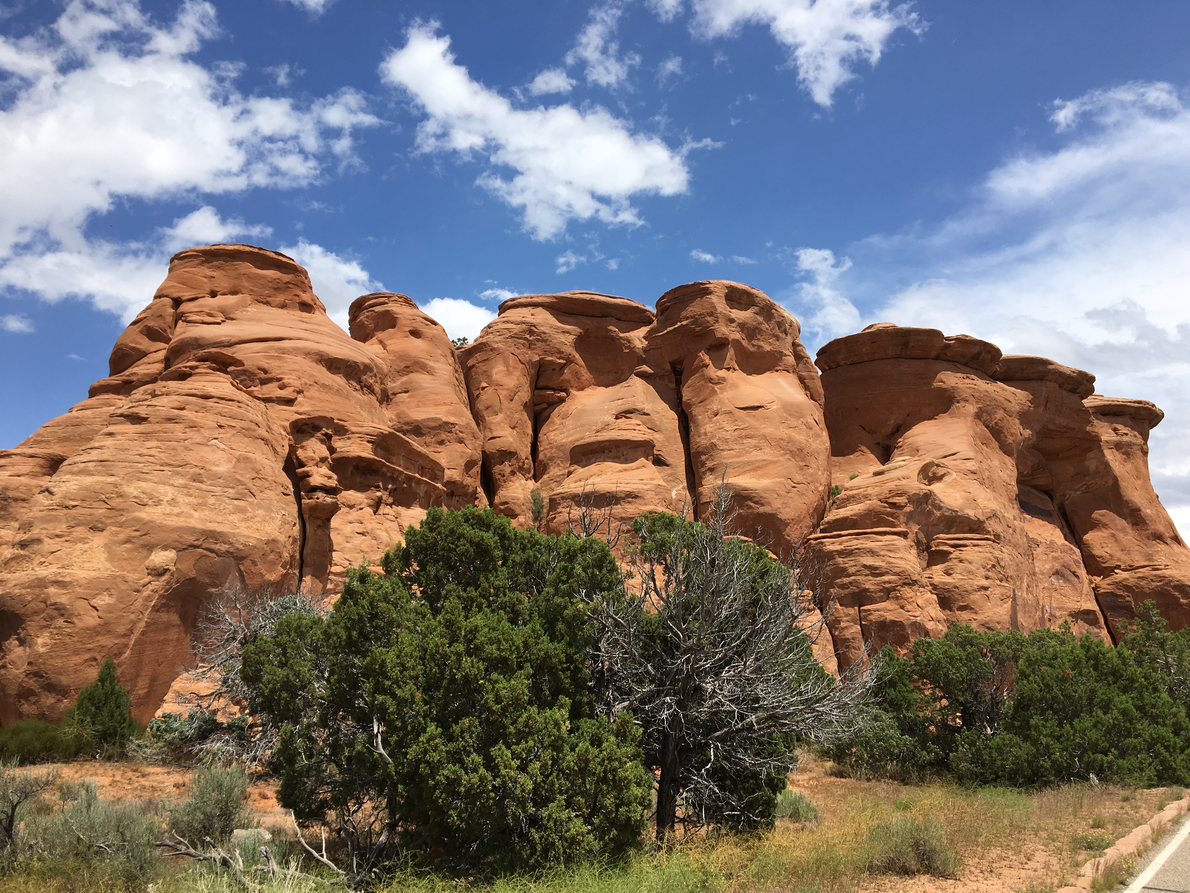
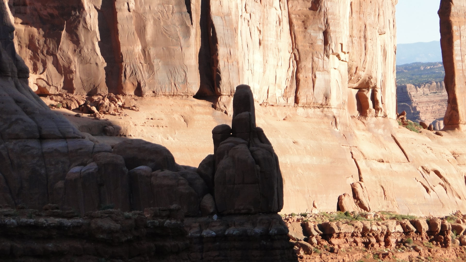
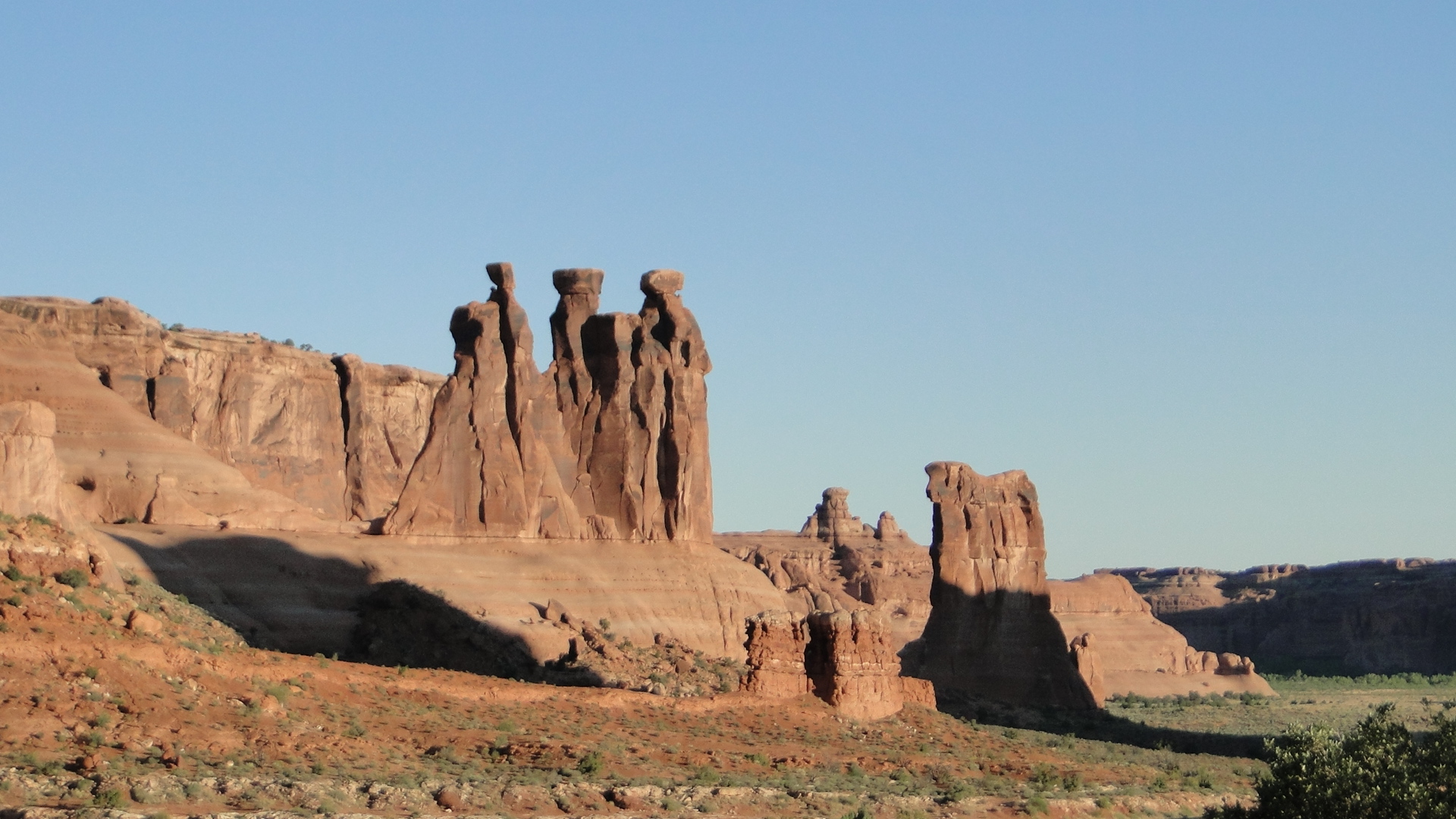
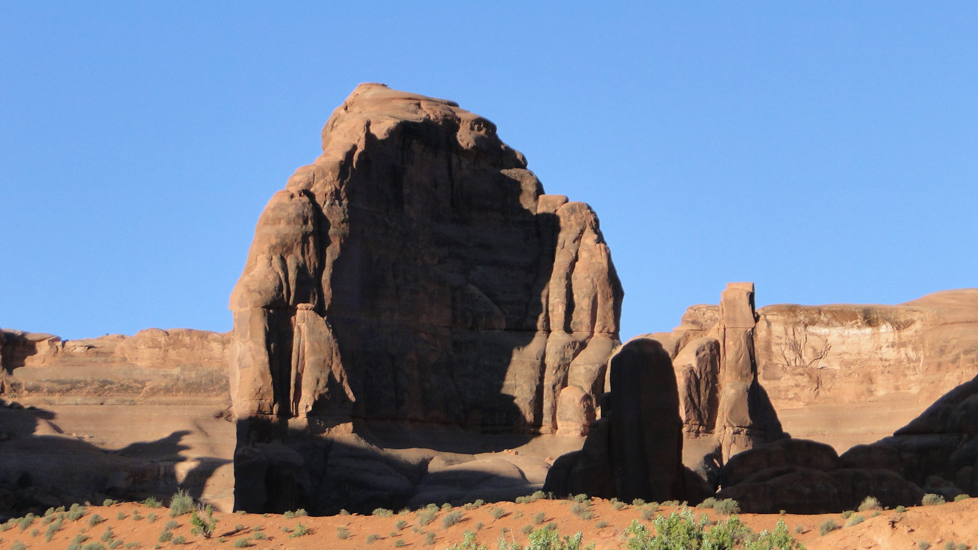
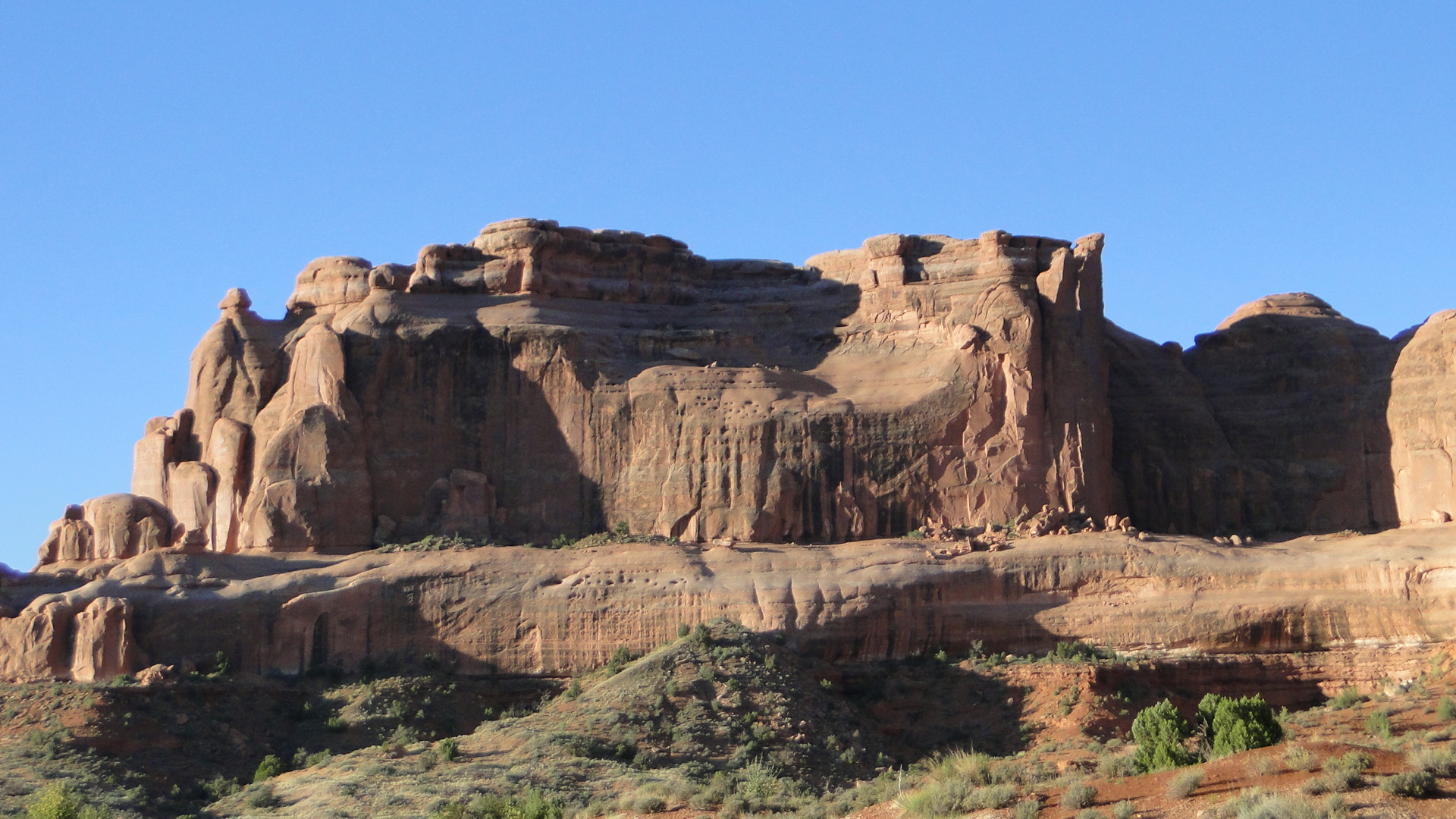
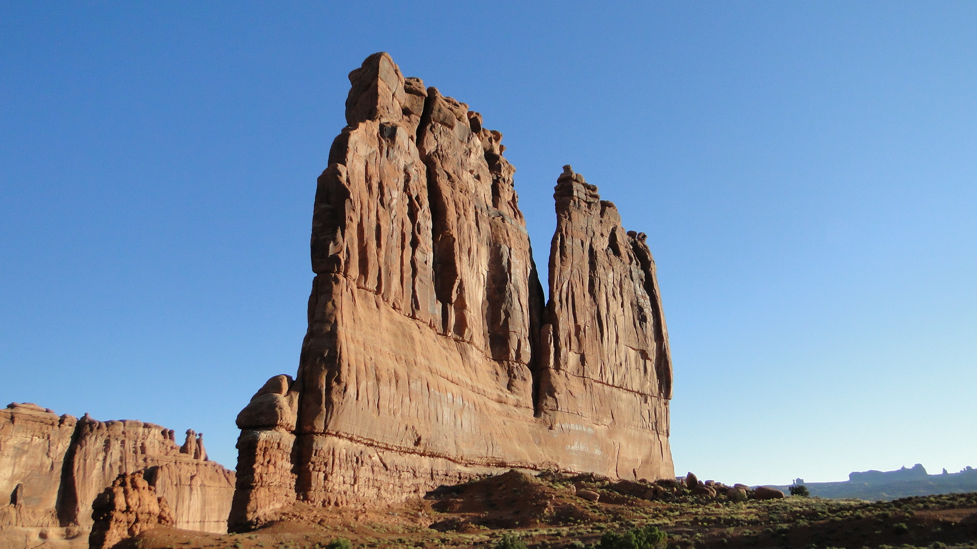
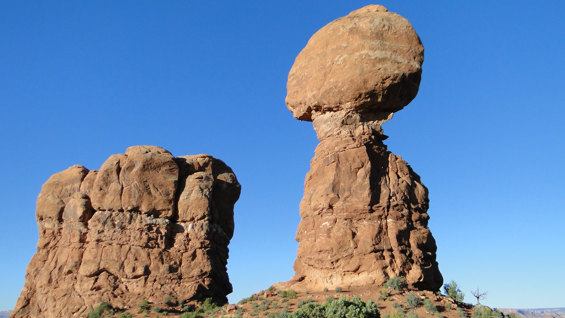
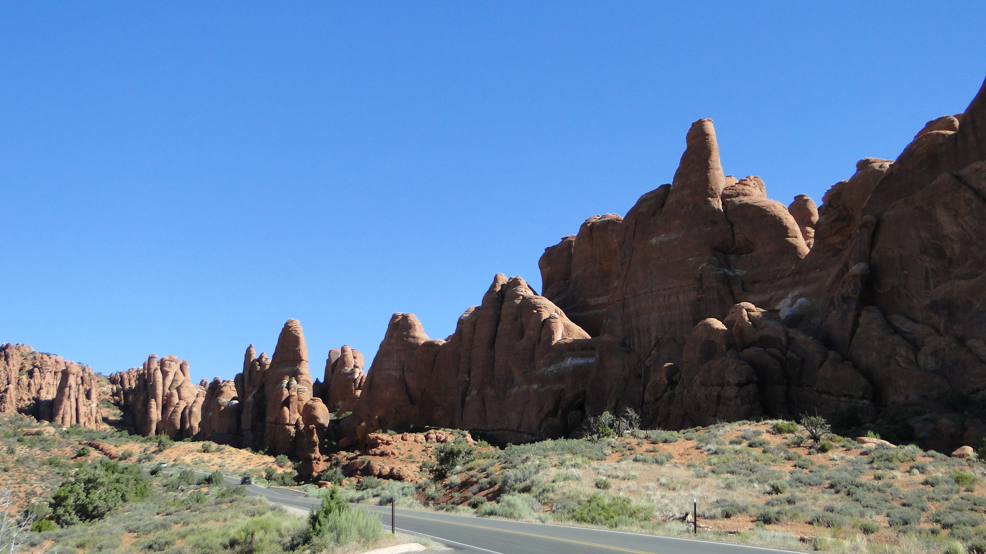
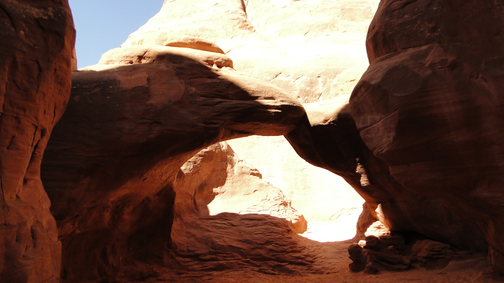
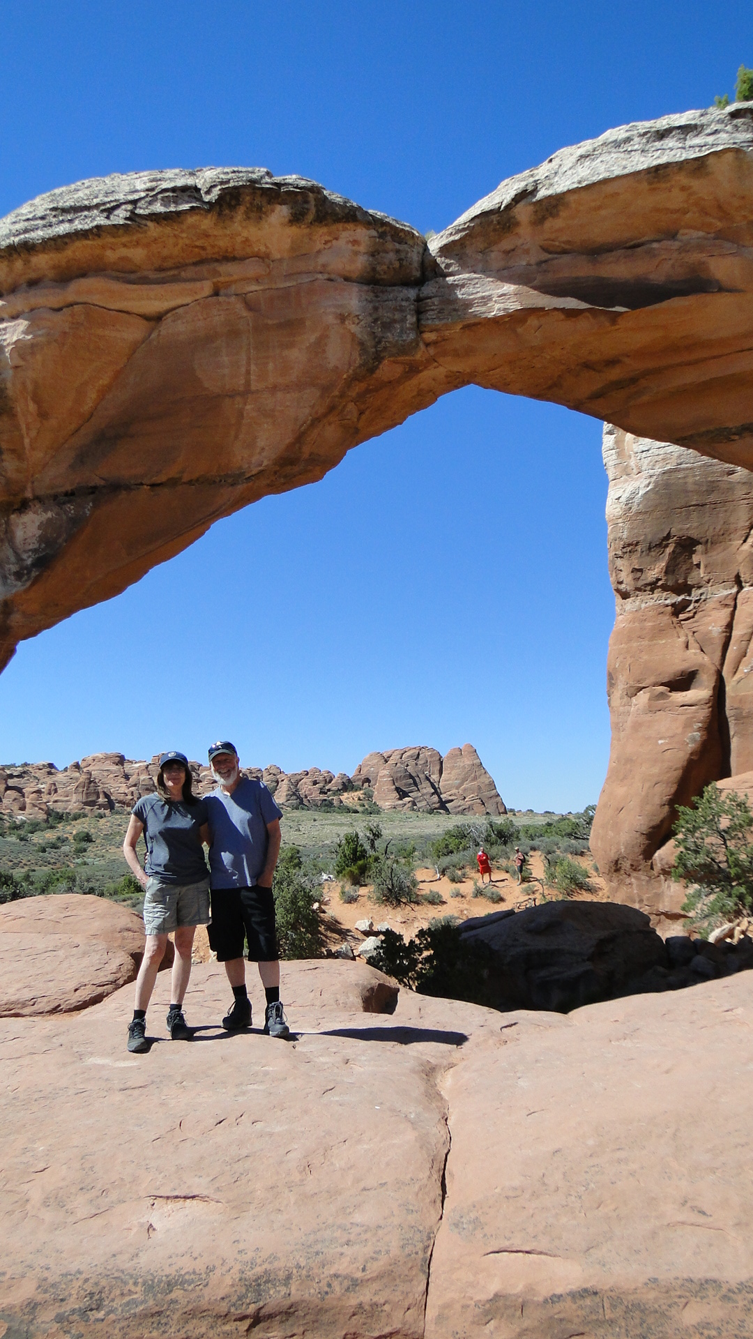
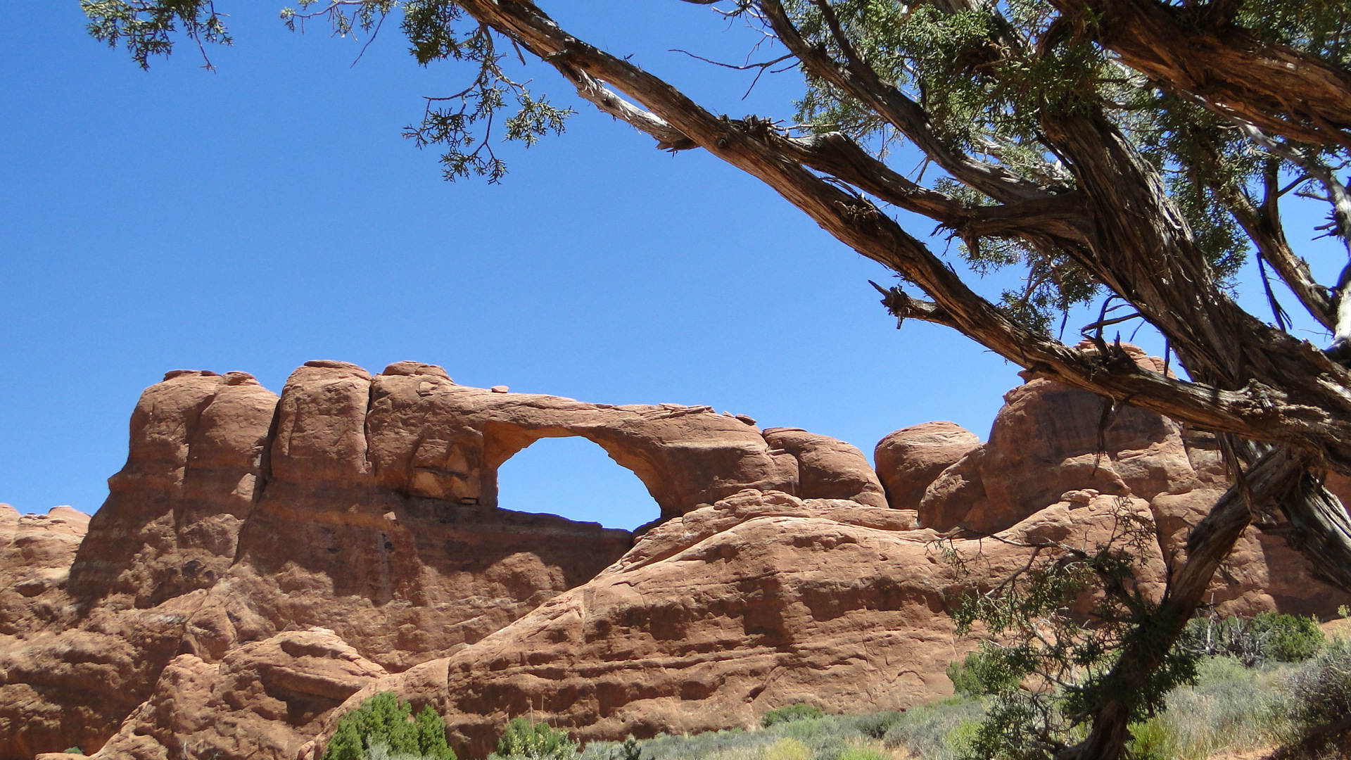
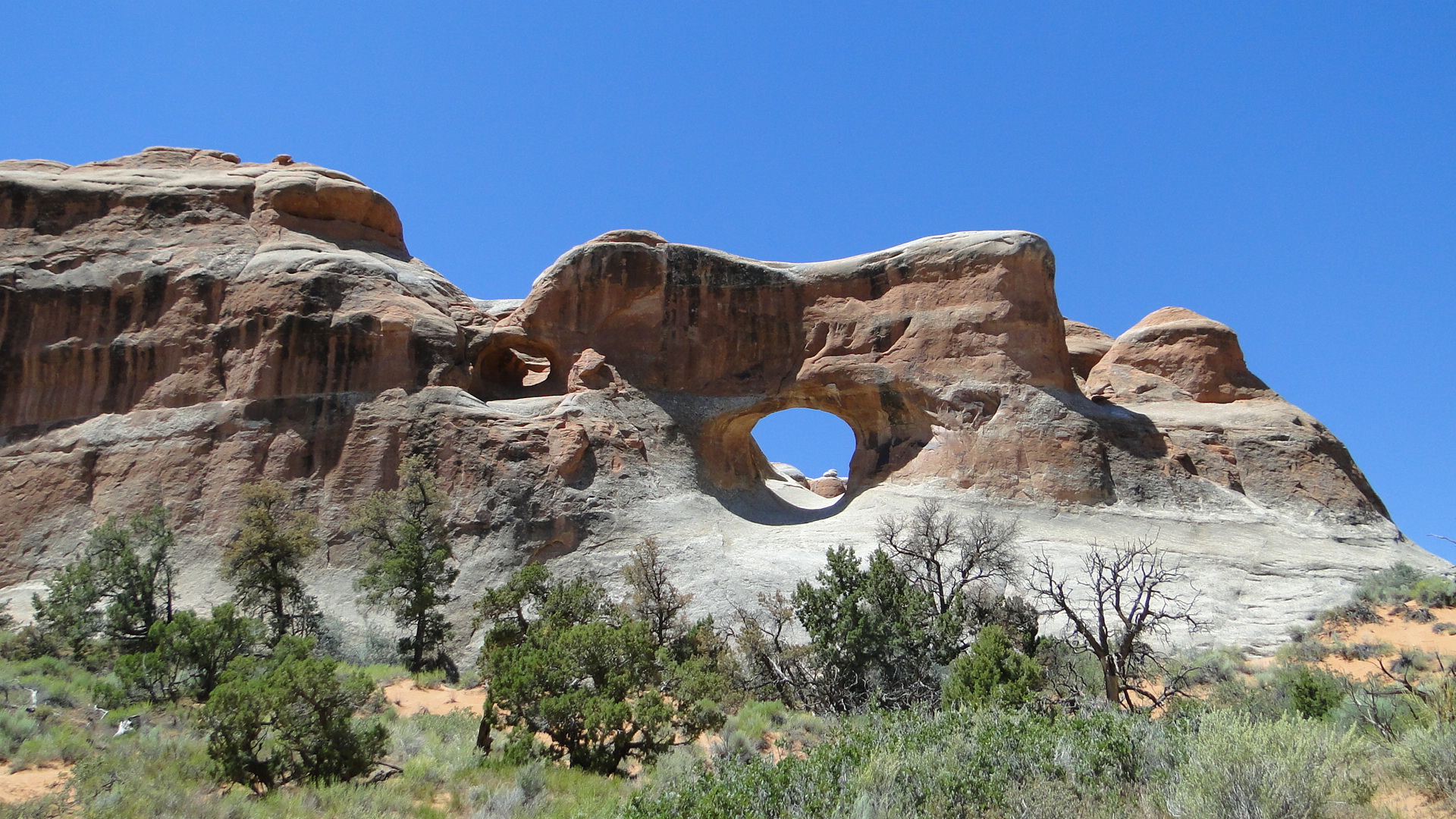
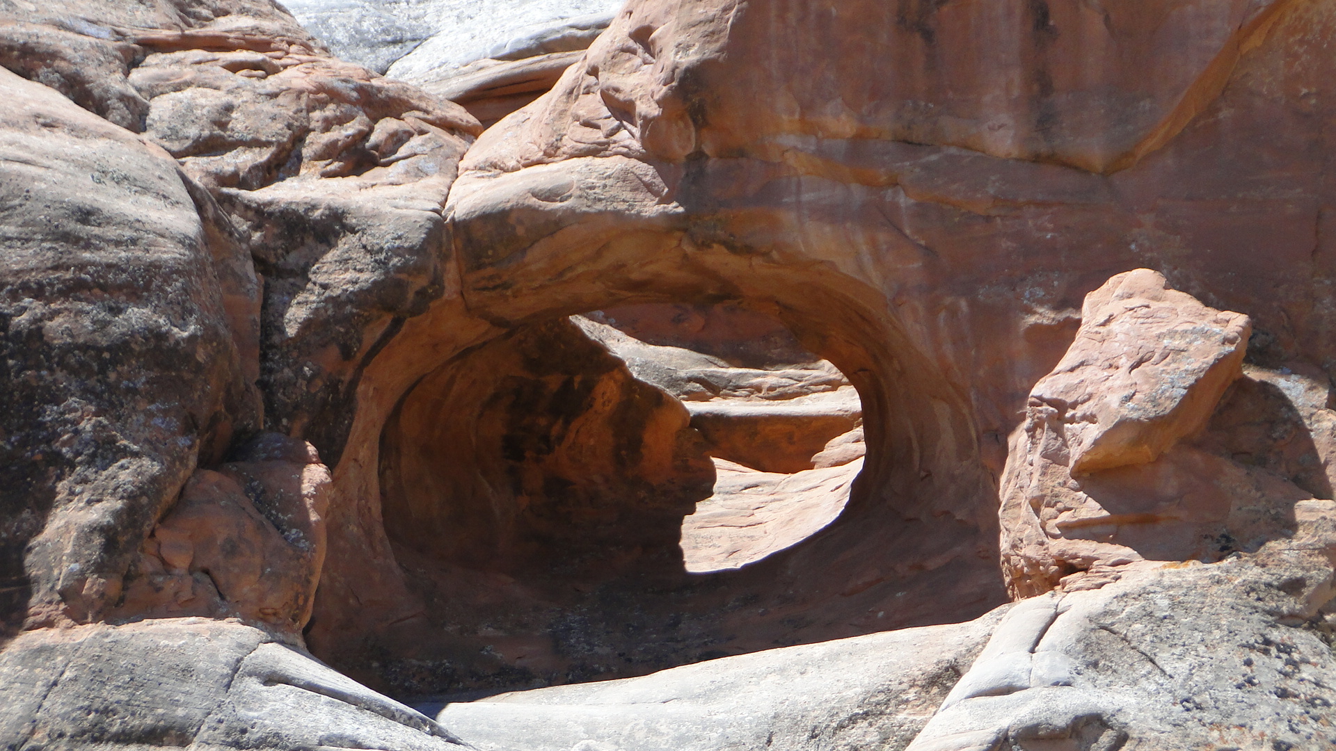
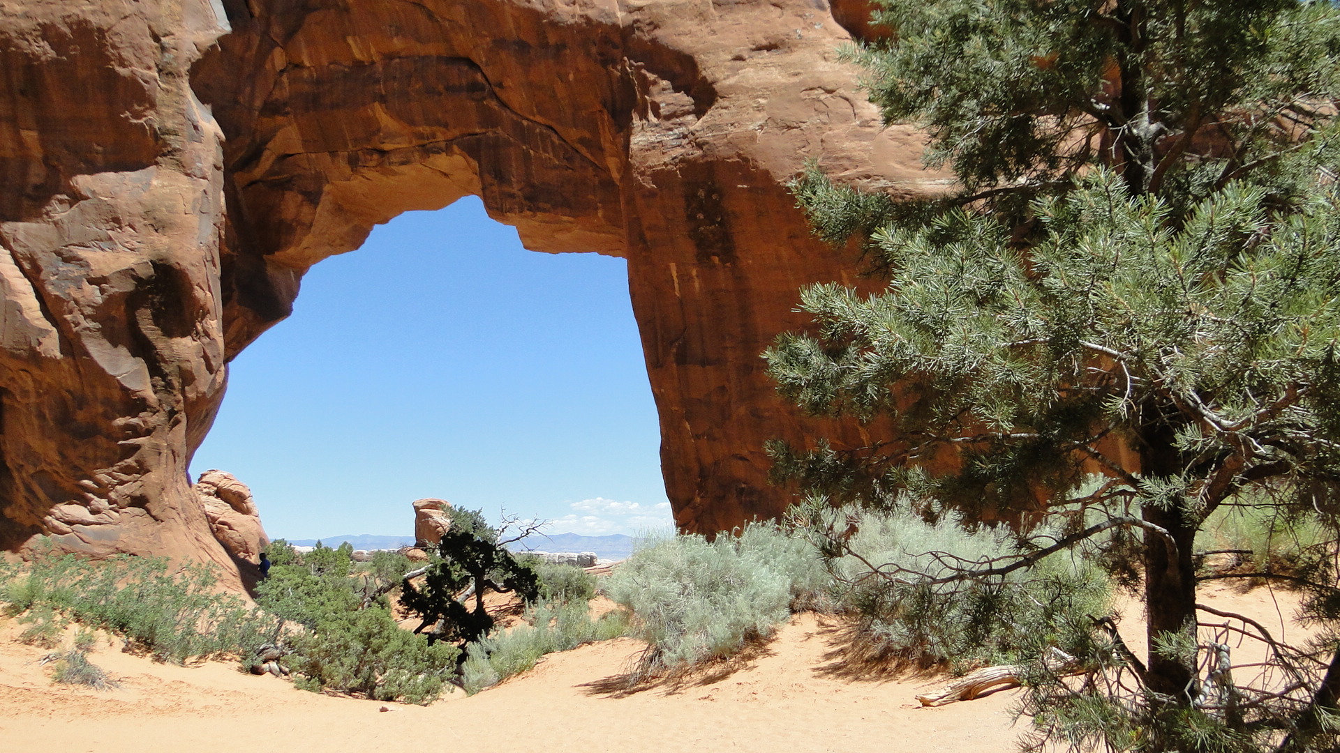
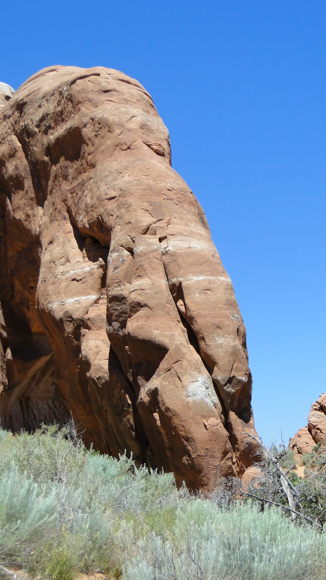
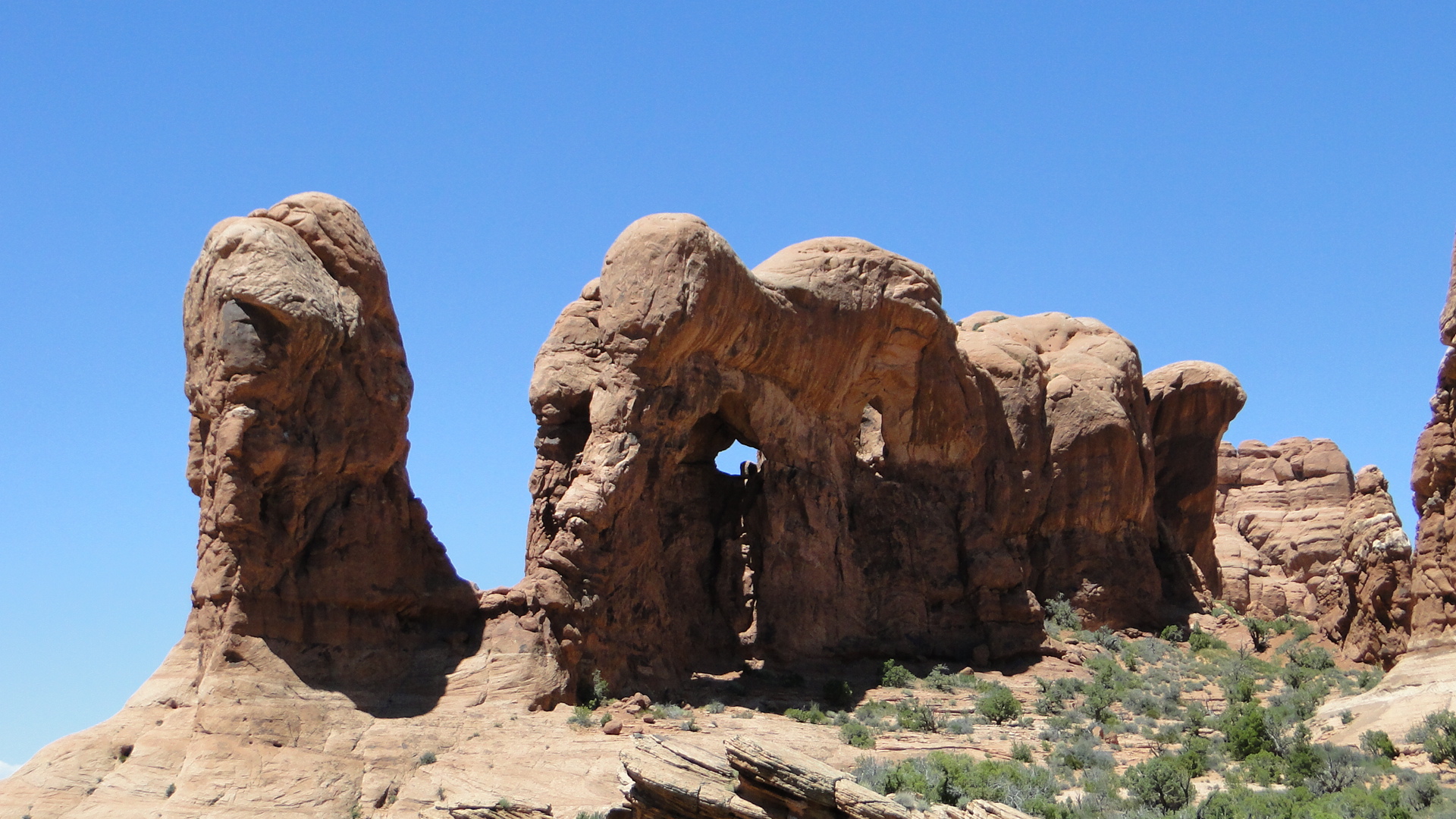
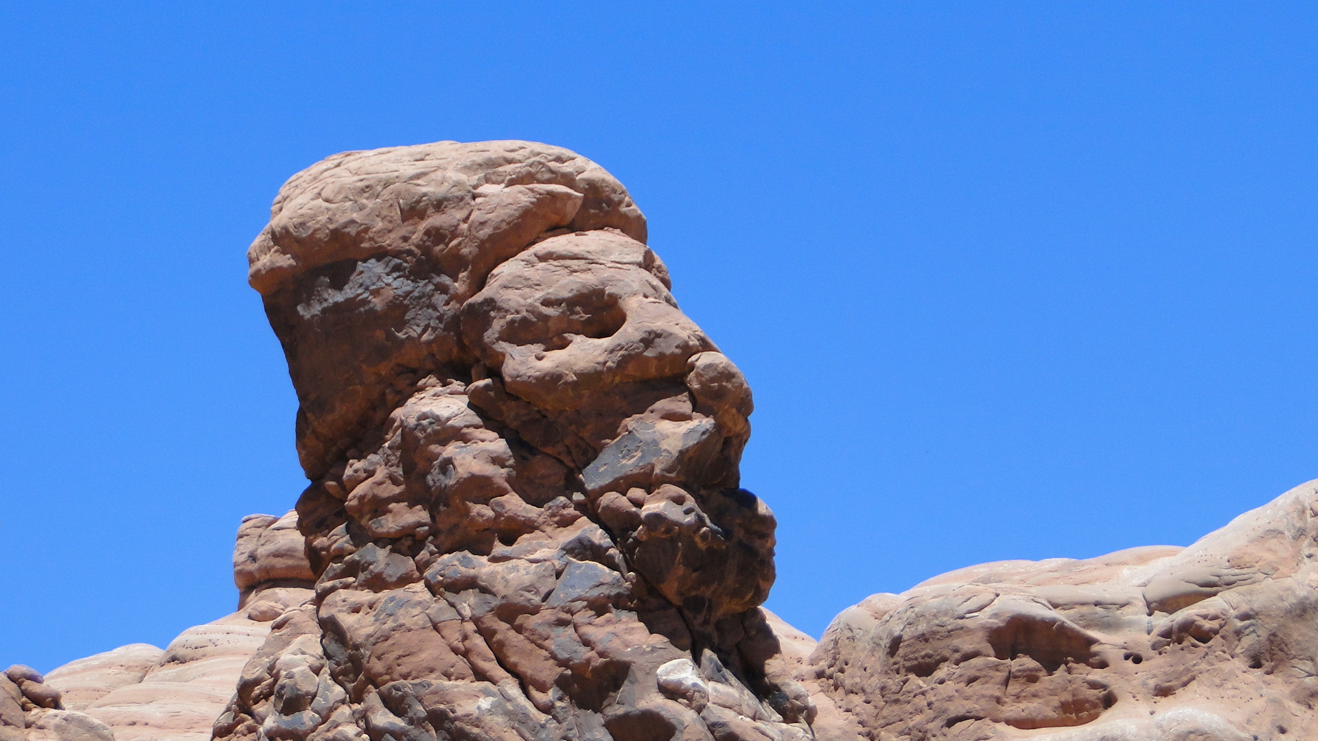
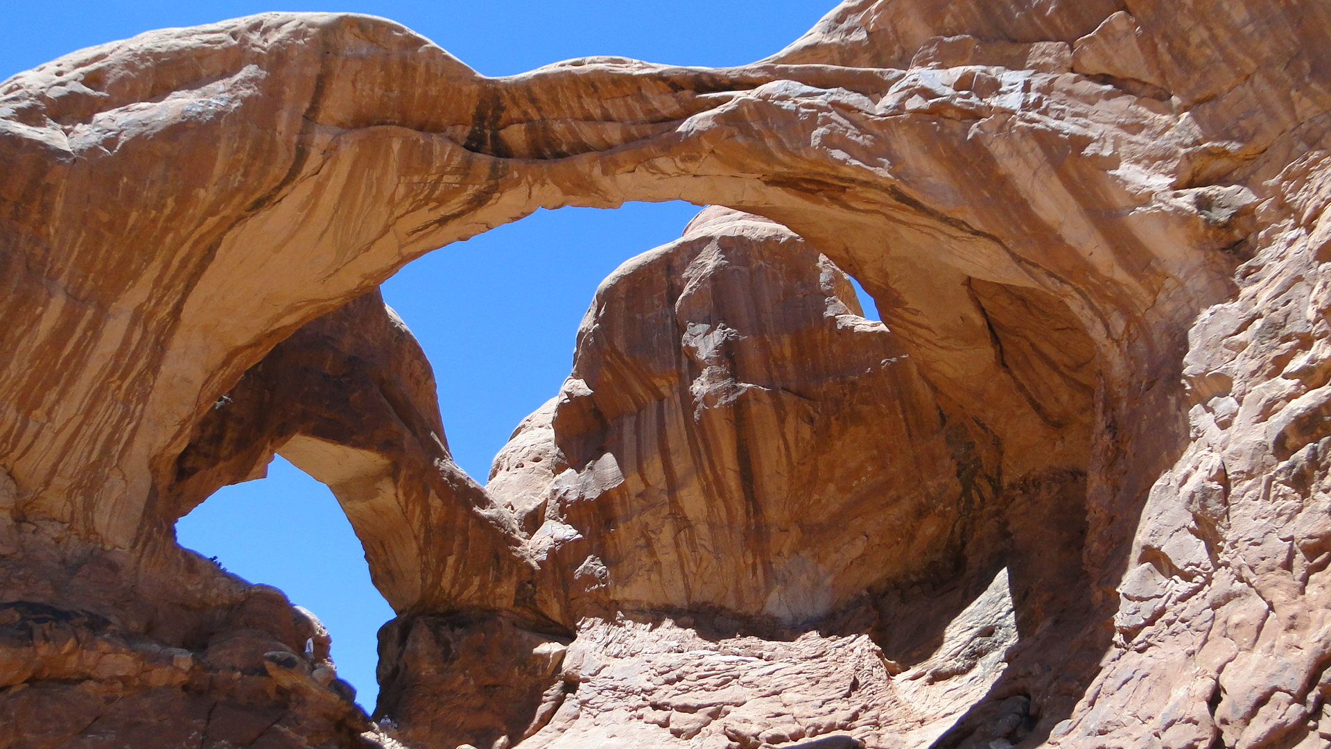
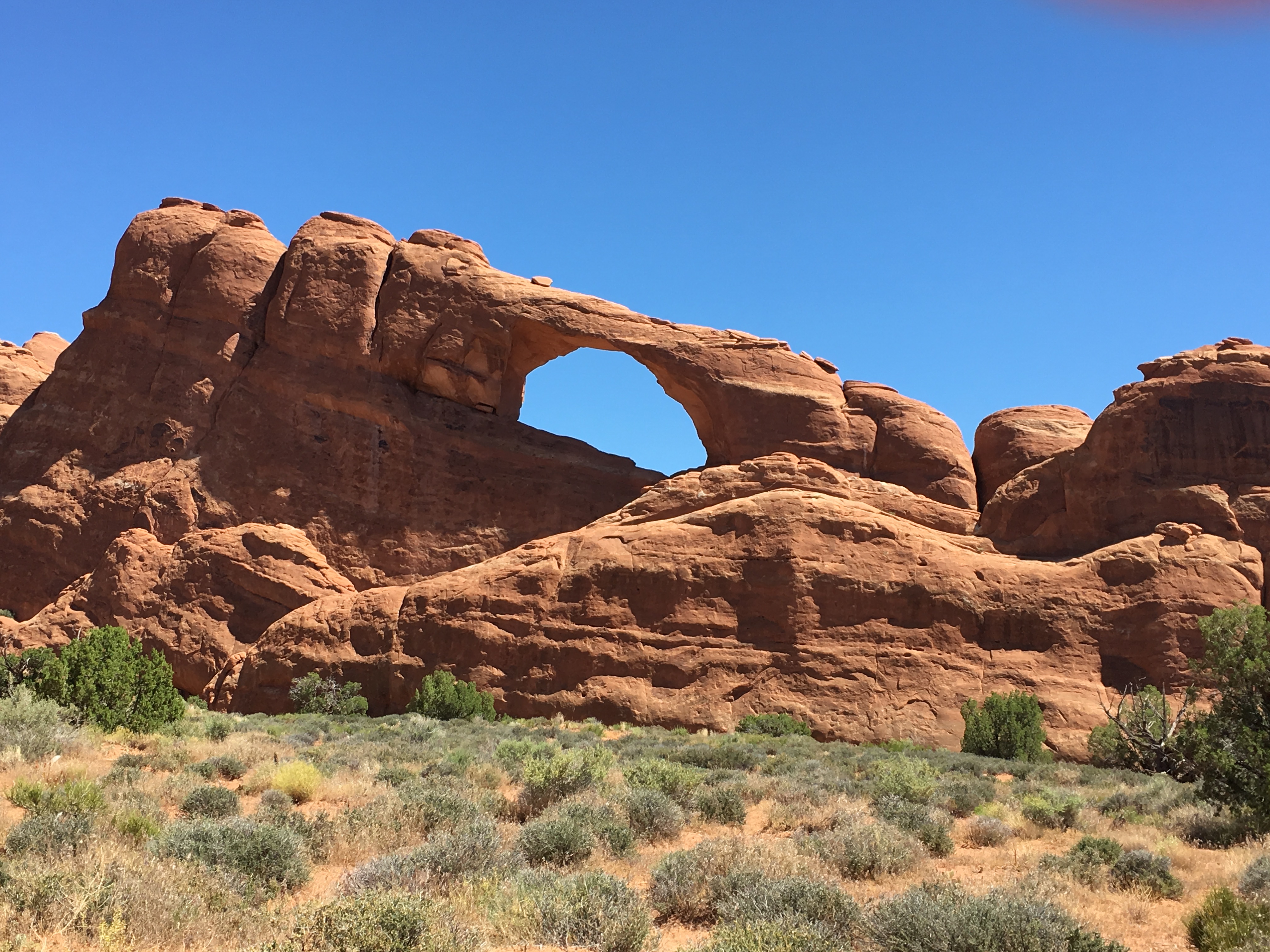
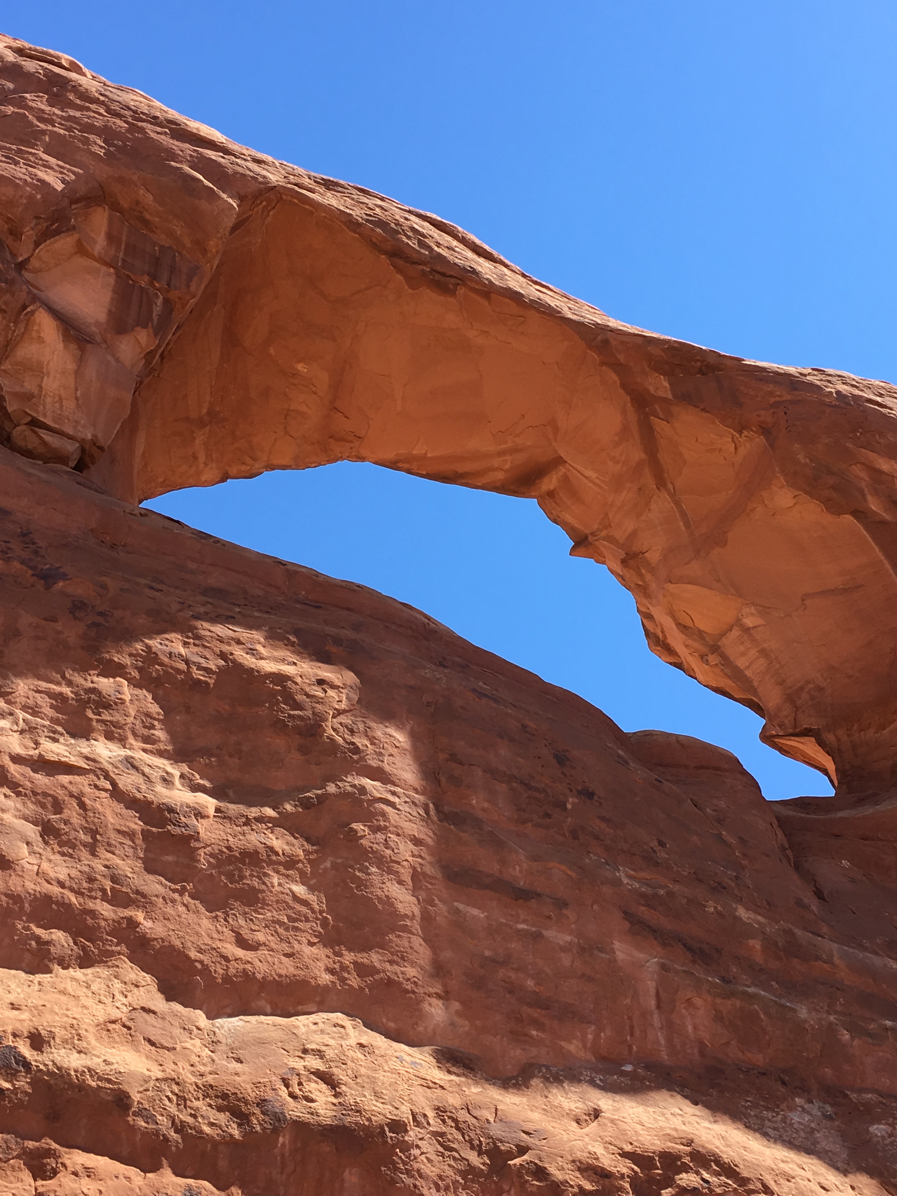
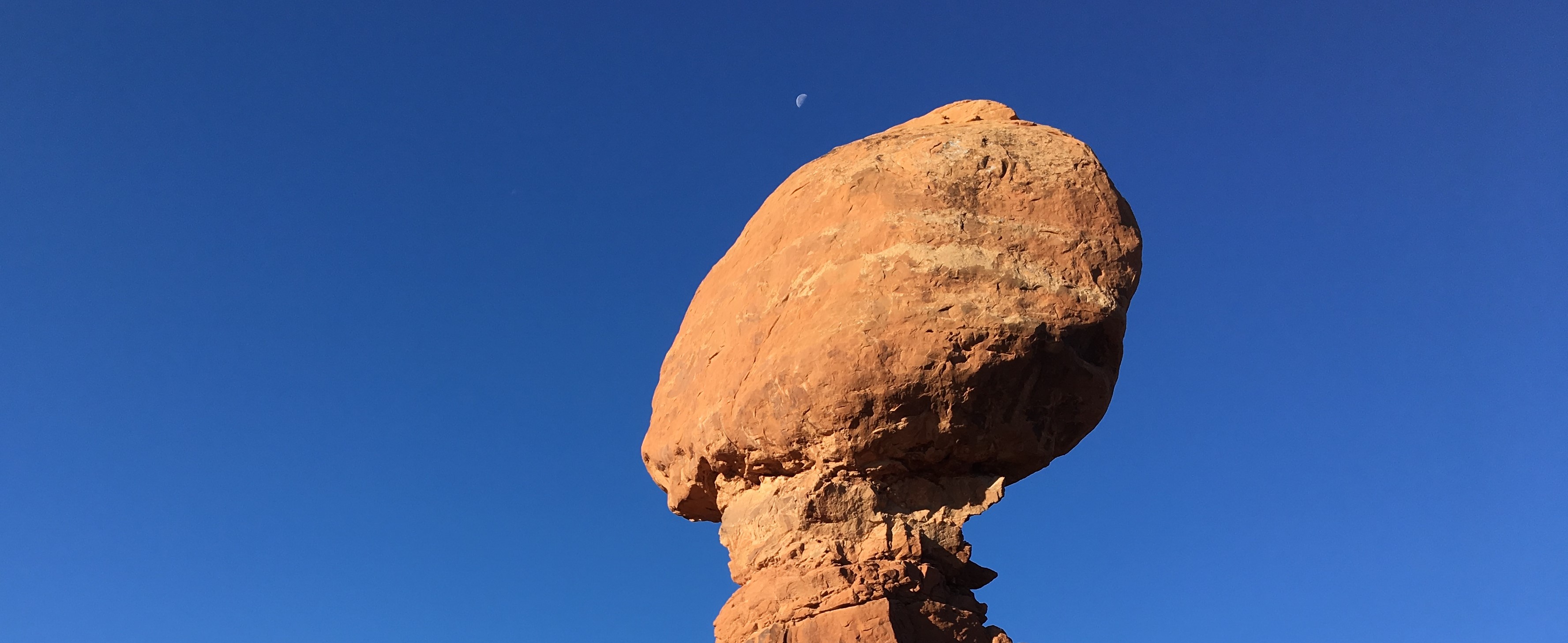
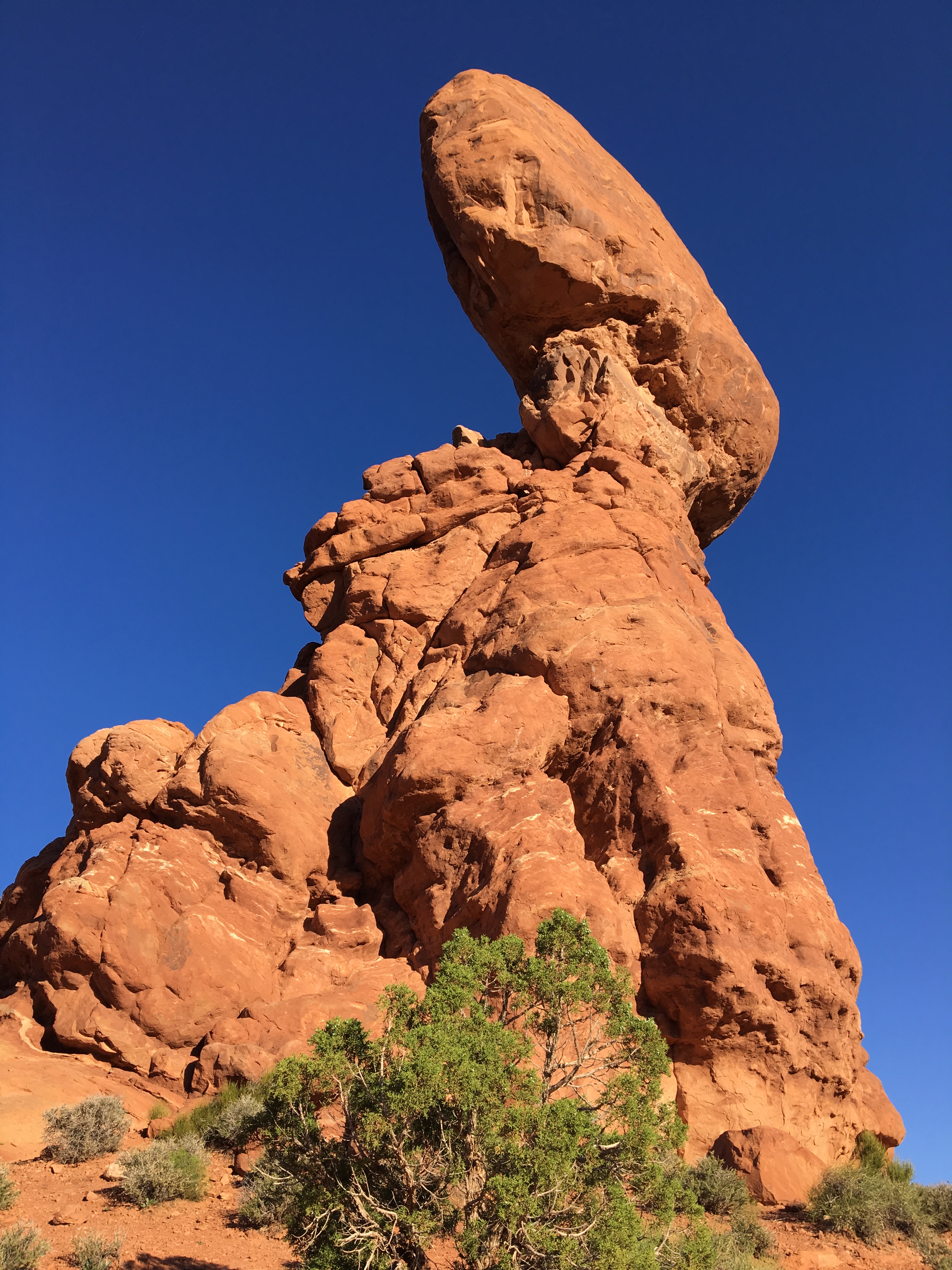
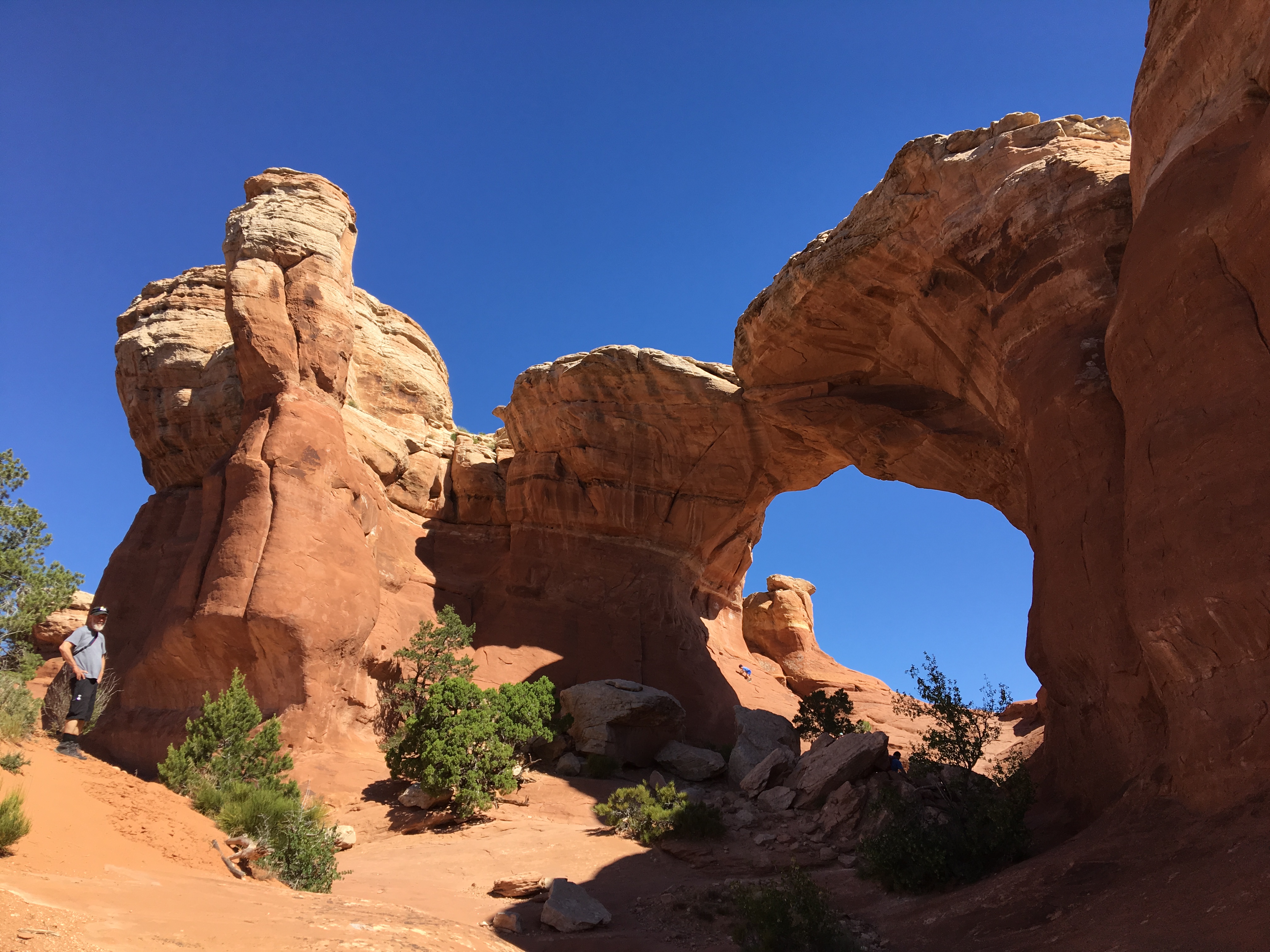
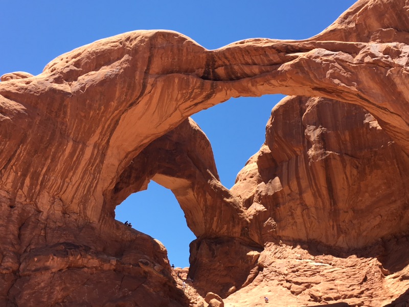
The true gem of this region is Arches National Park. Our research and the literature all suggest that from 9-2 the line to get into the park can be 30 minutes to over an hour, so we arrived by 6:30 a.m. and drove in without delay. By 9:30, many of the observation points and parking areas were crowded with tourists. This park features the greatest concentration of natural stone arches in the world and includes hiking trails, both short and rather extended, and jaw dropping monoliths, towering spires, pinnacles and balanced rocks. Water, ice, extreme temperatures and underground salt movement are responsible for this sculptured rock scenery. The Puebloan, Fremont and Ute peoples had used this area for thousands of years until the non-native explorers came looking for wealth in mineral form in the late 1800’s. Words cannot adequately describe this scenery so I’ve included many photos to create at least a basic image. As you can see, we had what we skiers call a bluebird perfect day.
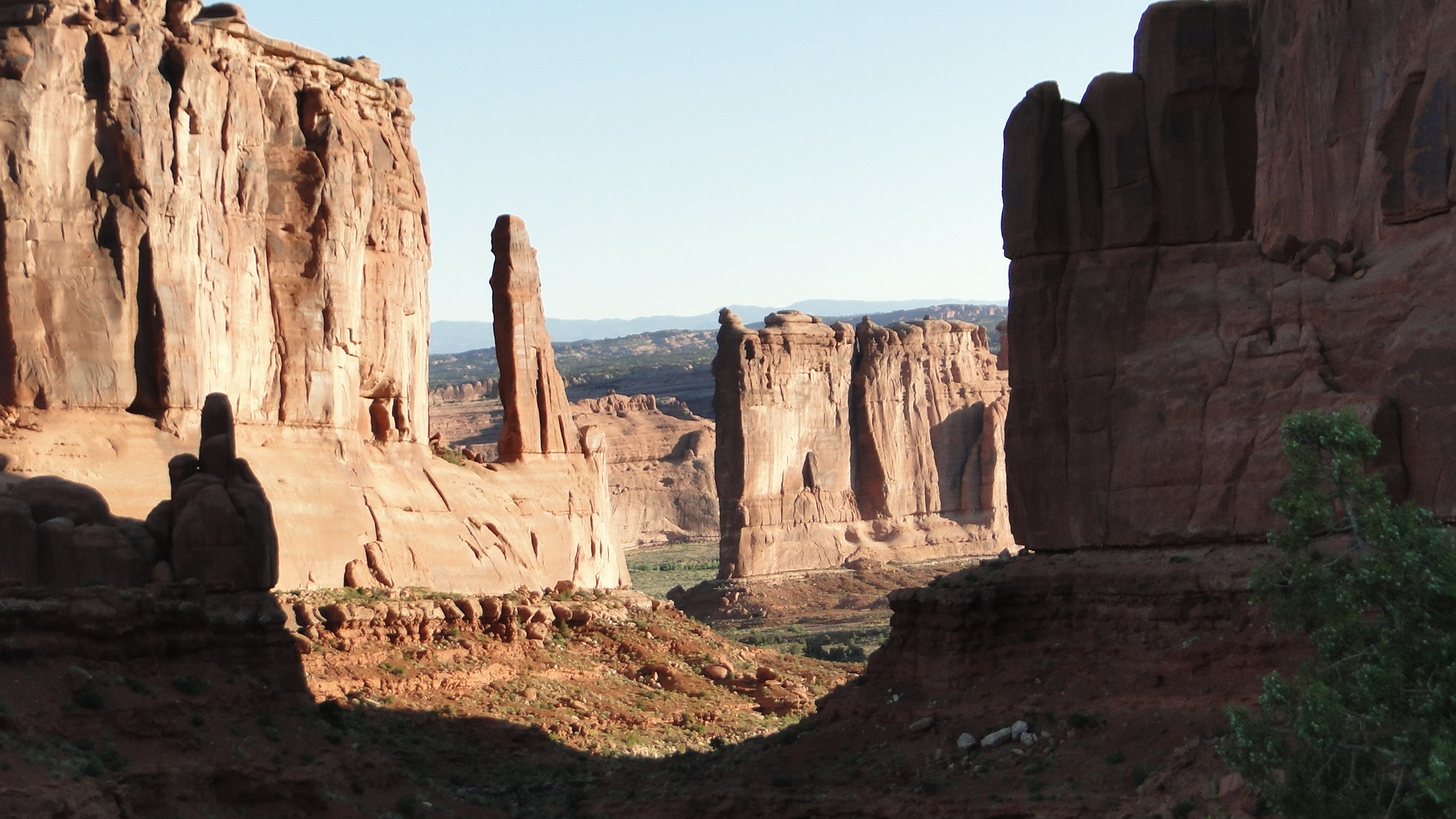
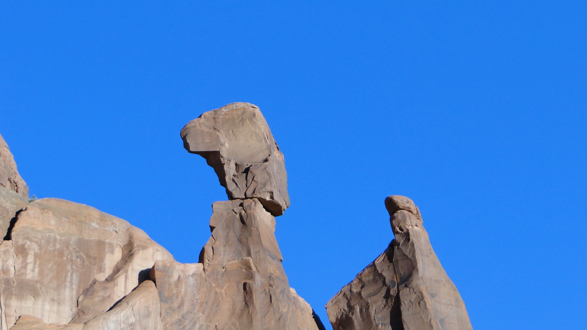
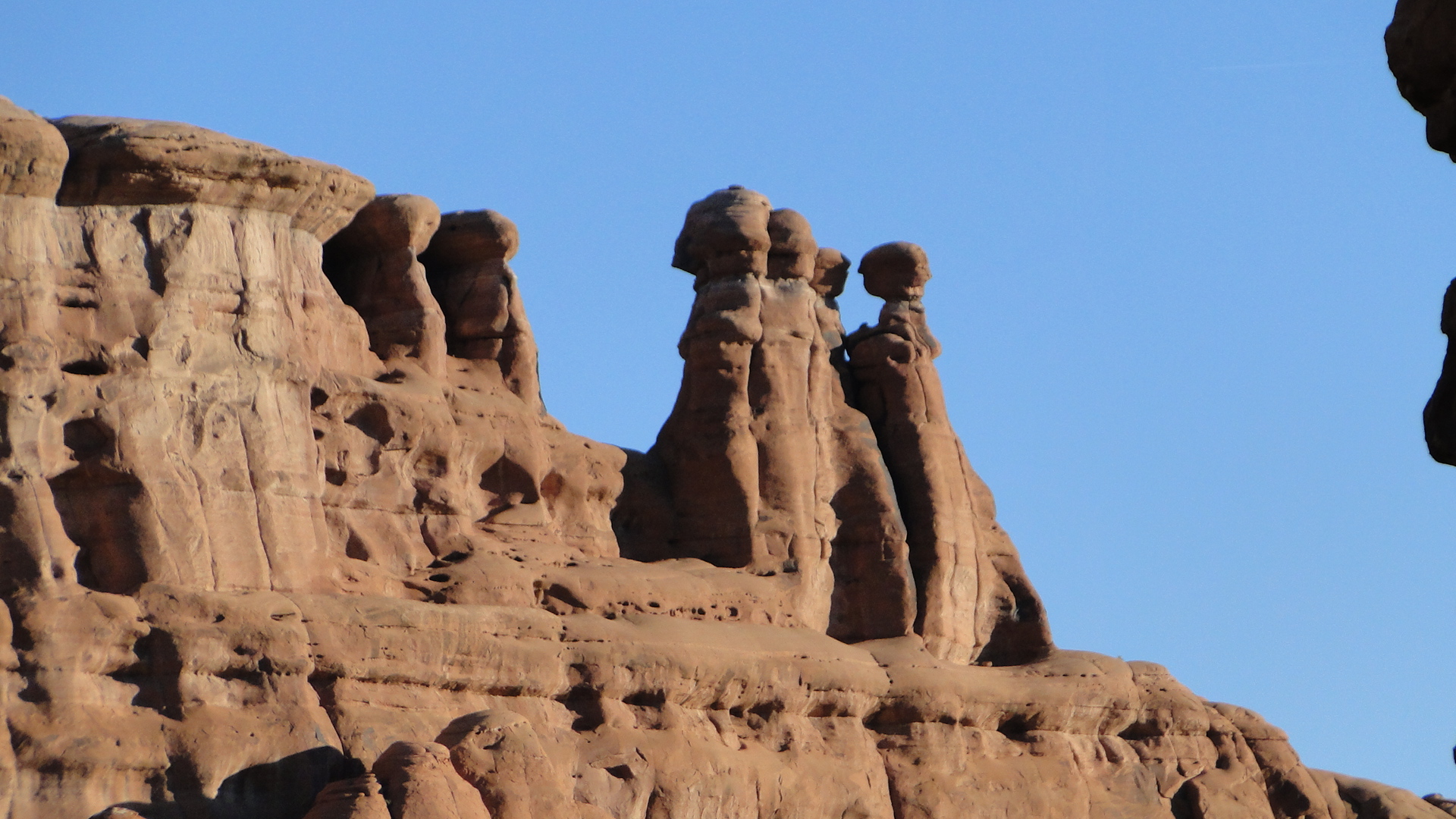
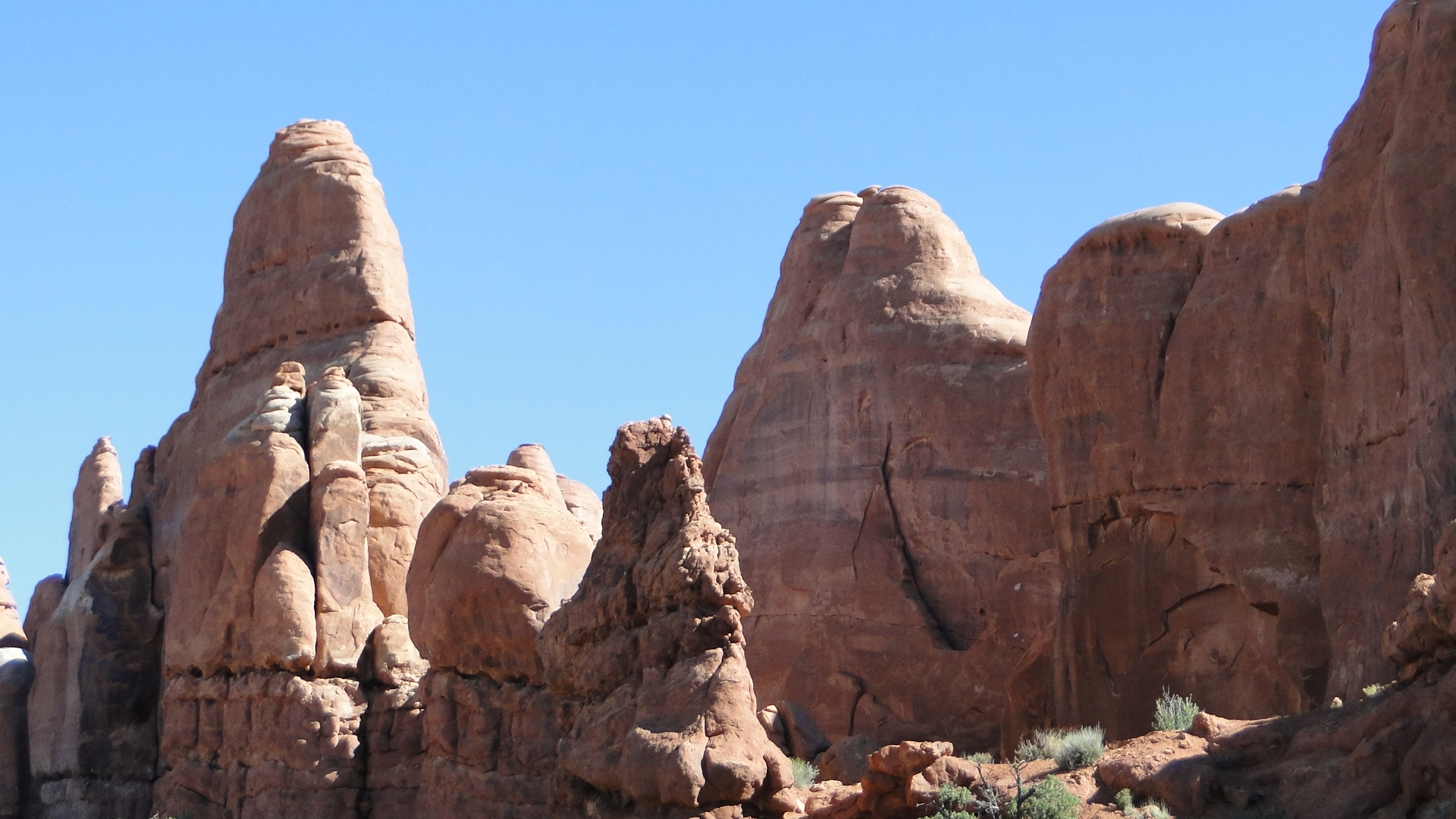
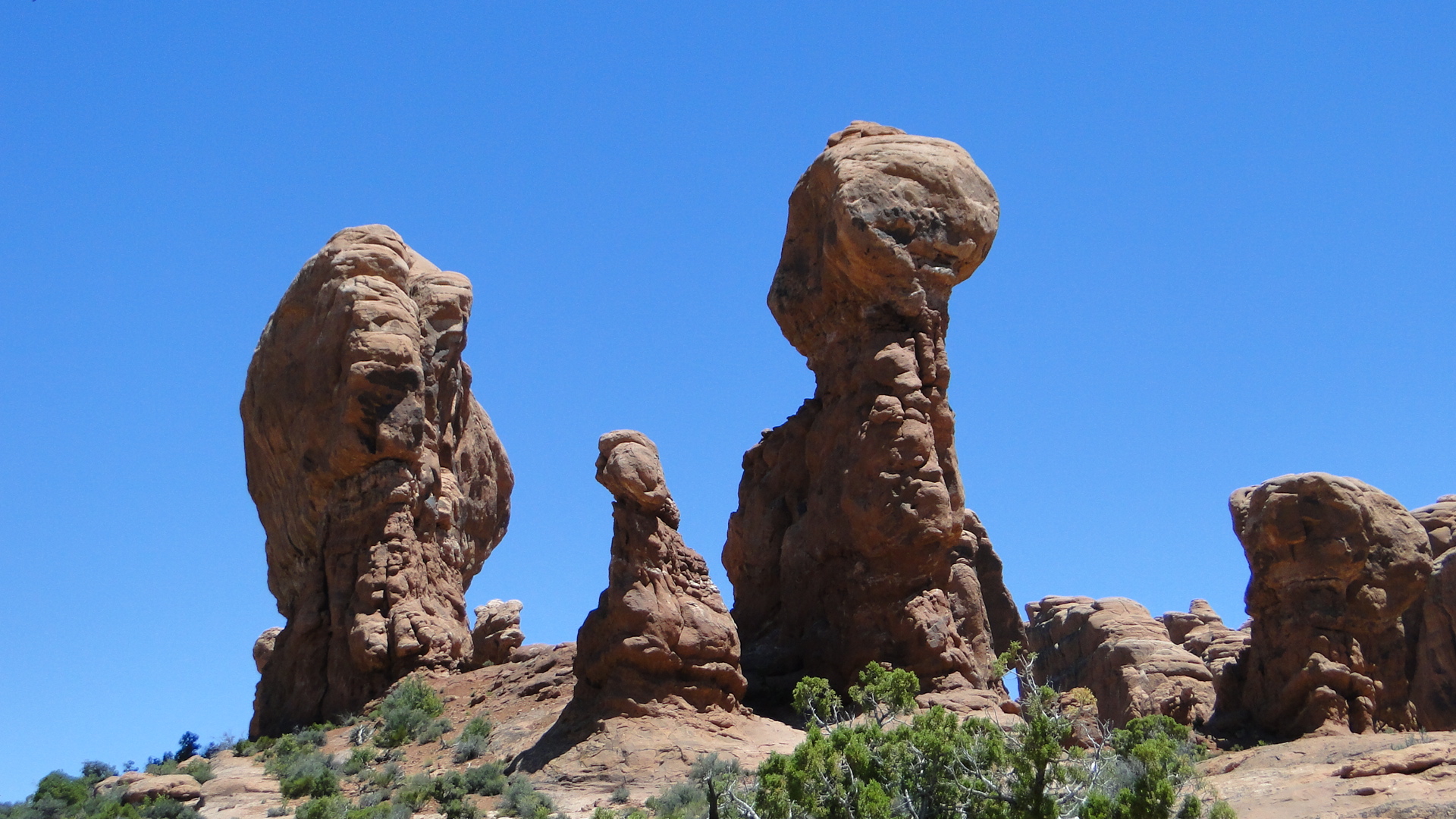
Side Bar: Some of the spires were reminiscent of the work of Catalan Modernist Architect Antoni Gaudi. Both Ellen and I saw the similarities immediately.
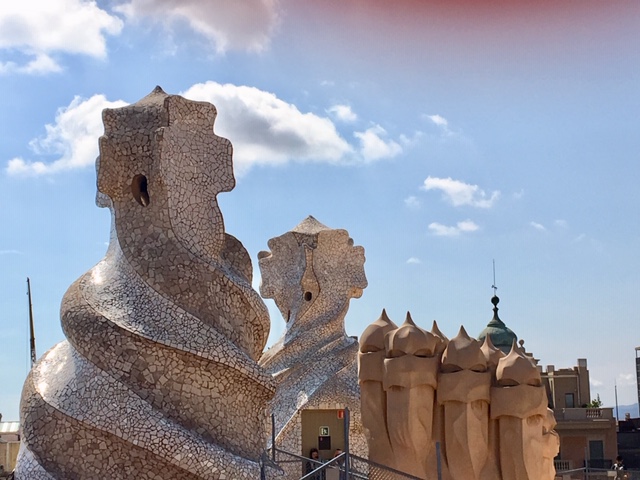
Rooftop of Gaudi’s Casa Mila in Barcelona 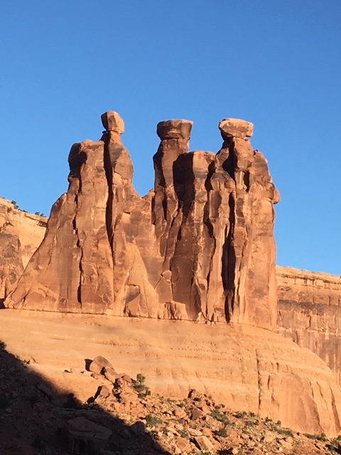
The spires at Arches
From Arches, we will be traveling north through Utah and into Idaho. Since some have inquired about the frequency of my posts, they will be on average one per week IF I have good WIFI. As we head north into British Columbia and the Yukon in a few weeks, the frequency may be reduced but I will diligently attempt to keep you along for the ride. As you may discern from my musings, this has already been a spectacular journey. I am glad that you are along for the ride. Thank you to everyone for your wonderful comments, suggestions and questions. We both love to hear from you.
Till the next time, peace.

Your photos are exquisite! So glad you are having the opportunity to experience these amazing places on such beautiful days.
LikeLike
Wow sounds like a wonderful trip.love reading
LikeLike
As I’m reading the blog, I’m thinking, I hope they have good brakes! These photos are making my eyes well with tears! They are so incredible. Love keeping up with your adventures. Are you enjoying the RV folks? XOs, Mellie
LikeLike
Haven’t met too many folks. Those we’ve spoken with have been very friendly and we’ve gotten some great suggestions about places to see. It’s funny but I think RV camping you don’t meet people like tent camping. I think it’s because tent camping you’re always outside. We prepare meals and often eat in the RV so we’re not as apt to meet people. Quite different. Our brakes are fine, thanks for asking!!!😁
LikeLike
Beautiful pictures,Arches is one of my favorites,only went in fall,you are seeing the spring flowers that are so lovely.Driving those roads in an RV is quite a feat!
LikeLike
Beautiful, beautiful photos and equally eloquent prose! Love the comparison between The Arches structures and Gaudi. Travel safely.
Sheree
LikeLike
Thank you Sheree. Love to get the feedback. The Gaudi impression hit both of us immediately. I will try to research if he had visited Arches because we found it uncanny. Going to meet up with the kids later this afternoon. Cheers. Jay
LikeLike
Again, thanks for sharing your experiences, pix and tips. It’s wonderful to learn about parks that may not be on the “greatest hits” lists but look and sound terrific. I especially appreciate the observation about Arches and Canyonlands. We are staying in Moab in late September and have plans to visit both parks. We will weight our time towards Arches. Keep on truckin’ and please keep on posting. Safe travels.
LikeLike
Barry, thanks for your kind words. Glad that my blog is having my intended outcome. You will love Moab. Hope you’re going to raft the Colorado while there. It is amazing through the canyons. Also we recommend two days at Arches if you plan to hike. Just not enough hours in one day. I’ll call you one night to discuss in more detail. Jay
LikeLike
Thanks Jay. This is really helpful and we’re enjoying the entire travelogue and great pics. I hope you continue to have smooth going.
Linda Wagner
LikeLike
Unbelievably gorgeous photos. You paint the picture with words and images — very, very nice work. You guys are covering a lot of ground, and you’ve only just started! Keep on doing your best Lowell Thomas impression as you travel the Open Road. Stay safe and sound.
LikeLike
Great pics and blog. The area around Moab is incredible which includes both Arches and Canyonlands NP’s. I have been there twice and ready to go back. We however we very much liked Canyonlands and want to go back to explore more. We have not explored Colorado much yet so really enjoyed your pics and blog about that area. Safe travels and look forward to your next post..
LikeLike
AWESOME, AWESOME, AWESOME! Sheryl and I just got back from 2 weeks in Italy and Greece and spent time this morning reading your blogs. Great pics, great info. Thanks! Your blurb about Rocky Mtn National Park brings back memories of Kolman confronting a bear when he exited our tent in 1973. Take care and enjoy. BTW – got engaged to Sheryl on a gondola in Venice. Yep, she said yes! Marc
LikeLike
Jay-
Following along. The photos are terrific;: and I enjoy the narrative. Looking forward to the continued adventure!
LikeLike
Thanks John. This journey has been pure joy to date. Just rafted the Clark Fork River in Montana today. Every day, another adventure. Hope all is calm at UA.
Cheers, Jay
LikeLike
Great pics !! Liked the Colorado as that is one state we have not explored much yet, but intend to. Moab and the national parks of Utah are incredible and we I intend to go back. However we really liked Canyonlands and really only scratched the surface of that park. Dead horse point SP is a state park that butts up against Canyonlands and is a great camping spot, with very nice mountain biking trails. It has water and a dump station and electric. So you just have to fill your tank on the way in and you are set for a few days, dump on the way out. Enjoying your blog and safe travels..
LikeLike
I love the descriptions of your Rockies experience. I imagine you are feeling some of the same heat out there we are feeling. My only Moab hiking was during 95F summer sunshine – probably the same for you(?). I look forward to opening your Into Idaho positing. B
LikeLike
Absolutely spec-tacular!! Wonderful words, beautiful images, love your thoughts. (Binging this blog and the next right now due to company and a side trip) So very exciting to follow along. .
LikeLike