Canada Highway 16, the Yellowhead Highway, leaves Jasper on a slow and steady ascent through glistening, limestone white mountains. The path now leads out of the verdant, mountainous Jasper National Park and into a high plains region of rivers and thick, low slung coniferous forest.
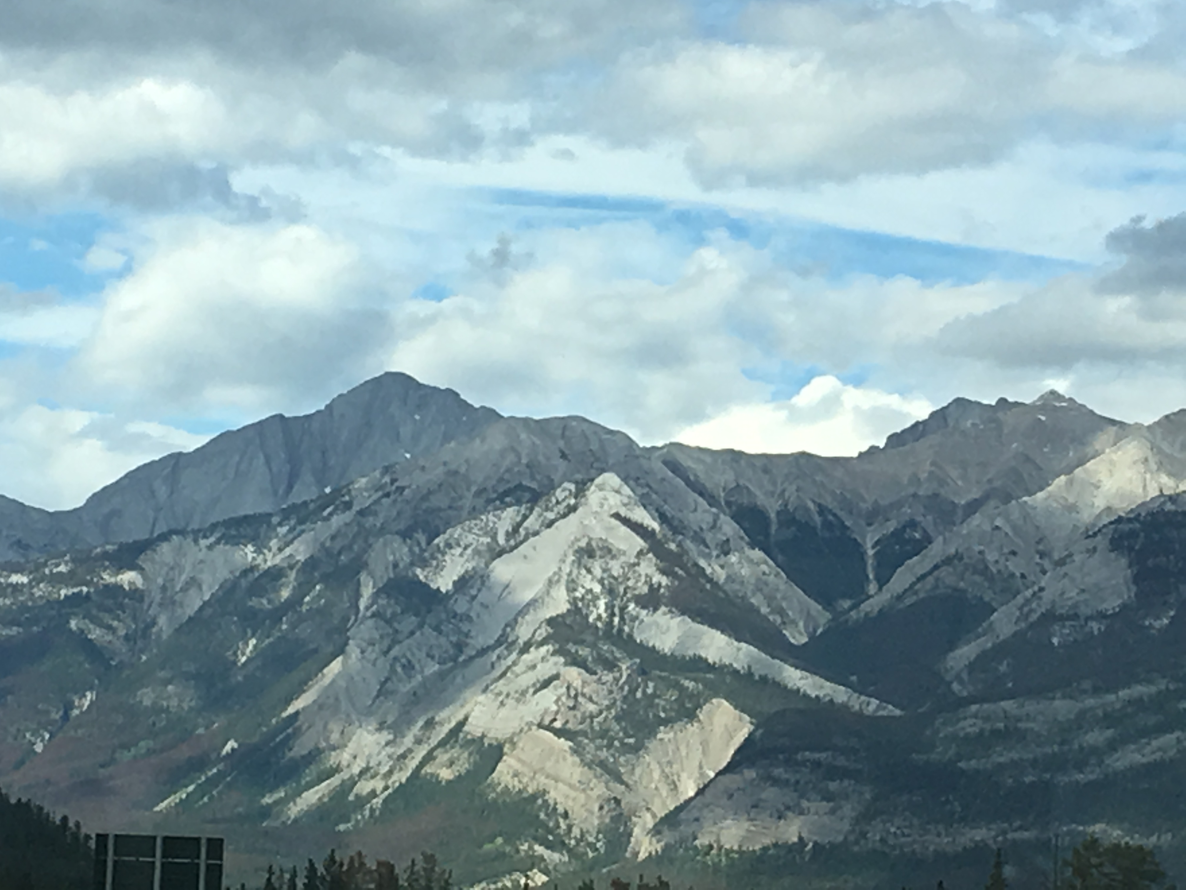
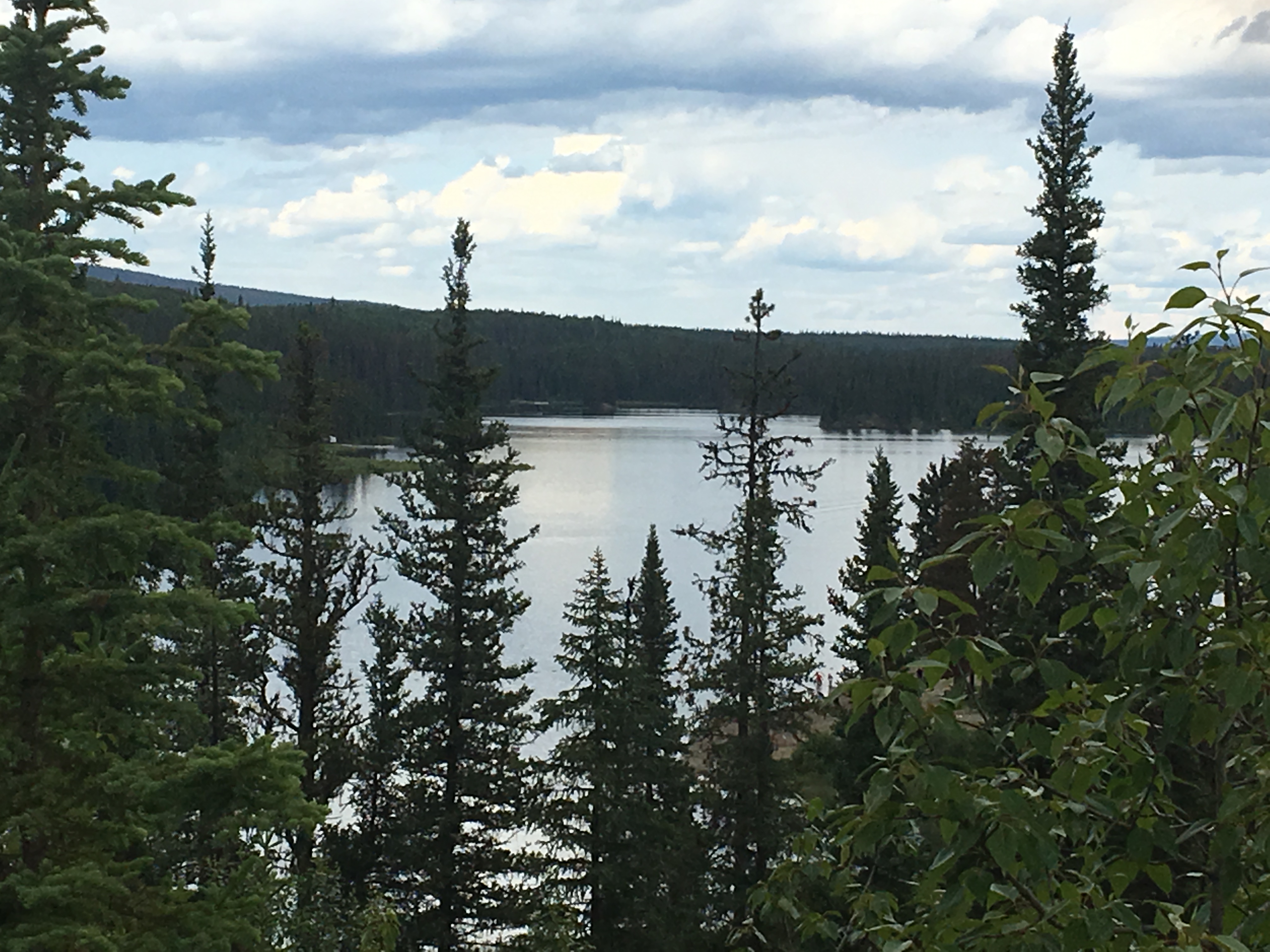
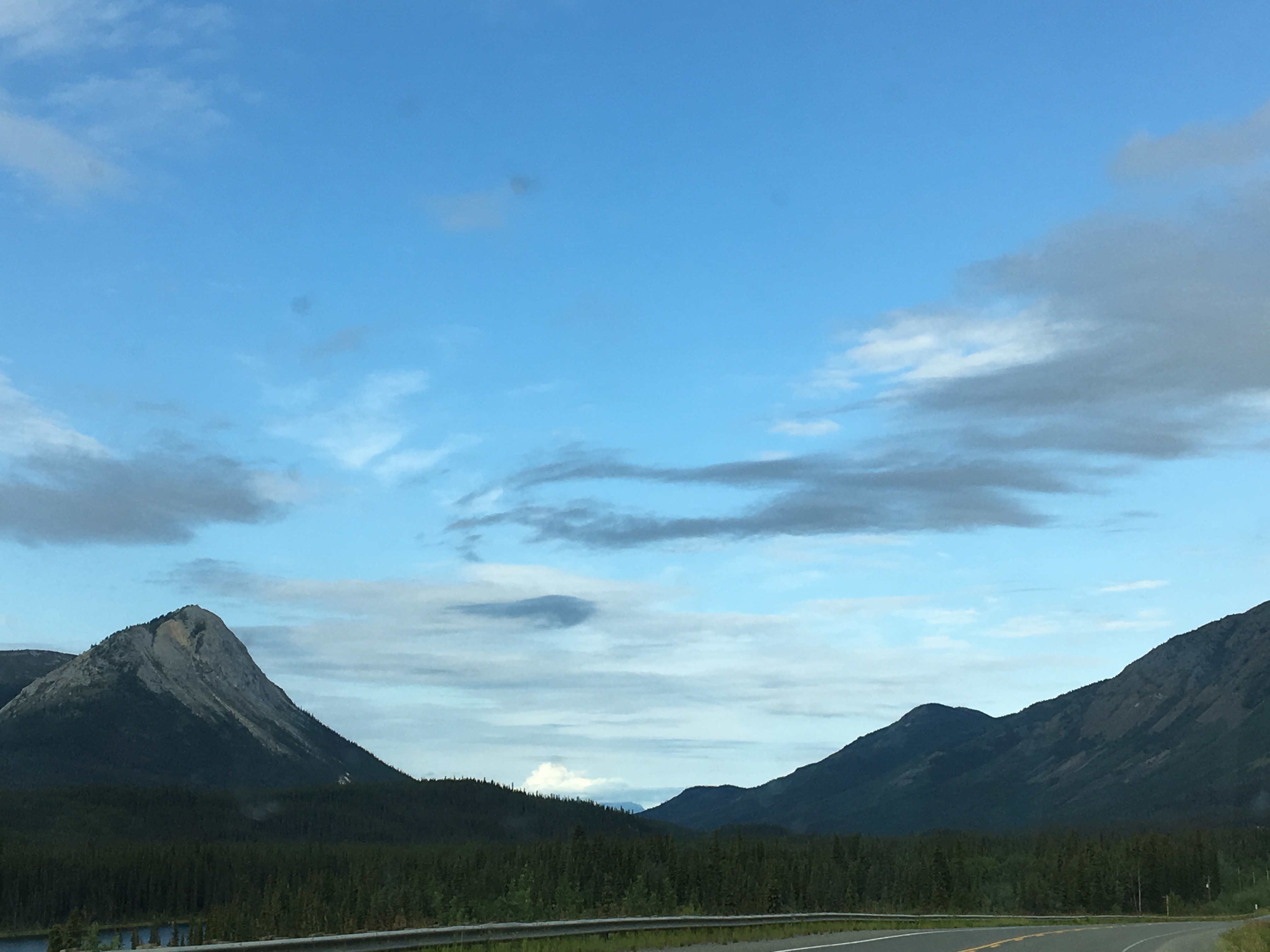
The towering peaks of Ranee (Elevation 2939 m/ 8817 ft.) to the west and Sirdar Mountain (Elevation 2804 m/ 8412 ft.) to the east, form the gateway into this next geographic plain. Some 72 Km north of Jasper we take Rt. 40 west from Hinton to Jarvis Lake Campground in the William A. Switzer Provincial Park. This is a no-frills dry camping park above the lovely Jarvis Lake. The camp sites are small with minimal privacy, there is no potable water, and there are pit toilets only. Though the lake is quite beautiful, we can’t enthusiastically recommend this campground as it felt too small, tight and seemed more geared towards local boaters, rather than traveling campers. The Provincial Parks in Canada vary quite a bit in their quality, their atmosphere, design and amenities as you will read later.
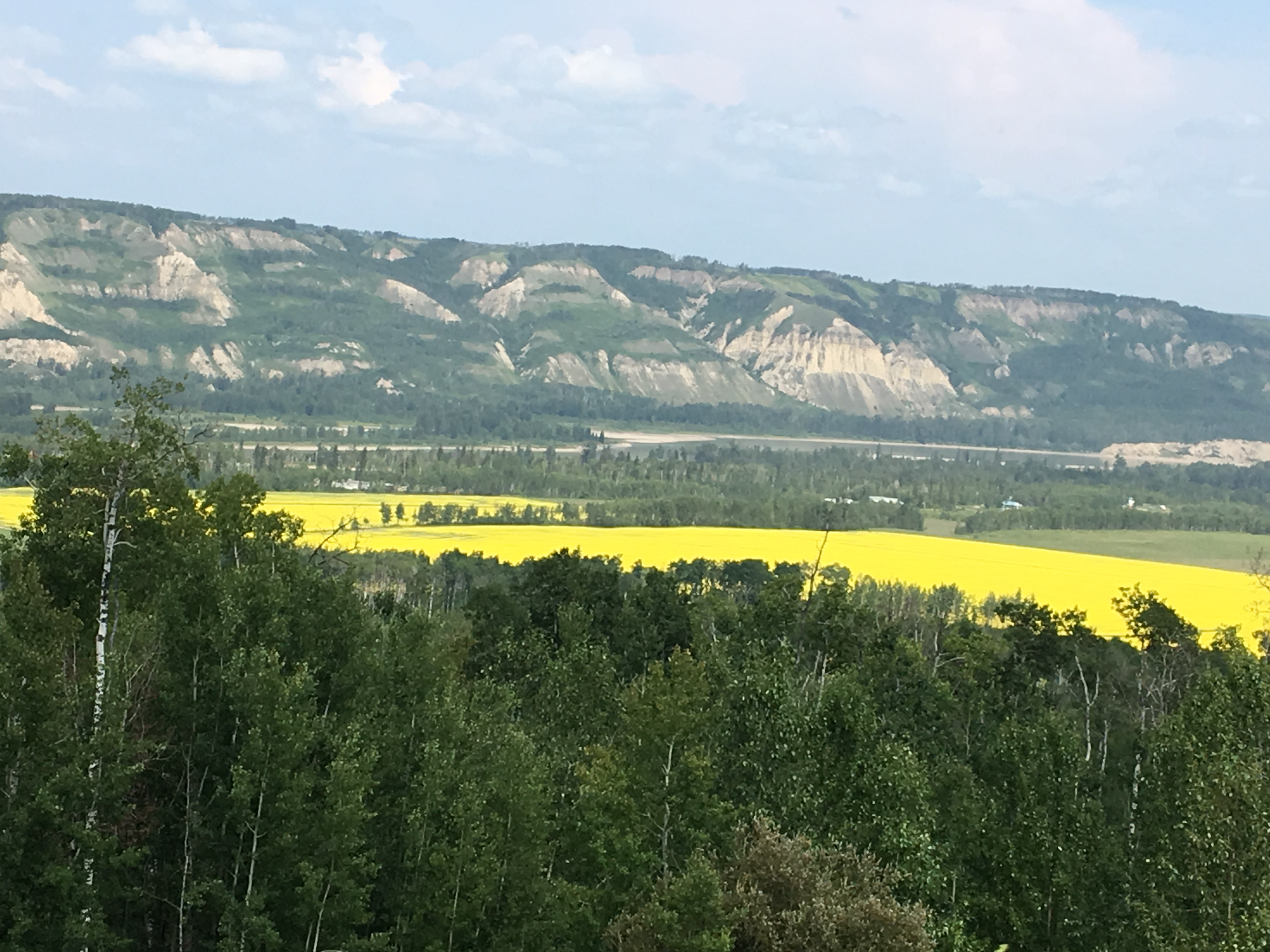
Leaving Jarvis Lake north on Rt 40 we are truly in total wilderness. The next town, Grand Cache is almost 140 Km, there are no services along this section of road and we see very few cars. From Grand Cache, a town that was only developed in 1969 for the purposes of resource development by the McIntyre Porcupine Coal, Ltd., it is yet another desolate 186 Km to Grand Prairie, a sizeable town that is our next destination. There is a certain beauty in the quiet and calm nature of this next portion of our route. We have at least temporarily left behind all traces of our formally urban lives, we are deep into the wilds of Alberta, and the sky has expanded its reach. And then, as sudden as the wind, we rise up over the next hill and come face to face with another golden field of canola.
Camp Tamarack RV Park in Grand Prairie is the next stop as we once again reach civilization. This park houses quite a few folks who are working on road construction all along the Canadian Highways so it is rather quiet during the day. The sites are not terribly private but we found this park to have the cleanest bathrooms and showers on this swing north. The host, Edward was the kindest and warmest proprietor we have met in some time and we highly recommend this stop. (FHU, $42/night Canadian) Grand Prairie is also a perfect town for supplies, be it pantry or vehicle.
Traveling in a northwesterly direction, we cross back into British Columbia 90 Km from Grand Prairie. The next town that we cross is Dawson Creek, the formal start of the Alaska Highway, formerly called the Alcan Highway, on our way to an uneventful stop at Pink Mountain Campsite and RV Park. The manager, Brian, was a character out of a Jack London novel and is worth stopping to talk to. His cell phone photos of bears and wolves are worth viewing, however, we cannot recommend staying at this RV Park. The bathrooms were rather dingy, the showers were coin operated and the place felt just a bit dodgy. The stop does have Diesel fuel; however, their price was the highest we have seen to date at $1.89/litre. (As mentioned in my opening post, the price of fuel needs to be carefully considered as you plan your budget. We had anticipated exorbitant prices in this region of NW Canada as well as in California and have budgeted accordingly) Though there are not many camping options along this path, 20 Km north of Pink Mountain is Sikanni River Campground and RV Park and may be a better option for this stretch.
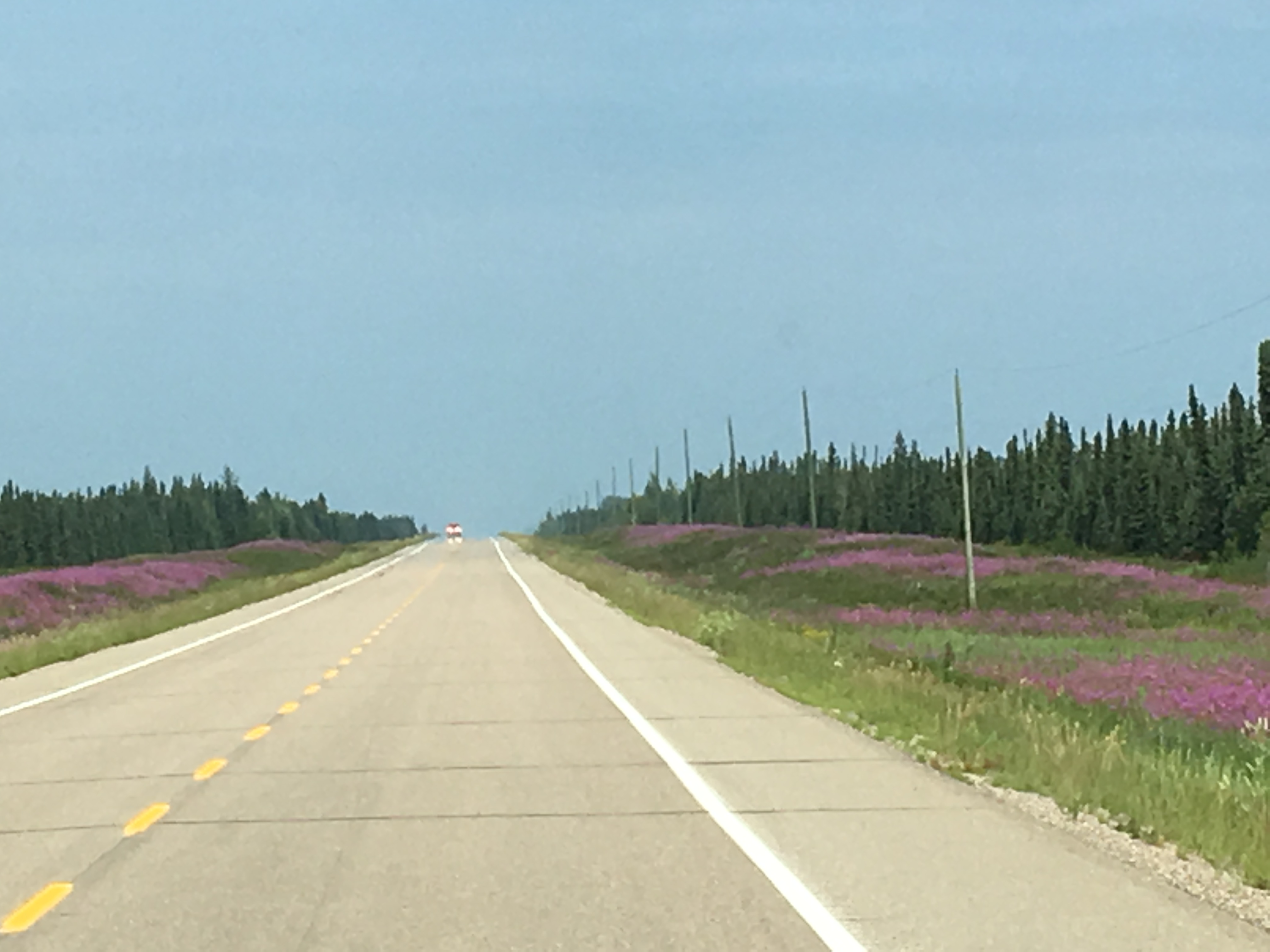
Traveling north on Canada 97, be aware that many sections of the road are under construction. You may encounter delays with varying stops of 10-20 minutes as this road is undergoing a major reconstruction effort. This is a difficult climate to maintain quality road surfaces and the Canadian government has committed a great deal of money and resources into this effort. The road does; however, provide plenty of gorgeous scenery. At one point the shoulders are peppered with Fireweed, the official floral emblem of The Yukon, as far as the eye can see. Driving through this cocoon of color feels as though we are dancing into a kaleidoscopic wonderland.
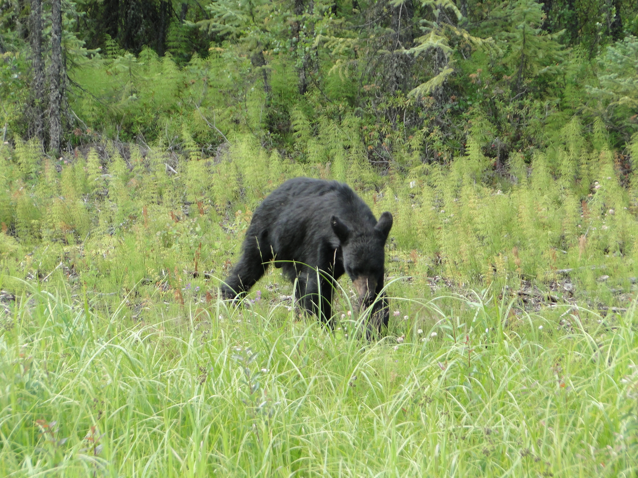
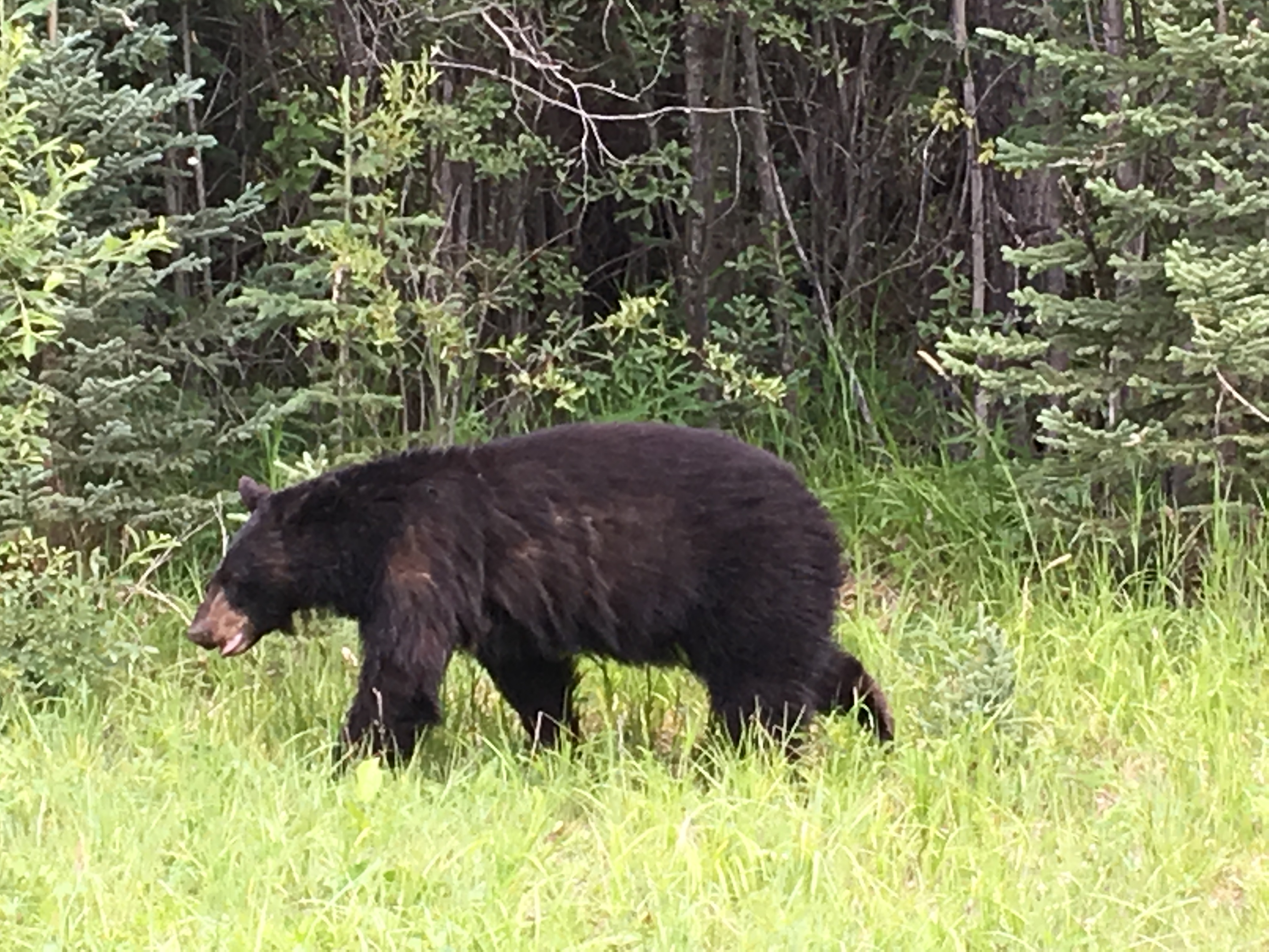
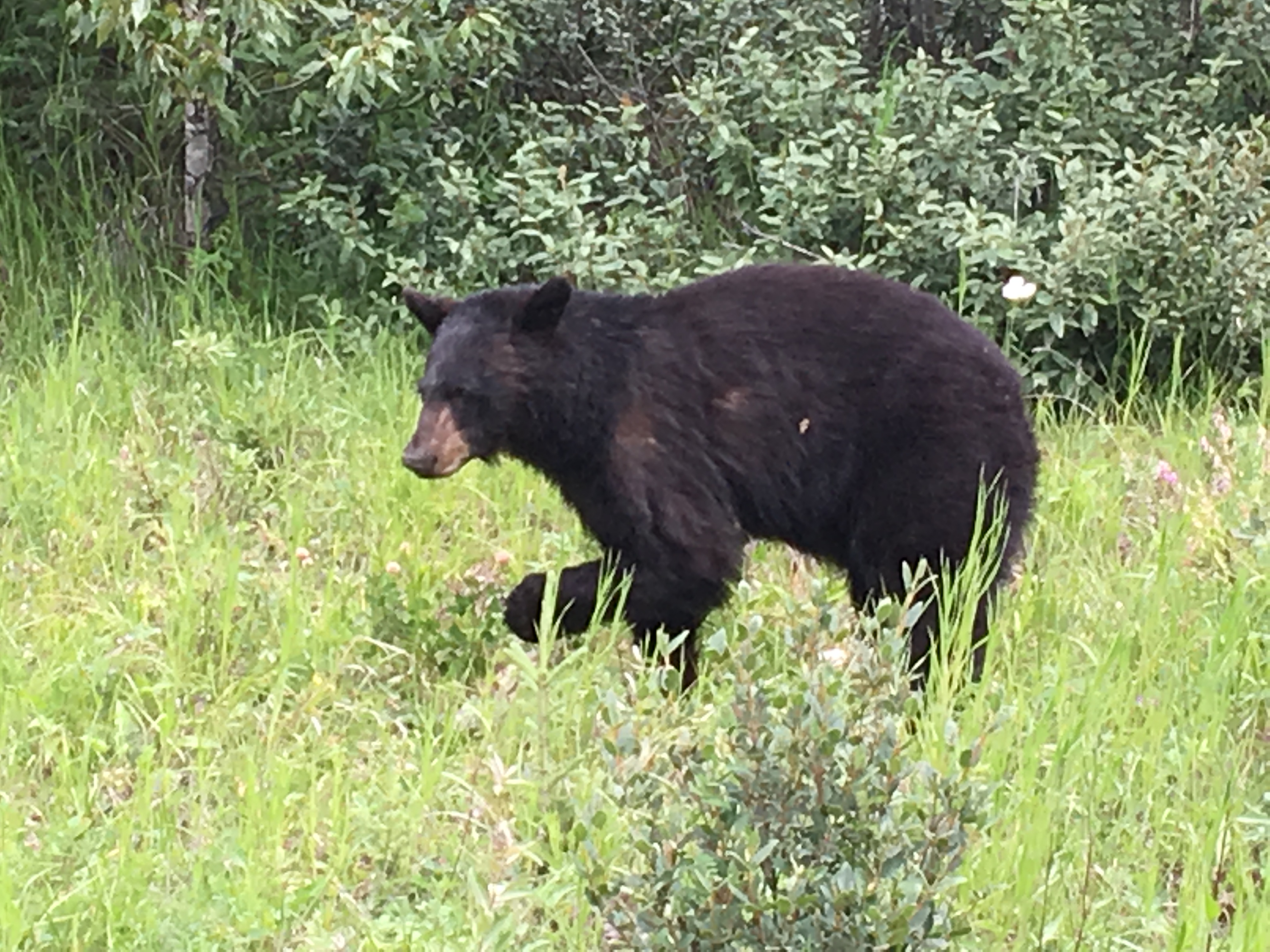
Just as we pass through this purple haze, we magically encounter a black bear meandering along the shoulder.

We travel next through Fort Nelson, another major supply stop, before the road enters back into what is called the Northern Rockies. The mountains have reappeared after two days of mostly high prairie on our way to a much -anticipated overnight at Tetsa River Lodge, advertised as the “Cinnamon Bun Center of the Galactic Cluster.”
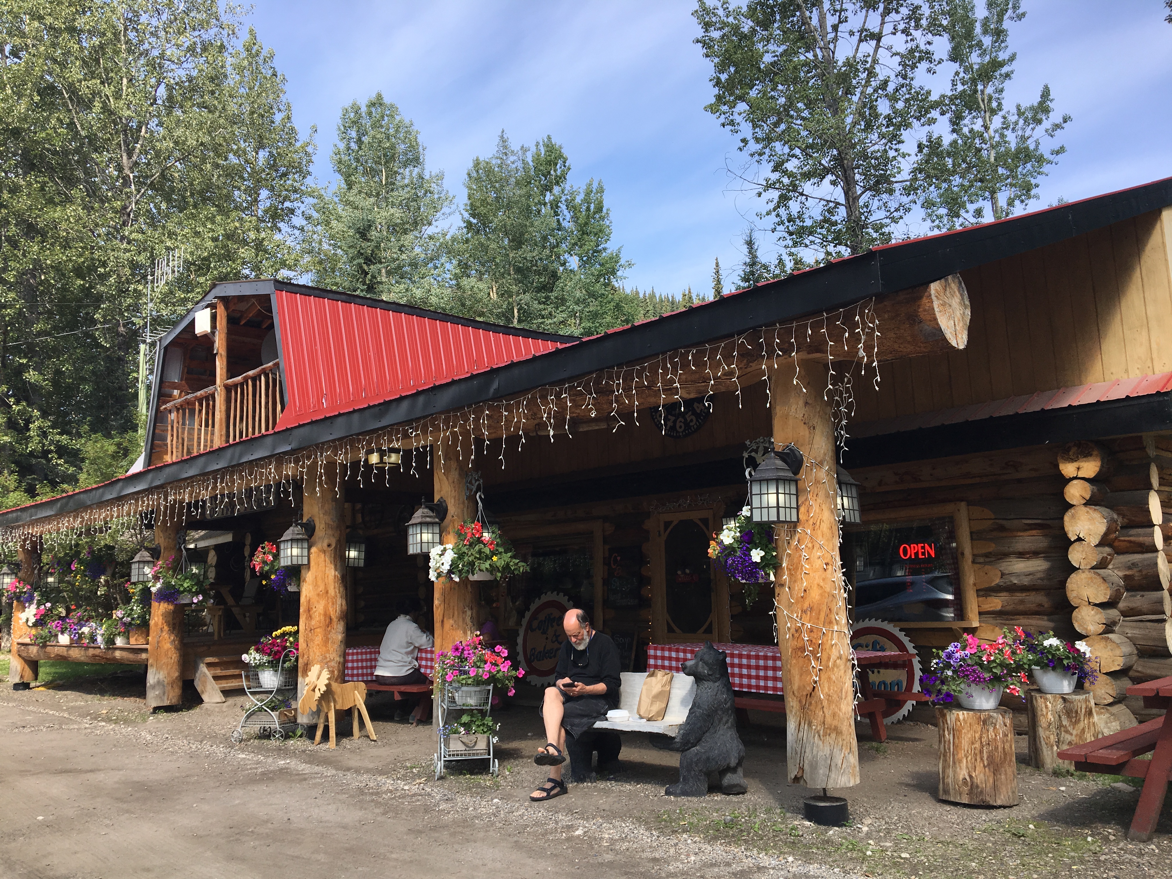
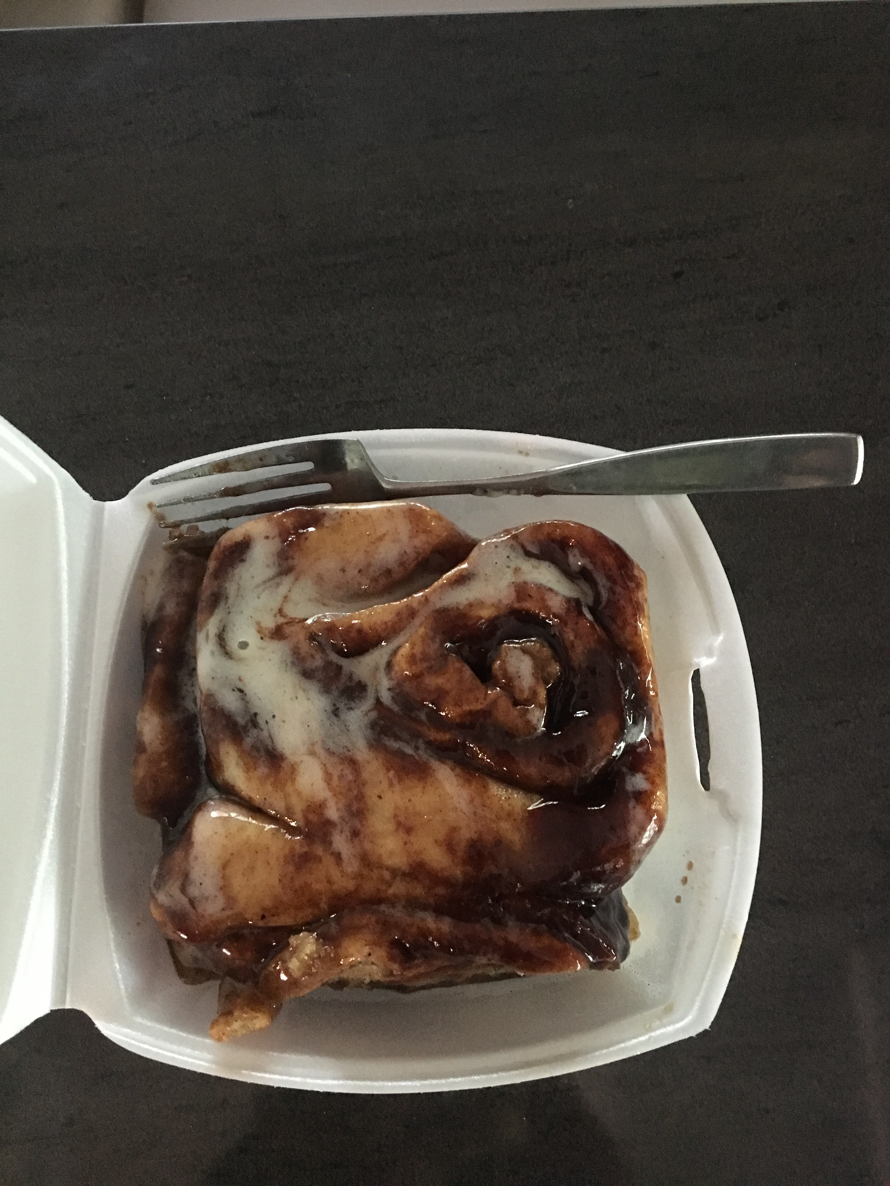
We have traveled over 5000 miles to get to this landmark and waste no time in purchasing the world famous cinnamon buns, hot out of the oven, even before we maneuver the RV into our site. Though we do wait to consume said delicacy till we moved to our campsite, the entire journey to date was worth the effort to finally bite into this north country specialty. The hosts, the Andrews family, are the third generation to maintain this wonderful way station along the Alaska Highway and they also offer homemade breads and artisan meats. The sites all have just 15- amp power, but do have water and sewer hook-ups. There are also very clean bathrooms and showers. ($35/night Canadian) If you stop here, do chat up the hosts as the wife is a wonderfully sarcastic and humorous mountain woman and enjoys visiting with her guests.
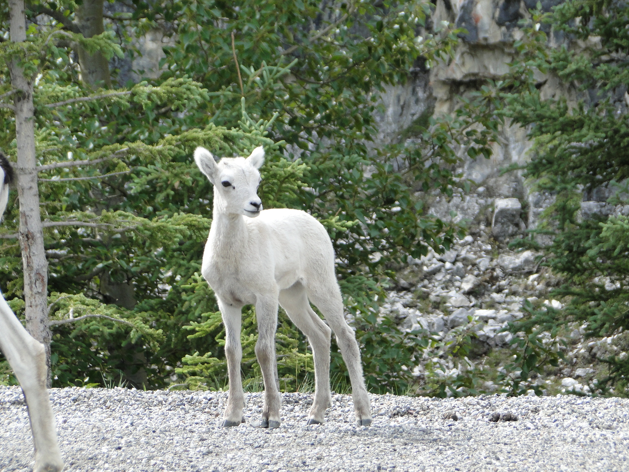
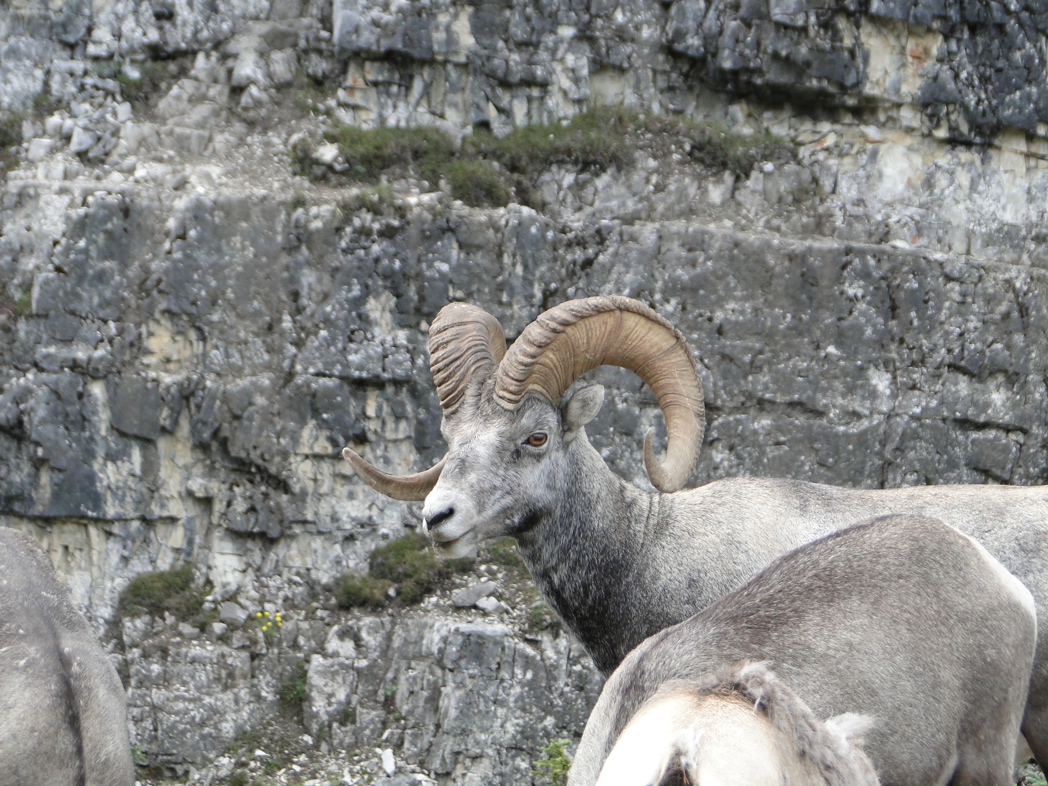
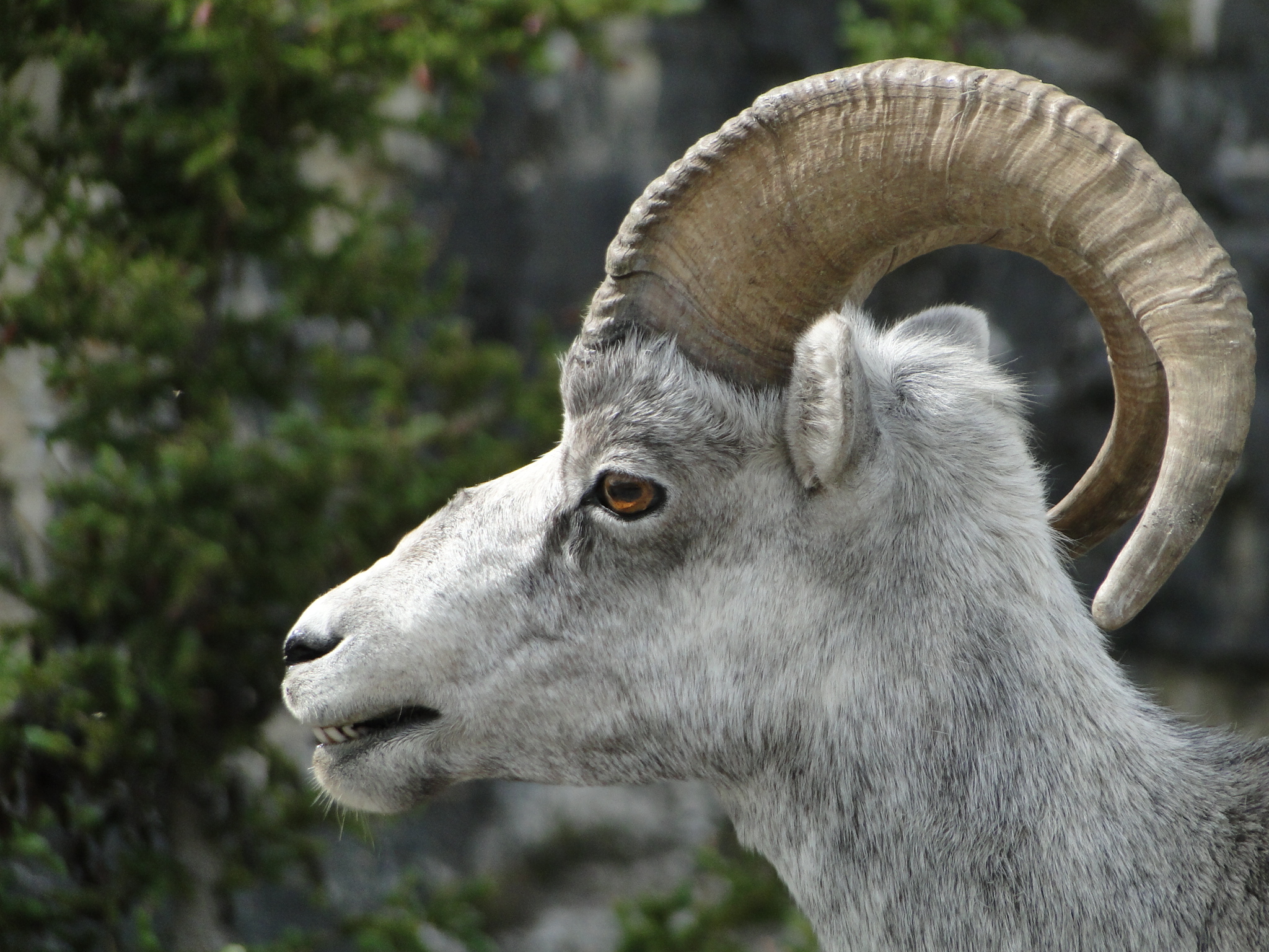
The drive west from Tetsa River begins a non-stop wildlife exhibition. 15 minutes out of the campground, we visit with a family of long horn sheep that has stopped traffic in both directions.
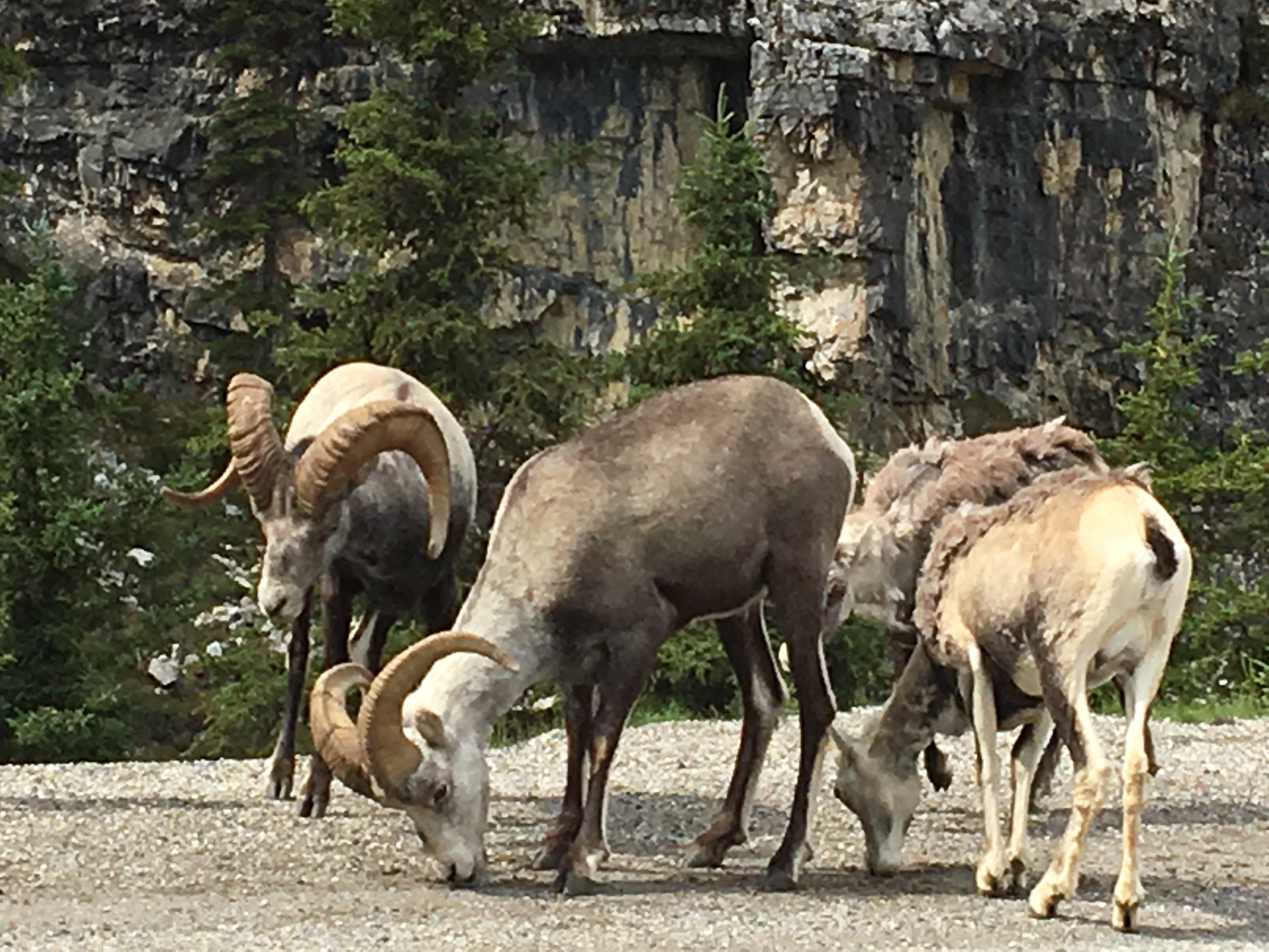
Note: The signs along the highway suggest that when you see wildlife, turn on your 4-way flashers to alert others of the sighting as you pull safely off the road. This practice truly offers a nice warning and can be seen from a good distance.
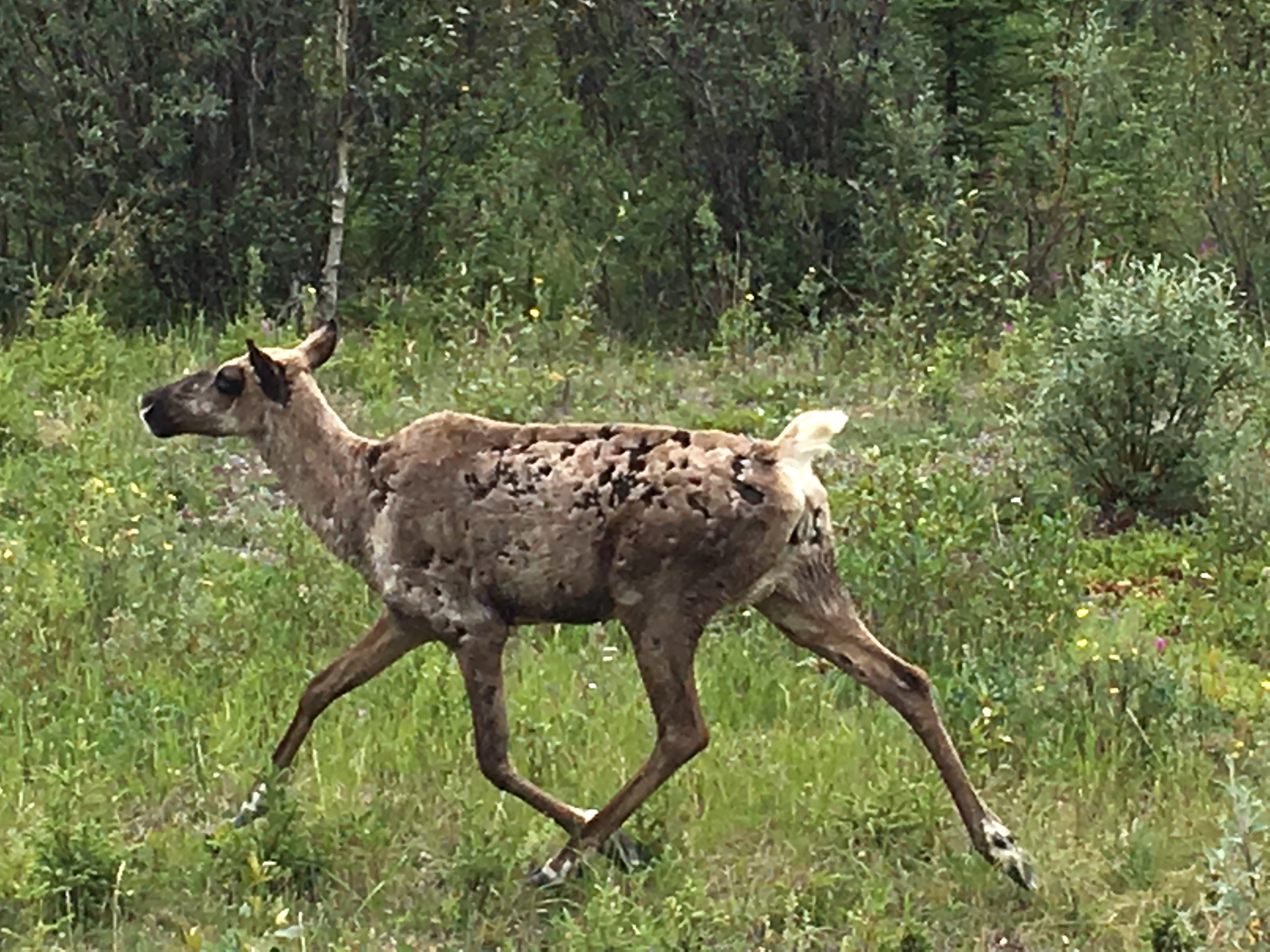
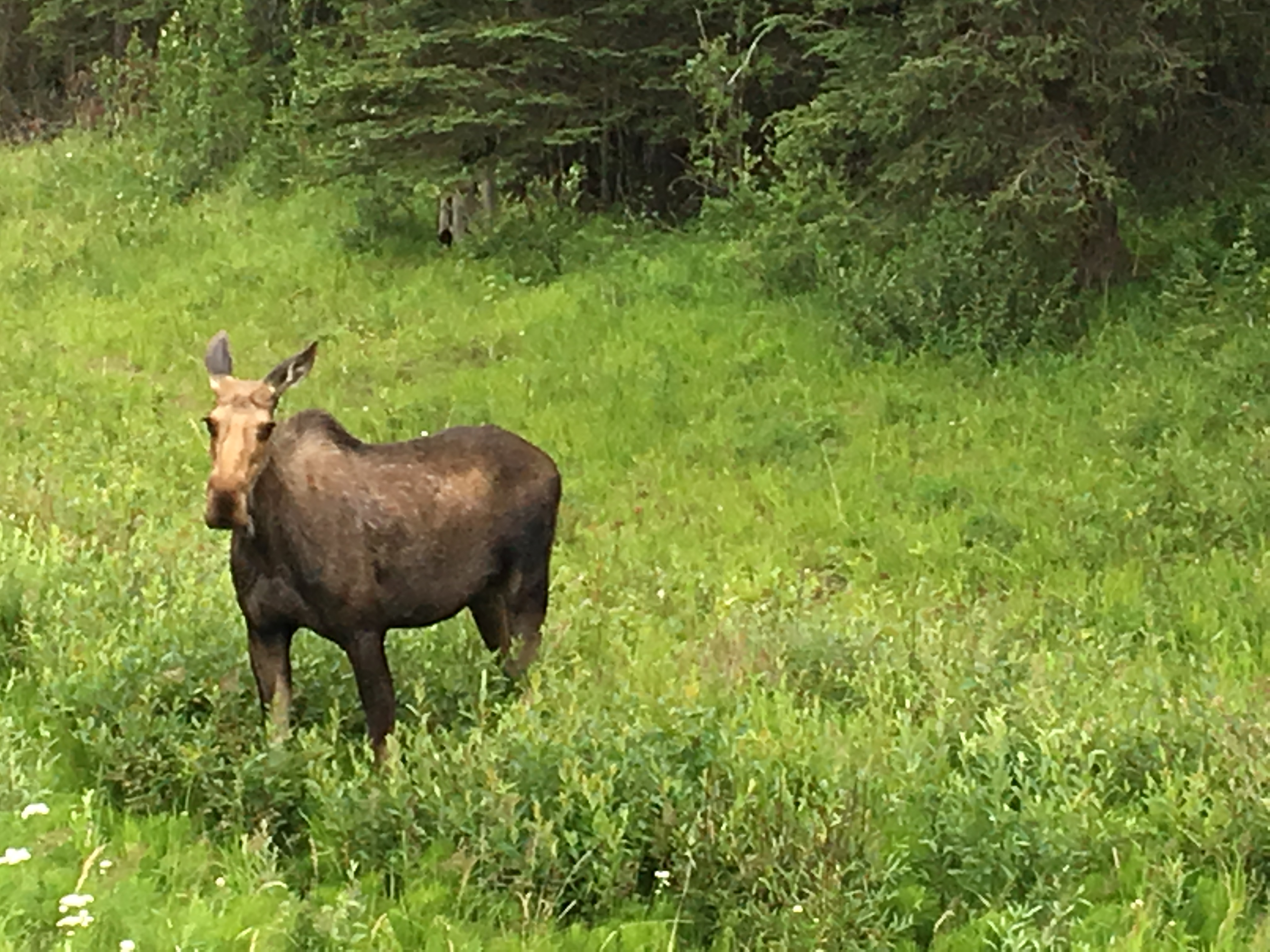
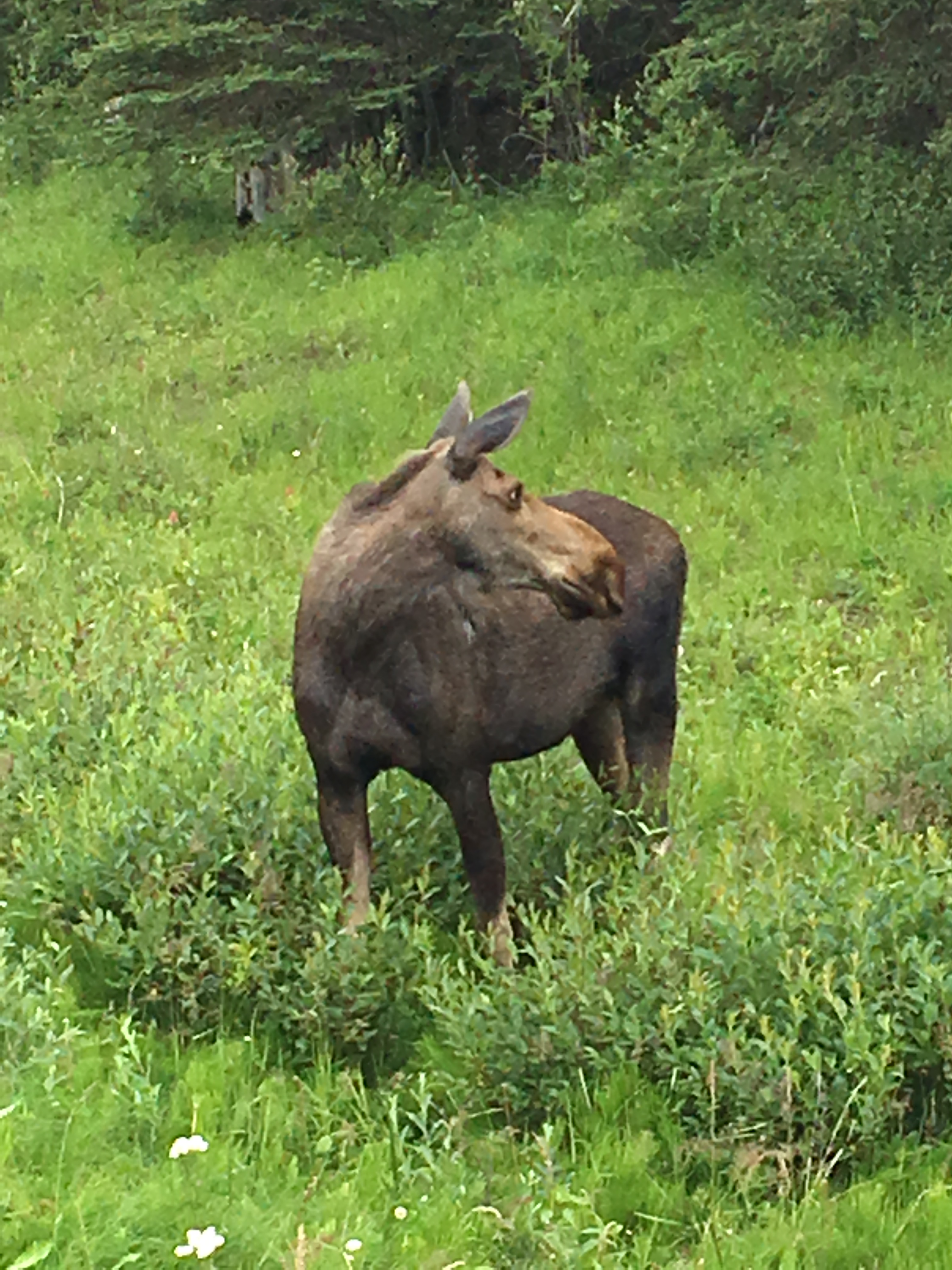
Shortly after the sheep, we spotted a young moose that was clearly confused with traffic and was not sure how, or if, to cross the road. The moose ran parallel to the road as we followed but finally made its way safely back into the brush.
As we continued north, we next spotted a rather large black bear that put on quite a show for us as he was nibbling at the berries along- side the tree line. The bear was not at all bothered by our relatively close proximity and continued feeding as we drove on.
Not too terribly far from this last sighting we came upon an adult moose. This sighting was indeed a special treat as this moose stayed close to the road and did not seem bothered by our presence for quite some time. However, a family in a rather large camper stopped just in front of us and as they rolled down their windows to take photographs their barking dog scared the moose back into the woods. If you do travel with an animal, please remember that we are the visitors and should minimize our impact on their home.
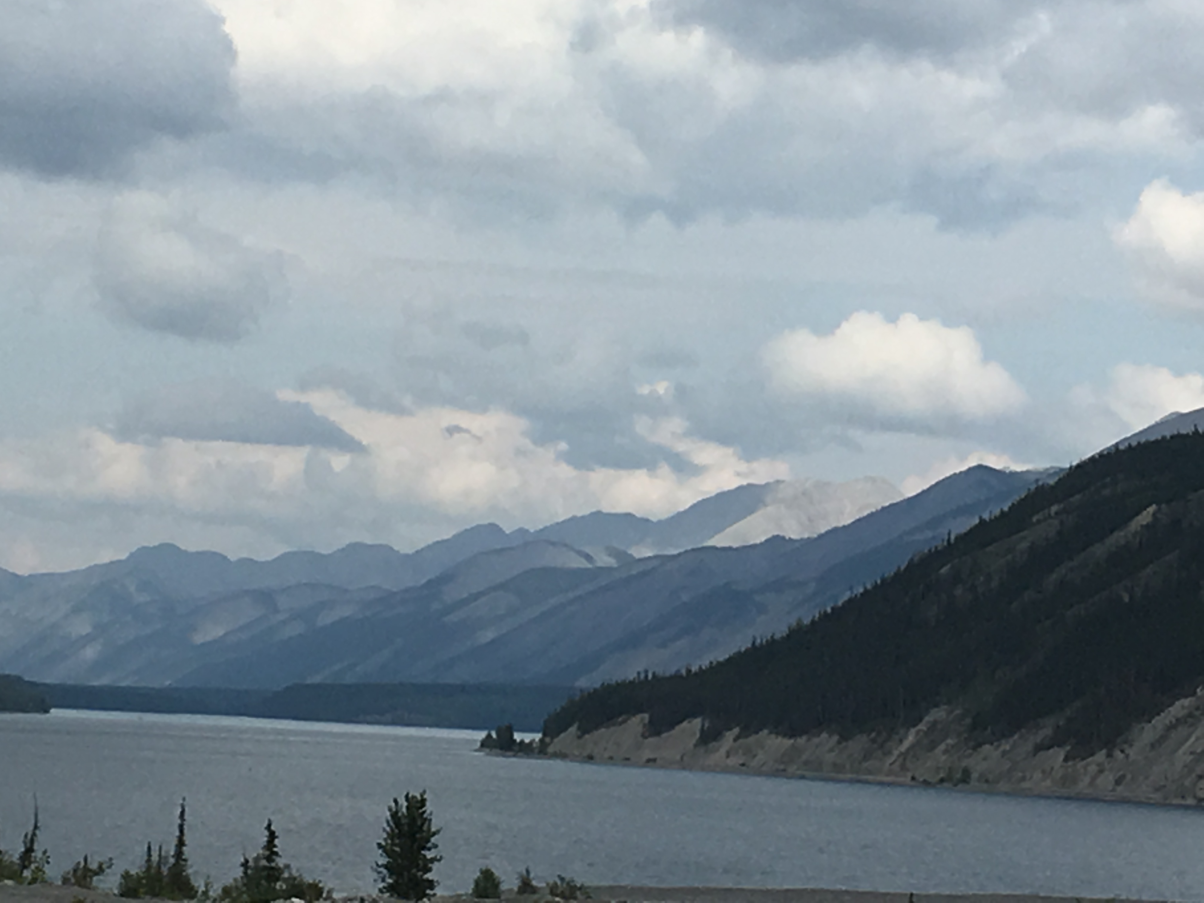
This non-stop wildlife viewing was a major highlight of our day as we traveled next to the Liard River Hot Springs Provincial Park. Before we arrive at this next Provincial Park, the road travels along the 7.5 Km long Muncho Lake, one of the largest natural lakes in the Canadian Rockies. This remote lake, population 29, is known for its beautiful deep green/blue waters. Muncho, “big lake” in the Kaska language is a fishing favorite featuring Dolly Varden, some grayling, rainbow trout, whitefish and lake trout. (Record lake trout- 50 lbs.)
Less than an hour west of Muncho, we arrive at our next destination, Liard River Hot Springs Provincial Park. This park and adjacent hot springs have long been a favorite stop for Alaska bound travelers. The camp sites are beautifully designed to maximize privacy, and the camping fee includes the use of the hotsprings. There are no amenities at this campground, but the hotsprings pool is just a short walk down a beautifully crafted winding boardwalk through the adjacent wetland.
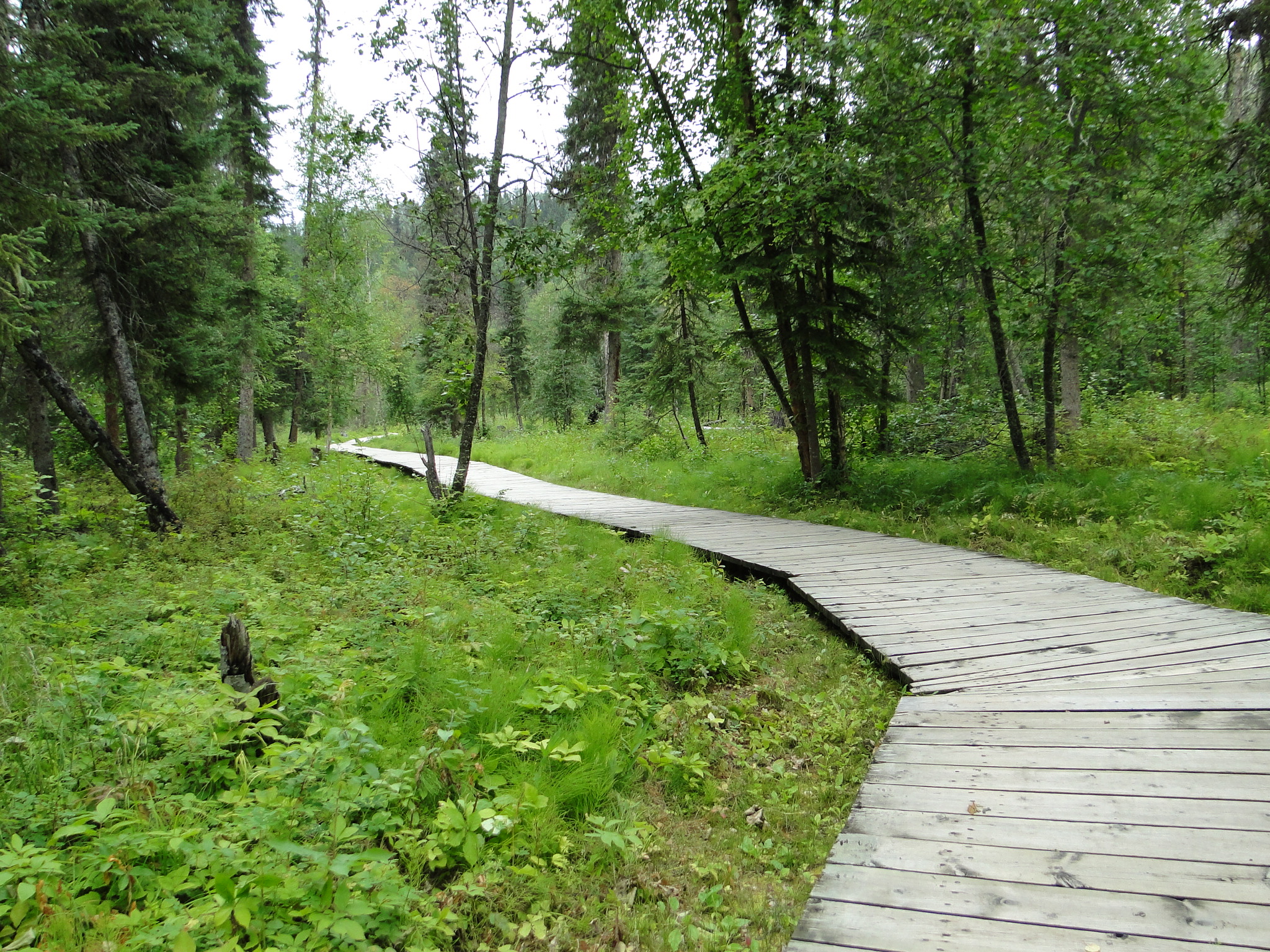
The wetland supports more than 250 boreal forest plants, including 14 species of orchids. Moose and bears are rather common visitors to this area as well and in fact a moose was spotted alongside the boardwalk just moments before we passed one day.
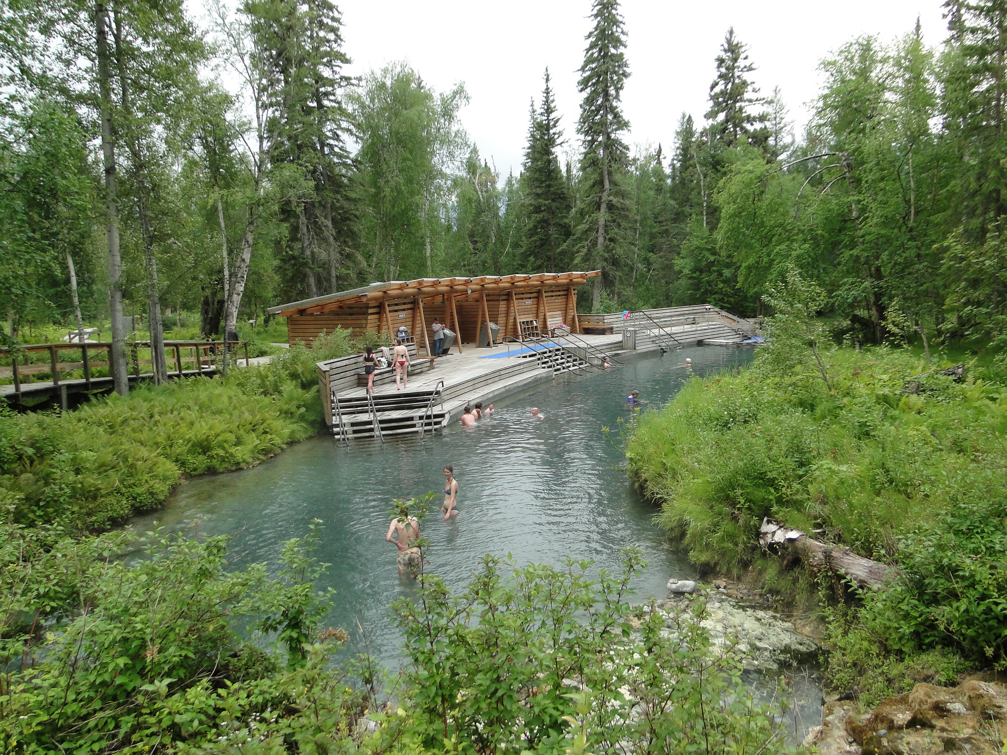
The temperature of the hot springs vary by how close you are to the in-flow from the spring but run from 107 to 127 degrees. At the far end of the pool though the water cools rather quickly and one can even walk to the creek outflow to cool water. All of the patrons at this campground are specifically there for the hotsprings and take the 20 minute walk to the pool a couple of times a day for a therapeutic soak.
Reluctantly we left Liard Hot Springs early the next morning for a longer than normal day to Teslin, in the Yukon. This drive through Watson Lake is intended to get us further into the Yukon so that we can get to Alaska a little sooner. Within five minutes of leaving the Liard River Campground we encounter an enormous Bison Bull, majestically commanding the hillside.
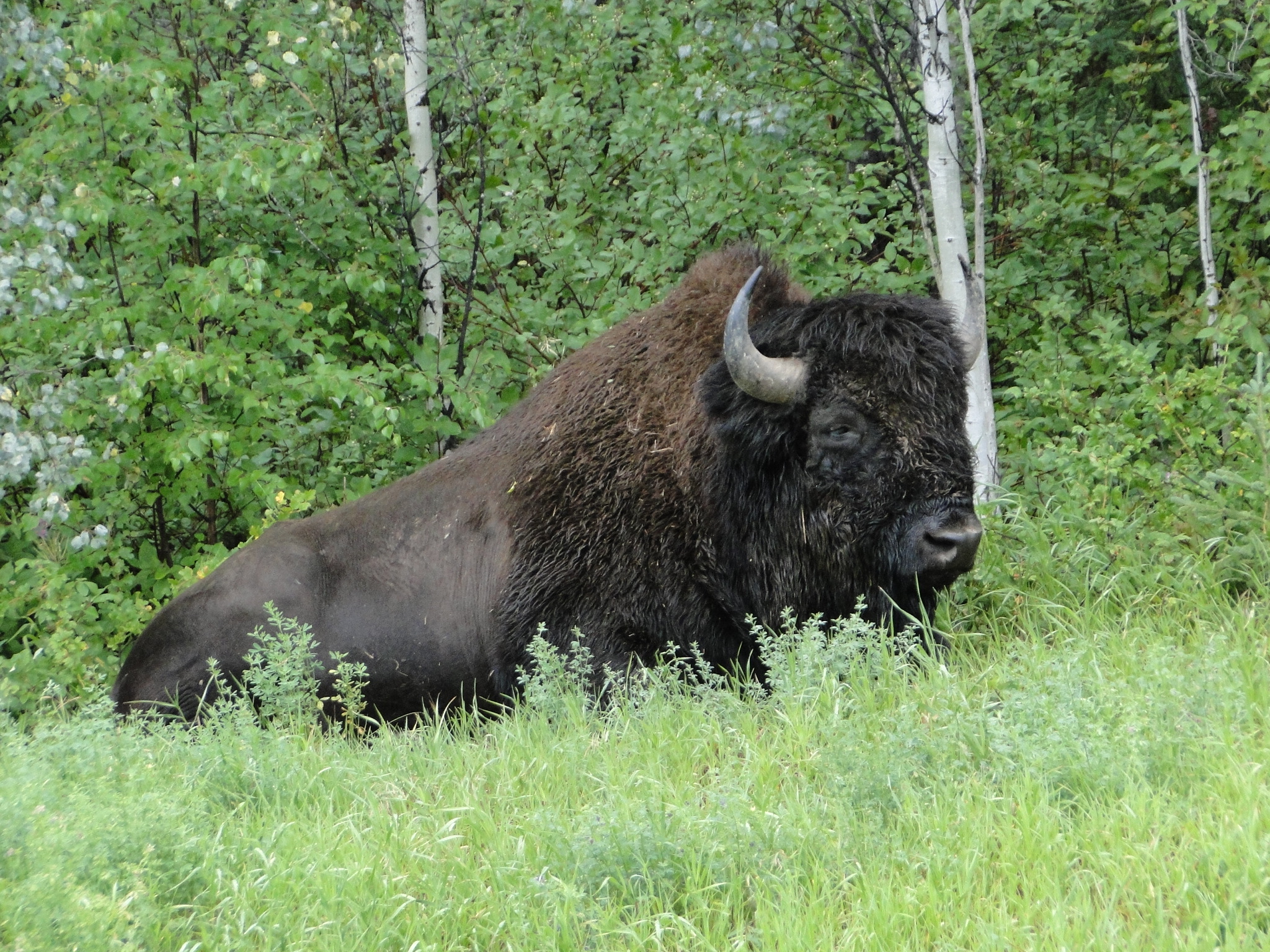

The bulls are known to wander alone or with just one other bull until mating season. We had been warned the night before by some south- bound travelers that there were a couple of herds of bison on this stretch of road and like clockwork, they appeared as predicted.
This stretch of road, waving along the Yukon/BC border rolls through the Cassiar Mountains, a lesser range of the northern Rockies. The road dips deep into valleys and then ascends again along winding paths of rather bumpy, recently repaired roads. This section of road through the Rancheria Valley has loose gravel, stones and sand flying and requires a much slower pace. (We already have sustained two windshield cracks, but we are reminded that if you’re driving to Alaska, don’t bother having your windshield repaired until you leave the state) We make a quick stop at Watson Lake for some supplies but also to see the world famous Sign Post Forest, a small park laden with signs that travelers have attached to posts that the community continually install for this explicit purpose.
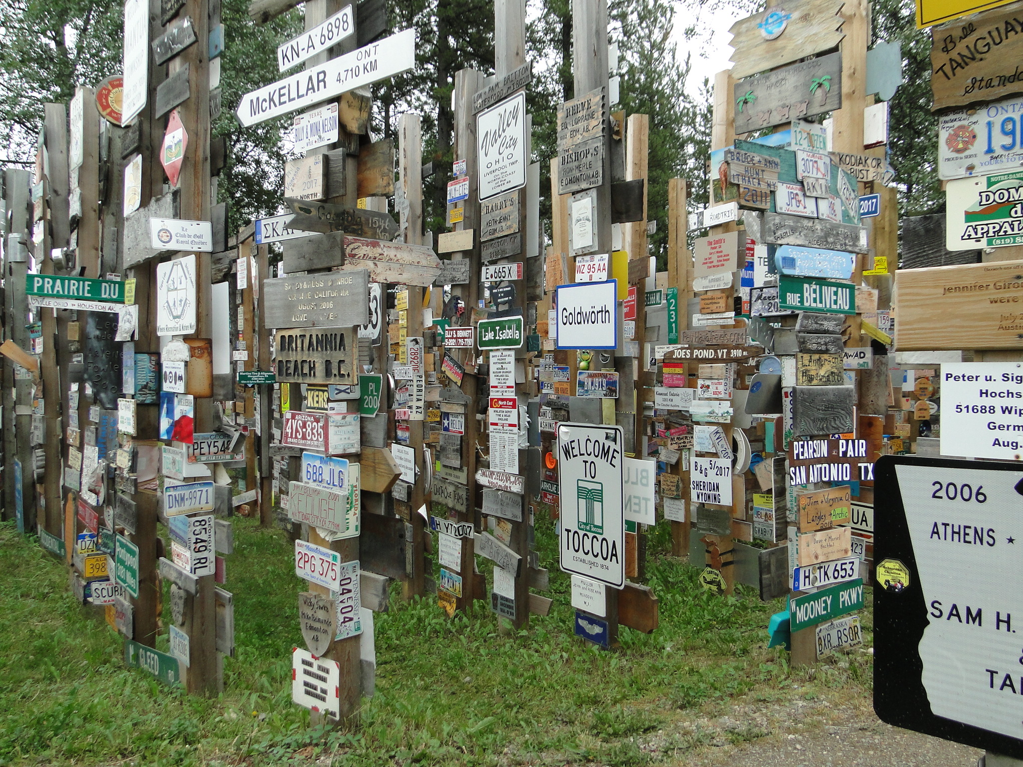
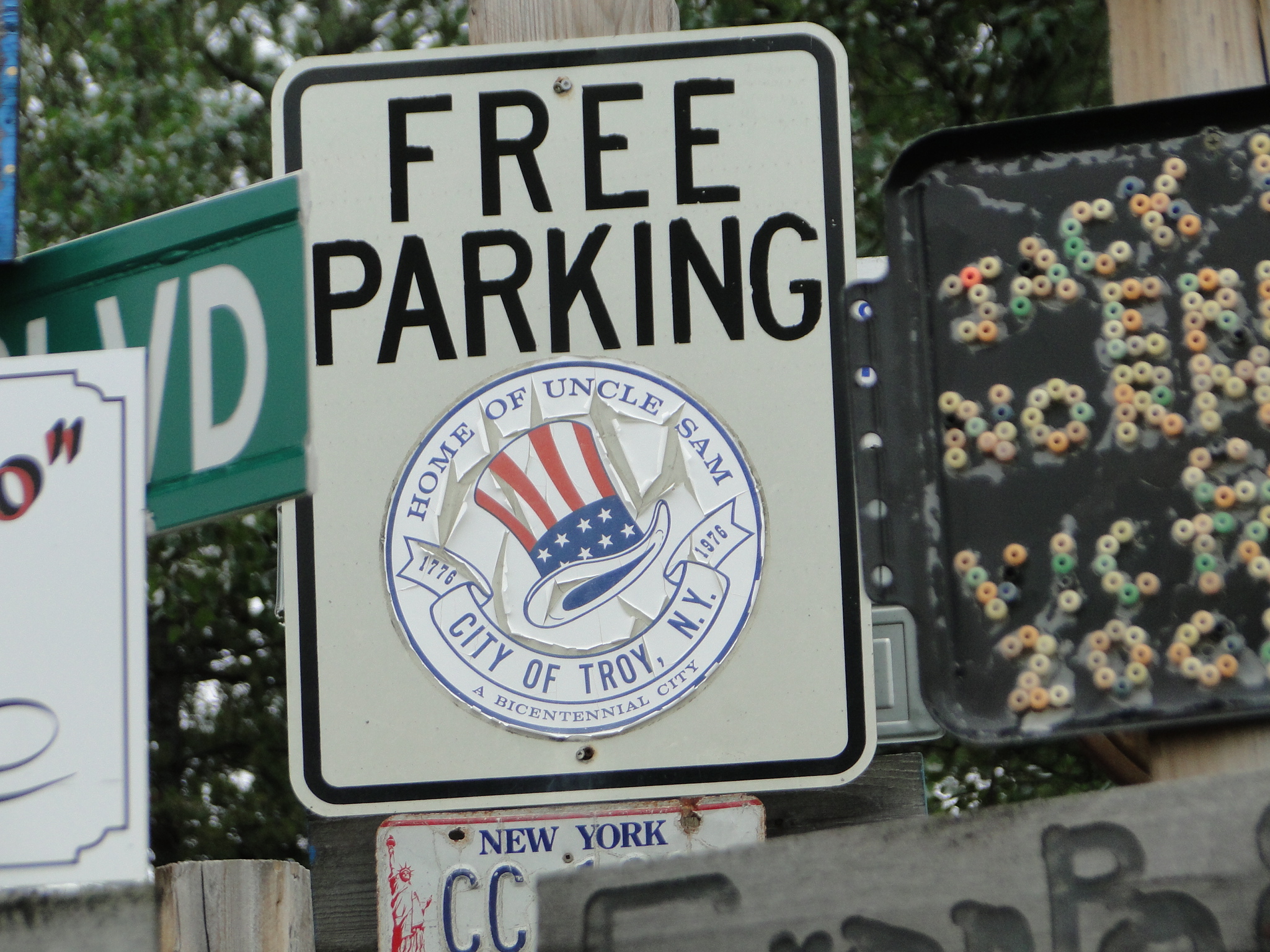
At last count there are over 88,000 signs and counting and we even find one from Troy, NY, close to our point of departure some seven short weeks ago. Apparently, people bring prepared signs to hang here as evidenced by some rather elaborate hand -carved pieces.
At Watson Lake is also the Northern Lights Centre where is advertised a “mysterious, mystical, magical” Aurora Borealis show in “SciDome HD Projection with System 360.” A fellow traveler did highly recommend this show, though we opted to pass as we have previously seen an amazing aurora show in Anchorage. (We are also hoping to see the aurora in real time though the very late sunsets require extremely late viewing.)
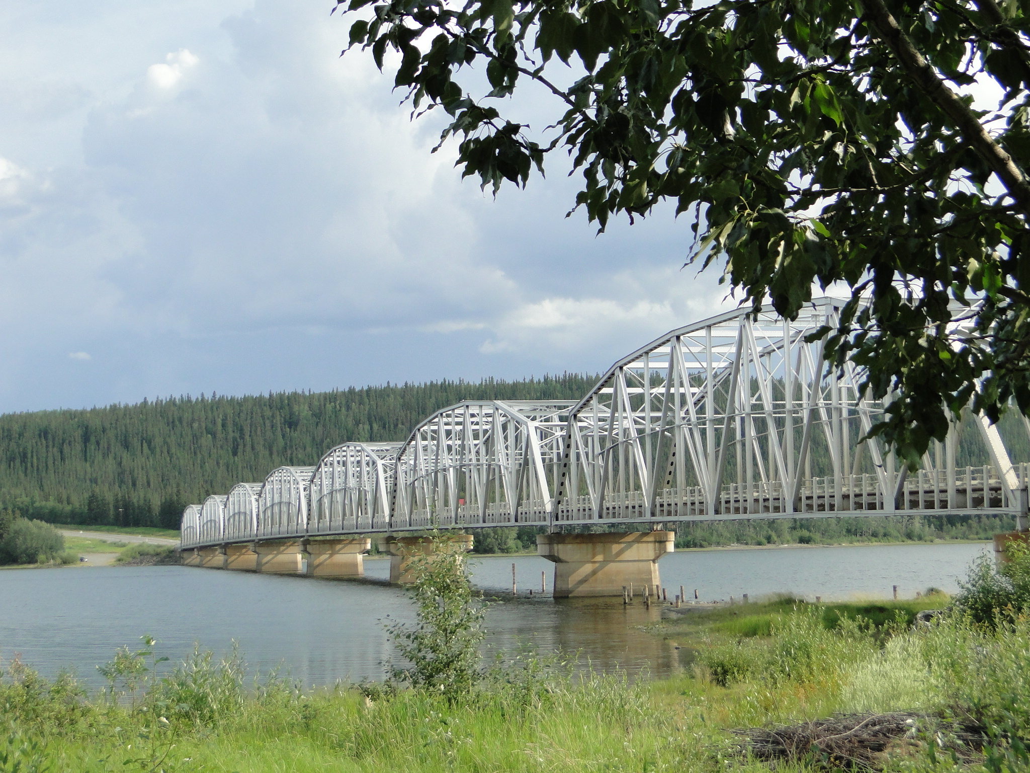
Three hours NW of Watson Lake we cross the Nisutlin Bay Bridge, the second longest water span on the Alaska Highway at 1,917 feet/584m.
The Nisutlin River forms the bay here as it flows into the Teslin Lake, which ultimately forms the Nisultin Delta National Wildlife Area, an important waterfowl migration stopover and is adjacent to our next campsite at the Yukon Motel and Lakeshore RV Park. This is what we call a parking lot camp, where RV’s are essentially in rows, but supplied with power and water services. However, we are on the lake adjacent to the bridge and the facility has hot showers and a laundromat. We also meet some very nice folks from Maine here who graciously share some of their salmon catch from a fishing trip in the Kenai Peninsula, AK where we will be in a few short weeks.
The town of Teslin, like many towns in the Yukon began as a trading post in 1903 and has one of the largest Native populations in the Yukon. The Tinglit (Klink-it) livelihood revolves around hunting, trapping and fishing though quite a few of the members trade in traditional woodworking crafts. The Yukon Motel has an exceptional Wildlife Gallery owned and managed by the Tinglit and is worth a visit whether or not you stop here overnight. We also visited the George Johnston Native Museum of Tinglit history. This small museum houses a wonderful collection of artwork, artifacts and history of the Tinglit Band and has a delightful 45 minute movie on the history of its namesake, George Johnston. The town of Teslin and the local population were forever changed by the construction of the Alaska Highway by the US Military in the 1940’s. The road was built by the military in order to move weapons to Alaska by land in support of the war effort. In addition to creating jobs and access to more consumer products, the military also brought diphtheria and pneumonia that wiped out a large portion of the native population. The Tinglit never fully recovered from this health crisis and today their numbers continue to dwindle.
Leaving Teslin, we are once again headed northwest, to the town of Whitehorse, the capital of the Yukon. Perched along the banks of the Yukon River, Whitehorse was a bustling stopover for stampeders traveling downriver to the Klondike goldfields in the late 1800’s. To this day it is a center of commerce and business in this enormous province and is home to nearly 31,000 people, about 75% of the total Yukon population. However, Sunday is not a good day to visit. Many of the stores that we had been told about are closed on Sunday, in particular the Alpine Bakery which came recommended by several fellow travelers.
Note: We needed some minor electrical work done on our RV and had contacted three shops a couple of days before we arrived in Whitehorse. The only shop in Whitehorse that was open on Sunday agreed to pick up the part that we needed the day before so they would have it and did in fact do our repairs in a very timely and professional manner. GoNorth Car & RV Rental (www.gonorth-yukon.com) Thank you to Alex for his quick diagnosis and friendly demeanor. Always a pleasure to have a good vehicle repair experience.
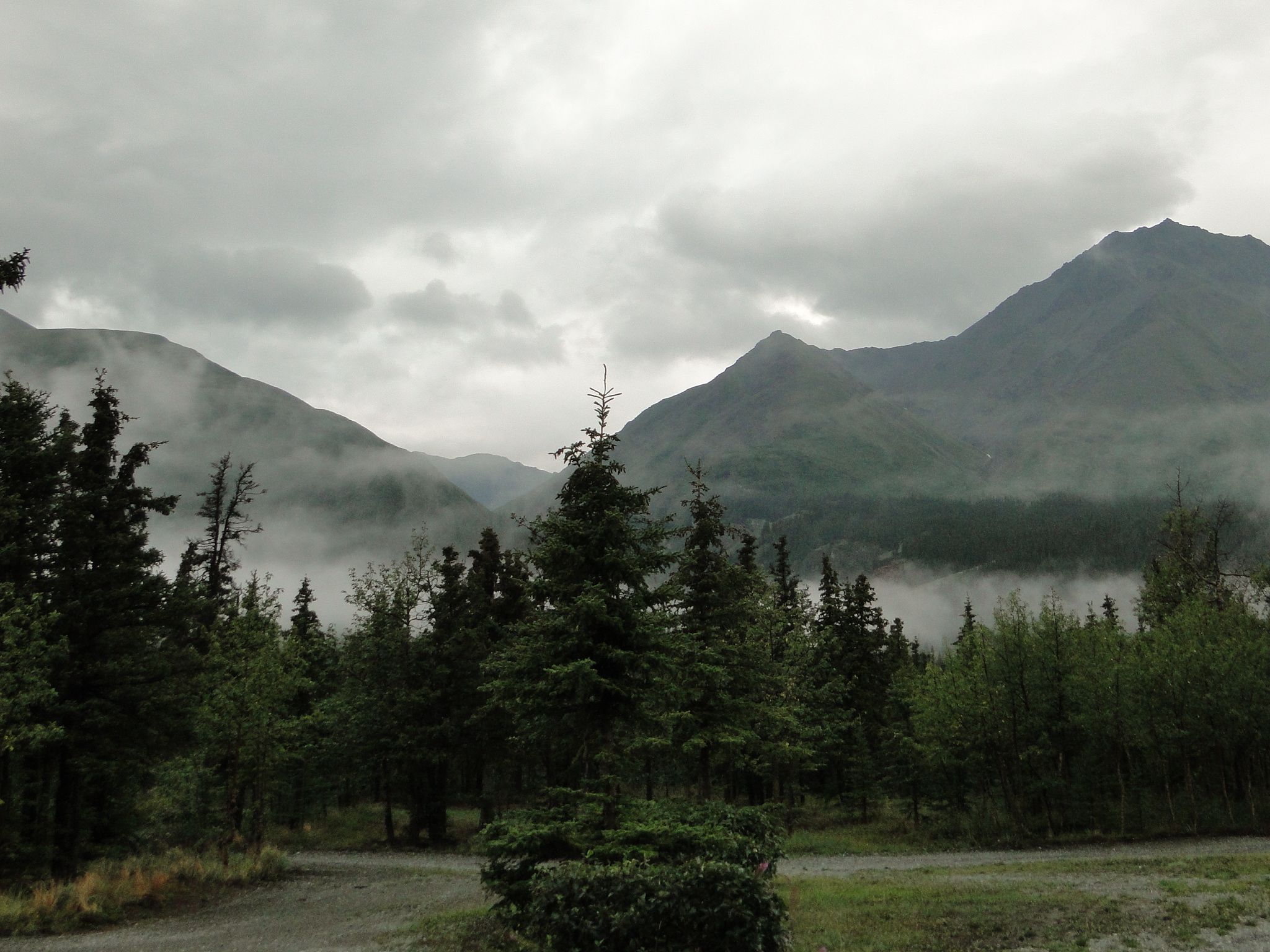
Leaving Whitehorse heading due west, we are approaching the Saint Elias Mountains that span both the Yukon and SE Alaska. These are the mountains that drew us back to Alaska after our previous visit did not allow enough time to travel to this region. This range includes the 16 highest peaks in Canada, including the granddaddy, Mt. Logan at 6517 m/19,551 feet. However, due to continuous rain storms and wildfires that are currently peppering much of the Yukon and Alaska, we are unable to see the peaks of the Saint Elias.
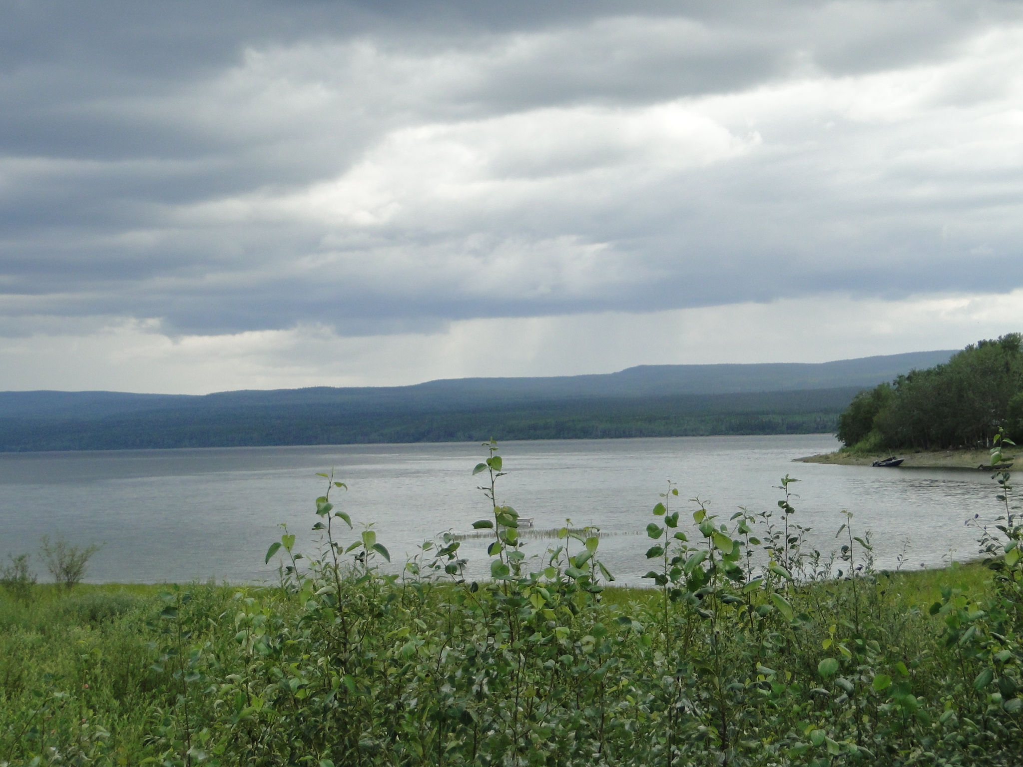
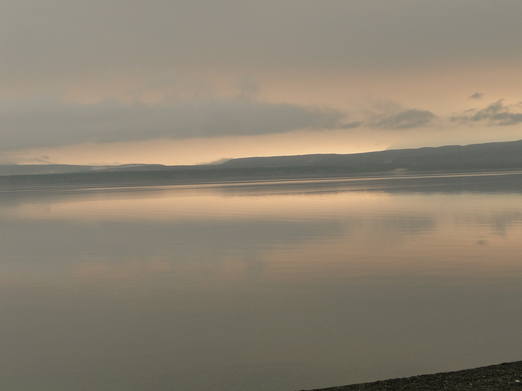
We travel through Haines Junction at the foot of the mountains and we are able to see only the foothills but these massive peaks are obscured. (We will be coming back through this path in about 3 weeks on our way to Haines, Ak so we trust that the weather and fires will subside for our viewing pleasure!) Our destination for the next couple of days is the Cottonwood RV Park at Destruction Bay on the shores of the most beautiful Kluane Lake. Destruction Bay earned its name when a storm destroyed buildings and materials that were stored here during construction of the Alaska Highway. It was one of many stations spaced at 100 mile intervals for truck driver rest and repairs.
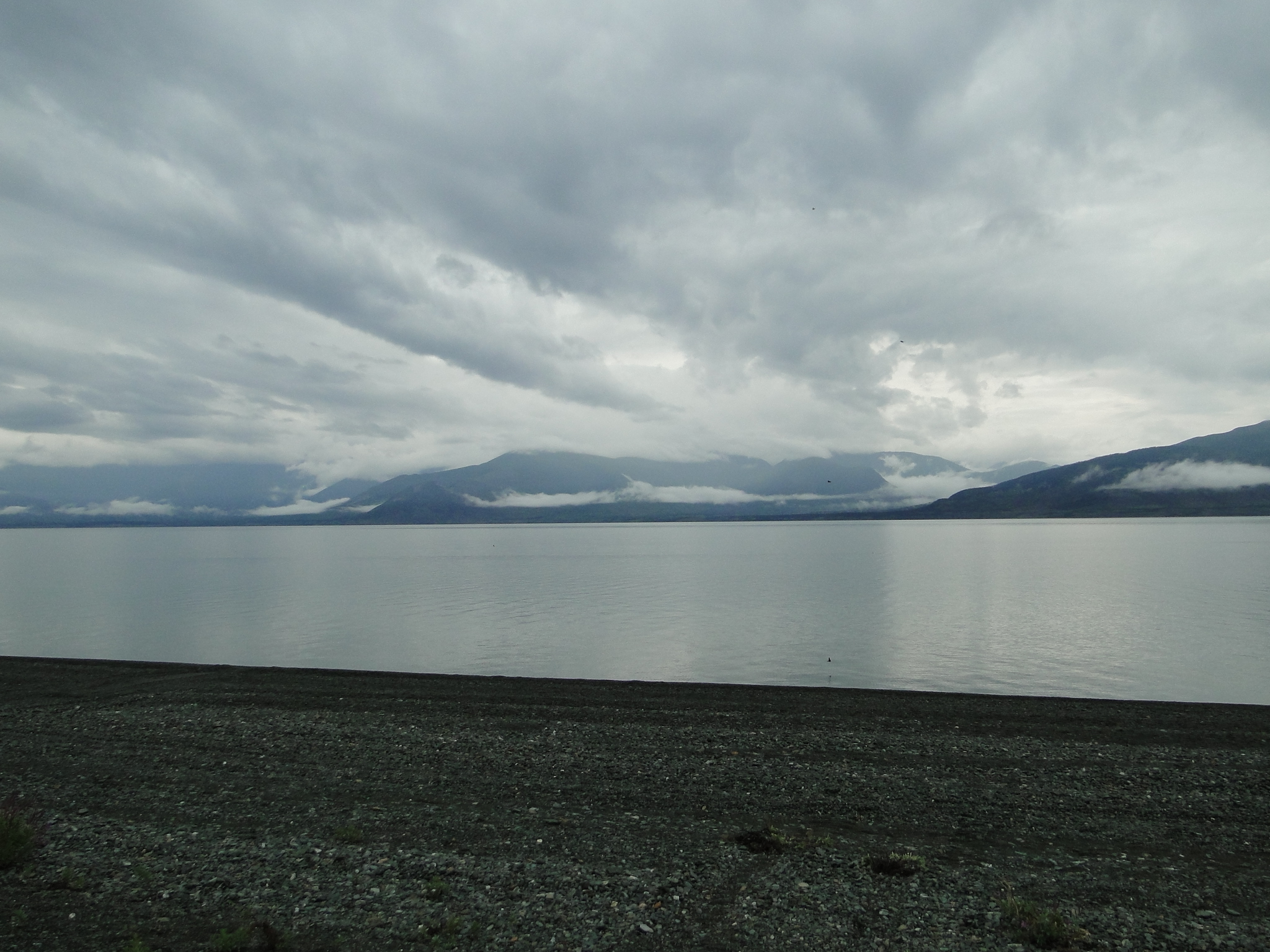
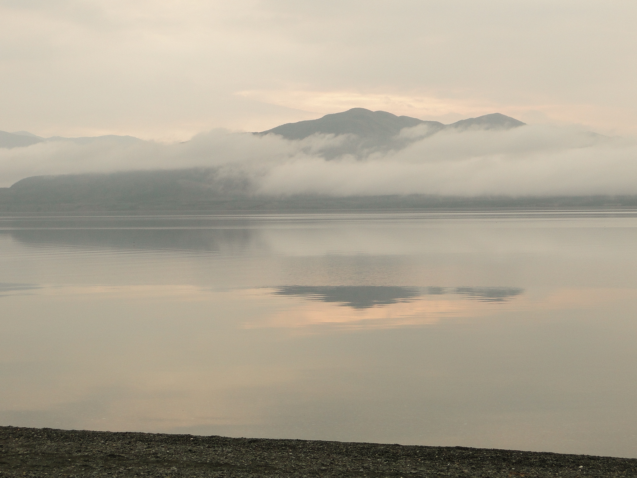
The Cottonwood RV Park sits on the shores of Kluane Lake, the largest lake in the Yukon, covering approximately 154 square miles and is fronted on the east by the Ruby Range. The grandeur of the surroundings was somewhat diminished by the clouds and fog, but the lake itself exudes a certain elegance and peace and we will most likely return here on our southern swing in several weeks. The campground was absolutely gorgeous, with flower gardens, walking paths and well kept, clean bathrooms and showers. They even have a mini-golf course laid out in the trees. Top recommendation. ($40 Canadian/night with 15 amp electric and water)

After two quiet and relaxing days at Cottonwood, we headed north with a heavy burden of clouds shadowing us. Again, the peaks of these mountains are obscured as we make our final run to the Alaska border at Beaver Creek. This section of the road is very slow going. There is quite a bit of construction, loose gravel and washboard chatter that we have been warned about by several southbound travelers. One must pay very close attention to the road ahead as the frost heaves can take a heavy toll on both your vehicle and your body. (The normally 3 hour drive to Tok, Ak took us almost 5. However, you do gain an hour in this direction!! Also, if you’re in a hurry on this journey, reconsider.)
At Beaver Creek, just south of the US Border crossing, on recommendation from two women working on the highway, we stopped at Buckshot Betty’s to taste their baked goods. This stop, needed after all the jostling on the highway, was a fortuitous stop as the bakery, though small, is excellent. (Cinnamon Buns and Fig Bars)
Note: The Canadian Customs Station at Beaver Creek was moved north of town in 1983, thrilling the locals, who had long endured the flashing lights and screaming sirens set off when a tourist forgets to stop.
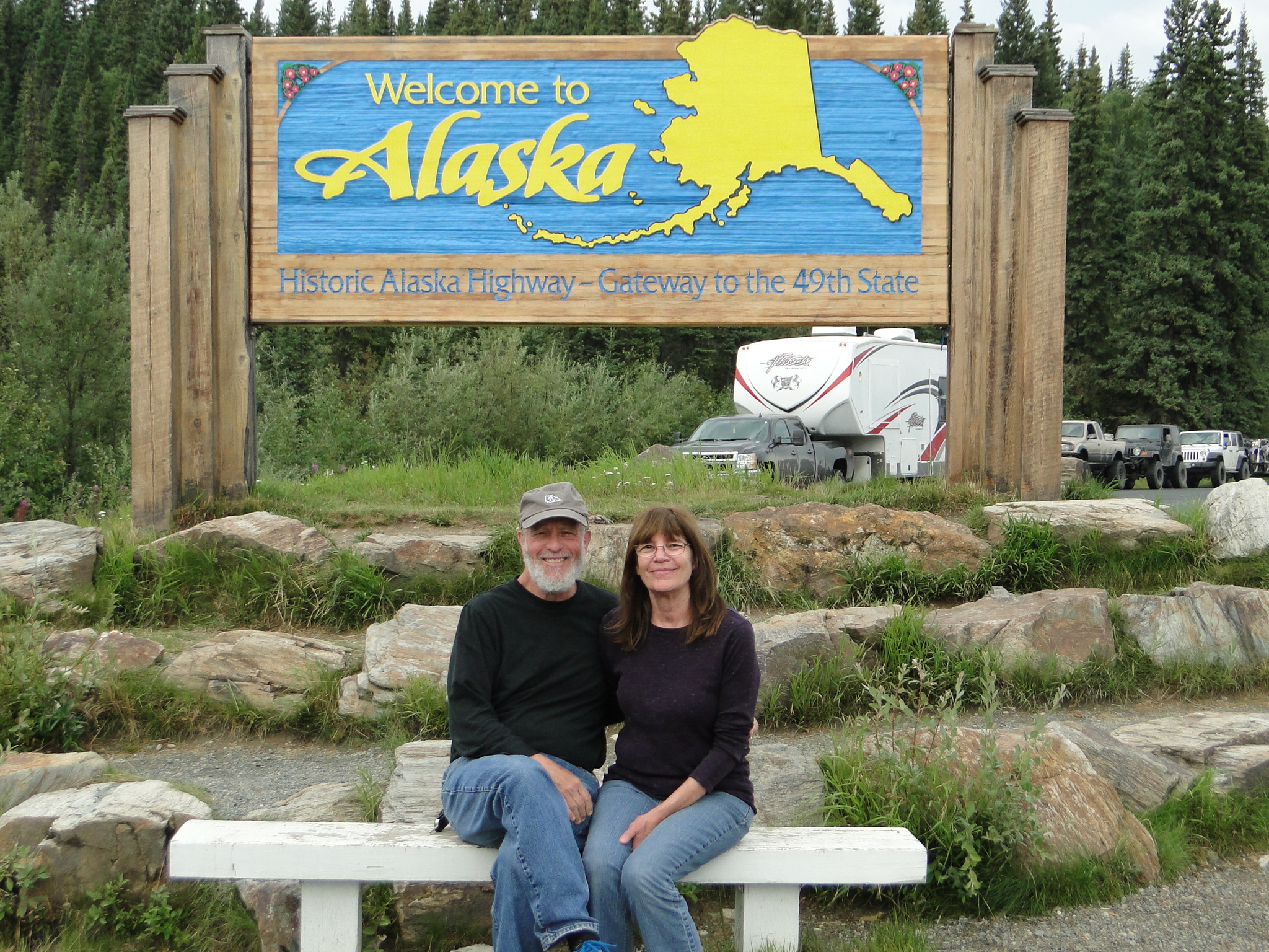
After finally reaching Alaska after 7 ½ weeks on the road, we settle in to the town of Tok. Until the next posting, peace.
Epilogue: As some of you may have read in the news, there was a triple homicide in Muncho Lake, two days before we came through the exact location of the murders. We camped at Liard River, 50 km north of the lake and while we were there the homicides were being investigated. We were quite concerned that there was no heightened security at the campground and very little evidence of the Royal Canadian Mounted Police, RCMP. We were happy to hear just recently, as we were moving further north, that the suspects seem to have headed to northern Saskatchewan, thousands of miles away.
Note: Photography by Ellen and Jay

Amazing photos, Jay. I’m really enjoying following your journey!
LikeLike
This is a fascinating part of your trip. In the States, people think of northern Canada as this empty place with nobody but the indigenous people of the Northwest Territories, eh? Not true, with all the folks and towns you’ve encountered. As usual, unbelievable pictures and they have a little more power given the wilderness you are touring.
“Where the river is windin’ big nuggets they’re findin’
North to Alaska go north the rush is on”
Gary
LikeLike
Northern BC felt very remote. (Ellen) There are not a lot of non-indigenous people. Most outside of the campgrounds are native.
LikeLike
Awesome experience! Be safe. Great pics, great review. Let us know if you get to see Russia from your RV.
LikeLike
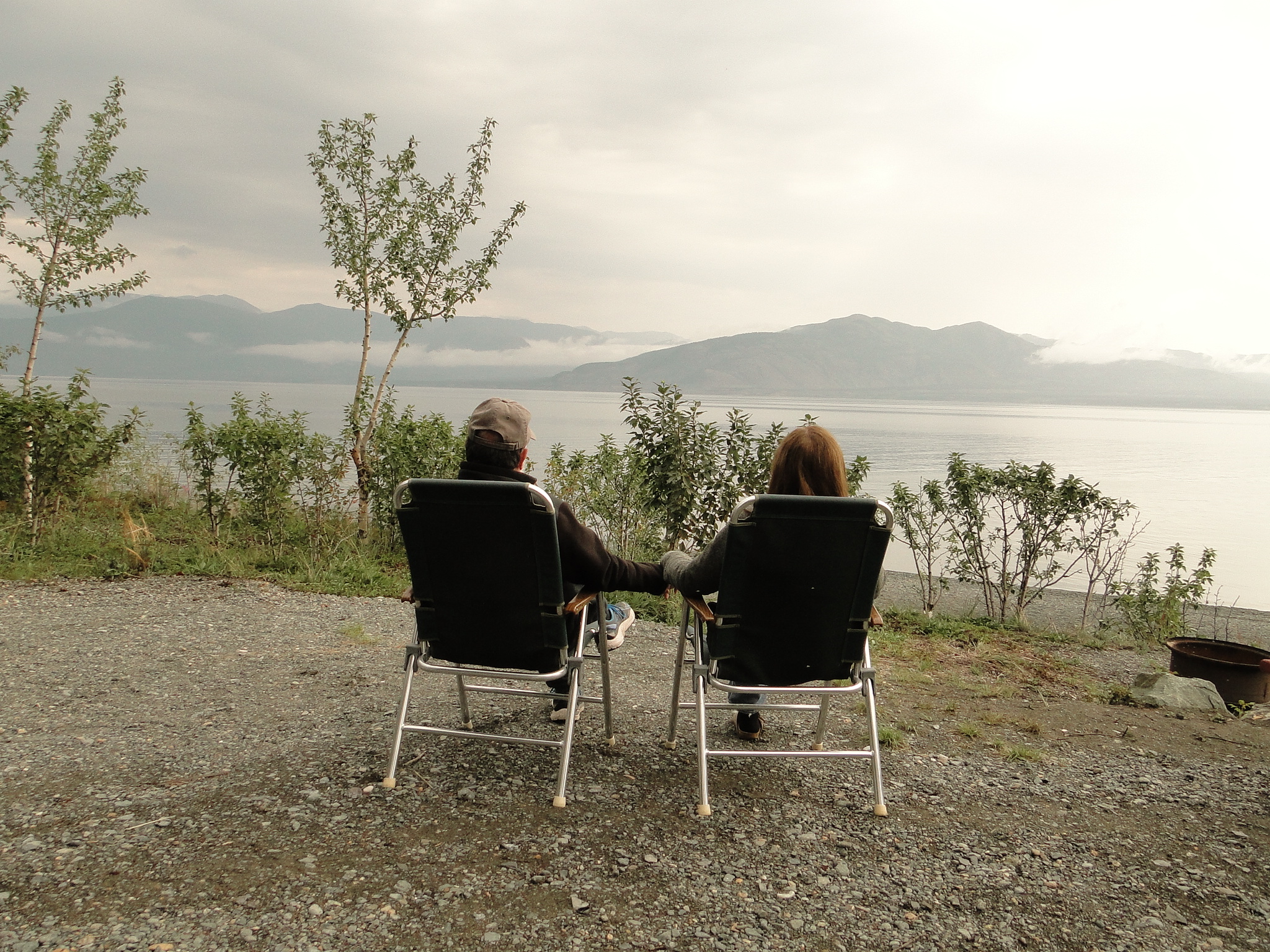
That last picture shows how much you both needed to retire. You look younger and much less stressed!!
LikeLike
Agree with Judy, the pic of you two is awesome, the trip sounds amazing, and the cinnamon bun is a close second to the amazing widlife shots you got. Did not hear about the homicides, but glad you are safe. Miss you guys. See you on the other side.
LikeLike
Hi there, let me know if you get this message, my second try at responding. Love the notes and blog.
Love, cb
LikeLike
I was so worried about you when I heard about the murders, but didn’t know where they were relative to where you were. I figured Canada is a rather large country. But knowing now how close you were in time and place really scares me. So glad you’re headed into Alaska and they are (hopefully) going a different direction.
Anyway, the animal and scenery photos are just great and I’m jealous of that cinnamon roll!
Stay safe and keep having fun!
LikeLike
It was a bit nerve wracking for sure. Doors were always locked and neither one of us walked alone. Even heading north we had no idea where they were heading. But we are well into Alaska now and compared to the Yukon it feels urban. 😁
On to Denali today amidst the rain and smoke. The clouds and rain are keeping the smoke closer today.
LikeLike
Apparently they’ve moved on to Manitoba https://www.cnn.com/2019/07/29/americas/canada-murder-mystery-monday/index.html
I hope you’re enjoying Denali and the smoke has cleared by now.
LikeLike
Denali has been amazing. We saw the mountain. Sounds like MLK. Though not to that level, it was still very special for both of us. The mountain is only visible about 30% of the time and we’ve now seen it on each trip here so…….Very spiritual actually seeing the top of the mountain as it is so high and closer to the sky.
LikeLike
Thanks, again, for descriptions, stories and pix. All great.
LikeLike
Thanks Barry. This is indeed, a trip of a lifetime. Absolutely amazing in every respect. Hope you clear the heat wave well. Best to Linda.
LikeLike
Amazing pictures,glad all is going so well,your descriptions are excellent.Stay safe,we were concerned about the news as well.
LikeLike
I finally read your latest installment this morning, I have to say, reading your blog is a GREAT way to start the day! I could feel the remoteness of this part of your journey through the amazing photos and vivid descriptions. The wildlife! Oh my goodness, what a gift! So sorry the other camper scared off the moose. David and I were wondering if you were anywhere near the crime scene, and as soon as I read you spent time at Liard Hot Springs, it unfortunately confirmed our worries! SO glad you were safe.
I can’t express enough just how much I am enjoying your journey, but have to admit, I am envious!
Be safe my dear friends, love and miss you!
LikeLike
Excellent writing in your blog. So glad I found it.
LikeLike